
Where Flight Simulation Enthusiasts Gather from Around the World!
AVSIM Library - Search Results

| Category: Flight Simulator 2004 - Scenery | |
| Java SRTM Mesh |

|
File Description:
This terrain mesh scenery covers Java, Madura and Bali islands, Indonesia. Some Minor neighboring islands have been included too.
Based on SRTM Data (3 arcsec, 90m), generated with Matthew Styles's program "SRTM To BGL v1.04", sampled to LOD9 resolution (76m). While only tested with Fs2004, this mesh should also run with FS2002.
| Filename: | Java_SRTM_Mesh.zip |
| License: | Freeware |
| Added: | 14th November 2003, 03:58:44 |
| Downloads: | 6,713 |
| Author: | Yohann Baptiste |
| Size: | 20.88 MB |
| Category: Strike Fighters: Project 1 - Mods, Utilities and Patches | |
| A-1H MiG Killers Missions and Bonus Skin |
|
File Description:
A-1H MiG killers is a package of missions with a matching skin.
To fully use this package, you need the following:
1. SFP1 with SP2 installed.
2. DigitalOverload's final release: A-1H Version 4.0a addon aircraft.
3. Flyable MiG-17 mod.
4. Gephard's DRV terrain and/or KB's SEA terrain.
The missions recreate two historical encounters. Both encounters represent the only MiG kills made by A-1Hs in Vietnam. Each encounter is covered by multiple missions covering both sides.
The skin is an improvement of Marcelo's outstanding VietnamNavyGrey skin that comes with the A-1H addon, which happens to be the VA-176 MiG killers of the second encounter.
| Filename: | A1H_MiG_Killers_Missions_and_Bonus_Skin.zip |
| License: | Freeware |
| Added: | 23rd August 2004, 20:37:21 |
| Downloads: | 1,017 |
| Author: | Stephen Lynn Flores |
| Size: | 865.77 KB |
| Category: Flight Simulator 2004 - Scenery | |
| Backcountry airfields for 19m terrain mesh in Idaho USA |
|
Images related to this file:
File Description:
These four backcountry fields are for use with the FSGenesis 19m mesh of Idaho, and are Big Creek, Johnson Creek, Dixie, and Sulphur Creek Ranch. They have been revised to fit and almost certainly do not work without the 19m mesh; a quick comparison with Big Creek before and after demonstrates the difference. I also have Ultimate Terrain installed. The three ingredients of terrain mesh, UT main roads, and UT streams, along with their individual margins of error, very often create conficts of space that make a grass runway impossible to site with it's correct length. Given the choice of turning off roads or streams (the terrain mesh cannot be turned off, obviously) I chose streams; the roads are less obviously incorrect, plus it matters not if roads go uphill while a climbing stream is to be avoided. On that basis the original series is reissued here for use with the 19m terrain mesh, on the presumption that you have already downloaded the original series. There are no textures or AI included as they remain the same as the originals, and the new scenery bgl's replace the originals to get the runways and grass etc in the right positions. There will be follow-on fields that are new, and all of the new ones will be only for the 19m mesh.
| Filename: | Backcountry_airfields_for_19m_terrain_mesh_in_Idah.zip |
| License: | Freeware, limited distribution |
| Added: | 29th May 2017, 04:19:43 |
| Downloads: | 125 |
| Author: | Roger Wensley |
| Size: | 2.22 MB |
| Category: Flight Simulator 2004 - Scenery | |
| Cambridge Bay CYCB |
|
Images related to this file:
File Description:
Cambridge Bay is an important transportation center on Canada's Northwest Passage. Access is by air only. This scenery is a complete and extensive remake of the default airport and surrounding area. The coastline has been redone, and the nearby town and NORAD facility added. Most of the buildings are photo textured. Should work OK without Ultimate Terrain. Thermal underwear recommended.
| Filename: | Cambridge_Bay_CYCB.zip |
| License: | Freeware |
| Added: | 27th April 2011, 20:51:31 |
| Downloads: | 1,285 |
| Author: | Sidney Schwartz & Peter Ham |
| Size: | 2.27 MB |
| Category: Fly! II - Scenery | |
| Alta, Northern Norway |
|
File Description:
Alta (ENAT) is a challening airport in northern Norway (69° 58,6' N, 23° 22,5' E), surrounded as it is by high mountains. One of the more difficult approaches is the circling approach, marked by lights in the terrain, for runway 30 (called runway 29 in Fly! 2).
Some approach and departure plates (SID's STAR's, ILS etc) are enclosed in the "Plates" folder.
| Filename: | Alta_Northern_Norway.zip |
| License: | Freeware |
| Added: | 16th August 2003, 04:01:15 |
| Downloads: | 264 |
| Author: | Krister Renard |
| Size: | 364.52 KB |
| Category: Flight Simulator 2004 - Scenery | |
| Parker-Carson STOLport Version 2.1.1 |
|
Images related to this file:
File Description:
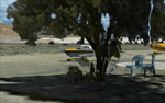
Parker-Carson STOLport is privately owned, public use airfield located east of Carson City, Nevada. Scenery features custom objects, custom terrain textures, HD airport textures (.5 ft/px), traffic, day, night and winter textures, and much more. This is version 2.1.1 of the scenery and is a stand alone install, all previous versions should be removed prior to installation. Created by Dustin Mosher
| Filename: | ParkerCarson_STOLport___Version_211.zip |
| License: | Freeware, limited distribution |
| Added: | 10th December 2009, 00:25:20 |
| Downloads: | 859 |
| Author: | Dustin Mosher |
| Size: | 57.7 MB |
| Category: Flight Simulator 2004 - Scenery | |
| PHJH Kapalua-West Maui |
|
Images related to this file:
File Description:

Kapalua airport (ICAO: PHJH—IATA: JHM—FAA:JHM) is located on the west side of the Hawaiian island of Maui. It serves Lahaina, and the resort communities of Kaanapali, Napili-Honokowai and Kapalua. This scenery includes a detailed model of Kapalua airport, the rooftop Hyatt Regency Resort helipad, approximately 170 square kilometers of West Maui terrain including extensive autogen buildings and trees, as well as numerous models of real-world resorts and hotels on a 12 km strip along the coast of West Maui.
| Filename: | PHJH_KapaluaWest_Maui.zip |
| License: | Freeware, limited distribution |
| Added: | 30th August 2017, 17:21:57 |
| Downloads: | 1,577 |
| Author: | Gregory Putz |
| Size: | 54.76 MB |
| Category: Flight Simulator X - Scenery | |
| USA East 10 metre mesh, Batch 4, Part 5 of 9 |
|
File Description:
USA EAST USGS 10 metre mesh terrain - FSX only, includes: IA, MN, WI, IL, IN, MI, OH, PA, NY, VT, NH, ME, MA, CT, RI. Part 5 of 9!
This constitutes 10 metre terrain mesh for a section of the USA, The whole USA East mesh files will abutt the US West Coast 10m mesh already available elsewhere, that was made by: Raimondo Taburet. Make sure you have your scenery terrain settings at about 5 metres in the FSX display dialogue for the mesh to show properly!
| Filename: | USA_East_10_metre_mesh_Batch_4_Part_5_of_9.zip |
| License: | Freeware |
| Added: | 11th May 2009, 10:14:06 |
| Downloads: | 613 |
| Author: | Wayne Evans |
| Size: | 33.15 MB |
| Category: Flight Simulator X - Scenery | |
| USA East 10 metre mesh, Batch 4, Part 9 of 9 |
|
File Description:
USA EAST USGS 10 metre mesh terrain - FSX only, includes: IA, MN, WI, IL, IN, MI, OH, PA, NY, VT, NH, ME, MA, CT, RI. Part 9 of 9!
This constitutes 10 metre terrain mesh for a section of the USA, The whole USA East mesh files will abutt the US West Coast 10m mesh already available elsewhere, that was made by: Raimondo Taburet. Make sure you have your scenery terrain settings at about 5 metres in the FSX display dialogue for the mesh to show properly!
| Filename: | USA_East_10_metre_mesh_Batch_4_Part_9_of_9.zip |
| License: | Freeware |
| Added: | 11th May 2009, 10:18:22 |
| Downloads: | 1,021 |
| Author: | Wayne Evans |
| Size: | 28.84 MB |
| Category: Flight Simulator X - Scenery | |
| USA East 10 metre mesh, Batch 4, Part 3 of 9 |
|
File Description:
USA EAST USGS 10 metre mesh terrain - FSX only, includes: IA, MN, WI, IL, IN, MI, OH, PA, NY, VT, NH, ME, MA, CT, RI. Part 3 of 9!
This constitutes 10 metre terrain mesh for a section of the USA, The whole USA East mesh files will abutt the US West Coast 10m mesh already available elsewhere, that was made by: Raimondo Taburet. Make sure you have your scenery terrain settings at about 5 metres in the FSX display dialogue for the mesh to show properly!
| Filename: | USA_East_10_metre_mesh_Batch_4_Part_3_of_9.zip |
| License: | Freeware |
| Added: | 11th May 2009, 10:11:50 |
| Downloads: | 1,065 |
| Author: | Wayne Evans |
| Size: | 29.25 MB |


© 2001-2026 AVSIM Online
All Rights Reserved
Privacy Policy |