
Where Flight Simulation Enthusiasts Gather from Around the World!
AVSIM Library - Search Results

| Category: X-Plane - Scenery | |
| ENNM - Namsos Airport - Namsos, Norway |

|
Images related to this file:
File Description:
This Namsos scenery corresponds to the current Airport Layout of ENNM. The near surroundings are designed based on a satellite photo so that VFR flights and VFR orientation should be very easy. The second bridge a bit far west of the airport is included, also the City of Namsos, a cruise ship dock and the marina south of the Namsos Bridge.
I used some parts of freeware libraries, which are already included in this package.
The airport buildings are converted from the famous FS2004 scenery from Kjell Arild Bersaas & Arne Sundsboe.
I did some small changes which were absolutely necessary to fit the new airport layout. Finally I only deleted a fence which blocked the new apron.
This scenery is converted from my ENNM-FSX scenery and the reworked with WED and OverlayEditor. The library "OpenSceneryX" must be installed first:
http://www.opensceneryx.com/
| Filename: | ENNM__Namsos_Airport__Namsos_Norway.zip |
| License: | Freeware |
| Added: | 17th May 2015, 08:59:30 |
| Downloads: | 140 |
| Author: | Wolfgang Allers |
| Size: | 16.75 MB |
| Category: X-Plane - Scenery | |
| BR AM SBUA - Sao Gabriel da Cachoeira v1.0.0 |
|
Images related to this file:
File Description:
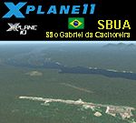
This is an X-Plane 11 and X-Plane 10 scenery package for Sao Gabriel da Cachoeira Airport (IATA: SJL, ICAO: SBUA), formerly called Uaupés Airport, which is the airport serving São Gabriel da Cachoeira, Amazonas, Brazil. Some of its facilities are shared with the Brazilian Air Force. It includes corrected aprons, ramps, gates, taxiways, lighting system, city buildings, ortho-photoscenery for the airfield area, the new military apron, and (XP11 only) airport ground services (like push back). This scenery was tested and is operational (as of April 13, 2017) in "X-Plane 11.00 RC #1 64 bit", Windows 10 Home. It was also tested and is also operational (as of April 13, 2017) in "X-Plane 10.51 64 bit", Windows 10 Home. Only the default X-Plane 11 libraries, by Laminar Research, are needed. No third party libraries are used.
| Filename: | BR_AM_SBUA__Sao_Gabriel_da_Cachoeira_v100.zip |
| License: | Freeware |
| Added: | 15th April 2017, 06:22:38 |
| Downloads: | 99 |
| Author: | Rui Mesquita |
| Size: | 11.21 MB |
| Category: X-Plane - Scenery | |
| BR BA SBSV - Dois de Julho Intl v1.0.0 |
|
Images related to this file:
File Description:
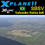
This is an X-Plane 11 and X-Plane 10 scenery package for Salvador-Deputado LuÃs Eduardo Magalhães International Airport (IATA: SSA, ICAO: SBSV), formerly called Dois de Julho International Airport, which is the airport serving Salvador da Bahia, Brazil. It is operated by Infraero. Some of its facilities are shared with the Salvador Air Force Base of the Brazilian Air Force. It includes corrected aprons, ramps, gates, taxiways, lighting system, the city skyline buildings and (XP11 only) airport ground services (like push back). This scenery was tested and is operational (as of March 01, 2017) in "X-Plane 11 Public Beta #13 64 bit", Windows 10 Home. It was also tested and is also operational (as of March 01, 2017) in "X-Plane 10.51 64 bit", Windows 10 Home. Only the default X-Plane 11 libraries, by Laminar Research, are needed. No third party libraries are used.
| Filename: | BR_BA_SBSV__Dois_de_Julho_Intl_v100.zip |
| License: | Freeware |
| Added: | 1st March 2017, 19:06:25 |
| Downloads: | 111 |
| Author: | Rui Mesquita |
| Size: | 16.07 MB |
| Category: X-Plane - Scenery | |
| BR CE - SNIG Iguatu Airport v1.0.0 |
|
Images related to this file:
File Description:
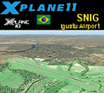
This is an X-Plane 11 and X-Plane 10 scenery package for Tomé da Frota Airport (IATA: IGT, ICAO: SNIG), which is the airport serving the city of Iguatu, state of Ceará, in Brazil.
It includes corrected aprons, ramps, gates, taxiways, lighting system, city buildings, ortho-photoscenery for the airfield area, and (XP11 only) airport ground services (like push back).
With an intense movement of small aircraft Iguatu Airport is of total importance for businessmen who have aircraft or use the air taxi. Sol Aviation flies from/to Fortaleza/SBFZ. Gol and Two airlines announced intention to fly to/from Fortaleza/SBFZ later in 2018.
This scenery was tested and is operational (as of January 26, 2018) in "X-Plane 11.11 64 bit", Windows 10 Home. It was also tested and is also operational (as of January 26, 2018) in "X-Plane 10.51 64 bit", Windows 10 Home.
| Filename: | BR_CE__SNIG_Iguatu_Airport_v100.zip |
| License: | Freeware |
| Added: | 2nd February 2018, 00:11:29 |
| Downloads: | 44 |
| Author: | Rui Mesquita |
| Size: | 8.3 MB |
| Category: Flight Simulator 2002 - Scenery | |
| Maylands Aerodrome Western Australia v1 |
|
File Description:
Maylands (subject to flooding) remained Perth’s main airport until the end of WW2. Large aircraft moved to Dunreath which became Guildford and then Perth Airport. Maylands continued to be used by light aircraft and was finally closed when Jandacot opened in the Early 60's. It then became a golf course and a Police training complex. The Hangars have been heritage listed and the field is now covered with buildings and trees.
It includes a grass runway, hangars and enough of the Swan River to make the flying more fun. Maylands and Langley Park are within sight of Perth airport and can be used as a set or separately.
This scenery was made using freeware Airport 2.9 Build 26 and if installed as instructed will not alter your scenery.cfg. Thanks to Steve James for his advice.
Textures if required are included.
Made by Alan Blencowe January 2003.
| Filename: | Maylands_Aerodrome_Western_Australia_v1.zip |
| License: | Freeware |
| Added: | 23rd January 2003, 05:17:13 |
| Downloads: | 358 |
| Author: | Alan Blencowe |
| Size: | 455.6 KB |
| Category: Flight Simulator X - Scenery | |
| Frankfurt Main Airport v4 (EDDF) |
|
Images related to this file:
File Description:
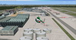
This is a major update to the previous airport package (Frankfurt Airport v3.2) using ADE 1.47 and represents the layout of the airport from June 2010.
This revision update includes all the re-designated taxiways and signage as per the real world airport at this time as well as introducing new taxiways and textures for Romeo, R3, L4, L5 and M8. Other major features include construction work on taxiway Sierra and the construction area including cranes at the site of the new A-plus terminal.
Also featured is additional apron lighting at various other northern parking and cargo aprons and Cargo Sud, re-modeled de-icing aprons with night lighting and addition of DP2 apron, updated gate designations for gates A11 to A25 and updated airline parking codes for V gates. A number of miscellaneous updates and fixes are also included. See readme file for more details.
| Filename: | Frankfurt_Main_Airport_v4_EDDF.zip |
| License: | Freeware |
| Added: | 17th July 2011, 20:28:35 |
| Downloads: | 2,452 |
| Author: | Mark Aldridge |
| Size: | 1.04 MB |
| Category: Flight Simulator X - AI Flight Plans | |
| Sky Regional - Summer 2018 |
|
Images related to this file:
File Description:

Current flight plan of Sky Regional for summer 2018.
Sky Regional Airlines is an airline whose corporate headquarters is on the property of Toronto Pearson International Airport, Mississauga, Ontario, Canada. Linked with Skyservice Business Aviation, it began operation under the Air Canada Express brand on May 1, 2011. The airline began offering daily flights between Toronto Island and Montréal–Pierre Elliott Trudeau International Airport.
Sky Regional introduced a fleet of Embraer 175 jets in March 2013 to serve US destinations such as New York, Newark, Boston, Philadelphia, Chicago, and Dallas/Fort Worth.
Between October and December 2015 the fleet of 20 was expanded to 25 after obtaining 5 additional Embraer 175 previously operated by Azul Brazilian Airlines. These aircraft were put into service in April 2016 allowing the airline to add routes to more US destination such as Denver International Airport, and Hartsfield-Jackson Atlanta International Airport.
| Filename: | Sky_Regional__Summer_2018.zip |
| License: | Freeware |
| Added: | 12th August 2018, 19:31:54 |
| Downloads: | 262 |
| Author: | Frank Drebing |
| Size: | 26.07 KB |
| Category: Flight Simulator X - Scenery | |
| KXWA Williston Basin International Airport + Photoscenery 2019 V2.0 |
|
Images related to this file:
File Description:

THIS FILE REPLACES THE EARLIER KXWA_2019.zip. STANDALONE FILE, NO OTHER DOWNLOADS NEEDED. Compatible for FSX & FSX:SE. Not tested in P3D, but I expect it should work there as well. Opened in October 2019, Williston Basin International Airport replaces Sloulin Field as Williston, ND's primary airfield. Previously unavailable in flight sims, this scenery now brings this airport within flying distance. Current as of December 2019. FEATURES: Properly aligned runway, taxiways and aprons perfect for flying online // Correct ILS for Runway 32 // VOR on airport grounds as in real life // Correct designation of taxiways with appropriate taxi signs // 4 gates as well as GA Apron // Accurate-to-size passenger terminal & hangars // Apron lighting // Optional night and day photoreal textures from early 2019 // Custom waterclass meaning that bodies of water use native sim water // Autogen exclusion around airport // New in V2.0 - bug fixes and tweaks + new ground poly.
| Filename: | KXWA_Williston_Basin_International_Airport__Photos.zip |
| License: | Freeware |
| Added: | 17th December 2019, 03:32:14 |
| Downloads: | 416 |
| Author: | Matt Lock |
| Size: | 122.1 MB |
| Category: Flight Simulator 2004 - Scenery | |
| OIBJ Jam/Tohid, Iran |
|
File Description:
Googly scenery for OIBJ Jam/Tohid - a small Iranian domestic airport for which
nothing more than a runway is provided in Flight Simulator 2004. These scenery
files add taxiways, aprons, buildings and other airport features so that you
and your "AI" traffic can land, taxi, park and take off in a realistic manner.
The airport is served about twice per week by Fokker jets of Iran Air.
The scenery does not purport to be ultra-accurate. Based on high-detail satellite
imagery from Google Earth, the layout is proportionally correct but the added
airport features, such as buildings, are built from default Microsoft objects
and add-on libraries so will not look like the real thing.
You are not obliged to download and install any additional scenery libraries,
but to enjoy this scenery in its entirety, you may wish to. It will work fine,
with or without.
| Filename: | OIBJ_JamTohid_Iran.zip |
| License: | Freeware |
| Added: | 8th July 2007, 21:19:39 |
| Downloads: | 1,020 |
| Author: | John Hinson |
| Size: | 80.11 KB |
| Category: Flight Simulator X - Scenery | |
| LOWL Linz Airport (also known as Blue Danube Airport), Austria |
|
Images related to this file:
File Description:
The airport Linz-Hoersching (blue danube airport linz) is located 10 km outside the city centre Linz direction south west direct from the town Hoersching. Therefore the epithet Hoersching.
This airport is in possession of the Austrian Army, but there is a civil right of use. The aerodrome Vogler is place south, the civil part is locate in north direction of the runway.
--------------------
Der Flugplatz Linz-Hoersching (blue danube airport linz) befindet sich 10 km ausserhalb des Stadtzentrums Linz in suedwestlicher Richtung direkt bei Hoersching. Darum auch der Beiname Hoersching. Der Flughafen gehoert dem oesterreichischen Bundesheer, es gibt aber ein ziviles Nutzungsrecht. Der Fliegerhorst Vogler ist suedlich, der zivile Teil noerdlich der Landebahn angesiedelt.
--------------------
Features: ground texture with 25cm / px., autogen, hand placed objects, correct road marking, correct taxiway signs, new middle lights, automatic switching of the seasons, night illumination.
| Filename: | LOWL_Linz_Airport_also_known_as_Blue_Danube_Airpor.zip |
| License: | Freeware |
| Added: | 21st July 2013, 13:47:13 |
| Downloads: | 11,006 |
| Author: | Oliver Brandl |
| Size: | 222.14 MB |


© 2001-2026 AVSIM Online
All Rights Reserved
Privacy Policy |