
Where Flight Simulation Enthusiasts Gather from Around the World!
AVSIM Library - Search Results

| Category: Flight Simulator 2004 - Scenery | |
| Alaska South Slope 7; Kobuk OBU & Dahl Creek DCK |

|
Images related to this file:
File Description:
There are four main northwestern Alaska towns which are serviced by Alaska Airlines, and from which local flights spread out. The northernmost is Barrow. Southwest of Barrow is Kotzebue, then Nome, and the furthest south is Bethel (not yet made). This is a continuation of the series for the flights from Kotzebue, 170 miles to the east where Kobuk is on the bank of the Kobuk River, and Dahl Creek is 2 miles to the north. Kobuk is a small village on the Kobuk River, like Ambler and Shungnak, but with a population of only around 150. The river is the reason for the existance of the villages as it served (and still does) as both a source of food and a transport route. The airfield is just beside the village, with a runway around 4,500 feet of lit gravel and aligned 09-27, with PAPI on both ends. There are scheduled flights by Era (now renamed Ravn) and by Bering Air, both of them originating in Kotzebue and routing east to Ambler, Shungnak, Kobuk, and then back again. The AI includes these flights along with Everts Air and GA. The FS9 airfield has been relocated by approximately a mile to the correct position, and the elevation accordingly adjusted. The Dahl Creek strip is publicly owned, with no maintenance and a deteriorating gravel runway that has not long to survive. This probably does not work properly without Ultimate Terrain Alaska Canada as the village is now on the river bank. I am presuming that you have downloaded and installed Nome PAOM, along with the instructions on how to adjust Ultimate Terrain Alaska Canada to get the most realistic results. If you are not making the UT adjustments then you may be seeing duplicated roads, as I am including new local dirt or gravel roads to connect village to airfield etc to get the best overall result; I will not be making alternate versions.
| Filename: | Alaska_South_Slope_7_Kobuk_OBU__Dahl_Creek_DCK.zip |
| License: | Freeware, limited distribution |
| Added: | 13th October 2016, 18:10:08 |
| Downloads: | 233 |
| Author: | Roger Wensley |
| Size: | 2.94 MB |
| Category: Flight Simulator X - AFCAD Files | |
| Peters Airport (4NJ8), NJ v1.1 |
|
File Description:
Located 05 miles W of Somerville, New Jersey on 70 acres of land, Peters Airport is a private turf strip that will test your short field skills to the max. The published runway dimensions for this strip are 1700x200 feet, and for the most case this is fairly accurate - however at the ends of both runways you have tree obstacles to overcome so this can shorten the amount of usable runway significantly, although the tree obstacles are no higher than 12-14m. There is no hardened runway surface so you will be landing/taking off on terrain. Depending on how high your mesh resolution is, this can be a significant factor, as Runway 31 is mainly uphill enough that you will need to power up with parking brakes on if you want to make it in the air. Runway 13 is the best since you are going downhill and the trees at the end are fewer and smaller. Pay close attention to the pattern! Runway 13 is Left and Runway 31 is Right - this airport is within 2 miles of Solberg-Hunterdon (N51) and you don't want to get in the way of that field's traffic! The runway is not lit, so daytime VFR operations only. There are no services at this strip for transient aircraft.
Scenery constructed with use of satellite images/streetview/aerial photos - the author has not been there in person.
This scenery is meant to be used in conjunction with MegaScenery Earth New Jersey/Delaware 001. It is not required, but apron use is minimized to allow satellite scenery to show through as much as possible, and objects are placed based on the MSE textures - lack of it may make scenery look out of place.
| Filename: | Peters_Airport_4NJ8_NJ_v11.zip |
| License: | Freeware |
| Added: | 20th September 2011, 14:08:43 |
| Downloads: | 405 |
| Author: | Drew Sikora |
| Size: | 461.03 KB |
| Category: Prepar3D V1-4 - Scenery | |
| TTCP - A. N. R. Robinson International Airport |
|
Images related to this file:
File Description:
P3Dv4.5 - A. N. R. Robinson International Airport (formerly Crown Point International Airport) - IATA TAB, ICAO TTCP. Version 1.0
A. N. R. Robinson International Airport (formerly Crown Point International Airport - IATA: TAB, ICAO: TTCP) is an international airport located on Crown Point, Tobago in Trinidad and Tobago.
It is located in the southwesternmost part of the island, near the town of Canaan, and 11 km (6.8 mi) from the capital, Scarborough.
The airport is one of two international airports serving the twin isle republic of Trinidad and Tobago.
The other airport is located on the island of Trinidad, Piarco International Airport.
Crown Point International Airport has two terminals. The International Terminal was once both the regional and international passenger terminal for the airport but has been renovated to serve as an all-international terminal. It serves international cargo flights, general aviation and helicopter flights. It has seven aircraft parking positions
This scenario was only tested on P3Dv4.5.
| Filename: | TTCP__A_N_R_Robinson_International_Airport.zip |
| License: | Freeware |
| Added: | 16th June 2022, 06:42:12 |
| Downloads: | 258 |
| Author: | Eduardo Puelker |
| Size: | 21.17 MB |
| Category: Prepar3D V1-4 - Scenery | |
| TNCC - - Curaçao International Airport V 2.0 |
|
File Description:
This is an improved version of my previous senario for TNCC. This version has substantial improvements in the terminals and areas of the airport.
Curaçao International Airport (IATA: CUR, ICAO: TNCC), (Dutch: Hato Internationale luchthaven) also known as Hato International Airport (formerly Dr. Albert Plesman International Airport), is the only airport for the island of Curaçao.
The airport is located on the north coast of Curaçao, 12 kilometres (7.5 mi) from the capital Willemstad. Curaçao International Airport services flights from the Caribbean region, South America, North America and Europe and has the third longest commercial runway in the Caribbean region after Rafael Hernández Airport in Puerto Rico and Pointe-à -Pitre International Airport in Guadeloupe.
The airport serves as a main base for Divi Divi Air, Jetair Caribbean as well as EZAir; it formerly served as a main base for ALM, KLM, DCA, DAE and Insel Air.
| Filename: | TNCC___Curaao_International_Airport_V_20.zip |
| License: | Freeware |
| Added: | 25th June 2021, 18:19:49 |
| Downloads: | 450 |
| Author: | Eduardo Puelker |
| Size: | 37.41 MB |
| Category: Flight Simulator 2004 - Aircraft Repaints, Textures and Modifications | |
| Japan Airlines Boeing 787-9 (JA861J) |
|
Images related to this file:
File Description:
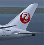
TDS Boeing 787-9 Japan Airlines Airlines (JA861J). Japan Airlines is an airline headquartered in Shinagawa, Tokyo, Japan. It is the flag carrier of Japan and its main hubs are Tokyo's Narita International Airport and Tokyo International Airport (Haneda Airport), as well as Osaka's Kansai International Airport and Osaka International Airport. TDS Model design by Hiroshi Igami. Flight dynamics design by Nick Wilkinson and David Biggar. Master textures by Kyle Schurb.
| Filename: | Japan_Airlines_Boeing_7879_JA861J.zip |
| License: | Freeware, limited distribution |
| Added: | 25th May 2015, 10:41:40 |
| Downloads: | 701 |
| Author: | Danny Cummings |
| Size: | 8.65 MB |
| Category: Prepar3D V1-4 - Scenery | |
| CYYG - Charlottetown Airport - Prince Edward Island, Canada |
|
File Description:
Charlottetown Airport, Prince Edward Island, Canada (IATA: YYG, ICAO: CYYG), is located 3 NM (5.6 km; 3.5 mi) north of Charlottetown, Prince Edward Island, Canada. The airport is currently run by the Charlottetown Airport Authority, is owned by Transport Canada and forms part of the National Airports System. The airport is classified as an airport of entry by NAV CANADA and is staffed by the Canada Border Services Agency.
| Filename: | CYYG__Charlottetown_Airport__Prince_Edward_Island_.zip |
| License: | Freeware |
| Added: | 10th October 2015, 11:31:26 |
| Downloads: | 463 |
| Author: | Robert Catherall |
| Size: | 821.4 KB |
| Category: Flight Simulator X - Scenery | |
| CYPR - Prince Rupert, BC |
|
File Description:
CYPR - Prince Rupert Airport, British Columbia, Canada. This update has been tested in FSX/P3D and replaces the stock airports scenery.
A new Terminal Building, Apron/Taxiway Lighting, Static Aircraft and other airport related objects have been added to improve the overall appearance of this airport. A road has been added which terminates at the ferry dock. Airport views are from above the airport terminal building when in tower view.
| Filename: | CYPR__Prince_Rupert_BC.zip |
| License: | Freeware |
| Added: | 8th May 2013, 00:03:51 |
| Downloads: | 1,795 |
| Author: | Robert Catherall |
| Size: | 1.66 MB |
| Category: Prepar3D V1-4 - Scenery | |
| CYHZ - Halifax International Airport - Nova Scotia, Canada |
|
File Description:
Halifax Robert L. Stanfield International Airport, or Halifax/Stanfield International Airport (IATA: YHZ, ICAO: CYHZ) is an airport in Enfield, Nova Scotia, Canada that serves the Halifax Regional Municipality and central Nova Scotia as well as adjacent areas in the neighbouring Maritime provinces.
The airport, owned by Transport Canada since it was constructed and operated, since 2000, by the Halifax International Airport Authority (HIAA) forms part of the National Airports System.
| Filename: | CYHZ__Halifax_International_Airport__Nova_Scotia_C.zip |
| License: | Freeware |
| Added: | 15th October 2015, 17:45:03 |
| Downloads: | 21,946 |
| Author: | Robert Catherall |
| Size: | 1002.56 KB |
| Category: Flight Simulator X - Scenery | |
| FSX Nakhchivan Airport Scenery |
|
File Description:
Nakhchivan International Airport ICAO Code UBBN Scenery for FSX , I use airport background photo and place all objects acurately as I could, Redesigned Parking positions, Taxiway and Runway as per aviation charts and satellite photos, Nakhchivan International Airport , is a civilian airport and Azeri military airbase located in Nakhchivan, the capital of the Nakhchivan Autonomous Republic, a landlocked exclave of Azerbaijan. The airport was built in the 1970s, By Reza Sadri.
| Filename: | FSX_Nakhchivan_Airport_Scenery.zip |
| License: | Freeware |
| Added: | 23rd April 2017, 20:28:18 |
| Downloads: | 1,156 |
| Author: | Reza Sadri |
| Size: | 53.41 MB |
| Category: Prepar3D V1-4 - Scenery | |
| EGKK - Gatwick Intl Airport - London, UK |
|
File Description:
This is Ray Smith's 'FSX_egkk_rs' file. Ray has given me permission modify his file for use with Prepar3Dv4. This is a reasonably accurate version of Gatwick Intl Airport to reflect today's situation and made only for P3Dv4: The North terminal buildings and its pier have been completely replaced with something better than the stock airport, new control tower, assigned parking as per their website with extra parking including Gate 110 for the A380, Runway 8L/26R closed and used as a taxiway, taxiways and taxi signs updated to the latest charts, extra fuel trucks, support vehicle roads rebuilt and many other scenery improvements and objects added.
| Filename: | EGKK__Gatwick_Intl_Airport__London_UK.zip |
| License: | Freeware |
| Added: | 10th December 2017, 07:43:22 |
| Downloads: | 34,134 |
| Author: | Robert Catherall |
| Size: | 2.56 MB |


© 2001-2026 AVSIM Online
All Rights Reserved
Privacy Policy |