
Where Flight Simulation Enthusiasts Gather from Around the World!
AVSIM Library - Search Results

| Category: Prepar3D V5 - AI Aircraft | |
| FAIB Royal Jordanian A321 1970s Retro livery. (FEB UPDATE) Modified |

|
Images related to this file:
File Description:

Royal Jordanian A321-200 in 1970s Retro livery for FAIB A321 IAE.
This a fixed repaint with massive list of modification.
| Filename: | FAIB_Royal_Jordanian_A321_1970s_Retro_livery_FEB_U.zip |
| License: | Freeware |
| Added: | 19th February 2022, 15:02:32 |
| Downloads: | 167 |
| Author: | Najib Sami |
| Size: | 775.41 KB |
| Category: Flight Simulator 2004 - Panels | |
| Cessna 310 Panel without GPS Mod (Dreamfleet) |
|
File Description:
This C310 panel modification replace the MS-GPS from the 2D and 3D panel with the radios from the Avionics Stack.
| Filename: | Cessna_310_Panel_without_GPS_Mod_Dreamfleet.zip |
| License: | Freeware |
| Added: | 23rd May 2006, 00:04:37 |
| Downloads: | 1,272 |
| Author: | Tim Scharnhop / Dreamfleet |
| Size: | 305.49 KB |
| Category: Flight Simulator X - AFCAD Files | |
| Montreal Pierre-Elliot Trudeau International Airport - CYUL |
|
File Description:
CYUL v2.1 represents a modification to the stock FSX scenery. Some of the changes include new airport buildings and facilities, new control tower, custom Terminal assignments, additional fuel trucks, reworked service roads, spot lighting and new up-to-date approaches with transitions per 2008 specifications. See the readme file enclosed for full details.
| Filename: | Montreal_PierreElliot_Trudeau_International_Airpor.zip |
| License: | Freeware |
| Added: | 11th December 2009, 09:57:23 |
| Downloads: | 2,349 |
| Author: | Kambiz Agazi |
| Size: | 33.73 KB |
| Category: Flight Simulator X - Scenery | |
| SBFZ - Fortaleza - Brasil Airport enhancements |
|
File Description:
SBFZ - Fortaleza - BRASIL - Pinto Martins International Airport --> for FS X ONLY!
VERSION 1.0 2007-AGO-12
My first attempt to modify / enhance FS X airports.
Try it out (day and especially at night) and give feedback.
This is a modification of the original FSX airport of Fortaleza (Brazil) SBFZ.
Summary of what has been changed / included:
Modifications on RW 13 / 31
- Runway center light
- Runway edge lights
- illuminated touchdown zones RW 13 / 31
- PAPI for RW 31
- Strobes for approach RW 31
Modification on taxiways
- all taxiways with green centerline lights up to the parking positions
- some additional taxiway indicators
- Gate indicators on APRON to gates 1 - 10 (most with moving jetways - CNTRL + J)
- Gate number at all gates and parking positions on Main Apron
| Filename: | SBFZ__Fortaleza__Brasil_Airport_enhancements.zip |
| License: | Freeware |
| Added: | 12th August 2007, 09:33:23 |
| Downloads: | 8,035 |
| Author: | Peter Koller |
| Size: | 382.19 KB |
| Category: Flight Simulator X - Scenery | |
| Coro Airport (SVCR) - Venezuela |
|
Images related to this file:
File Description:
National airport located in the city of Coro, capital of Falcon state,
in western Venezuela.
With photo-terrain scenery from satellite imagery in Google Earth.
Not compatible with versions prior to FSX.
This scenery includes terminal building and hangars with realistic
textures from images obtained from Internet.
Also includes a friendly Auto-Install.
| Filename: | Coro_Airport_SVCR__Venezuela.zip |
| License: | Freeware |
| Added: | 8th August 2011, 21:56:00 |
| Downloads: | 734 |
| Author: | David Maldonado |
| Size: | 39.83 MB |
| Category: Prepar3D V5 - Scenery | |
| EIDW Dublin Airport v2 |
|
File Description:
This scenery is a major modification of EIDW Dublin Airport for P3Dv5. This new and improved version 2 adds the new runway 10L/28R as well as many other updates and improvements. The airport is now even more up-to-date and realistic. See the Readme file for details.
| Filename: | EIDW_Dublin_Airport_v2.zip |
| License: | Freeware |
| Added: | 20th October 2022, 02:36:18 |
| Downloads: | 765 |
| Author: | David Midgett |
| Size: | 27.19 KB |
| Category: Combat Flight Simulators - Strike Fighters: Project 1 | |
| WWII Darwin/Timor Terrain |
|
File Description:
This is a complete WWII Darwin/Timor/Indonesia 1942-45 Terrain with accurate Target placements for Strike Fighters Project 1. You will need the Pacific Objects download to fully use this terrain.
| Filename: | WWII_DarwinTimor_Terrain.zip |
| License: | Freeware |
| Added: | 30th September 2005, 23:42:36 |
| Downloads: | 204 |
| Author: | Edward Eisler |
| Size: | 30.46 MB |
| Category: Flight Simulator 2004 - Scenery | |
| Aquile Randagie |
|
Images related to this file:
File Description:

Aquile Randagie (Roving Eagles) airstrip. Located in the Village of Sorga, near Verona is a nice little airport to take-off and fliying on the river Po and the Lake of Garda. Scenery made with original photoreal images and textures with original building. Made with GMax, SBuilder, ADE and Instant Scenery.
Cicare CH-7 Angel single seat, kit helicopter by Lasse Lindh, is included in pack.
This Scenery requires the library VEGETATION10 by Laszlo Variu. You can find it on several Flight Simulator related download services.
| Filename: | Aquile_Randagie.zip |
| License: | Freeware |
| Added: | 24th October 2012, 23:32:24 |
| Downloads: | 380 |
| Author: | Andrea Reani, Lasse Lindh |
| Size: | 8.61 MB |
| Category: Flight Simulator X - Scenery | |
| WV29 - Valley Point Airport |
|
Images related to this file:
File Description:
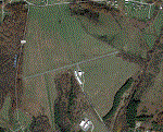
Valley Point (WV29) is a privately owned airport nestled in the hills of Albright, West Virginia. This has been updated from defualt FSX to include the north south grass runway.
Based on local a local flight instructor, the airport should always be approached for landing going north bound towards rising terrain (if the winds are less than 10 knots). This assists with braking. A go around should never be attempted going northbound after the wheels impact the ground.
Takeoffs should always be performed going south bound (if the winds are less than 10 knots) due to steeply rising terrain (300 feet above the airport) to the north.
| Filename: | WV29__Valley_Point_Airport.zip |
| License: | Freeware |
| Added: | 28th June 2021, 04:14:34 |
| Downloads: | 116 |
| Author: | David Abreu |
| Size: | 2.17 KB |
| Category: Flight Simulator 2004 - Scenery | |
| Flattens for use at PANC Anchorage, Alaska Airport |
|
Images related to this file:
File Description:
Flattens for use at PANC Anchorage, Alaska Airport - for FS2004 only.
While flying into PANC recently, I noticed the water was encroaching on the land near Runways 14 and 6 in a most unrealistic manner. This package provides two flattens which will eliminate that problem. Tested with the default scenery and with the Frame Rate Friendly Studio version of PANC. It has not been tested with any terrain enhancement such as Ultimate Terrain. Please unzip to a temporary folder and follow the very simple installation instructions. Compiled for your flying enjoyment by David "Opa" Marshall.
| Filename: | Flattens_for_use_at_PANC_Anchorage_Alaska_Airport.zip |
| License: | Freeware |
| Added: | 20th June 2010, 02:16:27 |
| Downloads: | 1,937 |
| Author: | David "Opa" Marshall |
| Size: | 765.25 KB |


© 2001-2026 AVSIM Online
All Rights Reserved
Privacy Policy |