
Where Flight Simulation Enthusiasts Gather from Around the World!
AVSIM Library - Search Results

| Category: Flight Simulator X - Scenery | |
| EGNC - Carlisle Airport, Scotland UK |

|
Images related to this file:
File Description:
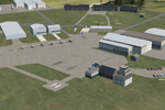
Airport files for Carlisle Lake District Airport of Carlisle, Cumbria, England - ICAO code EGNC, IATA code CAX. This airport is based on the FSX default files. This revision corrects errors with AI traffic; adds parking, buildings, and scenery objects; and corrects a few minor errors in the default airport. Includes versions with and without crosswind runways enabled. Also includes suggestions on populating the adjacent air museum.
| Filename: | EGNC__Carlisle_Airport_Scotland_UK.zip |
| License: | Freeware, limited distribution |
| Added: | 13th February 2013, 13:35:22 |
| Downloads: | 1,036 |
| Author: | Chris Thompson |
| Size: | 452.36 KB |
| Category: Flight Simulator X - AFCAD Files | |
| Kona Intl At Keahole - PHKO - Hawaii |
|
Images related to this file:
File Description:
This airport update was designed with the latest version of ADE v1.50 (Airport Design Editor) and made only for the FSX default airport: assigned parking with extra parking, taxiways and taxi signs updated, extra fuel trucks, helipads, support vehicle roads rebuilt and many other improvements, airport views are from the roof of control tower (when in tower view) please view the readme before installation
| Filename: | Kona_Intl_At_Keahole__PHKO__Hawaii.zip |
| License: | Freeware |
| Added: | 18th August 2011, 04:55:39 |
| Downloads: | 4,440 |
| Author: | Ray Smith |
| Size: | 433.98 KB |
| Category: Prepar3D V1-4 - Scenery | |
| KPVG Hampton Roads Executive Airport Scenery for P3Dv4 |
|
File Description:
[P3Dv4] Hampton Roads Executive Airport.
Scenery for the Hampton Roads Executive Airport in Chesapeake, VA. The Hampton Roads Executive Airport (ICAO: KPVG) is a general aviation airport serving the Hampton Roads area in coastal Virginia. This addon reflects the current (as of 2020) state of the airport, including a new terminal and new Runway 10/28 with precision approaches. All custom 3D buildings and ground polygons with accurate pavement and markings. Scenery by Er-Jin Jang.
| Filename: | KPVG_Hampton_Roads_Executive_Airport_Scenery_for_P.zip |
| License: | Freeware |
| Added: | 9th December 2020, 15:02:13 |
| Downloads: | 287 |
| Author: | Er-Jin Jang |
| Size: | 195.29 MB |
| Category: Flight Simulator 2004 - Scenery | |
| LIBD |
|
File Description:
Bari new airport (LIBD) with some building still under construction.
| Filename: | LIBD.zip |
| License: | Freeware |
| Added: | 12th March 2006, 15:11:24 |
| Downloads: | 11,604 |
| Author: | Filippo Infascelli |
| Size: | 1.13 MB |
| Category: Flight Simulator 2004 - Scenery | |
| EINN Shannon International Airport, Ireland |
|
File Description:
Shannon airport for FS2004, made with ADE9x and default libraries.
| Filename: | EINN_Shannon_International_Airport_Ireland.zip |
| License: | Freeware |
| Added: | 4th March 2012, 22:25:28 |
| Downloads: | 2,074 |
| Author: | Giacomo Gramazio |
| Size: | 29.8 KB |
| Category: Flight Simulator 2002 - AFCAD Files | |
| Dallas/Ft. Worth International Airport AFCAD |
|
File Description:
Radiused gates for KDFW airport (Dallas/Ft. Worth Intl airport). For use with AFCAD. Includes a single layer file and also a 4-part overlay utilizing all the different runways. For use with default scenery only.
| Filename: | DallasFt_Worth_International_Airport_AFCAD.zip |
| License: | Freeware |
| Added: | 31st December 2002, 16:15:04 |
| Downloads: | 936 |
| Author: | Bob Jarvis |
| Size: | 55.12 KB |
| Category: Fly! II - Scenery | |
| Nice Cote d'Azur-LFMN |
|
File Description:
This is the french riviera airport. It is the second airport in France for traffic.
It is my first important work with TerraModels. I create the mean buldings with Zmodeler. All the textures are photo-textures.
| Filename: | Nice_Cote_dAzurLFMN.zip |
| License: | Freeware |
| Added: | 2nd February 2003, 19:16:49 |
| Downloads: | 469 |
| Author: | Robert Morelli |
| Size: | 770.4 KB |
| Category: Flight Simulator X - AFCAD Files | |
| Strawberry Fields Airport (89NJ), NJ |
|
File Description:
Located 02 miles N of Mays Landing, New Jersey on 220 acres of land, Strawberry Fields Airport is a private turf/sand strip. SkyVector lists the runway as 2200' long, but as measured during development it is closer to 3000'. In addition to Runways 14 and 32, there is a second runway that is not listed in the airport directory and presumed closed. However if you need it in an emergency the numbers are 03 and 21 (no starts are available for these runways). This airport is not lit and is best used only during daytime VFR conditions. The windsock can be found at the intersection of the two runways and is also not lit. You will be landing on bare terrain so have your mesh complexity slider set as high as possible for best effect.
Scenery constructed with use of satellite images/streetview/aerial photos - the author has not been there in person.
This scenery is meant to be used in conjunction with MegaScenery Earth New Jersey/Delaware 003. It is not required, but apron use is minimized to allow satellite scenery to show through as much as possible, and objects are placed based on the MSE textures - lack of it may make scenery look out of place.
| Filename: | Strawberry_Fields_Airport_89NJ_NJ.zip |
| License: | Freeware |
| Added: | 17th February 2011, 07:55:52 |
| Downloads: | 204 |
| Author: | Drew Sikora |
| Size: | 1.75 MB |
| Category: Flight Simulator X - AFCAD Files | |
| Active ILS Innsbruck, Austria (LOWI) |
|
File Description:
This FSX Airport is more then just a AFX style Airport. As most know the Approach and Final (VMC) for AI Traffic in FSX is a straight in type landing and does not always consider high terrain at airports. This is due to the way that the coding is written in FSX and it puts limits on IFR arriving aircraft. At certain airports the AI Traffic will fly directly through a mountain once it is established on Final for a runway. What you will see with my files is a different type approach used for both the way I control AI and User Airplane Traffic in FSX. No longer do the AI Planes use a straight in approach when landing at LOWI. My AI Aircraft Approach coding for FSX uses a visual offset approach so AI Traffic does not fly through the mountains. The Innsbruck Control Tower will clear all AI Traffic (IFR FP) landing either on RWY 08 or 26 as a straight in landing even though the offset to final is 30 degrees from the runway center line. Read the text file for all the enhancements added to the FSX LOWI Airport along with a full understanding of how the new Approaches work *** Full set of Freeware Approach Charts included ***
| Filename: | Active_ILS_Innsbruck_Austria_LOWI.zip |
| License: | Freeware, limited distribution |
| Added: | 21st July 2007, 13:04:43 |
| Downloads: | 6,072 |
| Author: | Jim Vile |
| Size: | 799.84 KB |
| Category: Flight Simulator 2004 - Scenery | |
| Igloolik CYGT update (to FSGenesis 76m North Canada Terrain Mesh revision) |
|
Images related to this file:
File Description:
These are replacement bgl's and textures to correct the already posted Igloolik CYGT for use with the FSGenesis 76m terrain mesh for northern Canada. I noticed after posting that the PAPI were incorrectly positioned, and after fixing that I went on and updated the windsocks, added the wheeled roller/snow clearer that all gravel fields need in the north, and updated the signage to give the true headings for the runway. This is not stand-alone, and the presumption is that you have already downloaded and installed the previously posted scenery. Installation consists solely of replacing the existing scenery bgl's with the new, and adding the new signage textures.Any comments regarding further corrections that are required would be welcomed.
| Filename: | Igloolik_CYGT_update_to_FSGenesis_76m_North_Canada.zip |
| License: | Freeware, limited distribution |
| Added: | 30th September 2017, 20:11:03 |
| Downloads: | 84 |
| Author: | Roger Wensley |
| Size: | 1.03 MB |
© 2001-2026 AVSIM Online
All Rights Reserved
Privacy Policy |