
Where Flight Simulation Enthusiasts Gather from Around the World!
AVSIM Library - Search Results

| Category: Flight Simulator X - Scenery | |
| KLUA - Luray Caverns Airport - Luray, Virgina, USA |

|
Images related to this file:
File Description:
Luray Caverns Airport (ICAO: KLUA, FAA LID: LUA, formerly W45) is a public use airport located two nautical miles (4 km) west of the central business district of Luray, a town in Page County, Virginia, United States. The airport is owned by the Town of Luray and Page County.It is included in the National Plan of Integrated Airport Systems for 2011-2015, which categorized it as a general aviation airport.
Added taxiways and aircraft parkng along with custom buildings. Created with Airport Design Editor by ScruffyDuck Software using current FAA documentation and Google Earth measurements, this package offers a replacement for FSX's stock airport. All these enhancements are as close to the real airport as I can get with stock library objects and custom buildings.
| Filename: | KLUA__Luray_Caverns_Airport__Luray_Virgina_USA.zip |
| License: | Freeware |
| Added: | 29th November 2014, 14:11:35 |
| Downloads: | 314 |
| Author: | Wayne Roberts |
| Size: | 339.07 KB |
| Category: Prepar3D V1-4 - Scenery | |
| Charleroi Brussels south airport EBCI |
|
File Description:
Airport scenery for Charleroi Brussels south airport - Belgium.
The second airport of Belgium in passengers and aircraft numbers.
Runway designators corrected to 6-24
ILS with DME
Correct taxiway designators
Correct gate numbers
| Filename: | Charleroi_Brussels_south_airport_EBCI.zip |
| License: | Freeware |
| Added: | 26th February 2021, 19:55:17 |
| Downloads: | 910 |
| Author: | Johan Thiers |
| Size: | 15.21 MB |
| Category: Flight Simulator X - Scenery | |
| SKCM |
|
File Description:
SKCM
Cimitarra Airport (IATA: CIM, ICAO: SKCM) is an airport serving Cimitarra, a municipality of Santander Department of Colombia.
This file has the right coordenates, with the apron and characteristics of the airport.
| Filename: | SKCM.zip |
| License: | Freeware |
| Added: | 8th February 2011, 02:22:06 |
| Downloads: | 817 |
| Author: | Anwar Gonzalez |
| Size: | 2.81 KB |
| Category: Flight Simulator 2004 - Scenery | |
| More New Jersey Airports |
|
File Description:
FS2004 Scenery - This file contains 5 more New Jersey Airports. Enjoy flying from one to another. You can visit Bucks Airport (00N), Redwing Airport (2N6), Marlboro Airport (2N8, Now Closed), Hackettstown Airport (N05) and Li Calzi Airport (N50). There is information on all the airports in the readme file. Created with Instant Scenery. The usual EZ Scenery Libraries are required. In collaboration with Ray Lunning, this scenery was created by John B. Loney, Jr.
| Filename: | More_New_Jersey_Airports.zip |
| License: | Freeware, limited distribution |
| Added: | 16th December 2007, 16:16:38 |
| Downloads: | 740 |
| Author: | John B. Loney, Jr. |
| Size: | 577.69 KB |
| Category: Flight Simulator 2004 - Scenery | |
| VFR of Lario - Como lake, Italy |
|
Images related to this file:
File Description:
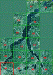
This is the first of the expected seventeen sceneries in the "VFR of Lario" project, that will include the full view of the Como Lake, made with photorealistic terrain (multiseason & night) and with 3D GMax realistic objects, including some motions. Further the Como seaplane airport, the project will include some other virtual ones, and all the piers of NLC (Navigation Lake Como). The project will be completed with a related AI seaplane traffic.
The "VFR of Lario" project REQUEST the installation of the scenery "Itcoast2.zip" & the related "ITAC2_P1.zip", both available for free download from different libraries.
Information: Como is the main and beautifull city on the namesake lake (called Lario), placed in the north of Italy, closed to the Helvetic border. It includes the AeroClub Como seaplanes international airport, with his own flight school. Como has the headseat of NLC, the fleet management for connection of forty Lario's piers. This first scenery covers approximately an area of 7.5x6 kmt.
Contents: airport water track with hangar and static seaplanes; breackwater and stadium lake front, war memorial monument, Volta's temple and lighthouse, main Cathedral, Social theater, city old towers and wall, villa Olmo, square Cavour's buildings, NLC main pier and some minor others, Como-Brunate's funicolar connection (animated), lake fountain, Tavernola shipyard, Baradello's castle, Valduce hospital; motor ships (animated), steamer, hydrofoils and other minor boats; several other buildings (GenericBuilding system), trees and lights widespread all over the scenery.
| Filename: | VFR_of_Lario__Como_lake_Italy.zip |
| License: | Freeware |
| Added: | 22nd December 2011, 23:30:47 |
| Downloads: | 3,549 |
| Author: | Aldo Della Vedova, Daniele Lanfranchi, Diego Caligiuri |
| Size: | 25.33 MB |
| Category: Flight Simulator 2004 - AFCAD Files | |
| AFCAD2 for EKCH Scenery for Freeware SwedflightPro v.2.0, UPDATE |
|
Images related to this file:
File Description:

AFCAD2 for EKCH Scenery for Freeware SwedflightPro v.2.0, update.
Reworked using, in the order:
1 - Airport related chart
2 - Airport web-site for terminal assignments
3 - Google Earth(r) Airport visualization and airport related internet site(s), where applicable on FS2004 scenery airport areas with changes to parking assignments.
| Filename: | AFCAD2_for_EKCH_Scenery_for_Freeware_SwedflightPro.zip |
| License: | Freeware |
| Added: | 26th February 2011, 22:27:39 |
| Downloads: | 666 |
| Author: | Vincenzo Mercolino |
| Size: | 8.54 KB |
| Category: Flight Simulator X - Scenery | |
| Toulouse Blagnac (LFBO) v1 |
|
File Description:
This is an addon scenery for FSX of the Toulouse Blagnac Airport LFBO. It has been made using the excellent freeware tool Airport Design Editor for the layout. I have used Sketchup from Google and Model Converter X to design the buildings of the airport.
You will find all the terminals of LFBO and the control tower, as well as the Airbus facilities of the A380 Lagardere plant North East of LFBO, the A380 delivery center Henry Ziegler North West of LFBO, and some buildings of the Airbus facilities in Blagnac, West of LFBO. All buildings have photo textures, most of them taking with my camera, as I am working in the area. All buildings include night textures. You have two landing pads for helicopters like in reality South East of LFBO.
I used google earth for some items position, but the current view not being up to date, I used my knowledge of the area to correctly position the taxiways, parkings, gates and building position.
I used the FSX generic buildings for the other missing buildings, however they have the size and position which corresponds as far as possible to the position of the real buildings. The surroundings of the airport not being too realistic with Ultimate Terrain X or with FSX, I have modified the landclass of the surroundings to make them look more in accordance with reality. I have changed the parking assignment to make sure that the usual traffic will park on the parkings E, F D AB, V and U.
| Filename: | Toulouse_Blagnac_LFBO_v1.zip |
| License: | Freeware |
| Added: | 21st December 2011, 13:09:29 |
| Downloads: | 23,242 |
| Author: | Jose Mauriz |
| Size: | 34.72 MB |
| Category: Flight Simulator X - AFCAD Files | |
| Fla-Net Airport (0NJ5), NJ |
|
File Description:
This another weird airport entry in the FSX database. The real 0NJ5 is the Meadowlands Sports Complex Heliport #2, and this just shows up as a random turf strip up near Netcong/Flanders in northern NJ. I could not find any specific information regarding the airport online, and while it does appear to once harbour the room and terrain for a grass strip, it's largely overgrown, even in the current MegaScenery Earth textures. So I've removed the strip entirely. There is still a start at the northwest end of where the strip used to be if you want to travel there, but that's it.
Scenery constructed with use of satellite images/streetview, the author has not been there in person.
This scenery is meant to be used in conjunction with MegaScenery Earth New York 005. It is not required, but apron use is minimized to allow satellite scenery to show through as much as possible, and objects are placed based on the MSE textures - lack of it may make scenery look out of place.
| Filename: | FlaNet_Airport_0NJ5_NJ.zip |
| License: | Freeware |
| Added: | 21st October 2010, 23:23:44 |
| Downloads: | 188 |
| Author: | Drew Sikora |
| Size: | 199.2 KB |
| Category: Flight Simulator X - AFCAD Files | |
| Coombs Airport (7NJ7), NJ |
|
File Description:
Located 04 miles NE of Elmer, New Jersey, Coombs Airport is a private turf field 2000' in length wilth clear 20:1 approach and departure at each end of the runway. You'll find some surrounding buildings but they are all located several hundred yards from the runway. This is a good strip to keep in mind for emergencies if you're in the area. You will be landing on terrain so having your mesh complexity set as high as possible is recommended. This airport is not lit at night, daytime VFR operations only are suggested. There are no transient services offered.
Scenery constructed with use of satellite images/streetview/aerial photos - the author has not been there in person.
This scenery is meant to be used in conjunction with MegaScenery Earth New Jersey/Delaware 004. It is not required, but apron use is minimized to allow satellite scenery to show through as much as possible, and objects are placed based on the MSE textures - lack of it may make scenery look out of place.
| Filename: | Coombs_Airport_7NJ7_NJ.zip |
| License: | Freeware |
| Added: | 16th February 2011, 00:03:55 |
| Downloads: | 191 |
| Author: | Drew Sikora |
| Size: | 756.22 KB |
| Category: Flight Simulator 2002 - Scenery Design | |
| LWMDraw3 |
|
File Description:
Re-upload. LWMDraw3 -- FS2002 Scenery Design
LWMDraw3 is developed to be an easy to use and
helpful time saving tool for placing free design shapes
or photoreal default type water areas such as lakes
"with effects" onto the FS2002 terrain surface generating
a "ready to assemble" LWMSource.asm file. Features
include the addition of default type FS2002 roads/
lines/shorelines with the generation of a separate
VTPSource.asm file as well. Also includes more
options explained within the detailed Help menu along
with Quick Start Guide menu for fast placement.
Freeware by Ken Nelson
| Filename: | LWMDraw3.zip |
| License: | Freeware, limited distribution |
| Added: | 16th May 2010, 21:18:34 |
| Downloads: | 554 |
| Author: | Ken Nelson |
| Size: | 1.4 MB |
© 2001-2026 AVSIM Online
All Rights Reserved
Privacy Policy |