
Where Flight Simulation Enthusiasts Gather from Around the World!
AVSIM Library - Search Results

| Category: Flight Simulator X - Scenery | |
| USA Landclass Vegetation Part I ** UPDATE ** |

|
Images related to this file:
File Description:
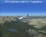
UPDATE:
Some small Cities, the Area around KAOC, Uinta Mountains.
Landclass Improvements for the USA, specialy the western Part of the USA:
Colorado, Yellow Stone, Little Part of Idaho, Montana and from LA to Seattle, also some Testscenery's for the eastern Part of the USA.
Compatible with Ultimate Terrain.
The LC Scenery's are for further devolpment, including the *.inf & *raw files of the folder USA_SBX1.
| Filename: | USA_Landclass_Vegetation_Part_I____UPDATE_.zip |
| License: | Freeware |
| Added: | 13th February 2015, 10:02:54 |
| Downloads: | 613 |
| Author: | Markus Balz |
| Size: | 4.56 MB |
| Category: Flight Simulator 2004 - Scenery | |
| Ebeko Volcano |
|
File Description:
This scenery will bring to life Ebeko volcano which rises above the city of Kurilsk on Paramushir island situated in the Kuril islands south of Kamchatka. (No excuses for not finding it now). I have used terrain mesh by FSGenesis, but should work with any good 76.4m mesh. Sound package included by Lou Frost, you will need FSEnhancer by Lago to hear sounds. Scenery can be used with or without sound package. See readme instructions for full details.
| Filename: | Ebeko_Volcano.zip |
| License: | Freeware, limited distribution |
| Added: | 18th July 2005, 04:12:17 |
| Downloads: | 682 |
| Author: | Kym Burton, Lou Frost |
| Size: | 337.36 KB |
| Category: Flight Simulator 2004 - Scenery | |
| California Central Coast Scenery CCCoastF revised 12/18/04 |
|
Images related to this file:
File Description:
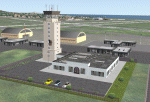
This is a complete and revised version of CCCOASTM.ZIP that was released on 3/31/04 and includes all subsequent revisions to CCCOASTM. It is compatible with and requires 38.2m LOD10 mesh terrain and has been tweaked to work better with, but doesn't require, USA Roads. Many other fixes, additions and improvements.
Note: This is a re-upload of the file originally uploaded on December 18th 2004 that was corrupted by the Avsim Library hack.
| Filename: | California_Central_Coast_Scenery_CCCoastF_revised_.zip |
| License: | Freeware |
| Added: | 28th May 2010, 19:54:02 |
| Downloads: | 4,175 |
| Author: | Al Wheeler |
| Size: | 5.66 MB |
| Category: Flight Simulator X - Scenery | |
| Sicily VFR - Terrain Mesh SRTM 1 Arc/Sec version 3 |
|
Images related to this file:
File Description:
Enhanced Terrain Mesh with SRTM 1 Arc/Sec (30 meters) version 3 at LOD 11 (19mt meters/pixel). SRTM 1 Arc-Second Global elevation data offer worldwide coverage of void filled data at a resolution of 1 arc-second (30 meters/0,000278 degrees) and provide open distribution of this high-resolution global data set. The SRTM 1 Arc-Second Global (30 meters) data set released in phases starting September 24, 2014. Fully compatible also with P3D.
| Filename: | Sicily_VFR__Terrain_Mesh_SRTM_1_ArcSec_version_3.zip |
| License: | Freeware |
| Added: | 7th February 2015, 20:18:17 |
| Downloads: | 4,689 |
| Author: | Giovanni Miduri |
| Size: | 43.32 MB |
| Category: Flight Simulator 2004 - Scenery | |
| California Central Coast Ultimate Terrain USA Compatible Version Revision 1 |
|
File Description:
This is revision #1 to CCCOASTU.ZIP dated 9/13/05 and only applies to that UT USA compatible version of my California Central Coast Scenery. Revised Morro Rock, added taxiway designations and signs at PRB, several other tweaks. CCCOASTU.ZIP is required.
| Filename: | California_Central_Coast_Ultimate_Terrain_USA_Comp.zip |
| License: | Freeware |
| Added: | 13th October 2005, 22:56:57 |
| Downloads: | 1,204 |
| Author: | Al Wheeler |
| Size: | 985.45 KB |
| Category: Strike Fighters: Project 1 - Mods, Utilities and Patches | |
| Enhanced Planning Maps for WoV's stock VietnamSEA terrain Version 1.0 |
|
File Description:
This is a very basic supplement to make it easier to design DRV missions. Paint Shop Pro 7 was used to combine WoV's planningmap2.bmp with an overlay. The overlay is a map from a game scenario book: p.2 of the DOWNTOWN Scenario Booklet by Lee Brimmicombe-Wood, published by GMT Games. The overlay and the stock map do not quite agree, but is reasonably accurate in the primary areas of interest: Thud Ridge, Hanoi, and Haiphong.
| Filename: | Enhanced_Planning_Maps_for_WoVs_stock_VietnamSEA_t.zip |
| License: | Freeware |
| Added: | 28th November 2005, 13:51:17 |
| Downloads: | 217 |
| Author: | Stephen Lynn Flores |
| Size: | 6.54 MB |
| Category: Flight Simulator 2004 - Scenery | |
| The Greater Toronto Area for Ultimate Terrain 1.2 Part 1 |
|
File Description:
Part 1 of Flight Ontario's scenery for the Greater Toronto Area for Ultimate Terrain. The scenery is bounded by Detroit in the west, Kingston in the east, Huntsville in the north and Buffalo in the south and features: * all-season scenery * custom water textures * completely modelled Toronto Airports...CYTZ (Toronto Island) and CYZD (Downsview-home to Bombardier Aerospace and the Canadair Regional Jet and Dash-8, and the Toronto Aerospace Museum) * Niagara Helicopters CPQ3 (NEW) *custom autogen for the GTA * Custom landclass for southern Ontario * prominent features around Hamilton include the Burlington Skyway,lift bridge and steel mills * the Welland Canal is featured with lift bridges from Pt Weller to Pt Colborne * the Niagara area includes two hydro generating plants with reservoirs * compatibility with SimFlyers CYYZ.
This scenery is downloadable in two parts and both parts are essential.
| Filename: | The_Greater_Toronto_Area_for_Ultimate_Terrain_12_P.zip |
| License: | Freeware |
| Added: | 31st December 2005, 18:39:52 |
| Downloads: | 13,895 |
| Author: | Jim Kanold - Flight Ontario |
| Size: | 62.05 MB |
| Category: Flight Simulator 2002 - Scenery | |
| NY-New York City, Central Park Area Terrain Mesh (10m) |
|
File Description: Take a break and enjoy Sunday afternoon in the park. This high resolution mesh demonstrates the amount of detail FS2002 is able to display. But you will not see any improvement in the park if you are still using the default value of TERRAIN_MAX_VERTEX_LEVEL=19 (in the [TERRAIN] section) of your fs2002.cfg file! This value is adequate for the default mesh, but will not display all the additional detail available in mesh constructed from 30m or better source data. I recommend a value of 21 for the most detail, but a value of 20 may be preferable if FPS is a serious problem. Hop in your favorite helicopter, depart from La Guardia (KLGA) airport, and head west toward the city. (If you are new to helicopters, set your Aircraft realism to Easy and turn off Crash Detection while getting started - and relax in this scenic park!)
| Filename: | NYNew_York_City_Central_Park_Area_Terrain_Mesh_10m.zip |
| License: | Freeware, limited distribution |
| Added: | 21st July 2002, 17:35:04 |
| Downloads: | 2,845 |
| Author: | Steve Greenwood |
| Size: | 1017.33 KB |
| Category: Flight Simulator 2004 - AFCAD Files | |
| FAVG Airport facilities and GA Flight Plans |
|
File Description:
FS2004 FAVG Airport facilities and GA Flight Plans
Airport facilities and Flight Plans for Virginia airport South Africa. Works only with Aeroworx FAVG scenery. Uses Default GA FS2004 aircraft for Fligtplans.
| Filename: | FAVG_Airport_facilities_and_GA_Flight_Plans.zip |
| License: | Freeware |
| Added: | 2nd January 2004, 18:10:55 |
| Downloads: | 868 |
| Author: | Loots van Emmenis |
| Size: | 13.34 KB |
| Category: Flight Simulator X - Scenery | |
| KMOT, Minot International Airport, North Dakota USA |
|
Images related to this file:
File Description:
Complete new setup, done with ADE, from top-down images. Minot International Airport is a non-hub primary public airport. The Airport is owned and operated by the City of Minot.
| Filename: | KMOT_Minot_International_Airport_North_Dakota_USA.zip |
| License: | Freeware |
| Added: | 4th December 2017, 14:50:12 |
| Downloads: | 626 |
| Author: | Tim van Ringen |
| Size: | 173.44 KB |


© 2001-2026 AVSIM Online
All Rights Reserved
Privacy Policy |