
Where Flight Simulation Enthusiasts Gather from Around the World!
AVSIM Library - Search Results

| Category: Flight Simulator X - AFCAD Files | |
| CYXE - John G. Diefenbaker International Airport / Saskatoon, Saskatchewan, Canada |

|
Images related to this file:
File Description:
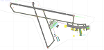
CYXE - John G. Diefenbaker International Airport / Saskatoon, Saskatchewan, Canada
This airport update was made with the latest version of ADE (Airport Design Editor) and made for FSX as a replacement for the stock (default) airport. I found that most stock airports in FSX lack a decent amount of character and realism and this area in particular was dreadful! The stock airport was rather inaccurate. I've made several additions to the airport which are listed below. All these enchancements are as close to the real airport as I can get with stock library objects. I've used satellite images, terminal photos and maps throughout the whole process so building locations are as accurate as possible. Happy landings in the beautiful Canada!
Features:
*Expanded parking apron
*Main terminal building with its jetways and regional jet parking area
*Seperate parking aprons for GA traffic
*Hangars and other airport buildings added
*Airport vehicles and objects throughout the airport
*Parking lots with static vehicles
*Airport fire station with fire trucks/ambulance
*De-icing ramp with static de-icing vehicles/runway plows
*Cargo ramp
| Filename: | CYXE__John_G_Diefenbaker_International_Airport__Sa.zip |
| License: | Freeware |
| Added: | 25th July 2012, 06:29:06 |
| Downloads: | 1,303 |
| Author: | Jaison Diaz |
| Size: | 152.47 KB |
| Category: Flight Simulator X - AFCAD Files | |
| KJFK New York |
|
File Description:
AFCAD for New yorks JFK airport for default airport only with allocated gates and moving jetways built with AFX READ THE READ ME FILE BEFORE INSTALLING
| Filename: | KJFK_New_York.zip |
| License: | Freeware |
| Added: | 31st December 2007, 21:48:52 |
| Downloads: | 2,273 |
| Author: | David Roberts |
| Size: | 57.43 KB |
| Category: Flight Simulator 2004 - Aircraft Repaints, Textures and Modifications | |
| Repaints and Panel Updates for YAK-18T |
|
File Description:
This package contains 2 different textures and a panel modification.
-1st repaint: RA44400, (I corrected some small issues from my previous upload)
this repaint is from a real Yak-18T. Check http://www.russianaeros.com/yak18Tproduct.htm.
-2nd repaint: N416RG, this is a new repaint from a Yak-18T flown by Ross Granley in aerobatic airshows in Canada and USA.
I have fixed the manifold pressure gauge, added a "post-it" with some useful flight data, and added sub panels to access some gauges/switches without leaving the VC.
You need the following files prior using these repaints and panel modification:
* Original Aircraft: yak-18t.zip (FlightSim) or yakovlev_yak-18t.zip (AVSIM) - from the original Design Team Alexey Yuzefov, George Sukhykh, Alexander Aphonin, Dmitry Shvetsov and Mike Maarse.
* 2.2 Yak-18T Update: yak18a22.zip - from Wolfram Beckert & Nick Schreger (MeatWater), who updated this great Freeware airplane.
| Filename: | Repaints_and_Panel_Updates_for_YAK18T.zip |
| License: | Freeware |
| Added: | 12th January 2008, 04:08:59 |
| Downloads: | 3,076 |
| Author: | Steffen Moessner |
| Size: | 11.82 MB |
| Category: Flight Simulator 2004 - Scenery | |
| Prudhoe Bay area on Alaska North Slope US |
|
Images related to this file:
File Description:
The Prudhoe Bay area of the Alaska north slope is dominated by all the equipment and machinery that is necessary for the extraction of oil and its transfer by the pipeline that reaches south to Valdez. Prudhoe Bay airport is now closed, and its replacement just to the south is Deadhorse PASC, with numerous storage, maintenance, and accomodation areas immediately to the north of the apron, and others adjacent to the road between the two. The runway is just under 6,500 feet with approach lights at both ends and ILS on 04 (true heading of 75 degrees). This scenery reflects the overall situation in 2011 and oil production facilities and buildings are included here. The airport buildings and those close to the airport are replicas of the real life buildings; while as distance increases the accuracy fades somewhat there are everywhere replica trucks and cross country vehicles that are true to life. Deadhorse handles around 7,000 passengers per month as staff are rotated in and out on Alaska Air and ERA flights and by oil company private flights. There are also freight flights to complement the trucking effort up the Dalton Highway. The Alaska Airlines terminal building and ERA (the red buildings nearby) are at one end of the apron, while at the other end is a very large and new green terminal, storage, hangar building built by the airport authority. All of the airport components, runways, taxiways, and aprons, are built up on a gravel base to raise them above the surrounding terrain that floods with melting snow, freezes, or dries out, according to the seasons. There are other new airstrips included here that serve the oil industry. Around 33 miles to the east is Badami PABP airport servicing a subsiduary oil producing area, with 5,000 feet of gravel runway. Some 28 miles to the west of Deadhorse is Ugnu-Kuparuk UBW with just over 6,000 feet of gravel (gravel in 2011, it is now asphalted) servicing oil production by Conoco Phillips, which uses 737's to fly staff in and out. A further 32 miles west is Alpine AK15 with 5,400 feet of gravel and also served by the Conoco Phillips 737's. To the south of Alpine and connected by road is the village of Nuiqsut. To the north of Alpine and reachable only by air in the delta of the Sagavanirktok River is CD-3, an oil collection and pump station area with another gravel runway of 3,000 feet. Other airstrips that were prviously posted are now updated, Nuiqsut and Oliktok. I experimented, but decided against trying to reproduce the several hundred miles of pipelines. The are new AI aircraft, and there are notes regarding downloading. There is a new "cement" texture (not its name, but used as that by SBuilder) for the built up gravel bases. It is slightly darker than the original but not so much that any previous use will be spoilt. You may wish to download my "Alaska Frozen Rivers and Lakes" which freezes lakes and the northern sea and makes them landable on wheels.
| Filename: | Prudhoe_Bay_area_on_Alaska_North_Slope_US.zip |
| License: | Freeware, limited distribution |
| Added: | 19th December 2017, 00:38:06 |
| Downloads: | 586 |
| Author: | Roger Wensley |
| Size: | 28.54 MB |
| Category: Flight Simulator 2004 - Miscellaneous Files | |
| Red Dog SAR update |
|
File Description:
Red Dog SAR mission update for those of you that have default terrain. This has the complete mission so no need to download anything but RWY 12 object placer if you don't already have it.
| Filename: | Red_Dog_SAR_update.zip |
| License: | Freeware |
| Added: | 14th February 2005, 19:06:55 |
| Downloads: | 190 |
| Author: | Paul Leveich |
| Size: | 12.74 KB |
| Category: Flight Simulator 2004 - Scenery | |
| FS2004 Scenery-UBxx- (no ICAO-code) Baku-Lokbatan AB |
|
File Description:
FS2004 Scenery-UBxx- (no ICAO-code) Baku-Lokbatan AB
Based on open photos available, Baku 2017 for FS2004 by Drzewiecki Design and
Ultimate Terrain Europe. Please see Install notes for necessary object files and enjoy.
| Filename: | FS2004_SceneryUBxx_no_ICAOcode_BakuLokbatan_AB.zip |
| License: | Freeware |
| Added: | 19th May 2023, 19:56:54 |
| Downloads: | 33 |
| Author: | Bernd Barsch |
| Size: | 2.75 MB |
| Category: Flight Simulator X - Scenery | |
| KPNE Northeast Philadelphia Airport |
|
Images related to this file:
File Description:

KPNE Northeast Philadelphia Airport. Detailed general aviation airport with all new hand placed buildings using Google earth. Some buildings were left out to keep this highly detailed airport frame rate friendly. This scenery works well with general aviation AI.
| Filename: | KPNE_Northeast_Philadelphia_Airport.zip |
| License: | Freeware |
| Added: | 30th November 2010, 06:20:58 |
| Downloads: | 919 |
| Author: | Rob Touchtone |
| Size: | 199.36 KB |
| Category: Flight Simulator 2004 - Scenery | |
| Metro Field MTF in Fairbanks Alaska |
|
Images related to this file:
File Description:
Metro Field is more of a float plane "pond" than a field, close to and northeast of Fairbanks International Airport in Alaska. There is a gravel strip alongside the water, but the "strip" is actually a gravel road that functions as a runway when required. And if that sounds familiar it is also pretty much the description for nearby Chena Marina, though Metro is nowhere near as busy. This is one of four float plane bases around Fairbanks. You will definitely need Ultimate Terrain Alaska Canada.
| Filename: | Metro_Field_MTF_in_Fairbanks_Alaska.zip |
| License: | Freeware, limited distribution |
| Added: | 21st August 2010, 03:27:58 |
| Downloads: | 373 |
| Author: | Roger Wensley |
| Size: | 986.7 KB |
| Category: Flight Simulator X - AFCAD Files | |
| Missing Asian Airports - ZBMZ (NZH) - ZSWZ (WNZ) - ZMDN (ULZ) |
|
File Description:
Missing airports/afcads for FSX, ZBMZ(NZH) Manzhouli Xijiao Airport,China - ZSWZ(WNZ) Wenzhou Yongqiang Airport,China - ZMDN(ULZ) Donoi Airport (aka New Uliastai Airport),Mongolia. Tested with FSX Acceleration SP2, UTX/GEX.
| Filename: | Missing_Asian_Airports__ZBMZ_NZH__ZSWZ_WNZ__ZMDN_U.zip |
| License: | Freeware, limited distribution |
| Added: | 16th June 2014, 06:37:55 |
| Downloads: | 1,331 |
| Author: | Kevin Wynn |
| Size: | 11.74 KB |
| Category: Flight Simulator 2002 - AFCAD Files | |
| Heathrow Airport 2000 AFCAD |
|
File Description:
AFCAD file for Heathrow airport with more than 100 gates
Requires need Wilco's airport 2000 vol 2.
| Filename: | Heathrow_Airport_2000_AFCAD.zip |
| License: | Freeware |
| Added: | 4th January 2003, 22:17:31 |
| Downloads: | 311 |
| Author: | Frederic Kabalu |
| Size: | 7.46 KB |


© 2001-2026 AVSIM Online
All Rights Reserved
Privacy Policy |