
Where Flight Simulation Enthusiasts Gather from Around the World!
AVSIM Library - Search Results

| Category: X-Plane - Scenery | |
| BR PA SBEK - Jacareacanga Airport v1.0.0 |

|
Images related to this file:
File Description:

This is an X-Plane 11 and X-Plane 10 scenery package for Jacareacanga-Rio Tapajos Municipal Airport (IATA: JCR, ICAO: SBEK), which is the airport serving Jacareacanga, Para, in Brazil. This airport is lost into the deep Amazon Rainforest, by the Tapajos River, in the state of Para, in Brazil. It includes corrected aprons, ramps, gates, taxiways, lighting system, city buildings, ortho-photoscenery for the airfield area, and (XP11 only) airport ground services (like push back). This scenery was tested and is operational (as of June 04, 2017) in "X-Plane 11.02b1 64 bit", Windows 10 Home. It was also tested and is also operational (as of June 04, 2017) in "X-Plane 10.51 64 bit", Windows 10 Home.
| Filename: | BR_PA_SBEK__Jacareacanga_Airport_v100.zip |
| License: | Freeware |
| Added: | 5th June 2017, 13:58:34 |
| Downloads: | 72 |
| Author: | Rui Mesquita |
| Size: | 10.28 MB |
| Category: Microsoft Flight Simulator (2020) - Scenery | |
| Norman Y. Mineta San Jose International Airport (KSJC) |
|
Images related to this file:
File Description:
Also known as just San Jose International Airport, this is the main airport located at the heart of downtown San Jose, CA in Silicon Valley. As an alternative to larger airports such as San Francisco Intl, KSJC has parallel 11,000ft runways and serves many destinations; from local flights to flights to London, Tokyo, Beijing, and formerly Frankfurt and Shanghai. The airport is continuing to expand it's Terminal B due to a huge pre-pandemic increase in demand from local travelers.
Here the airport has been created from scratch for MSFS and features custom ground textures, buildings, navaids, vehicles, functional custom jetways, and dynamic lighting. This project was created by one person and is over five years in the making. Enjoy!
| Filename: | Norman_Y_Mineta_San_Jose_International_Airport_KSJ.zip |
| License: | Freeware |
| Added: | 10th January 2021, 21:41:37 |
| Downloads: | 466 |
| Author: | Nick Bauer |
| Size: | 303.7 MB |
| Category: Microsoft Flight Simulator (2020) - Scenery | |
| Airport Saglek CYSV in Canada, Labrador |
|
File Description:
Saglek Airport CYSV (Route additions to radar etc.)
The airport is located north of New Fourdland in Canada, there is a radar station on the mountain near the Atlantic.
In 1945, he had research on BPS.
The scenery comes from information collected from Google Earth and other images.
Runway 17 has an ILS approach on frequency 110.10.
Runway 35 also has an ILS approach on frequency 112.10.
The landing is quite critical because we are close to the ground.
ATC control is active for approaches and ground service.
Special Warning:
If you have another CYSV scene in Community, please delete it or remove it from the Community.
Installation: unzip the folder: rd-airport-cysv-saglek-v4.zip and place the rd-airport-saglek folder in the community.
| Filename: | Airport_Saglek_CYSV__in_Canada_Labrador.zip |
| License: | Freeware |
| Added: | 6th November 2023, 15:25:17 |
| Downloads: | 25 |
| Author: | Regis Dassylva |
| Size: | 5.9 MB |
| Category: Flight Simulator 2004 - Scenery | |
| Frazier Lake Airpark (1C9) California Scenery |
|
File Description:
This is a scenery upgrade for Frazier Lake, California (1C9). This is part Eight of a series of small airstrip and minor airfield scenery enhancements which are based on real world data from Google Earth. The scenery mainly reflects the appearance of the airpark from directly above. If you are familiar with the place when on the ground, due to the limited number of buildings available it probably looks quite different. There is now however, a water strip for float planes which was missing from the default. It is proper FS9 water so you may land on it. Also, a few images from the net show that the ground varies from green grass to bare earth so I have made four .bgl files for the base texture. Note, I am using Flight1 Ground Environment; the default fields will look different. You must have rwy12 and EZ scenery libraries installed for the buildings to show. Both libraries of objects are free. EZ Library is available at http://www.abacuspub.com/pub/AbacusEZLibraries.exe. Rwy12 and additional EZ Custom libraries from Avsim. Search under Scenery design.
| Filename: | Frazier_Lake_Airpark_1C9_California_Scenery.zip |
| License: | Freeware |
| Added: | 31st March 2006, 01:00:25 |
| Downloads: | 501 |
| Author: | Kim Gowney |
| Size: | 400.27 KB |
| Category: Flight Simulator X - Scenery | |
| Essweiler Gliderfield, Germany Ver. 1.0 |
|
Images related to this file:
File Description:
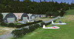
Essweiler is actually a classic glider field, but also engine aircrafts up to 2t are approved.
The field is situated in the region Rheinland-Pfalz/Germany at a hillside eastly of the village Essweiler, approximately 7,5 nautical miles north of the well known US-Airbase Ramstein.
The environment of the airfield is adapted by land classes. Surrounding villages and major roads are initially implemented.
As well the field is covered by a photo background, which includes four different images , each for one of the four seasons: spring, summer, autumn and winter. The buildings in this scenery should match quite good the originals. But also a lot of objects from three very popular freeware libraries are used.
If these libraries are not installed, many objects are not visible!
The following libraries are used:
1. FS-Piloten_Objektlibrary:
http://www.fs-piloten.de/thread.php?threadid=1063
2. FSX_FlightPortLib
http://www.flightport.de/libraries/flightport-library/
3: 3d People Library
http://library.avsim.net/download.php?DLID=192454
| Filename: | Essweiler_Gliderfield_Germany_Ver_10.zip |
| License: | Freeware |
| Added: | 29th November 2016, 19:15:50 |
| Downloads: | 605 |
| Author: | Wolfgang Allers |
| Size: | 168.18 MB |
| Category: Flight Simulator X - Scenery | |
| LOSM Mauterndorf, Austria Version1 for FSX and P3D_v3/v4 |
|
Images related to this file:
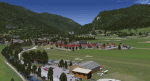
File Description: The Airfield Mauterndorf is the highest situated airfield in Austria: 3642 ft or 1110 meters above sealevel.
This Airfield is very common for glider flyers due to the usually good upwinds for flying in the alps. But also small engine aircrafts are approved. Link:
http://www.losm.at/index.php/losm.html The environment of the airfield is adapted by landclasses. Mauterndorf and the surrounding villages, valleys and major roads are included.
As well the field is covered by a photo background, wich includes four different images , each for one of the four seasons spring, summer, autum and winter. The buildings in this scenery are designed mainly new by myself, but also a lot of objects from two very popular freeware libraries.
If these libraries are not installed, many objects are not visible! The following libraries are used: 1. FS-Piloten_Objektlibrary:
http://www.fs-piloten.de/thread.php?threadid=10632 2.FSX_FlightPortLib:
http://www.flightport.de/libraries/flightport-library/ This senery works also with Austria Professional HD.
| Filename: | LOSM_Mauterndorf_Austria_Version1_for_FSX_and_P3D_.zip |
| License: | Freeware |
| Added: | 28th August 2017, 20:01:00 |
| Downloads: | 480 |
| Author: | Wolfgang Allers |
| Size: | 249.9 MB |
| Category: Flight Simulator 2002 - AFCAD Files | |
| Chicago O'Hare International Airport (KORD) AFCAD |
|
File Description:
The original AFCAD file, named KORDBB.txt, is an FS2002 facility file for the
Chicago O'Hare International Airport in Chicago, Illinois. It adds as
many gates as possible to the airport. The gates are logically labeled,
but may not reflect their real-world equivalent. Boyd Barker's goal was to add
'life' to the airport, not recreate an exact replica of the real thing.
The revised AFCAD file, named KORDBB_gatenum.txt, includes gate numbers based on info. from the O'Hare airport's web site, http://www.ohare.com/ohare/terminals/terminal.shtm.
All runways are available for FS2K2 to select the active.
| Filename: | Chicago_OHare_International_Airport_KORD_AFCAD.zip |
| License: | Freeware, limited distribution |
| Added: | 12th January 2003, 21:38:27 |
| Downloads: | 1,607 |
| Author: | Boyd Barker, Bob Blackmun |
| Size: | 74.07 KB |
| Category: Flight Simulator 2002 - AFCAD Files | |
| Tashkent Yuzhny (UTTT) |
|
File Description:
This file will fix an error in FS2002 whereby the programme crashes on approach to the airport. It also corrects the untowered take-off arrangements which seems mighty curious given that this is a two-runway airport! This is a major Uzbekistan airport - after all the massive lumbering Antonov AN-22s were built here, and the Tupolev Tu114s (the fastest turboprop in the world) used to call here on the Moscow-Delhi run.
You must have Lee Swordy's AFCAD programme, or his AF Installer, to imports the data from this file into FS2002.
| Filename: | Tashkent_Yuzhny_UTTT.zip |
| License: | Freeware |
| Added: | 23rd May 2003, 09:32:05 |
| Downloads: | 531 |
| Author: | John Hinson |
| Size: | 3.36 KB |
| Category: Flight Simulator 2002 - Scenery | |
| Baguio City Airport , Baguio City, Philippines |
|
File Description:
LOAKAN AIRPORT SCENERY, BAGUIO CITY,PHILIPPINES
Version 1.0
July 2,2003
Baguio City is the SUMMER CAPITAL OF THE PHILIPPINES.Baguio City is known for its Tourist spots like:Camp John Hay,Mines View Park,Lourdes Grotto,Daniel Burnham Park,Philippine Military Academy,The Marcos Mansion,Wright Park,and so much more attractions.
This Baguio City scenery has a specially designed terrain,totally different from the default FS2002 terrain for Baguio City Airport.
Baguio City Airport has an elevation of 4,251 feet.This is my third Philippine Scenery design.
| Filename: | Baguio_City_Airport__Baguio_City_Philippines.zip |
| License: | Freeware |
| Added: | 2nd July 2003, 13:10:38 |
| Downloads: | 1,379 |
| Author: | Ver Walter L. Gulfan |
| Size: | 1.4 MB |
| Category: Flight Simulator 2004 - AFCAD Files | |
| Wellington Intl v2 (NZWN) New Zealand |
|
File Description:
This file is an update of my previous version for the default airport (my previous version not required) a big thanks to Lee Swordy's latest version of AFCAD_2.1.1 which i used here, with 41 gates/parking/cargo parking, airport views are from the roof of the control tower (only when you are in TOWER view) improvments are: correct alignment of the main taxiways, asphalt areas around the airport realigned with the buildings, and all taxiways/aprons and the runway now have improved lighting (fully tested with Ultimate Traffic but not required)
| Filename: | Wellington_Intl_v2_NZWN_New_Zealand.zip |
| License: | Freeware |
| Added: | 1st December 2003, 19:02:22 |
| Downloads: | 1,904 |
| Author: | Ray Smith |
| Size: | 6.24 KB |


© 2001-2026 AVSIM Online
All Rights Reserved
Privacy Policy |