
Where Flight Simulation Enthusiasts Gather from Around the World!
AVSIM Library - Search Results

| Category: Flight Simulator 2004 - Helicopters | |
| Sikorsky CH-3 'Jolly Green Giant'. Three detailed Sikorsky CH-3 liveries of original helicopters, used by the USAF in the early sixties. |

|
File Description:
This download, based on the original Giovanni Quai's Agusta HH-3F, contains three detailed Sikorsky CH-3 liveries of original helicopters, used by the USAF in the early sixties.
-Sikorsky CH-3E USAF/21stHeliSqdr. No.703 'DUSTY'.Vietnam War Livery.
CH-3E Jolly Green Giant heavy-lift helicopter, introduced in 1962. It was developed for aircrew rescue missions deep into enemy-held territory during the Vietnam War where the helicopters were best known as the "Jolly Green Giants". This version contains an improved and more detailed livery.
-Sikorsky CH-3 USAF 1370th Photographic Mapping Wing, MATS, APCS, Turner AFB, Albany, GA 1959-1966. Bare metal liveries around 1966, No's. 39686 and 39687.
These helicopters were used by the 1370th Photo-Mapping Wing for supply and support of geodetic ground stations in conjunction with aerial surveys. They were assigned to the wing in 1964 and replaced the H-21 "Workhorse". Both "Jollys" joined the Ethiopia-U.S. Mapping Mission (Project AF58-3), aka Project "King's Ransom " in 1964-1966. This unique mission was created in order to photograph and map the entire Empire of Ethiopia.
If you want to know more about the 1370th Photographic Mapping Wing or photomapping helicopters in general, please visit the very interesting page of Jim Kinter sr.
You can find it under: http://www.1370th.org/Helicopters_files/ch-3b,c/ch3bc.htm
| Filename: | Sikorsky_CH3_Jolly_Green_Giant__Three_detailed_Sik.zip |
| License: | Freeware |
| Added: | 6th October 2010, 08:44:11 |
| Downloads: | 1,920 |
| Author: | Andreas Becker |
| Size: | 18.55 MB |
| Category: Navigation and ATC - Navigation | |
| Papua New Guinea charts for FSMMM |
|
Images related to this file:
File Description:
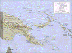
Re-upload. What these are: calibration files for use with Rana Hossain's freeware program FSM Moving Map (FSMMM) and the PNG Charts hosted by the AVSIM file library. What these are not: the charts themselves. In order to use the charts, you will need to download three additional files, which are much larger than this one: png_charts_1.zip (35mb), png_charts_2.zip (35mb), and png_charts_3.zip (36mb). Why not package everything together? To minimize file size. The original image files, which are quite large, were uploaded to AVSIM and calibrated for the payware program FSMap by David Wilson-Okamura. Within a few days, downloaders started asking how to use the charts with the freeware program FSMMM. New charts (which are quite large to store and download) weren't needed, just new calibration files (which are quite small). These were created by TERRY CARR, who is the hero of this download. To use the charts with FSMMM, first download all four of the files listed here, including this one. You don't need to download FSMMM again if you already have that installed.) Unzip all of them into the folder where you keep your FSMMM charts. Then run FSMMM and use the mass import feature. If you don't know how to do that, please read the manual or, if that doesn't help, Google is your friend.
| Filename: | Papua_New_Guinea_charts_for_FSMMM.zip |
| License: | Freeware |
| Added: | 5th June 2010, 05:21:06 |
| Downloads: | 544 |
| Author: | Terry Carr, David Wilson-Okamura |
| Size: | 11.97 KB |
| Category: Flight Simulator 2004 - AI Aircraft | |
| Sky Airline Airbus A319-111 CC-AFY |
|
Images related to this file:
File Description:

Sky Airline is an airline based at Comodoro Arturo Merino Benitez International Airport in Santiago, Chile.
It is the second largest airline in the country behind rival LAN Airlines. It has international routes to Peru, Argentina, Bolivia and Brazil. It operates under a semi-low cost model, although its service is superior compared to other European or US low cost carriers.
It also operates charter flights in Chile and South America. Source Wiki. //
Flightplans may be available on AVSIM/Flightsim.com.
This works for both FS9 and FSX. Tested in FSX. FS9 model used.
For FSX users make sure you have UNCHECKED "Aircraft casts shadows on the ground" under the Aircraft - Exterior Settings in FSX to make any FS9-based model visible during the day!
Texture quality; FSX Native: DDS DXT5 with alpha. FS9 Native: BMP DXT3 with alpha.
FSX Light Fix included in the DDS night texture.
Custom Light Map. Custom Shadows, Highs, Weathering as usual...
Included repaint is for the following model; DJC_A319 from DJC.
By renaming the texture files to "EvolveAI_A319_CFM_T & EvolveAI_A319_CFM_L" it will also work for EvAI's model.
This is a non-reflective model.
Model is available on AVSIM and FlightSim.com or on the author/developers site.
You need the basekit for this to work!!
Do make sure you copy the texture folder(s) in the respective folder.
| Filename: | Sky_Airline_Airbus_A319111_CCAFY.zip |
| License: | Freeware, limited distribution |
| Added: | 22nd July 2012, 15:11:11 |
| Downloads: | 960 |
| Author: | Stephan Faessler / ImpulseAI |
| Size: | 1.45 MB |
| Category: Flight Simulator X - AI Aircraft | |
| Sky Airline Airbus A319 (CC-AFY) |
|
Images related to this file:
File Description:

Sky Airline is an airline based at Comodoro Arturo Merino Benitez International Airport in Santiago, Chile.
It is the second largest airline in the country behind rival LAN Airlines. It has international routes to Peru, Argentina, Bolivia and Brazil.
It operates under a semi-low cost model, although its service is superior compared to other European or US low cost carriers.
It also operates charter flights in Chile and South America. Source Wiki.
Flightplans may be available on AVSIM/Flightsim.com.
This works for both FS9 and FSX. Tested in FSX. FS9 models used.
For FSX users make sure you have UNCHECKED "Aircraft casts shadows on the ground" under the Aircraft - Exterior Settings in FSX to make any FS9-based model visible during the day!
Texture quality; FSX Native: DDS DXT5 with alpha. FS9 Native: BMP DXT3 with alpha.
FSX Light Fix included in the DDS night texture.
Custom Light Map. Custom Shadows, Highs, Weathering as usual...
Included repaint is for the following model; DJC_A319 from DJC.
By renaming the texture files to "EvolveAI_A319_CFM_T & EvolveAI_A319_CFM_L" it will also work for EvAI's model.
This is a non-reflective model.
Model is available on AVSIM and FlightSim.com or on the author/developers site.
You need the basekit for this to work!!
Do make sure you copy the texture folder(s) in the respective folder.
| Filename: | Sky_Airline_Airbus_A319_CCAFY.zip |
| License: | Freeware, limited distribution |
| Added: | 13th July 2012, 16:14:22 |
| Downloads: | 408 |
| Author: | Stephan Faessler, ImpulseAI |
| Size: | 1.45 MB |
| Category: Flight Simulator 2004 - AI Aircraft | |
| United Express Air Wisconsin OC BAe 146-100 N463AP |
|
Images related to this file:
File Description:

United Express Air Wisconsin OC FMAI BAe 146-100 N463AP //
Air Wisconsin Airlines Corporation is an airline based at Outagamie County Regional Airport in the town of Greenville, Wisconsin, United States, near Appleton. Air Wisconsin is the largest privately held regional airline in the United States. It operates regional jet flights as US Airways Express under contract to US Airways, serving 69 cities in the US and Canada with hubs at Philadelphia International Airport and Ronald Reagan Washington National Airport. The airline is also a ground-handler for United Express at over 30 locations. Source Wiki. //
Flightplans may be available on AVSIM/Flightsim.com.
This works for both FS9 and FSX. Tested in FSX. FS9 model used.
For FSX users make sure you have UNCHECKED "Aircraft casts shadows on the ground" under the Aircraft - Exterior Settings in FSX to make any FS9-based model visible during the day!
Texture quality; FSX Native: DDS DXT5 with alpha. FS9 Native: BMP DXT3 with alpha.
FSX Light Fix included in the DDS night texture.
Custom Light Map. Custom Shadows, Highs, Weathering as usual...
Included repaint is for the following model; BAe 146-100 from FMAI
Model is available on AVSIM, FlightSim.com or on the author/developers site.
You need the basekit for this to work!!
Do make sure you copy the texture folder(s) in the respective folder.
| Filename: | United_Express_Air_Wisconsin_OC_BAe_146100_N463AP.zip |
| License: | Freeware, limited distribution |
| Added: | 5th August 2012, 13:45:16 |
| Downloads: | 401 |
| Author: | Stephan Faessler / ImpulseAI |
| Size: | 1.55 MB |
| Category: Flight Simulator X - Scenery | |
| 63 AI Ships and AI Ship Traffic for South America and Europe V1 |
|
Images related to this file:
File Description:

Plenty of good designers have created beautiful navy ships and aircraft carriers for FSX, but only few have created container ships, tankers, off-shore supply ships, tugs, or bulk carriers and put them to sail around the globe in FSX. With this package I intend to fill a part of this gap and to bring more life to the mostly empty oceans in FSX by providing AI ships and AI traffic files with a fleet of modern merchant ships travelling through some of the most heavily trafficked sea routes in the world. The pack contains 63 AI ships based on more than 35 different GMAX models. Around one third are equipped with landable helicopter decks. Most ships have simple animations like rotating radars and most have custom light, smoke and wake effects. The pack also contains traffic files for the east coast of South America and the coasts of North West Europe: In South America ships visit Belem, Sao Louis, Natal, Recife, Salvador, Macae, Rio de Janeiro, Santos, Florianopolis, Pelotas, Porto Alegre, Montevideo, Buenos Aires and Puerto Madryn. In Europe ships visit Gibraltar, Algeciras, Lissabon, Bordeaux, La Rochelle, Saint Nazaire, Brest, Le Havre, Antwerp, Rotterdam, Amsterdam, Thamesport, Felixstowe, Bremerhaven, Hamburg, Esbjerg, Oslo, Aarhus, Copenhagen and St.Petersburg. For map of coverage, routes and ship details see the PDF manual.
| Filename: | 63_AI_Ships_and_AI_Ship_Traffic_for_South_America_.zip |
| License: | Freeware |
| Added: | 3rd March 2013, 16:37:41 |
| Downloads: | 23,956 |
| Author: | Henrik Nielsen |
| Size: | 17.24 MB |
| Category: X-Plane - Original Aircraft | |
| China Clipper Martin M-130 for X-Plane 6.40/6.51 |
|
File Description:
China Clipper or Martin M130 for X-Plane 6.40/6.51 - Built by the Martin Company for Pan American Airlines, they were known by the company as Martin Ocean Transports. Only three of these aircraft were built, the China Clipper, the Philippine Clipper and the Hawaii Clipper. To the public, China Clipper became a generic name and originally was applied to all three of the Martin M-130's in Pan Am's fleet and, later, even to the Boeing B-314's which came later. With 4-950 HP radial engines giving a cruising speed of 163 mph and with a range in excess of 3200 miles the "Clippers" were used in the pacific by Pan Am. The "China Clipper" on November 22, 1935 inaugurated the first trans-pacific postal service with 111,000 letters; it returned to San Francisco on December 6, 1935. In 1936 the Hawaii Clipper and Philippine Clipper inaugurated paying passenger service to the Philippines and Hong Kong respectively. These were the original "Clippers" for those including the Boeing B134 to follow. Look for the B134 soon for X-Plane. Just a note : since landing gear skids are used for the wing braces X-Plane thinks that the plane has landing gear and will actually place it on the ground at the airport you select, choose an airport near water and then request a seaplane takeoff or pick a location and altitude on the regional or planet map.
| Filename: | China_Clipper_Martin_M130_for_XPlane_640651.zip |
| License: | Freeware, limited distribution |
| Added: | 11th February 2003, 05:51:20 |
| Downloads: | 1,327 |
| Author: | Robert App |
| Size: | 1.13 MB |
| Category: Flight Simulator 2002 - Miscellaneous Files | |
| Reality XP GPS Navigation Tutorial |
|
File Description:
This is a higly illustrated 40 pages GPS Navigation Tutorial that will take you from Meigs Parking 8 to Oshkosh! With this guide, you will be able to understand and master all the rich features presented in the Reality XP's Flight Line Avionics GPS and Radios!
Flight Line Avionics v1.2 is the latest edition of our Flight Simulator 2002 add-on, with 29 new features added to the other 25 new of v1.10, an extended User’s Manual, an improved Navigation Database tool and the support for third party developers through a new SDK. Our customers will welcome the addition of our EZConfig tool to add Flight Line Avionics to any aircraft with a simple point-and-click!
Reality XP Flight Line Avionics gives you a fully interactive avionics stack featuring the UPS-AT advanced GPS GX 50 with moving map, SL30 next-generation Nav/Comm, SL70 Mode A/C transponder with altitude alerting feature and a full audio panel. With Flight Line Avionics you'll be flying a simulated avionics package capable of providing the same features and benefits as the real avionics package. The Reality XP Flight Line Avionics package is so realistic that pilots can use it as a training tool to familiarize themselves with the workings of the actual equipment. Each button and knob is fully functional and performs identically to its real-world counterpart. The system even creates audio and visual alerts, like the actual avionics. For more information, fly direct to www.reality-xp.com.
| Filename: | Reality_XP_GPS_Navigation_Tutorial.zip |
| License: | Freeware, limited distribution |
| Added: | 26th June 2002, 18:01:06 |
| Downloads: | 1,446 |
| Author: | Reality XP |
| Size: | 1.91 MB |
| Category: Civil Flight Simulators - Looking Glass Flight Unlimited 3 | |
| FU3 Outer Terrain GTL Tile Editor v2.0 |
|
Images related to this file:
File Description:
This spreadsheet allows you to view, edit and save changes to the outer terrain's GTL tiles. Tiles are loaded into a 256x256 grid and the 13 default terrain textures are represented by cell background colours, i.e. the Mesa texture is represented by a reddish-brown background colour. The controls for loading and saving tiles are deliberately located on a separate worksheet. When loading and saving tiles I recommend that you do NOT select the main FU3 GTL Editor worksheet until a message box informs you that the load/save has finished. Otherwise, load/saves times (approx. 30 seconds for an average tile) will increase dramatically if you watch the tile while it is being populated or saved.
This 2.0 version also allows you to load a tile's terrain elevation. This is useful because the rules-based approach to modifying the OT was based on altitude constraints and it helps to be able to view the elevation (on the same scale as the tile itself) when modifying the terrain. However, in order to load the elevation you must first load the corresponding GTL tile. There is no provision to modify or save the elevation, because we already have Andre's excellent tools for that.
A complete map of the outer terrain's 2296 GTL files (plus Andre's 164 tile extension to the north) is provided in a separate worksheet. This includes a search facility you can use to identify tiles based on FU3 world co-ordinates.
| Filename: | FU3_Outer_Terrain_GTL_Tile_Editor_v20.zip |
| License: | Freeware |
| Added: | 26th December 2009, 02:11:13 |
| Downloads: | 49 |
| Author: | Jonathan Stonehouse |
| Size: | 103.36 KB |
| Category: Prepar3D V1-4 - Scenery | |
| KCVG - Cincinnati - Northern Kentucky USA International Airport For Prepar3Dv4 |
|
Images related to this file:
File Description:
This is an enhancement of the default P3Dv4 airport. There are custom made terminal buildings included to replace the ones included in the default scenery; all aircraft gates are included and have been correctly coded using Airport Design Editor 1.76.6715, according to the latest terminal map information; all jetways and scenery objects will display, provided scenery complexity in P3Dv4 is set at normal or higher; autogen objects have been prevented from displaying on the airport grounds; the magnetic variation has been changed to the correct current value; Runway 18R-36L has been changed to 18C-36C and a new runway 18R-36L has been added, along with ILS,RNAV, and GPS approaches; a new airport vehicle network has been built; extra fuel trucks have been added throughout the airport; the tower view has been changed to display from the roof of the control tower; all taxiway designators are correct and all taxiway signs are correctly placed and named; There is the option to open all runways to AI traffic; there is a large and highly detailed cargo area for DHL; and there are two files included for GSX L2 users to enable them to have custom GSX L2 SODE jetways displayed. This airport has only been tested in P3Dv4, and is not guaranteed to work in earlier versions. Please refer to the README FIRST.txt file to insure proper installation of all files.
| Filename: | KCVG__Cincinnati__Northern_Kentucky_USA_Internatio.zip |
| License: | Freeware, limited distribution |
| Added: | 6th April 2019, 03:57:13 |
| Downloads: | 1,396 |
| Author: | Patrick Finch |
| Size: | 4.26 MB |


© 2001-2026 AVSIM Online
All Rights Reserved
Privacy Policy |