
Where Flight Simulation Enthusiasts Gather from Around the World!
AVSIM Library - Search Results

| Category: Flight Simulator X - Scenery | |
| YRDY Reedy's Gold Mine, Western Australia |

|
File Description:
YRDY Reedy's Mine open cut was closed in 1997 but further exploration drilling is under way. Reedy is an abandoned town in the Murchison region of Western Australia. The town is located between Cue and Meekatharra in the Mid West region of Western Australia. Gold was discovered in the area by H Reed in 1899-1900 and a nearby well, Reedy's Well, was named after him. The well appeared on maps of the area in 1908 as a known water source. Further gold discoveries were made in the 1930s and sveral mines were developed. By 1933 the Cue-Day Dawn road board petitioned for a townsite to be surveyed and declared. Suggestions for the name of the town included Triton, Mathers and Reedy. The town was gazetted in 1934. If you fly over, you will note that the airstrip runs down the main streets of the old town. REQUIRES Blencowe_LibraryKit.zip
REQUIRES blencowe_librarykit_309494.zip (Available HERE)
| Filename: | YRDY_Reedys_Gold_Mine_Western_Australia.zip |
| License: | Freeware |
| Added: | 28th February 2013, 14:01:09 |
| Downloads: | 226 |
| Author: | Alan Blencowe |
| Size: | 8.99 MB |
| Category: Flight Simulator X - Aircraft Repaints, Textures and Modifications | |
| North American AT-6 Texan (N651SH) |
|
Images related to this file:
File Description:

This is a repaint for the freeware Warwick "Wozza" Carter AT-6G Texan. This repaint depicts the restored AT-6D Ser. 49-3305, N651SH, registered to Flying Texans and Mustangs Unlimited, LLC. This aircraft was originaly built during WWII for the USAAF, but was completely rebuilt by North American in 1949 for the newly formed USAF. In 1962, the aircraft was once again overhauled and exported to Spain, where it served until the early 1980's. Today this aircraft is operated by an organization called Texan Flight, based in Houston, Texas, which provides flight experiences to paying customers. The aircraft remains painted in the markings it wore while serving as part of the Spanish AF, keeping this part of its heritage intact. The aircraft has been nicknamed "Dulcinea" by its owners, a character from the tale of Don Quixote. This repaint includes all new exterior textures (including specular and bump maps), new engine and modified wheel well textures, and new and modified cockpit textures throughout. This repaint requires the files t6texmod.zip and fsds_t-6update.zip to be installed first.
| Filename: | North_American_AT6_Texan_N651SH.zip |
| License: | Freeware |
| Added: | 27th June 2013, 16:57:03 |
| Downloads: | 262 |
| Author: | John Terrell |
| Size: | 9.86 MB |
| Category: Flight Simulator 2004 - Aircraft Repaints, Textures and Modifications | |
| Boeing F/A-18E Hornet VF-201 Hunters |
|
File Description:
These are textures only and are applied
to Daisuke Yamamoto's Boeing F/A-18E,
filename: fa18e_sh.zip; available at
http://www.flightsim.com "or" filename:
fa18esh3_138105.zip; Avsim library. This is
the CAG version of the bird. VFA-201 Hunters
fly the F/A-18A+ version of the Hornet now and
this paint scheme was originally applied to
that model Hornet. Upon transitioning to the
F/A-18 from F-14A Tomcats the Hunters dropped
the state of Texas insignia that they wore on
their Tomcats and re-adopted their earlier
chevron insignia that now adorns their
Hornets. For the first time in 50 years, an
entire Naval Reserve strike fighter squadron
was called up for active duty over Iraq. The
Hunters flew more than 1,000 sorties off of
the USS THEODORE ROOSEVELT, then returned home
to Ft. Worth NAS, JRB, in Texas. I wish to
thank Daisuke Yamamoto and Hiroaki Kubota for
providing us with such a fine model of this
aircraft and their kind permission to repaint
it. These are 32-bit textures with no mip-maps
to preserve image clarity.
| Filename: | Boeing_FA18E_Hornet_VF201_Hunters.zip |
| License: | Freeware, limited distribution |
| Added: | 5th May 2004, 15:27:08 |
| Downloads: | 2,549 |
| Author: | Heather Sherman (Repaint), Daisuke Yamamoto (Model) |
| Size: | 3.81 MB |
| Category: Civil Flight Simulators - Looking Glass Flight Unlimited 3 | |
| GenQuadrant Version 2.5 |
|
File Description:
High Resolution Region Builder Tool
GenQuadrant25.zip: NEW Version 2.5 15.nov.2002
Starting with an input file 4096 x 4096 x 256 colors as targa file a full set of
megatile .bin for the levels 0 to 4 are generated using mean color resampling.
inputfile name s0aaaa.tga will generate l0aaaa.bin, l1aaaa.bin,l2aaaa.bin,l3aaaa.bin and l4aaaa.bin
after loading of a level 0 fu3 mapfile you can create back the targa version of it as L0.tga
this works for each level 0 map that is stored as .bin, but not if stored as .cpd !
Palettes for Sanfran and Seattle are built in.
Genquadrant can generate classification maps for a full region in one step.
With Level57Maker you can finished the generation up to the level 7.
There is a new toolbar in version 2.5 with all function for .bin files in the left part.
The buttons on the right side are when generating compressed .cpd files.
cpd files are for Seattle palette only and development is stopped due to poor quality of the results.
USE .BIN for new regions
| Filename: | GenQuadrant_Version_25.zip |
| License: | Freeware, limited distribution |
| Added: | 29th November 2002, 23:52:54 |
| Downloads: | 211 |
| Author: | André Meystre |
| Size: | 162.88 KB |
| Category: Flight Simulator 2004 - Scenery | |
| "Himalayan Peaks" LOD10 Mesh, Volume 8 - Tirich Mir and Pamir |
|
Images related to this file:
File Description:
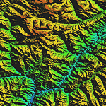
Highly detailed terrain mesh of the Tirich Mir and Pamir areas, N36-39 E71-74. The files in this package are based on Shuttle Radar (SRTM) Version 2 data but with many of the void areas, especially the most significant sections, filled with elevation data generated from topographic maps by Jonathan de Ferranti. While Jonathan's work is unrelated to flight simulation he kindly gave me permission to compile his data for use in FS. The result is a wonderful improvement in detail and accuracy over any existing mesh file, freeware or commercial, based on SRTM or DTED data alone.
Due to the large area of the Himalayas I've compiled the source data as two separate series: the "Himalayan Peaks" series covers prominent mountains and ranges in higher detail and locally overrides any existing LOD9 terrain mesh. In addition, a LOD9 "base mesh" series covering the entire Himalayas will be available for those who do not yet have an add-on terrain mesh of these beautiful mountains.
| Filename: | Himalayan_Peaks_LOD10_Mesh_Volume_8__Tirich_Mir_an.zip |
| License: | Freeware, limited distribution |
| Added: | 29th May 2010, 08:52:47 |
| Downloads: | 9,114 |
| Author: | Holger Sandmann, Jonathan de Ferranti |
| Size: | 47.94 MB |
| Category: Flight Simulator 2004 - Scenery | |
| Himalayas LOD9 Base Mesh, Volume 2 - Southcentral Ranges |
|
Images related to this file:
File Description:
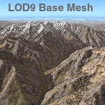
Detailed terrain mesh of the Southcentral Himalayan Ranges, N26-32 E82-90. The files in this package are based on Shuttle Radar (SRTM) Version 2 data but with many of the void areas, especially the most significant sections, filled with elevation data generated from topographic maps by Jonathan de Ferranti. While Jonathan's work is unrelated to flight simulation he kindly gave me permission to compile his data for use in FS. The result is a wonderful improvement in detail and accuracy over any existing mesh file, freeware or commercial, based on SRTM or DTED data alone.
Due to the large area of the Himalayas I've compiled the source data as two separate series: the "Himalayan Peaks" series covers prominent mountains and ranges in higher detail and locally overrides any existing LOD9 terrain mesh. In addition, a LOD9 "base mesh" series, with LOD8 and LOD7 "buffer" mesh files, covering the entire Himalayas, is meant for those who do not yet have an add-on terrain mesh of these beautiful mountains.
| Filename: | Himalayas_LOD9_Base_Mesh_Volume_2__Southcentral_Ra.zip |
| License: | Freeware, limited distribution |
| Added: | 29th May 2010, 09:05:56 |
| Downloads: | 9,456 |
| Author: | Holger Sandmann, Jonathan de Ferranti |
| Size: | 90.25 MB |
| Category: Flight Simulator 2004 - Scenery | |
| Himalayas LOD9 Base Mesh, Volume 3 - Southwestern Ranges |
|
Images related to this file:
File Description:
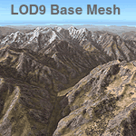
Detailed terrain mesh of the Southwestern Himalayan Ranges, N28-37 E78-82. The files in this package are based on Shuttle Radar (SRTM) Version 2 data but with many of the void areas, especially the most significant sections, filled with elevation data generated from topographic maps by Jonathan de Ferranti. While Jonathan's work is unrelated to flight simulation he kindly gave me permission to compile his data for use in FS. The result is a wonderful improvement in detail and accuracy over any existing mesh file, freeware or commercial, based on SRTM or DTED data alone.
Due to the large area of the Himalayas I've compiled the source data as two separate series: the "Himalayan Peaks" series covers prominent mountains and ranges in higher detail and locally overrides any existing LOD9 terrain mesh. In addition, the LOD9 "base mesh" series, with LOD8 and LOD7 "buffer" mesh files, covering the entire Himalayas, is meant for those who do not yet have an add-on terrain mesh of these beautiful mountains.
| Filename: | Himalayas_LOD9_Base_Mesh_Volume_3__Southwestern_Ra.zip |
| License: | Freeware, limited distribution |
| Added: | 30th May 2010, 10:00:26 |
| Downloads: | 155,813 |
| Author: | Holger Sandmann, Jonathan de Ferranti |
| Size: | 62.16 MB |
| Category: Flight Simulator 2004 - Scenery | |
| Himalayas LOD9 Base Mesh, Volume 1 - Southeastern Ranges |
|
Images related to this file:
File Description:
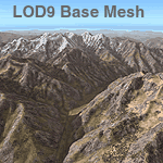
Detailed terrain mesh of the Southeastern Himalayan Ranges, N26-32 E90-98. The files in this package are based on Shuttle Radar (SRTM) Version 2 data but with many of the void areas, especially the most significant sections, filled with elevation data generated from topographic maps by Jonathan de Ferranti. While Jonathan's work is unrelated to flight simulation he kindly gave me permission to compile his data for use in FS. The result is a wonderful improvement in detail and accuracy over any existing mesh file, freeware or commercial, based on SRTM or DTED data alone.
Due to the large area of the Himalayas I've compiled the source data as two separate series: the "Himalayan Peaks" series covers prominent mountains and ranges in higher detail and locally overrides any existing LOD9 terrain mesh. In addition, a LOD9 "base mesh" series, with LOD8 and LOD7 "buffer" mesh files, covering the entire Himalayas, is meant for those who do not yet have an add-on terrain mesh of these beautiful mountains.
| Filename: | Himalayas_LOD9_Base_Mesh_Volume_1__Southeastern_Ra.zip |
| License: | Freeware, limited distribution |
| Added: | 29th May 2010, 09:01:26 |
| Downloads: | 10,309 |
| Author: | Holger Sandmann, Jonathan de Ferranti |
| Size: | 71.82 MB |
| Category: Flight Simulator 2004 - Scenery | |
| Himalayas LOD9 Base Mesh, Volume 4 - Kashmir and Jammu |
|
File Description:
Detailed terrain mesh of the Kashmir and Jammu Ranges, N30-39 E76-78. The files in this package are based on Shuttle Radar (SRTM) Version 2 data but with many of the void areas, especially the most significant sections, filled with elevation data generated from topographic maps by Jonathan de Ferranti. While Jonathan's work is unrelated to flight simulation he kindly gave me permission to compile his data for use in FS. The result is a wonderful improvement in detail and accuracy over any existing mesh file, freeware or commercial, based on SRTM or DTED data alone.
Due to the large area of the Himalayas I've compiled the source data as two separate series: the "Himalayan Peaks" series covers prominent mountains and ranges in higher detail and locally overrides any existing LOD9 terrain mesh. In addition, the LOD9 "base mesh" series, with LOD8 and LOD7 "buffer" mesh files, covering the entire Himalayas, is meant for those who do not yet have an add-on terrain mesh of these beautiful mountains.
| Filename: | Himalayas_LOD9_Base_Mesh_Volume_4__Kashmir_and_Jam.zip |
| License: | Freeware, limited distribution |
| Added: | 22nd February 2006, 20:32:50 |
| Downloads: | 7,509 |
| Author: | Holger Sandmann, Jonathan de Ferranti |
| Size: | 29.24 MB |
| Category: Flight Simulator 2004 - Scenery | |
| Himalayas LOD9 Base Mesh, Volume 5 - Hindu Kush and Pamir |
|
Images related to this file:
File Description:
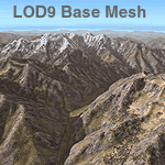
Detailed terrain mesh of the Hindu Kush and Pamir Ranges, N32-40 E70-76. The files in this package are based on Shuttle Radar (SRTM) Version 2 data but with many of the void areas, especially the most significant sections, filled with elevation data generated from topographic maps by Jonathan de Ferranti. While Jonathan's work is unrelated to flight simulation he kindly gave me permission to compile his data for use in FS. The result is a wonderful improvement in detail and accuracy over any existing mesh file, freeware or commercial, based on SRTM or DTED data alone.
Due to the large area of the Himalayas I've compiled the source data as two separate series: the "Himalayan Peaks" series covers prominent mountains and ranges in higher detail and locally overrides any existing LOD9 terrain mesh. In addition, the LOD9 "base mesh" series, with LOD8 and LOD7 "buffer" mesh files, covering the entire Himalayas, is meant for those who do not yet have an add-on terrain mesh of these beautiful mountains.
| Filename: | Himalayas_LOD9_Base_Mesh_Volume_5__Hindu_Kush_and_.zip |
| License: | Freeware, limited distribution |
| Added: | 29th May 2010, 08:57:29 |
| Downloads: | 7,611 |
| Author: | Holger Sandmann, Jonathan de Ferranti |
| Size: | 85.72 MB |


© 2001-2026 AVSIM Online
All Rights Reserved
Privacy Policy |