
Where Flight Simulation Enthusiasts Gather from Around the World!
AVSIM Library - Search Results

| Category: Flight Simulator X - Scenery | |
| Ruacana Airport in Namibia on the African continent. |

|
File Description:
This is Ruacana Airport in Namibia. This airport is near the border with Angola and was used by the South African Defence force for operations into Angola before Namibia became independant. Now it is a popular tourist destination and ideal for traveling to Ruacana Falls. It is made from default FSX scenery librarys. Not the real thing but pretty close.
| Filename: | Ruacana_Airport_in_Namibia_on_the_African_continen.zip |
| License: | Freeware |
| Added: | 26th January 2009, 14:23:43 |
| Downloads: | 797 |
| Author: | Jacques Botha |
| Size: | 10.38 KB |
| Category: Flight Simulator 2004 - Scenery | |
| AI Tall Ships sailing on Long Island Sound |
|
Images related to this file:
File Description:
AI Tall Ships sailing on Long Island Sound - A gathering of ten vintage AI Sailing Ships near Fisher's Island, New York. This scenery features incredibly detailed AI Sailing Ships modeled by Ron Jeffers, Pierre de Rotalier and Mike Hill. The project includes a replica of the Pequod - Captain Ahab's whaling ship in the epic novel "Moby Dick". Eight of the ten ships make twice daily trips around Fisher's Island. There is also an animated naval rowboat which makes short demonstration runs daily. With one exception, all required files are included. This scenery has been tested with Ultimate Terrain and the FS2004 default environment. Please unzip to a temporary folder and follow the simple, illustrated instructions. Then sit back, watch the seas come to life and relive a little history. This package works very well with John B.Loney's Elizabeth Airport - 0b8_v1.zip - available here. Compiled for your flying (and sailing) enjoyment by David "Opa" Marshall.
| Filename: | AI_Tall_Ships_sailing_on_Long_Island_Sound.zip |
| License: | Freeware |
| Added: | 10th December 2009, 12:42:56 |
| Downloads: | 2,381 |
| Author: | David "Opa" Marshall |
| Size: | 21.05 MB |
| Category: Flight Simulator 2004 - Miscellaneous Files | |
| EXC.object files; Default Erzurum (LTCE) on 26L-Runway |
|
Images related to this file:
File Description:
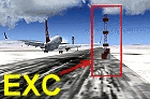
Default LTCE_Erzurum/Turkey airport runway 26L N39 '57.40' and E041 '11:35'
coordinates and 5571.7ft. (1756.8 m) altitude (airport elevation)has the NDB transmitter.
As a result of the transmitter to be there this runway 26L planes takeoff and landings, was Crash.
EXC.bgl files, and prepared and have eliminated this problem.VAPS-vaps.hooxs.com
| Filename: | EXCobject_files_Default_Erzurum_LTCE_on_26LRunway.zip |
| License: | Freeware |
| Added: | 4th March 2012, 06:51:52 |
| Downloads: | 130 |
| Author: | Dincman Wings (VAPS) |
| Size: | 8.87 KB |
| Category: Flight Simulator 2004 - Aircraft Repaints, Textures and Modifications | |
| Antonov An-14 - General Aviation - Brown on Beige |
|
File Description:
These are textures ***ONLY*** for Anton "Xomer" Nikolaev's superb model of this unique little aircraft, filename an-14_ussr_army.zip available from the Avsim library. This is a superb model with detail rivaling that of many of the better payware models, but this one's FREE. I wish to thank Anton for presenting the flightsim community with this excellent model and his kind permission to repaint it. Enjoy!
| Filename: | Antonov_An14__General_Aviation__Brown_on_Beige.zip |
| License: | Freeware, limited distribution |
| Added: | 5th March 2005, 06:31:32 |
| Downloads: | 652 |
| Author: | Heather Sherman (Repaint) |
| Size: | 2.19 MB |
| Category: Flight Simulator 2004 - Aircraft Repaints, Textures and Modifications | |
| Antonov An-14 - General Aviation - Red on White |
|
File Description:
These are textures ***ONLY*** for Anton "Xomer" Nikolaev's superb model of this unique little aircraft, filename an-14_ussr_army.zip available from the Avsim library. This is a superb model with detail rivaling that of many of the better payware models, but this one's FREE. I wish to thank Anton for presenting the flightsim community with this excellent model and his kind permission to repaint it. Enjoy!
| Filename: | Antonov_An14__General_Aviation__Red_on_White.zip |
| License: | Freeware, limited distribution |
| Added: | 5th March 2005, 06:33:34 |
| Downloads: | 945 |
| Author: | Heather Sherman (Repaint) |
| Size: | 2.51 MB |
| Category: Flight Simulator 2004 - Aircraft Repaints, Textures and Modifications | |
| Antonov An-14 - General Aviation - Blue on Blue |
|
File Description:
These are textures ***ONLY*** for Anton "Xomer" Nikolaev's superb model of this unique little aircraft, filename an-14_ussr_army.zip available from the Avsim library. This is a superb model with detail rivaling that of many of the better payware models, but this one's FREE. I wish to thank Anton for presenting the flightsim community with this excellent model and his kind permission to repaint it. Enjoy!
| Filename: | Antonov_An14__General_Aviation__Blue_on_Blue.zip |
| License: | Freeware, limited distribution |
| Added: | 5th March 2005, 06:31:19 |
| Downloads: | 726 |
| Author: | Heather Sherman (Repaint) |
| Size: | 2.29 MB |
| Category: Flight Simulator 2004 - AI Aircraft | |
| Pegasus Aviation AI Pack: The Viscount Flies On |
|
Images related to this file:
File Description:
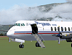
In deepest darkest Africa, one Viscount can still be found flying commercially - with Pegasus Aviation in the Democratic Republic of Congo.
These files include the aircraft, appropriate AI flight plans and AFCAD files for some of the airports served. Although not a true "AI
aircraft" it is unlikely to cause a strain on computer resources given the light
demands of AI traffic and scenery in the Congo area on Flight Simulator.
The aircraft is a modified version of Rick Piper's excellent Vickers Viscount 800
model available from http://www.btinternet.com/~rick.piper/ . If you wish to fly
the Pegasus Aviation Viscount yourself, please download the original aircraft files
from his site and install these textures to work with them - what is included
here is not suitable for your own flying as the Flight Dynamics have been modified
to work as AI traffic. [File re-uploaded at request of AVSIM] Footnote - since this file was first released in 2007, the aircraft has changed hands, it passed to Mango Airlines as 9Q-COD and is currently out of service at FZQA Lubumbashi. Sadly, it seems that the Viscount no longer flies on.
| Filename: | Pegasus_Aviation_AI_Pack_The_Viscount_Flies_On.zip |
| License: | Freeware |
| Added: | 26th May 2010, 19:15:46 |
| Downloads: | 985 |
| Author: | John Hinson, Billy Rutherford & Rick Piper |
| Size: | 812.55 KB |
| Category: Flight Simulator 2004 - Scenery | |
| Kotzebue PAOT on the northwestern coast of Alaska |
|
Images related to this file:
File Description:
There are four main northwestern Alaska towns which have good airports and are serviced by Alaska Airlines. From these airports local flights connect to nearby villages, "nearby" in Alaska meaning up to 150 miles away. The northernmost is Barrow. Southwest of Barrow is Kotzebue, then Nome, and the furthest south is Bethel. The town of Kotzbue is north of the Bering Strait on the northwestern coast, 320 miles southwest of Barrow. The population is just over 3,000 people. The location was for a long time a base for trading in furs, with three rivers emptying into the sea and providing routes into the interior land and villages; a meeting place between hunters and traders from Russia and elsewhere. The Kotzebue airport is called the Ralph Wien Memorial and has two runways. The modern one is aligned 08-26 and is 5,880 feet of 150 feet wide asphalt built across a shallow lagoon, with an ILS on 08 and PAPI on both ends. The second and older runway is originally military and gravel, aligned 17-35 and 3,786 feet long and used (wind allowing) by the GA planes that park alongside the runway. The prevalent wind is from the west; when the wind is from the east it is generally relatively feeble and with a much lower cloud base, possibly to the ground, hence the need for an ILS. All AI aircraft in FS9 much prefer to use a runway that has an ILS and so will continue to use 08-26 even if the wind is from the south until it reaches 30+ knots, even if they are a Cessna 150 flying VFR. So for AI realism in FS9 a northern or southern wind needs to be a strong one so that the runway is actually used. However, as Alaska Airlines, Northern Air Cargo, and Everts Air also fly to Kotzebue and can only use the east-west runway (as less than 4,000 feet of asphalt would be seriously inconvenient for a Boing 737 or DC6) it is necessary to have the northern or southern wind UNDER 30 knots at the times when they are landing or taking off. Your choice. I suppose a permanent strong wind from the west would be the most realistic on a daily basis, deterring all planes from ever using 17-35. The AI will develop along with further scenery additions in the neighbourhood.
| Filename: | Kotzebue_PAOT_on_the_northwestern_coast_of_Alaska.zip |
| License: | Freeware, limited distribution |
| Added: | 2nd August 2016, 16:47:52 |
| Downloads: | 457 |
| Author: | Roger Wensley |
| Size: | 19.32 MB |
| Category: Flight Simulator 2004 - Scenery | |
| Nome PAOM on the northwestern coast of Alaska |
|
Images related to this file:
File Description:
There are four main northwestern Alaska towns which have good airports and are serviced by Alaska Airlines. From these airports local flights connect to nearby villages, "nearby" in Alaska meaning up to 200 miles away. The northernmost is Barrow. Southwest of Barrow is Kotzebue, then Nome, and the furthest south is Bethel. The town of Nome is south of the Bering Strait on the southern coast of the Seward Peninsula, around 185 miles south of Kotzebue, with a population of about 3,800. It is the town that led to the creation of the most famous dogsledge race in the world, the Iditarod, which is based on the delivery to Nome of diphtheria serum during the blizzard conditions of the winter of 1925. The Nome airport (it currently has no other name) was originally built as the last of the refuelling airfields for planes being ferried to Russia during WW2. It has two runways, aligned 09-27 and 02-20 in FS9 (the wandering magnetic north has recently renamed the magnetic headings) and both of them around 6,000 feet with an ILS on 27. There is a modern airport layout diagram included showing taxiway names etc. Alaska Airlines, ERA, and Bering Air (which is headquartered in Nome), along with the shared cargo terminal for Northern Air Cargo and Everts Air, are all on the southern apron. The northern apron is mainly for GA, along with maintenance facilities, a garage building that also houses a weather bureau, and at the far northern end of runway 02-20 an apron and hanger for the Alaska Air National Guard. All AI aircraft in FS9 much prefer to use a runway that has an ILS and so will continue to use 09-27 even if the wind is from the north or south, right up until it reaches 30+ knots, so for AI realism in FS9 a permanent wind from the west would be the most realistic on a daily basis. There is also a small gravel strip just north of the town and this is included (94Z), as are some old line-of-sight radio communication reflectors on the hills above the town. There is a note about making adjustments to Ultimate Terrain Alaska-Canada regarding both realistic road lighting and also auto-generation.
| Filename: | Nome_PAOM_on_the_northwestern_coast_of_Alaska.zip |
| License: | Freeware, limited distribution |
| Added: | 18th October 2016, 02:38:42 |
| Downloads: | 486 |
| Author: | Roger Wensley |
| Size: | 22.65 MB |
| Category: Flight Simulator 2004 - Scenery | |
| Maurice Bishop TGPY on Grenada in the Caribbean |
|
Images related to this file:
File Description:
Grenada island is 17 miles south of the southernmost island of the Grenadines, Carriacou; there are some smaller islands between the two. Grenada is 18 miles long and around 8 miles wide, has an estimated population of 110,000, and produces a very large part of the world's annual nutmeg harvest. The capital, St Georges, is by far the largest town and is at the southern end of the island, with the airport close by.
The airport is now called Maurice Bishop, but for some years was called Point Salines. The runway is just over 9,000 feet long and oriented 10/28. Point Salines replaced Pearl Airport, which is on the east coast 12 miles northeast of St Georges and was difficult to expand as the runway had mountains at one end and the sea at the other. Pearl is now closed; it is included here but only as a visual landmark with "closed" markings. There are regular international flights from North America and Europe, some of which are seasonal only (Air Canada for instance) and local connecting flights by LIAT and SVG. I retained the default control tower as it is some distance away. In real life it is also some distance away and on a hill northwest of the terminal. Which is why I did not take photos from which I would have made the real one. The hill does not feature in FS9.
| Filename: | Maurice_Bishop_TGPY_on_Grenada_in_the_Caribbean.zip |
| License: | Freeware, limited distribution |
| Added: | 11th June 2013, 23:28:17 |
| Downloads: | 824 |
| Author: | Roger Wensley |
| Size: | 7.38 MB |
© 2001-2026 AVSIM Online
All Rights Reserved
Privacy Policy |