
Where Flight Simulation Enthusiasts Gather from Around the World!
AVSIM Library - Search Results

| Category: Flight Simulator 2002 - Scenery | |
| Quebec Terrain Mesh (2) |

|
File Description:
New resolution (76m) terrain mesh of province of Quebec, Canada, covering longitude W58 to W80 and latitude N45 to N53. This resolution terrain mesh is based on SRTM-3 (90m) digital elevation models, resampled to Lod of 09 (76m). Five parts: qclod09a.zip, qclod09b.zip, qclod09c.zip, qclod09d.zip, qclod09e.zip.
| Filename: | Quebec_Terrain_Mesh_2.zip |
| License: | Freeware, limited distribution |
| Added: | 20th March 2003, 14:54:09 |
| Downloads: | 5,136 |
| Author: | Gilles Gauthier |
| Size: | 21.45 MB |
| Category: Flight Simulator 2002 - Scenery | |
| Quebec Terrain Mesh (3) |
|
File Description:
New resolution (76m) terrain mesh of province of Quebec, Canada, covering longitude W58 to W80 and latitude N45 to N53. This resolution terrain mesh is based on SRTM-3 (90m) digital elevation models, resampled to Lod of 09 (76m). Five parts: qclod09a.zip, qclod09b.zip, qclod09c.zip, qclod09d.zip, qclod09e.zip.
| Filename: | Quebec_Terrain_Mesh_3.zip |
| License: | Freeware, limited distribution |
| Added: | 20th March 2003, 14:54:48 |
| Downloads: | 5,047 |
| Author: | Gilles Gauthier |
| Size: | 21.94 MB |
| Category: Flight Simulator 2002 - Scenery | |
| Quebec Terrain Mesh (4) |
|
File Description:
New resolution (76m) terrain mesh of province of Quebec, Canada, covering longitude W58 to W80 and latitude N45 to N53. This resolution terrain mesh is based on SRTM-3 (90m) digital elevation models, resampled to Lod of 09 (76m). Five parts: qclod09a.zip, qclod09b.zip, qclod09c.zip, qclod09d.zip, qclod09e.zip.
| Filename: | Quebec_Terrain_Mesh_4.zip |
| License: | Freeware |
| Added: | 20th March 2003, 18:22:00 |
| Downloads: | 5,431 |
| Author: | Gilles Gauthier |
| Size: | 23.33 MB |
| Category: Flight Simulator 2002 - Scenery | |
| Quebec Terrain Mesh (5) |
|
File Description:
New resolution (76m) terrain mesh of province of Quebec, Canada, covering longitude W58 to W80 and latitude N45 to N53. This resolution terrain mesh is based on SRTM-3 (90m) digital elevation models, resampled to Lod of 09 (76m). Five parts: qclod09a.zip, qclod09b.zip, qclod09c.zip, qclod09d.zip, qclod09e.zip.
| Filename: | Quebec_Terrain_Mesh_5.zip |
| License: | Freeware, limited distribution |
| Added: | 20th March 2003, 18:59:53 |
| Downloads: | 5,637 |
| Author: | Gilles Gauthier |
| Size: | 18.93 MB |
| Category: Flight Simulator 2002 - Miscellaneous Files | |
| FSFlightMax Hi-res Terrain Image |
|
File Description:
This archive contains a high resolution terrain image for use with FSFlightMax. It is significantly clearer and of higher resolution than the existing image provided with FSFlightMax. The terrain imagery is used in conjunction with the map view in FSFlightMax to provide graphical terrain information during flight.
| Filename: | FSFlightMax_Hires_Terrain_Image.zip |
| License: | Freeware, limited distribution |
| Added: | 13th May 2003, 22:09:26 |
| Downloads: | 5,019 |
| Author: | Sim Systems |
| Size: | 16.78 MB |
| Category: Flight Simulator 2004 - Scenery | |
| Slovenia Terrain Mesh 76m |
|
File Description:
Terrain mesh file for Slovenia at LOD9 or 76.4 m resolution. Covers between N45.25 E13.25 - N47 E16.5. High resolution SRTM data was merged with resampled GTOPO30 SRTM data to correct high alpine data voids. Perfectly fits with the previously released Croatia mesh, which covers Slovenia only partially.
| Filename: | Slovenia_Terrain_Mesh_76m.zip |
| License: | Freeware, limited distribution |
| Added: | 1st December 2003, 15:45:51 |
| Downloads: | 3,019 |
| Author: | Hrvoje Kruhek |
| Size: | 7.02 MB |
| Category: Flight Simulator 2004 - Aircraft Repaints, Textures and Modifications | |
| Mooney Bravo Freedom Scheme 5 |
|
File Description:
Two repaints of default Mooney Bravo Freedom Scheme 5.
| Filename: | Mooney_Bravo_Freedom_Scheme_5.zip |
| License: | Freeware |
| Added: | 6th March 2005, 20:40:12 |
| Downloads: | 527 |
| Author: | David Robinson |
| Size: | 2.86 MB |
| Category: Flight Simulator X - Aircraft Repaints, Textures and Modifications | |
| Aerosoft F-16C LV 86-0222 706 AGRS 'Haveglass5' Repaint Textures |
|
Images related to this file:
File Description:
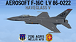
This is a repaint for the Aerosoft F-16 depicting Nellis AFB aircraft LV 86-0222 of the 706th Aggressor Squadron in the new 'Haveglass 5' paint scheme.
To give the jet a "Hi-Def" look I first painted these textures in 2048 resolution, then reduced them to Aerosofts' native 1024 resolution, and saved them with DXT5. However, I left a couple textures/areas on the jet in 2048, that way the decals in those textures/areas look sharp and not pixilated. PLUS, I painted the drop tanks and pylons in both Grey AND Haveglass, AND repainted/upgraded weapon textures in both INERT and LIVE colors!
I've included installation instructions for the CLEAN "C" model, but these textures can be used with ANY of the Aerosoft F-16 models (except the CFT model), so feel free to install/use them on those jets as well!
| Filename: | Aerosoft_F16C_LV_860222_706_AGRS_Haveglass5_Repain.zip |
| License: | Freeware |
| Added: | 6th June 2024, 13:40:58 |
| Downloads: | 39 |
| Author: | Daniel Gregory |
| Size: | 11.47 MB |
| Category: Flight Simulator X - Scenery | |
| Mesh South America / MeSA Islands |
|
File Description:
FSX Mesh South America Project:
This terrain mesh file is a part of a whole project covering all the Continent of South America and some islands, divided in tiles identified in a map by its column (letters) and rows (numbers).
Those files were multi-LOD compiled from 90m SRTM2 source data, reprocessed with 3DEM to remove voids and spikes, providing a 76.4m (LOD9) horizontal resolution topography intended for use only in FSX updated with SP1.
Although not well documented, to improve performance, the updated FSX loads DEM files in threads and only the closer terrain (about 5 NM from the point of view) is rendered in high detail, while at far distances FSX shows up its default low resolution mesh, when there is not a third part terrain mesh compiled in all others intermediate level of details (multi-LOD).
THIS FILE: FSX_MeSA_Islands (Ascencion, Georgia, Gough and Trindade)
| Filename: | Mesh_South_America__MeSA_Islands.zip |
| License: | Freeware |
| Added: | 10th June 2007, 23:59:44 |
| Downloads: | 1,138 |
| Author: | Hely Heck Junior and José Lôbo |
| Size: | 2.75 MB |
| Category: Fly! II - Scenery | |
| Alaska Scenery 1.1 |
|
File Description:
Title: Snow hut and Winter trees in the snow v1.1
Other files required: bdALwinter_vs.zip
Description:
This update was to accommodate elevation changes when using Don Bishop's
new SE Alaska elevation scenery - sealaska1.zip
Two new situation files are added for both night and day 3.5nm low visibility with snow falling.
This update scenery, and new situation place you on the snow covered ground near
the beautiful Glacier National Park in Alaska.
There is no flight plan. Keep under the cloud, avoid mountains and have fun!
| Filename: | Alaska_Scenery_11.zip |
| License: | Freeware |
| Added: | 13th March 2003, 13:43:06 |
| Downloads: | 260 |
| Author: | Ben Donaldson |
| Size: | 205.69 KB |
© 2001-2026 AVSIM Online
All Rights Reserved
Privacy Policy |