
Where Flight Simulation Enthusiasts Gather from Around the World!
AVSIM Library - Search Results

| Category: Flight Simulator X - Aircraft Repaints, Textures and Modifications | |
| Jetstar Airbus A320 Neo |

|
File Description:
Aerosoft Airbus X Extended A320NEO IAE repaint, Contains the new jetstar livery. This repaint includes the sharklet version of this aircraft.
| Filename: | Jetstar_Airbus_A320_Neo.zip |
| License: | Freeware, limited distribution |
| Added: | 10th November 2014, 19:29:12 |
| Downloads: | 1,101 |
| Author: | Jackson Reilly |
| Size: | 9.27 MB |
| Category: Flight Simulator 2004 - AI Flight Plans | |
| Yakutia Airlines - Summer 2013 |
|
Images related to this file:
File Description:

Include Optimize speed version,Season:Summer 2013,Callsign:AIR YAKUTIA,ICAO:SYL,IATA:R3,Weekly flights:336,Hubs:Yakutsk Airport,Irkutsk Airport,Krasnodar Airport,Vnukovo Airport
| Filename: | Yakutia_Airlines__Summer_2013.zip |
| License: | Freeware, limited distribution |
| Added: | 2nd July 2013, 06:30:23 |
| Downloads: | 477 |
| Author: | Michael 'Pushen' Babitskiy,UTT |
| Size: | 200.64 KB |
| Category: Prepar3D V1-4 - Aircraft Repaints, Textures and Modifications | |
| P3D PMDG 737-700 NGXu Braathens Nordlys |
|
Images related to this file:
File Description:

A repaint of the payware PMDG Boeing 737-700 NGXu into the colors of Braathens 'Nordlys version' LN-TUD, circa 2003.
| Filename: | P3D_PMDG_737700_NGXu_Braathens_Nordlys.zip |
| License: | Freeware, limited distribution |
| Added: | 1st October 2020, 19:51:51 |
| Downloads: | 102 |
| Author: | Joakim Zenk |
| Size: | 26.52 MB |
| Category: Flight Simulator X - Aircraft Repaints, Textures and Modifications | |
| Lufthansa "New Colors" Airbus A321 (D-AISP) V2 |
|
Images related to this file:
File Description:
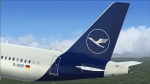
Lufthansa new livery for Aerosoft Airbus A321 (Extended). Works in P3D too. Use AirbusX Extended Livery Manager to install. V2 version.
| Filename: | Lufthansa_New_Colors_Airbus_A321_DAISP_V2.zip |
| License: | Freeware |
| Added: | 10th February 2018, 00:57:49 |
| Downloads: | 1,317 |
| Author: | Gustavo Aguiar |
| Size: | 8.94 MB |
| Category: Flight Simulator X - Scenery | |
| Refuge des Grands Mulets - Glacier des Bossons - Chamonix, France |
|
Images related to this file:
File Description:
New version of this hut. Next to Chamonix in French Alps, at 3050m.
You can land on the roof. Have fun !
| Filename: | Refuge_des_Grands_Mulets__Glacier_des_Bossons__Cha.zip |
| License: | Freeware, limited distribution |
| Added: | 27th November 2014, 21:30:54 |
| Downloads: | 917 |
| Author: | Manolo Dobrazil |
| Size: | 3.28 MB |
| Category: Flight Simulator X - AI Flight Plans | |
| VietJet Air September 2017 |
|
Images related to this file:
File Description:

AI Flightplans for VietJet Air Summer 2017 September 17 to 23. Easy to install with AI Flight Planner Version 3 (AIFPv3)
| Filename: | VietJet_Air_September_2017.zip |
| License: | Freeware |
| Added: | 30th September 2017, 07:36:26 |
| Downloads: | 333 |
| Author: | Uli Haehnel |
| Size: | 25.54 KB |
| Category: Flight Simulator 2004 - Scenery | |
| King Shaka Airport FALE |
|
Images related to this file:
File Description:
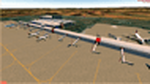
This is V1.1 of the King Shaka Airport in Kwa Zulu Natal, South Africa. This version has working Photo Ground Textures.
| Filename: | King_Shaka_Airport__FALE.zip |
| License: | Freeware, limited distribution |
| Added: | 22nd November 2011, 00:14:02 |
| Downloads: | 2,811 |
| Author: | Gerrit Geldenhuys |
| Size: | 9.09 MB |
| Category: Flight Simulator X - Scenery | |
| China Burma India Malaya and N.E.I. WWII airfields |
|
File Description:
Allied WWII airfields in India, Burma, China, Malaya and the N.E.I. Bibliography, Maps and Diagrams.
Expands and replaces previous CBIX.zip version.
| Filename: | China_Burma_India_Malaya_and_NEI_WWII_airfields.zip |
| License: | Freeware |
| Added: | 26th March 2011, 23:08:21 |
| Downloads: | 871 |
| Author: | Alex D. Nicolson |
| Size: | 47.1 MB |
| Category: Flight Simulator 2004 - Scenery | |
| Eagle County (KEGE), Glenwood Springs (KGWS), Colorado, Photo-Scenery (FS9 & FSX) |
|
Images related to this file:
File Description:
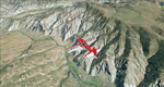
To explore this region depart from Eagle County Regional Airport (KEGE) which is a popular regional airport used in winter to transport skiers to nearby Vail. Northwest of the airport you can see the pit gypsum mine of American Gypsum which produces a variety of wallboard products. When you fly to the west and along the Eagle River, you soon pass its confluence with the Colorado River. Further west you can fly along Glennwood Canyon and finally reach Glennwood Springs where the Colorado meets the Roaring Fork River. Here you can turn south and fly direct Glenwood Springs Airport (KGWS) which lies south of the city. This scenery brings you another 3.500 sq km of beautiful Colorado in 4.7m/pix quality.
High resolution versions of this scenery for FS9 and FSX (much sharper, but larger and multiple downloads) are available at www.blueskyscenery.com/GNB_SouthWest2.html . The screenies are taken from the high-res versions, so expect this version to be slightly more blurry. YourDonation@Work: Dedicated to Alain and James.
| Filename: | Eagle_County_KEGE_Glenwood_Springs_KGWS_Colorado_P.zip |
| License: | Freeware, limited distribution |
| Added: | 30th January 2010, 17:01:49 |
| Downloads: | 2,710 |
| Author: | Gottfried Razek - blueskyscenery.com |
| Size: | 93.8 MB |
| Category: Flight Simulator 2004 - Scenery | |
| Colorado Springs South (KCOS), Colorado, Photo-Scenery |
|
Images related to this file:
File Description:
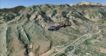
Colorado Springs South (KCOS), Colorado, Photo-Scenery (FS9 & FSX)
This region covers the area of Colorado Springs. Just west of the city you can fly around Pikes Peak. At 14.115ft it is the easternmost of Colorado's 54 fourteeners. Northwest of the city lies the Garden Of Gods with its many vertical rock formations. They are made of sedimentary beds red and white sandstones, conclomerates and limestone that were deposited horizontally but have been tilted vertically and faulted by the immense mountain building forces caused by the uplift of the Pikes Peak massiv. Deep within Chayenne Mountain is the North American Aerospace Defense Command's (NORAD) main technical facility which collects and evaluates data from a worldwide system of satellites, radars and other sensors.
High resolution versions of this scenery for FS9 and FSX (much sharper, but larger and multiple downloads) are available at www.blueskyscenery.com/GNB_South3East.html . The screenies are taken from the high-res versions, so expect this version to be slightly more blurry. YourDonation@Work: Dedicated to Veit and Hector.
| Filename: | Colorado_Springs_South_KCOS_Colorado_PhotoScenery.zip |
| License: | Freeware, limited distribution |
| Added: | 5th February 2010, 16:30:42 |
| Downloads: | 1,983 |
| Author: | Gottfried Razek, blueskyscenery.com |
| Size: | 95.63 MB |


© 2001-2026 AVSIM Online
All Rights Reserved
Privacy Policy |