
Where Flight Simulation Enthusiasts Gather from Around the World!
AVSIM Library - Search Results

| Category: Flight Simulator 2004 - Aircraft Repaints, Textures and Modifications | |
| FSD Northrop T-38 "BB" - Beale AFB scheme |

|
Images related to this file:
File Description:
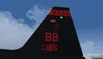
This is a repaint of the FSD T-38 in Beale "BB" scheme. It features high resolution, 32-bit textures, for the exterior and virtual cockpit, accurate markings/logos. Requires The freeware FSD T-38. Paint by by John Hoopes
| Filename: | FSD_Northrop_T38_BB__Beale_AFB_scheme.zip |
| License: | Freeware, limited distribution |
| Added: | 20th May 2011, 21:54:10 |
| Downloads: | 112 |
| Author: | John Hoopes |
| Size: | 1.79 MB |
| Category: Prepar3D V5 - Aircraft Repaints, Textures and Modifications | |
| Qatar Airways Boeing 777-3DZ(ER) A7-BAC (Retro cs) repaint for PMDG 777-300ER |
|
Images related to this file:
File Description:

Qatar Airways Boeing 777-3DZ(ER) A7-BAC (Retro cs) repaint for PMDG 777-300ER. Painted with hand drawn logo in 4096x4096 resolution and saved in DDS 32-bit file to preserve the details. Aircraft configuration file included. Happy flying!
| Filename: | Qatar_Airways_Boeing_7773DZER_A7BAC_Retro_cs_repai.zip |
| License: | Freeware |
| Added: | 19th February 2022, 15:51:54 |
| Downloads: | 473 |
| Author: | Aldriand Wibisono |
| Size: | 27.99 MB |
| Category: Flight Simulator 2002 - Aircraft Repaints, Textures and Modifications | |
| NapuleVola Airbus A330-200 |
|
File Description:
The first "Heavy" entry in Napulevola fleet.
Registration I-MARE. Includes 40 sided fuselage, flexing wings, full moving parts, steerable front wheel, and high resolution textures. Repaint by Massimiliano Rega, flight dinamic by Stefano Caputo.
Original model by Project OpenSky.
| Filename: | NapuleVola_Airbus_A330200.zip |
| License: | Freeware |
| Added: | 29th June 2002, 08:37:22 |
| Downloads: | 235 |
| Author: | POSKY, Massimiliano Rega |
| Size: | 4.04 MB |
| Category: Flight Simulator 2004 - Scenery | |
| Sicily Scenery Mesh |
|
File Description:
This terrain mesh scenery covers whole Sicily with Eolie archipelago, Pantelleria, Lampedusa, Malta and Gozo Islands. Based on SRTM Data (3 arcsec, 90m), generated with Matthew Styles's program "SRTM To BGL v1.04", sampled to LOD9 resolution (76m) with 10 interpolation passes.
| Filename: | Sicily_Scenery_Mesh.zip |
| License: | Freeware |
| Added: | 5th November 2003, 16:39:10 |
| Downloads: | 10,422 |
| Author: | Giovanni Miduri |
| Size: | 8.97 MB |
| Category: Flight Simulator 2004 - Scenery | |
| Appalachian Mountains, Virginia / West Virginia |
|
File Description:
USGS SRTM30 1 arc-second, resampled to LOD10 (38.2 meters).
This high-resolution terrain mesh is centered in the Appalachian Mountains
between Virginia and West Virginia. Coverage area: From West -81° to West -79°
and North 37° to North 39°.
| Filename: | Appalachian_Mountains_Virginia__West_Virginia.zip |
| License: | Freeware, limited distribution |
| Added: | 10th January 2004, 18:06:59 |
| Downloads: | 3,683 |
| Author: | Andreas Trawny |
| Size: | 17.1 MB |
| Category: Flight Simulator X - Scenery | |
| South America Mesh Scenery, MeshX_F4 |
|
File Description:
Mesh terrain scenery for the whole continental South America, based on SRTM 90m
dem geotiff files (at: ftp://ftp.glcf.umiacs.umd.edu/glcf/SRTM/Degree_Tiles/),
resampled to 76 meter of horizontal resolution (LOD 9). The new files have
improved the vertical resolution from 16m to 10m, resulting in more details
and accuracy over previous versions. There are 50 files, compatible with FS 9
and FS X, identified in a map by column letter and line number, covering the
contiguous countries and states. Boundaries: N = 5º 37.5' S; S = 11º 15' S;
W = 41º 15' W; E = 33º 45' W;
| Filename: | South_America_Mesh_Scenery_MeshX_F4.zip |
| License: | Freeware |
| Added: | 28th October 2006, 05:54:09 |
| Downloads: | 1,526 |
| Author: | Oséas Dourado and José Lôbo |
| Size: | 32.14 MB |
| Category: Flight Simulator X - Scenery | |
| South America Mesh Scenery, MeshX_E3 |
|
File Description:
Mesh terrain scenery for the whole continental South America, based on SRTM 90m
dem geotiff files (at: ftp://ftp.glcf.umiacs.umd.edu/glcf/SRTM/Degree_Tiles/),
resampled to 76 meter of horizontal resolution (LOD 9). The new files have
improved the vertical resolution from 16m to 10m, resulting in more details
and accuracy over previous versions. There are 50 files, compatible with FS 9
and FS X, identified in a map by column letter and line number, covering the
contiguous countries and states. Boundaries: N = 0º 0' S; S = 5º 37.5' S;
E = 41º 15' W; W = 48º 45' W;
| Filename: | South_America_Mesh_Scenery_MeshX_E3.zip |
| License: | Freeware |
| Added: | 28th October 2006, 05:54:49 |
| Downloads: | 1,610 |
| Author: | Oséas Dourado and José Lôbo |
| Size: | 27.48 MB |
| Category: Flight Simulator X - Scenery | |
| South America Mesh Scenery, MeshX_E4 |
|
File Description:
Mesh terrain scenery for the whole continental South America, based on SRTM 90m
dem geotiff files (at: ftp://ftp.glcf.umiacs.umd.edu/glcf/SRTM/Degree_Tiles/),
resampled to 76 meter of horizontal resolution (LOD 9). The new files have
improved the vertical resolution from 16m to 10m, resulting in more details
and accuracy over previous versions. There are 50 files, compatible with FS 9
and FS X, identified in a map by column letter and line number, covering the
contiguous countries and states. Boundaries: N = 5º 37.5' S; S = 11º 15' S;
E = 41º 15' W; W = 48º 45' W;
| Filename: | South_America_Mesh_Scenery_MeshX_E4.zip |
| License: | Freeware |
| Added: | 28th October 2006, 05:55:47 |
| Downloads: | 1,529 |
| Author: | Oséas Dourado and José Lôbo |
| Size: | 38.91 MB |
| Category: Flight Simulator X - Scenery | |
| South America Mesh Scenery, MeshX_D8 |
|
File Description:
Mesh terrain scenery for the whole continental South America, based on SRTM 90m
dem geotiff files (at: ftp://ftp.glcf.umiacs.umd.edu/glcf/SRTM/Degree_Tiles/),
resampled to 76 meter of horizontal resolution (LOD 9). The new files have
improved the vertical resolution from 16m to 10m, resulting in more details
and accuracy over previous versions. There are 50 files, compatible with FS 9
and FS X, identified in a map by column letter and line number, covering the
contiguous countries and states. Boundaries: N = 28º 7.5' S; S = 33º 45' S;
E = 48º 45' W; W = 56º 15' W;
| Filename: | South_America_Mesh_Scenery_MeshX_D8.zip |
| License: | Freeware |
| Added: | 28th October 2006, 15:07:00 |
| Downloads: | 1,922 |
| Author: | Oséas Dourado and José Lôbo |
| Size: | 28.66 MB |
| Category: Flight Simulator X - Scenery | |
| South America Mesh Scenery, MeshX_F6 |
|
File Description:
Mesh terrain scenery for the whole continental South America, based on SRTM 90m
dem geotiff files (at: ftp://ftp.glcf.umiacs.umd.edu/glcf/SRTM/Degree_Tiles/),
resampled to 76 meter of horizontal resolution (LOD 9). The new files have
improved the vertical resolution from 16m to 10m, resulting in more details
and accuracy over previous versions. There are 50 files, compatible with FS 9
and FS X, identified in a map by column letter and line number, covering the
contiguous countries and states. Boundaries: N = 16º 52.5' S; S = 22º 30' S;
E = 33º 45' W; W = 41º 15' W;
| Filename: | South_America_Mesh_Scenery_MeshX_F6.zip |
| License: | Freeware |
| Added: | 28th October 2006, 15:07:29 |
| Downloads: | 1,511 |
| Author: | Oséas Dourado and José Lôbo |
| Size: | 9.8 MB |


© 2001-2026 AVSIM Online
All Rights Reserved
Privacy Policy |