
Where Flight Simulation Enthusiasts Gather from Around the World!
AVSIM Library - Search Results

| Category: Flight Simulator 2004 - Sounds | |
| ATC Voices -Airport names set 7 |

|
File Description:
A collection of additional and corrected airport names, for use with
Flight Simulator 2004 and FS2002. Installation requires the
EditVoicepack software (see
http://bevelstone.xs4all.nl/FlightSimulator/EditVoicepack) by Lars
Møllebjerg which is also available free download from the usual Flight
Simulator download sites such as Avsim.
The airports represented here are:
EDBF Fehrbelin (Germany),
EDBZ Schwarzheide (Germany),
EDHG Luneburg (Germany),
EDOQ Oschatz (Germany),
HCMF Bosaso (Somalia),
LFHV Villefranche/Tarare (France),
LFKO Propriano (France),
LFLX Deols/Chateauroux (France) - fixed,
LFOV Laval (France),
MM0I La Retama Southwest (Mexico),
MM1B Cerro Azul (Mexico),
NZWU Wanganui (New Zealand),
UA0A Batken (Kyrgyzstan),
UAOO Kzyl Orda (Russian Federation),
UEVV Zhigansk (Russian Federation),
UHMS Seymchan (Russian Federation), and
WASF Fak-Fak/Torea (Indonesia).
| Filename: | ATC_Voices_Airport_names_set_7.zip |
| License: | Freeware |
| Added: | 25th April 2007, 20:38:42 |
| Downloads: | 2,031 |
| Author: | John hinson |
| Size: | 12.9 KB |
| Category: Flight Simulator 2004 - Scenery | |
| KPVG - Hampton Roads Executive Airport - Virginia, USA |
|
Images related to this file:
File Description:
FS2004 Scenery - Hampton Roads Executive Airport (ICAO: KPVG, FAA LID: PVG) is a public-use airport
located seven miles (11 km) southwest of the central business district of Norfolk and northwest of Chesapeake, both independent cities in the U.S. state of Virginia. It is privately owned by Virginia Aviation Associates, L.L.C. Although most U.S. airports use the same three-letter location identifier for the FAA and IATA, Hampton Roads Executive Airport is assigned PVG by the FAA but has no designation from the IATA (which assigned PVG to Pudong International Airport in Shanghai, China). All buildings are custom made. AI traffic contains default aircraft. Created for your flight simming pleasure by John B. Loney, Jr.
| Filename: | KPVG__Hampton_Roads_Executive_Airport__Virginia_US.zip |
| License: | Freeware, limited distribution |
| Added: | 7th September 2014, 23:06:07 |
| Downloads: | 527 |
| Author: | John B. Loney, Jr. |
| Size: | 18.79 MB |
| Category: Flight Simulator 2004 - Scenery | |
| Southern Ontario Canada LOD 9 Mesh |
|
File Description:
Please note that I forgot to cut the one side of the screenshots so the right side of the image is what was present on my second monitor which in the first two pictures was my background.
The default mesh for Southern Ontario Canada was pretty flat and did not show the small rolling hills that are present throughout the province. This is LOD9 (90 meter) mesh that covers ALL of Southern Ontario from Elliot Lake, Sudbury and North Bay in the North, to near Montreal in the east, to Windsor in the southwest and all points in between. This mesh covers the entire area of Ontario shown in the Toronto VNC.
| Filename: | Southern_Ontario_Canada_LOD_9_Mesh.zip |
| License: | Freeware, limited distribution |
| Added: | 16th January 2004, 02:01:29 |
| Downloads: | 6,542 |
| Author: | David Voogd |
| Size: | 41.32 MB |
| Category: Flight Simulator 2004 - Scenery | |
| Lauriston TGPZ on Carriacou Island in the Caribbean |
|
Images related to this file:
File Description:
Canrriacou Island, though part of the Grenadines geographically, is south of the island chain known politically as St Vincent and the Grenadines, and with Petite Martinique is a dependency of Grenada. Carriacou is around 7 miles long and 2 miles wide, with a resident population of perhaps 5,000. Lauriston airport is at the southwest end of the island, on the north coast, and the runway is around 2,600 feet and aligned 09/27. There are connecting flights both north and south to the other islands by SVG and LIAT. The terminal is stucco and pastel colours and not exactly new. The airport apron is tight. This is the last of my Caribbean series made for default FS9.
| Filename: | Lauriston_TGPZ_on_Carriacou_Island_in_the_Caribbea.zip |
| License: | Freeware, limited distribution |
| Added: | 6th July 2013, 22:23:03 |
| Downloads: | 643 |
| Author: | Roger Wensley |
| Size: | 2.47 MB |
| Category: Flight Simulator 2004 - Scenery | |
| Canyonlands National Park, The Maze-South, Utah, Photo-Scenery (FSX too) |
|
Images related to this file:
File Description:
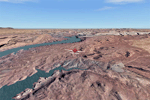
This is a re-upload of a package that was corrupted during the crash of the AVSIM library. This is the fourth package of the Arches/Canyonlands area. It covers the area southwest and including the confluence of the Colorado and Green Rivers. From there you can fly down Cataract Canyon which is famed for its premium whitewater rafting oportunities. Or explore the Maze (the area west of the Green and north of the Colorado River) with it's labyrinth of canyons and colorful sandstone formations. The scenery extends west to Hite (UT03) on Lake Powell. Brings the total Southern Utah coverage to 14.000 sq km in 4.7m/pix quality. YourDonation@Work: Dedicated to Patrick, Hideyuki and Art. Thanks!
| Filename: | Canyonlands_National_Park_The_MazeSouth_Utah_Photo.zip |
| License: | Freeware, limited distribution |
| Added: | 31st December 2009, 22:33:46 |
| Downloads: | 2,083 |
| Author: | Gottfried Razek - blueskyscenery.com |
| Size: | 95.67 MB |
| Category: Flight Simulator X - Scenery | |
| KPVG - Hampton Roads Executive Airport - Virginia, USA |
|
Images related to this file:
File Description:
FSX Scenery - Hampton Roads Executive Airport (ICAO: KPVG, FAA LID: PVG) is a public-use airport located seven miles (11 km) southwest of the central business district of Norfolk and northwest of Chesapeake, both independent cities in the U.S. state of Virginia. It is privately owned by Virginia Aviation Associates, L.L.C. Although most U.S. airports use the same three-letter location identifier for the FAA and IATA, Hampton Roads Executive Airport is assigned PVG by the FAA but has no designation from the IATA (which assigned PVG to Pudong International Airport in Shanghai, China). All buildings are custom made. AI traffic contains default aircraft. Created for your flight simming pleasure by John B. Loney, Jr.
| Filename: | KPVG__Hampton_Roads_Executive_Airport__Virginia_US.zip |
| License: | Freeware, limited distribution |
| Added: | 7th September 2014, 23:05:56 |
| Downloads: | 847 |
| Author: | John B. Loney, Jr. |
| Size: | 18.89 MB |
| Category: Flight Simulator X - Scenery | |
| Yuba Co-Oroville Muni |
|
File Description:
FSX Scenery - Yuba County Airport (IATA: MYV, ICAO: KMYV) is a public airport located three miles (4.8 km) southeast of Marysville, serving Yuba County, California, USA. The airport has two runways and is mostly used for general aviation. Oroville Municipal Airport (IATA: OVE, ICAO: KOVE) is a public airport located 3 miles (5 km) southwest of the city of Oroville in Butte County, California, USA. Oroville Municipal Airport covers 920 acres and has two runways. This airport is about 23nm NW of Yuba Co. An 18 hole golf course is located right next to the facility for you "Fly-in Golfers". EZ Scenry libraries require, some are included. By John B. Loney, Jr. and Robert Lacy.
| Filename: | Yuba_CoOroville_Muni.zip |
| License: | Freeware, limited distribution |
| Added: | 11th May 2010, 21:36:46 |
| Downloads: | 1,305 |
| Author: | John B. Loney, Jr. |
| Size: | 9.77 MB |
| Category: Flight Simulator 2004 - Scenery | |
| Newport, Oregon - KONP. A conservative enhancement of the Newport, Oregon airport. |
|
Images related to this file:
File Description:
Newport, Oregon - KONP. A conservative enhancement of the Newport, Oregon airport which lies some 130 miles Southwest of Portland, Oregon. Featured is an AI U.S. Coast Guard Helicopter (included in the package) making training and reconnaissance flights over and around the area. Also included is a new bridge allowing the fishing fleet access to and from the bay. Tillamook, which is just North of Newport, is famous for it's cheese but you will find much more to enjoy on this portion of the Oregon coastline. Default, RWY12 and EZ scenery objects were used in this project. Please unzip to a temporary folder and follow the easy installation instructions. Compiled for your flying enjoyment by David "Opa" Marshall.
| Filename: | Newport_Oregon__KONP__A_conservative_enhancement_o.zip |
| License: | Freeware |
| Added: | 31st January 2010, 21:22:48 |
| Downloads: | 4,052 |
| Author: | David "Opa" Marshall |
| Size: | 2.52 MB |
| Category: Flight Simulator 2004 - Scenery | |
| Kotzebue PAOT on the northwestern coast of Alaska |
|
Images related to this file:
File Description:
There are four main northwestern Alaska towns which have good airports and are serviced by Alaska Airlines. From these airports local flights connect to nearby villages, "nearby" in Alaska meaning up to 150 miles away. The northernmost is Barrow. Southwest of Barrow is Kotzebue, then Nome, and the furthest south is Bethel. The town of Kotzbue is north of the Bering Strait on the northwestern coast, 320 miles southwest of Barrow. The population is just over 3,000 people. The location was for a long time a base for trading in furs, with three rivers emptying into the sea and providing routes into the interior land and villages; a meeting place between hunters and traders from Russia and elsewhere. The Kotzebue airport is called the Ralph Wien Memorial and has two runways. The modern one is aligned 08-26 and is 5,880 feet of 150 feet wide asphalt built across a shallow lagoon, with an ILS on 08 and PAPI on both ends. The second and older runway is originally military and gravel, aligned 17-35 and 3,786 feet long and used (wind allowing) by the GA planes that park alongside the runway. The prevalent wind is from the west; when the wind is from the east it is generally relatively feeble and with a much lower cloud base, possibly to the ground, hence the need for an ILS. All AI aircraft in FS9 much prefer to use a runway that has an ILS and so will continue to use 08-26 even if the wind is from the south until it reaches 30+ knots, even if they are a Cessna 150 flying VFR. So for AI realism in FS9 a northern or southern wind needs to be a strong one so that the runway is actually used. However, as Alaska Airlines, Northern Air Cargo, and Everts Air also fly to Kotzebue and can only use the east-west runway (as less than 4,000 feet of asphalt would be seriously inconvenient for a Boing 737 or DC6) it is necessary to have the northern or southern wind UNDER 30 knots at the times when they are landing or taking off. Your choice. I suppose a permanent strong wind from the west would be the most realistic on a daily basis, deterring all planes from ever using 17-35. The AI will develop along with further scenery additions in the neighbourhood.
| Filename: | Kotzebue_PAOT_on_the_northwestern_coast_of_Alaska.zip |
| License: | Freeware, limited distribution |
| Added: | 2nd August 2016, 16:47:52 |
| Downloads: | 458 |
| Author: | Roger Wensley |
| Size: | 19.32 MB |
| Category: Flight Simulator 2004 - Sounds | |
| 1Time Airlines Callsign |
|
File Description:
This voicepack file adds the 1Time Airlines callsign to your airlines list recognized by ATC. Needed for the recently updated 1Time Airlines package from 'World of AI'.
| Filename: | 1Time_Airlines_Callsign.zip |
| License: | Freeware |
| Added: | 17th February 2008, 16:12:58 |
| Downloads: | 1,502 |
| Author: | Mario Billiani |
| Size: | 1.31 KB |


© 2001-2026 AVSIM Online
All Rights Reserved
Privacy Policy |