
Where Flight Simulation Enthusiasts Gather from Around the World!
AVSIM Library - Search Results

| Category: Flight Simulator 2004 - Scenery | |
| Newcastle Xtreme |

|
Images related to this file:
File Description:

Newcastle International Airport (IATA: NCL, ICAO: EGNT). Extremely accurate scenery for Newcastle airport. Includes night lighting, new tower, photo ground, large amount of animation vehicles and replacement AFCAD file. All textures made to the highest standard based on actual photographs.
DEMO FILE, fully funtional but has 'demo signs'
| Filename: | Newcastle_Xtreme.zip |
| License: | Commercial demo |
| Added: | 16th September 2011, 14:26:49 |
| Downloads: | 1,168 |
| Author: | Gary Summons, UK2000 Scenery |
| Size: | 93.13 MB |
| Category: Flight Simulator 2004 - Scenery | |
| London City Xtreme |
|
Images related to this file:
File Description:
Extremely accurate scenery for London City airport. This scenery Includes detailed images of the real London City airport, it has a high resolution 25cm base image, static aircraft (optional), nearly all the buildings, detailed ground markings, and most of the surrounding docklands buildings, it also includes stunning night lighting and animation vehicles.
| Filename: | London_City_Xtreme.zip |
| License: | Commercial demo |
| Added: | 19th November 2011, 23:59:57 |
| Downloads: | 2,044 |
| Author: | Gary Summons/UK2000 Scenery |
| Size: | 64.93 MB |
| Category: Flight Simulator X - Scenery | |
| London City Xtreme |
|
Images related to this file:
File Description:
Extremely accurate scenery for London City airport. This scenery Includes detailed images of the real London City airport, it has a high resolution 25cm base image, static aircraft (optional), nearly all the buildings, detailed ground markings, and most of the surrounding docklands buildings, it also includes stunning night lighting and animation vehicles.
| Filename: | London_City_Xtreme.zip |
| License: | Commercial demo |
| Added: | 20th November 2011, 00:01:31 |
| Downloads: | 2,658 |
| Author: | Gary Summons/UK2000 Scenery |
| Size: | 69.41 MB |
| Category: Flight Simulator 2004 - Miscellaneous Files | |
| EXC.object files; Default Erzurum (LTCE) on 26L-Runway |
|
Images related to this file:
File Description:
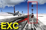
Default LTCE_Erzurum/Turkey airport runway 26L N39 '57.40' and E041 '11:35'
coordinates and 5571.7ft. (1756.8 m) altitude (airport elevation)has the NDB transmitter.
As a result of the transmitter to be there this runway 26L planes takeoff and landings, was Crash.
EXC.bgl files, and prepared and have eliminated this problem.VAPS-vaps.hooxs.com
| Filename: | EXCobject_files_Default_Erzurum_LTCE_on_26LRunway.zip |
| License: | Freeware |
| Added: | 4th March 2012, 06:51:52 |
| Downloads: | 130 |
| Author: | Dincman Wings (VAPS) |
| Size: | 8.87 KB |
| Category: Flight Simulator X - AFCAD Files | |
| KDCA Ronald Reagan Washington National Airport- 2012 Updated (V1.2) |
|
File Description:
Welcome to Washington's Ronald Reagan National Airport for FSX. The biggest changes are much-updated airline parking to represent DCA as it is in 2012. Several gates have also been added, as well as additional remote parking. Created with Airport Design Editor v.1.50. This version fixes several misplaced jetways and parking spaces.
| Filename: | KDCA_Ronald_Reagan_Washington_National_Airport_201.zip |
| License: | Freeware |
| Added: | 8th August 2012, 20:26:35 |
| Downloads: | 1,875 |
| Author: | Erik Ingram |
| Size: | 23.84 KB |
| Category: Flight Simulator 2004 - Scenery | |
| Heringsdorf 2012 |
|
File Description:
This scenery presents the airport Heringsdorf, EDAH in condition of 2012. Heringsdorf is a small regional airport in the northeast of germany on the island Usedom. The scenery also included the UL Field Mellenthin, ED1M.
For more sceneries, history, aircraft and repaints of the formerly GDR Aviation visit: www.ddr-flugzeuge.de
| Filename: | Heringsdorf_2012.zip |
| License: | Freeware |
| Added: | 21st August 2012, 23:17:32 |
| Downloads: | 1,052 |
| Author: | Frithjof Koch, Volker Loew, Henry Baumann |
| Size: | 30.35 MB |
| Category: Flight Simulator 2004 - Scenery | |
| Nairobi Markers |
|
File Description:
Nice and simple scenery for MS FS2004. In contains the 4 Markers inside the Nairobi Control Zone of Jomo Kenyatta Airport (HKJK), the airport is located in Nairobi the capital of Kenya. I built this small scenery with EZ-scenery. You must download the EZ-Scenery database from here: http://www.abacuspub.com/pub/AbacusEZLibraries.exe
| Filename: | Nairobi_Markers.zip |
| License: | Freeware |
| Added: | 18th February 2014, 00:17:40 |
| Downloads: | 328 |
| Author: | Andreas Fruehauf |
| Size: | 672.41 KB |
| Category: Flight Simulator X - Scenery | |
| UHPP - Kamchatka Yelizovo v1.1 * Fix * |
|
Images related to this file:
File Description:
FSX UHPP Kamchatka Yelizovo v1.1 scenery fix.
The payware scenery is designed by "RU Scenery Design" and distributed by Aersoft.
Developers unfortunately missed the important AFD file for the airport.
This add on adds this file and fixes the problem where airport custom lights objects remain disabled without an AFD file below.
| Filename: | UHPP__Kamchatka_Yelizovo_v11__Fix_.zip |
| License: | Freeware, limited distribution |
| Added: | 3rd April 2014, 04:18:10 |
| Downloads: | 717 |
| Author: | Kyprianos Biris |
| Size: | 355.98 KB |
| Category: Flight Simulator X - AFCAD Files | |
| SBTP - Tupi Airport - Tupi Paulista, Sao Paulo - Brazil |
|
Images related to this file:
File Description:
This airport does not really exist. It was created in the middle of the Atlantic Ocean (as a floating airport) to support operations "off-shore" oil drilling of the "pre-salt". It is located about 450 km south of the city of Rio de Janeiro and 370 km south-southeast of Santos.
| Filename: | SBTP__Tupi_Airport__Tupi_Paulista_Sao_Paulo__Brazi.zip |
| License: | Freeware |
| Added: | 1st December 2014, 23:59:12 |
| Downloads: | 92 |
| Author: | Wellington Silva de Farias |
| Size: | 105.28 KB |
| Category: Flight Simulator X - Scenery | |
| Abumusa Island, Persian Gulf, Iran |
|
Images related to this file:
File Description:
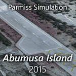
Abumusa Island (Iran) ,is a 12.8 square kilometers (4.9 sq mi) Iranian island in the eastern "Persian Gulf" near the entrance to the "Strait of Hormuz". Abumusa Airport (IATA: AEU, ICAO: OIBA) is an airport serving Abumusa Island. This package contains Abumusa Island photoreal scenery based on Google satellites images with LOD19 quality.
| Filename: | Abumusa_Island_Persian_Gulf_Iran.zip |
| License: | Freeware, limited distribution |
| Added: | 15th December 2014, 13:28:35 |
| Downloads: | 2,561 |
| Author: | Khashayar Talebzadeh |
| Size: | 289.35 MB |


© 2001-2026 AVSIM Online
All Rights Reserved
Privacy Policy |