
Where Flight Simulation Enthusiasts Gather from Around the World!
AVSIM Library - Search Results

| Category: Flight Simulator X - AFCAD Files | |
| Halka Nurseries Airport (9NJ6), NJ |

|
File Description:
Located 02 miles W of Fairton, New Jersey on 150 acres of land, Halka Nurseries Airport is a private turf strip 2400' in length. The airspace has been analyzed and deemed suitable for aircraft up to a light twin. Take caution on the Runway 18 approach as power lines are strung up along the street opposite the runway. There is no hard surfaced runway so have your terrain mesh set as high as possible to experience bumpy terrain. There is no windsock, so be sure to know your weather before arriving or departing - the winds in this area are predominantly out of the west and this runway is north/south. Trees and bushes are close to some areas of the runway and can pose a danger in high crosswinds. There are no services for transient aircraft.
Scenery constructed with use of satellite images/streetview/aerial photos - the author has not been there in person.
This scenery is meant to be used in conjunction with MegaScenery Earth New Jersey/Delaware 005. It is not required, but apron use is minimized to allow satellite scenery to show through as much as possible, and objects are placed based on the MSE textures - lack of it may make scenery look out of place.
| Filename: | Halka_Nurseries_Airport_9NJ6_NJ.zip |
| License: | Freeware |
| Added: | 6th April 2011, 03:27:56 |
| Downloads: | 207 |
| Author: | Drew Sikora |
| Size: | 829.12 KB |
| Category: Flight Simulator X - Scenery | |
| Opa Locka, FL Airport (KOPF) |
|
Images related to this file:
File Description:
This scenery includes the old control tower (inactave), a temporary control tower (active) and a new control tower (inactive, near completion). Generic floating buildings have been replaced with custom and library objects. Landclass changes, roads, rework of runways, taxiways and aprons, placement of library objects and a library of new airport buildings are included. Military parking is included at the Coast Guard facility. Scenery in this package is based on Virtual Earth (Bing) and Google Earth imagery.
| Filename: | Opa_Locka_FL_Airport_KOPF.zip |
| License: | Freeware |
| Added: | 7th April 2011, 00:15:39 |
| Downloads: | 2,299 |
| Author: | Art Poole |
| Size: | 2.83 MB |
| Category: Flight Simulator X - AFCAD Files | |
| Newton Airport (3N5), NJ v1.0.1 |
|
File Description:
Located 03 miles S of Newton, New Jersey on 90 acres of land, Newton Airport is a public airstrip. No services are offered for transient aircraft. Trees are summertime ONLY.
Scenery constructed with use of satellite images/streetview, the author has not been there in person.
This scenery is meant to be used in conjunction with MegaScenery Earth New York 005. It is not required, but apron use is minimized to allow satellite scenery to show through as much as possible, and objects are placed based on the MSE textures - lack of it may make scenery look out of place.
Visit http://www.blade-edge.com/MSEAirports/?page_id=223 for more information and pictures.
Revision Notes: Moved mis-placed start location to runway
| Filename: | Newton_Airport_3N5_NJ_v101.zip |
| License: | Freeware |
| Added: | 15th January 2011, 02:43:50 |
| Downloads: | 213 |
| Author: | Drew Sikora |
| Size: | 884.5 KB |
| Category: Flight Simulator X - AFCAD Files | |
| Var-Sky Airport (JY08), NJ |
|
File Description:
Located 02 miles E of Woodstown, New Jersey on 38 acres of land, Var-Sky Airport is a private turf strip 1165' in length and a slightly challenging approach with trees closely bordering the sides of both runway ends. This airport has lighting on the runway however there is no beacon and the windsock (located atop the hangar) is not lit. There are no services offered for transient aircraft. There is no hard surfaced runway so having your terrain mesh settings as high as possible is recommended.
Scenery constructed with use of satellite images/streetview/aerial photos - the author has not been there in person.
This scenery is meant to be used in conjunction with MegaScenery Earth New Jersey/Delaware 004. It is not required, but apron use is minimized to allow satellite scenery to show through as much as possible, and objects are placed based on the MSE textures - lack of it may make scenery look out of place.
| Filename: | VarSky_Airport_JY08_NJ.zip |
| License: | Freeware |
| Added: | 19th April 2011, 06:21:50 |
| Downloads: | 195 |
| Author: | Drew Sikora |
| Size: | 361.96 KB |
| Category: Flight Simulator X - AFCAD Files | |
| Paramount Air Airport JY04 , NJ |
|
File Description:
Located 01 miles N of Green Creek, New Jersey on 20 acres of land, Paramount Air Airport is a private turf strip 2000' in length, although about 300' of it at the end of Runway 32 isn't in the best shape. The runway is 100' wide but closely hedged in by trees along both sides for the length of the runway. A hangar is past the end of Runway 14 but no services are offered for transient aircraft. Still, you can choose to start parked at the hangar if you wish. There is no hard surfaced runway so having your terrain mesh set as high as possible is recommended. No windsock is present, so know your weather (KWWD is very close by) and the airport is unlit so daytime VFR operations only are recommended.
Scenery constructed with use of satellite images/streetview/aerial photos - the author has not been there in person.
This scenery is meant to be used in conjunction with MegaScenery Earth New Jersey/Delaware 005. It is not required, but apron use is minimized to allow satellite scenery to show through as much as possible, and objects are placed based on the MSE textures - lack of it may make scenery look out of place.
| Filename: | Paramount_Air_Airport__JY04__NJ.zip |
| License: | Freeware |
| Added: | 20th April 2011, 16:42:48 |
| Downloads: | 179 |
| Author: | Drew Sikora |
| Size: | 418.37 KB |
| Category: Flight Simulator X - AFCAD Files | |
| Weiss Farm Airport (JY24), NJ |
|
File Description:
Located 02 miles W of Allamuchy, New Jersey on 264 acres of land, Weiss Farm Airport is a private turf strip 1800' in length. The published width is 50' but you really have closer to 100' to play with. There are no services offered to transient aircraft but you can start parked next to the barn if you wish to taxi out to the runway. No hard surfaced runway is used to have your terrain mesh set as high as possible the start of Runway 23 is a bit slanted and bumpy so you may want to aim long on your approach. The airport is unlit so daytime VFR operations only are recommended.
Scenery constructed with use of satellite images/streetview/aerial photos - the author has not been there in person. This scenery is meant to be used in conjunction with MegaScenery Earth New York 007. It is not required, but apron use is minimized to allow satellite scenery to show through as much as possible, and objects are placed based on the MSE textures - lack of it may make scenery look out of place.
| Filename: | Weiss_Farm_Airport_JY24_NJ.zip |
| License: | Freeware |
| Added: | 21st April 2011, 10:09:59 |
| Downloads: | 192 |
| Author: | Drew Sikora |
| Size: | 593.91 KB |
| Category: Flight Simulator 2004 - Sounds | |
| Zweibrucken (EDRZ) airport call sign |
|
File Description:
Here is the long time missed call sign for the german airport Zweibrucken (EDRZ). PLEASE READ THE readme.txt VERY CAREFULLY!
| Filename: | Zweibrucken_EDRZ_airport_call_sign.zip |
| License: | Freeware |
| Added: | 19th March 2011, 23:50:22 |
| Downloads: | 243 |
| Author: | Hans-Juergen Merkel |
| Size: | 2.03 KB |
| Category: Flight Simulator 2004 - Sounds | |
| Antalya Gazipasa Airport ICAO LTFG |
|
Images related to this file:
File Description:

FS2004/FSX EditVoicepack ICAO file for Antalya Gazipasa Airport, LTFG/GZP, Turkey. Uses the Turkish pronunciation. This is part of our 2nd round of EditVoicepack files (see aig_tower_release_2.zip). Our goal is to provide accurate ATC calls in order to provide Microsoft Flight Simulator traffic with quality ATC. These sounds are the best that we have been able to compile and are accurate as of release date and to the extent that our data and the limitations of the EditVoicepack allow. Visit us at www.alpha-india.net for more information.
| Filename: | Antalya_Gazipasa_Airport_ICAO_LTFG.zip |
| License: | Freeware, limited distribution |
| Added: | 2nd January 2011, 17:02:18 |
| Downloads: | 425 |
| Author: | Bruce Nicholson & Alpha India Group |
| Size: | 2.53 KB |
| Category: Flight Simulator X - Scenery | |
| 5R2 - Ocean Springs Airport (MS) |
|
Images related to this file:
File Description:

NOTE: This scenery requires the RWY12 and EZScenery Object libraries. 5R2 is located in Ocean Springs, Mississippi and is the airport where I learned to fly, having never been upgraded in FS, I decided it was time to do so.
It is not 100% accurate as of yet, I will be updating it once I find the time to visit it in the real world again. I hope you enjoy flying the beautiful Gulf Coast! This scenery was originally made for the great community of FSEconomy
| Filename: | 5R2__Ocean_Springs_Airport_MS.zip |
| License: | Freeware, limited distribution |
| Added: | 8th August 2012, 23:24:57 |
| Downloads: | 389 |
| Author: | Joseph Chamberlain |
| Size: | 502.78 KB |
| Category: Flight Simulator X - AFCAD Files | |
| Chicago O'Hare International Airport (KORD) |
|
Images related to this file:
File Description:
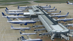
This is a AFCAD file for KORD. All gates have been redone to prevent wing overlap, and represent actually parking positions.
Runway west-flow has been simulated.
Tested with AIG/WOAI flightplan packages and associated AI models.
| Filename: | Chicago_OHare_International_Airport_KORD.zip |
| License: | Freeware |
| Added: | 8th May 2012, 02:46:40 |
| Downloads: | 3,715 |
| Author: | Kevin Boydston / FSDreamTeam |
| Size: | 39.62 KB |


© 2001-2026 AVSIM Online
All Rights Reserved
Privacy Policy |