
Where Flight Simulation Enthusiasts Gather from Around the World!
AVSIM Library - Search Results

| Category: Flight Simulator 2004 - Scenery | |
| New River Gorge Bridge |

|
File Description:
This is a Model of the New River Gorge Bridge on US19 in Fayette County West Virginia by Daniel Greenwood.
| Filename: | New_River_Gorge_Bridge.zip |
| License: | Freeware |
| Added: | 13th November 2003, 00:56:15 |
| Downloads: | 1,221 |
| Author: | Daniel Greenwood |
| Size: | 520.16 KB |
| Category: Flight Simulator 2004 - Scenery | |
| Chandler Municipal KCHD |
|
File Description:
FS2004 Scenery-Chandler Municipal Airport (KCHD) serves Chandler and Maricopa County and is owned by the City Of Chandler. The airport has more than one runway. The longest is a paved runway extending 4840 feet. The facility is at an elevation of 1242 feet at a distance of about 3 miles from Chandler. Created with FSDS2, Rwy12 and Lago's FSE. AFCAD2 and Traffic Tools required. Textures included. By John B. Loney, Jr.
| Filename: | Chandler_Municipal_KCHD.zip |
| License: | Freeware |
| Added: | 19th October 2005, 14:58:01 |
| Downloads: | 651 |
| Author: | John B. Loney, Jr. |
| Size: | 1.93 MB |
| Category: Flight Simulator 2004 - Scenery | |
| FS2004 Scenery - Woodbine Municipal 1N4 |
|
File Description:
FS2004 Scenery - Woodbine Municipal Airport (1N4) serves Woodbine and Cape May County, New Jersey and is owned by Chairman Woodbine Port Authority. The airport has more than one runway. The longest is a paved runway extending 3304 feet. The facility is at an elevation of 42 feet at a distance of about 2 miles from Woodbine. PEASE READ THE README FOR IMPORTANT INFORMATION. Created with EZ Scenery by John B. Loney, Jr
| Filename: | FS2004_Scenery__Woodbine_Municipal_1N4.zip |
| License: | Freeware, limited distribution |
| Added: | 12th April 2007, 01:10:59 |
| Downloads: | 454 |
| Author: | John B. Loney, Jr. |
| Size: | 603.18 KB |
| Category: Flight Simulator X - Scenery | |
| FSX Scenery Only KESC Delta County Airport, Escanaba, Michigan USA |
|
Images related to this file:
File Description:
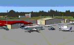
A small untowered GA airport in Upper Peninsula, Michigan USA.
Served by Delta Connection flights to Detroit and Minneapolis.
Scenery features custom built terminal, hangars, FBO, and other
buildings, some with transparent windows and open doors for night lighting.
By Dan French.
| Filename: | FSX_Scenery_Only_KESC_Delta_County_Airport_Escanab.zip |
| License: | Freeware, limited distribution |
| Added: | 8th September 2023, 05:48:27 |
| Downloads: | 91 |
| Author: | Dan French |
| Size: | 5.83 MB |
| Category: Flight Simulator 2004 - AFCAD Files | |
| Aspen - Aspen-Pitkin County Airport/Sardy Field, Colorado (KASE) Localizer |
|
File Description:
This file adds to the existing FS9 KASE Aspen, CO. scenery by adding the new Localizer for the Approach into KASE on frequency 111.15.
| Filename: | Aspen__AspenPitkin_County_AirportSardy_Field_Color.zip |
| License: | Freeware |
| Added: | 13th October 2005, 23:06:15 |
| Downloads: | 1,695 |
| Author: | Richard Snaer |
| Size: | 1.16 KB |
| Category: Flight Simulator 2004 - Aircraft Repaints, Textures and Modifications | |
| Long Island Classics Aeronca : Stormville Champ |
|
File Description:
Repaint of Long Island Classic's L16A Aeronca in the color of an an aeronca 7C based at Stormville airport in Dutchess County NY, during the 1970's. A picture of this aircraft is on the aft bulk head and the file is named for the owner. Texture only, by Paul Corish, requires the LIC Aeronca 16A package.
| Filename: | Long_Island_Classics_Aeronca__Stormville_Champ.zip |
| License: | Freeware |
| Added: | 2nd December 2004, 01:58:52 |
| Downloads: | 396 |
| Author: | Paul Corish/Lon Island Classics |
| Size: | 1.06 MB |
| Category: Flight Simulator 2004 - Scenery | |
| St Clair Regional K39 |
|
Images related to this file:
File Description:
FS2004 Scenery - St Clair Regional Airport (K39) serves St Clair and Franklin County and is owned by the City Of St Clair, Missouri, USA. The paved runway extends for 3200 feet. The facility is at an elevation of 654 feet at a distance of about 2 miles from St Clair. Created with Instant Scenery by John B. Loney, Jr.
| Filename: | St_Clair_Regional_K39.zip |
| License: | Freeware, limited distribution |
| Added: | 2nd November 2009, 19:56:50 |
| Downloads: | 187 |
| Author: | John B. Loney, Jr. |
| Size: | 9.51 MB |
| Category: Flight Simulator X - Aircraft Repaints, Textures and Modifications | |
| Silver Airways BAe Jetstream 41 |
|
Images related to this file:
File Description:

Silver Airways Corp., operating as Silver Airways (formerly Gulfstream International Airlines), is a United States airline with its headquarters on the property of Fort Lauderdale-Hollywood International Airport in unincorporated Broward County, Florida, near Fort Lauderdale. The Original livery is flown by a Saab 340B, but I've chosen to paint it for the PMDG Jetstream 4100. Textures only.
| Filename: | Silver_Airways_BAe_Jetstream_41.zip |
| License: | Freeware |
| Added: | 29th March 2014, 16:44:57 |
| Downloads: | 522 |
| Author: | Johnny Rosario |
| Size: | 13.22 MB |
| Category: Flight Simulator X - Scenery | |
| KASE - Pitkin Airport - Aspen, Colorado |
|
Images related to this file:
File Description:

This is Aspen-Pitkin County Airport/Sardy Field (KASE) for FSX and P3D. This scenery was created using ADE9X, SBuilderX, and Instant Scenery 2, and includes accurate aprons, taxiways, and runway as of 2013. Building placement is also accurate, and all building models were taken from existing 3rd party object libraries. I hope you enjoy the scenery!
| Filename: | KASE__Pitkin_Airport__Aspen_Colorado.zip |
| License: | Freeware |
| Added: | 18th May 2013, 07:45:02 |
| Downloads: | 2,590 |
| Author: | Todd Harrell |
| Size: | 3.55 MB |
| Category: Flight Simulator X - Scenery | |
| KTMA - Henry Tift Myers Airport - Tifton, Georgia (V1.1 Update) |
|
Images related to this file:
File Description:

The scenery represents KTMA FA08 Henry Tift Myers Airport in Tifton, Tift county, Georgia, USA. Used for training by the USSAC in WWII it returned to civil authorities in 1947. The airport was renamed Henry Tift Myers Airport in honour of Tifton native Colonel Henry T. "Hank" Myers, who was the first pilot of Air Force One.
The scenery includes custom built objects representing the characteristic terminal and T-hangars. The surrounding grounds are made by land class polygons.
v1.1 fixed some flickering on rwy15.
| Filename: | KTMA__Henry_Tift_Myers_Airport__Tifton_Georgia__V11_Update.zip |
| License: | Freeware |
| Added: | 16th October 2012, 08:43:22 |
| Downloads: | 1,113 |
| Author: | Vassilios Dimoulas |
| Size: | 1.2 MB |


© 2001-2026 AVSIM Online
All Rights Reserved
Privacy Policy |