
Where Flight Simulation Enthusiasts Gather from Around the World!
AVSIM Library - Search Results

| Category: Prepar3D V1-4 - Scenery | |
| KMSN - Madison Wisconsin USA Dane County Airport |

|
Images related to this file:
File Description:
Madison Wisconsin Dane County Regional Airport for P3D. Originally created for FSX, this airport has been converted to work in P3D. Several improvements have been made to the default airport. The default terminal buildings have been replaced with buildings created in FSDS; aircraft gates have been correctly coded using Airport Design Editor 1.76.6582; a new airport vehicle network has been built; extra fuel trucks have been added throughout the airport; the tower view has been changed to display from the roof of the control tower; a missing taxiway has been added, and all taxiway signs are correctly placed and named; there is the option to open all three runways to AI traffic; the 115th Fighter Wing of the Wisconsin Air National Guard is represented; and Jim Dhaenen's excellent ramp lights are also included. Please refer to the README FIRST.txt file to insure proper installation of all files.
| Filename: | KMSN__Madison_Wisconsin_USA_Dane_County_Airport.zip |
| License: | Check within download |
| Added: | 29th March 2018, 02:45:51 |
| Downloads: | 687 |
| Author: | Patrick Finch |
| Size: | 2.47 MB |
| Category: Flight Simulator 2002 - AFCAD Files | |
| Lake County Airport, Colorado, USA KLXV AFCAD |
|
File Description:
AFCAD file fix for Lake County Airport, Colorado, USA (KLXV).
An airport in the Aspen area, west of Denver.
Fixes a couple of minor problems and adds more parking to the default airport.
Requires AFCAD by Lee Swordy. If you have AFCAD's newer versions you can just drop in the AFCAD installer screen and you are done.
| Filename: | Lake_County_Airport_Colorado_USA_KLXV_AFCAD.zip |
| License: | Freeware |
| Added: | 29th December 2002, 15:17:34 |
| Downloads: | 400 |
| Author: | Alex Feldstein |
| Size: | 2.25 KB |
| Category: Flight Simulator X - AFCAD Files | |
| KMSV - Sullivan County International Airport - Monticello, NY |
|
File Description:
Here is an improved version of the stock Sullivan County International Airport. I moved the aprons closer to the runway, added new roads, removed and replaced every building. Added static airplanes and parking lot with cars and light poles.
| Filename: | KMSV__Sullivan_County_International_Airport__Monti.zip |
| License: | Freeware |
| Added: | 4th August 2008, 01:05:44 |
| Downloads: | 517 |
| Author: | Jim Cook |
| Size: | 6.25 KB |
| Category: Flight Simulator X - Scenery | |
| Punta Gorda, FL- Charlotte County Airport (KPGD) |
|
Images related to this file:
File Description:
What appears to be a nearly "dead" airport in FSX is brought to life with scenery objects and air traffic. Generic floating buildings have been replaced with custom and library objects. Landclass changes, roads, rework of runways, taxiways and aprons, placement of library objects and a library of new airport buildings are included. Scenery in this package is based on Virtual Earth (Bing) and Google Earth imagery.
Even though the airport doesn't have a control tower and no gate parking is included in FSX, it does have a terminal and airline traffic in real life. Also, no GA traffic has been observed in FSX other than an occasional aircraft doing a couple of touch-and-gos and moving on. The World of AI traffic file for Allegiant Airlines does not include flights to this airport, so a traffic file is included adding the Allegiant flights as well as some GA flights. The World of AI package is required for the airline flights to display.
| Filename: | Punta_Gorda_FL_Charlotte_County_Airport_KPGD.zip |
| License: | Freeware |
| Added: | 3rd January 2011, 03:06:31 |
| Downloads: | 1,718 |
| Author: | Art Poole |
| Size: | 1.47 MB |
| Category: Flight Simulator X - Scenery | |
| KMFV - Accomack County Airport - Melfa, Virginia, USA |
|
Images related to this file:
File Description:
Accomack County Airport (IATA: MFV, ICAO: KMFV) is a county-owned public-use airport located 1 mile (1.6 km) west of the central business district of Melfa. The airport was built by the United States Army Air Forces about 1942, and was known as Melfa Flight Strip. It was an emergency landing airfield for military aircraft on training flights. It was closed after World War II, and was turned over for local government use by the War Assets Administration (WAA).
This is a complete re-work of the airport with added taxiways, parking and custom buildings. Created with Airport Design Editor by ScruffyDuck Software using current FAA documentation and Google Earth measurements, this package offers a replacement for FSX's stock airport. All these enhancements are as close to the real airport as I can get with stock library objects and custom buildings.
| Filename: | KMFV__Accomack_County_Airport__Melfa_Virginia_USA.zip |
| License: | Freeware |
| Added: | 16th February 2015, 11:56:40 |
| Downloads: | 430 |
| Author: | Wayne Roberts |
| Size: | 292.84 KB |
| Category: Flight Simulator X - Scenery | |
| Chandler Municipal (KCHD) Update |
|
File Description:
UPDATES:
ILS for RWY 4L and 22R (CAT III)
Chandler Municipal Airport - KCHD - is a city owned, public use airport located three nautical miles (6 km) southeast of the central business district of Chandler, a city in Maricopa County, Arizona, United States.
| Filename: | Chandler_Municipal_KCHD_Update.zip |
| License: | Freeware |
| Added: | 2nd December 2013, 05:00:41 |
| Downloads: | 339 |
| Author: | Alex Kulak |
| Size: | 8.66 KB |
| Category: Flight Simulator X - Scenery | |
| Aurora Muni - Greater Kankakee |
|
File Description:
FSX Scenery - Aurora Municipal Airport serves Chicago/Aurora and Kane County and is owned by the City Of Aurora. The airport has more than one runway. The longest is a paved runway extending 6500 feet. The facility is at an elevation of 706 feet at a distance of about 38 miles from Chicago. Greater Kankakee Airport serves Kankakee and Kankakee County and is owned by Kankakee Valley Arpt Auth. The airport has more than one runway. The longest is a paved runway extending 5979 feet. The facility is at an elevation of 629 feet at a distance of about 3 miles from Kankakee. Created with Instant Scenery. By John B. Loney, Jr.
| Filename: | Aurora_Muni__Greater_Kankakee.zip |
| License: | Freeware, limited distribution |
| Added: | 2nd November 2009, 20:05:32 |
| Downloads: | 500 |
| Author: | John B. Loney, Jr. |
| Size: | 1.11 MB |
| Category: Flight Simulator X - Helicopters | |
| Collier County MedFlight1 EMS |
|
File Description:
Collier County Florida EMS Helicopter. MedFlight1 N911CK
| Filename: | Collier_County_MedFlight1_EMS.zip |
| License: | Freeware |
| Added: | 14th November 2008, 15:22:49 |
| Downloads: | 1,174 |
| Author: | Steve Adams |
| Size: | 1.63 MB |
| Category: Flight Simulator 2004 - Aircraft Repaints, Textures and Modifications | |
| JFK Jr.'s Piper Saratoga N9253N |
|
Images related to this file:
File Description:
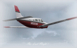
Repaint of the payware Carenado's Piper Saratoga SP. It represent a real airplane : the one owned and piloted by John F. Kennedy Jr. Unfortunately he crashed with his wife and sister-in-law on board near Martha's Vineyard on July 16, 1999.
| Filename: | JFK_Jrs_Piper_Saratoga_N9253N.zip |
| License: | Freeware |
| Added: | 21st April 2010, 21:34:03 |
| Downloads: | 385 |
| Author: | Daniel Gauthier, Didier Charriere |
| Size: | 1.45 MB |
| Category: Flight Simulator 2004 - Panels | |
| Photobased 2D panel for Piper PA32TCII, Saratoga. |
|
File Description:
This panel is with the Garmin 340/530/430-stack and custom gauges.
The enginegauges are tuned to work with the Lycoming TIO-540 engine.
Can be used with the Piper Saratoga or Mooney Bravo or any similar sized single engine aircraft.
| Filename: | Photobased_2D_panel_for_Piper_PA32TCII__Saratoga.zip |
| License: | Freeware |
| Added: | 19th April 2007, 23:47:08 |
| Downloads: | 1,032 |
| Author: | Lars Fors |
| Size: | 1.65 MB |


© 2001-2026 AVSIM Online
All Rights Reserved
Privacy Policy |