
Where Flight Simulation Enthusiasts Gather from Around the World!
AVSIM Library - Search Results

| Category: Flight Simulator 2002 - Miscellaneous Files | |
| Wingtip Vortices / T-prop Engine Smoke For OV-10 Bronco |

|
File Description:
XML Gauge Eye Candy for MS FS2002. Wingtip vortices / T-prop engine smoke effect for OV-10 Bronco(by Tim Conrad) using XML gauges for automatic effects activation under certain conditions.
Must have downloaded OV-10 Bronco by Tim Conrad. Easy manual install, with wingtip and flap vortice effects; and optional turbo-prop exhaust effect. Extra XML gauges. By I.Candymaker.
| Filename: | Wingtip_Vortices__Tprop_Engine_Smoke_For_OV10_Bron.zip |
| License: | Freeware |
| Added: | 18th September 2002, 02:33:07 |
| Downloads: | 1,105 |
| Author: | I. Candymaker |
| Size: | 119.22 KB |
| Category: Flight Simulator X - Scenery | |
| Type21 Amazon Class Frigates |
|
Images related to this file:
File Description:
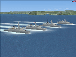
Type21 Amazon Class Frigates, AI and static, intended as stand alone or escort vessels for Carriers. Four of the class are included. They depict the vessels at various times during their life in the Royal Navy. One as originally built, and three with Exocet launchers. All are helicopter landable. Provided both with and without wake effect, and with smoke effect. By Mike Hudson
| Filename: | Type21_Amazon_Class_Frigates.zip |
| License: | Freeware |
| Added: | 2nd October 2011, 00:15:21 |
| Downloads: | 417 |
| Author: | Michael Hudson |
| Size: | 7.47 MB |
| Category: Flight Simulator 2004 - Scenery | |
| Southeast Farallon Islands Version 3 |
|
File Description:
Complete download: Surf height fix. Also new island texture map. These islands were mysteriously absent from the FS2004 default scenery, probably owing to their small size. When I went to look for them I found a small mountain of water instead of the islands. Most people don't seem to be aware of the Farallon Islands. Located off the coast of California, near San Francisco, they are home to thousands of birds, seals, and some of the largest Great White sharks known to man. All of this is within a very short distance of the city. Today, it is a wildlife refuge and is off limits to visitation by the general public. Those of you interested in more info might check out "The Devil's Teeth" by Susan Casey. This island is actually a scenery object. As such it doesn't have a landable surface. Future versions will have a helicopter pad, a lighthouse, and the 100 year old houses used by researchers.
| Filename: | Southeast_Farallon_Islands_Version_3.zip |
| License: | Freeware, limited distribution |
| Added: | 22nd November 2005, 19:05:56 |
| Downloads: | 1,097 |
| Author: | Glen Gordon (Prof K.) |
| Size: | 1.38 MB |
| Category: Flight Simulator 2004 - Scenery | |
| North and Middle Farallon Islands Version 3 Update |
|
File Description:
Beta version 3 update: Adds the North and Middle Farallon Islands to the chain. To be used in conjunction with the Southeast Farallon Island Version 3 download available separately. These islands were mysteriously absent from the FS2004 default scenery, probably owing to their small size. When I went to look for them I found a small mountain of water instead of the islands. Most people don't seem to be aware of the Farallon Islands. Located off the coast of California, near San Francisco, they are home to thousands of birds, seals, and some of the largest Great White sharks known to man. All of this is within a very short distance of the city. Today, it is a wildlife refuge and is off limits to visitation by the general public. Those of you interested in more info might check out "The Devil's Teeth" by Susan Casey. These islands were created as scenery objects instead of traditional terrain in order to preserve detail.
| Filename: | North_and_Middle_Farallon_Islands_Version_3_Update.zip |
| License: | Freeware, limited distribution |
| Added: | 24th November 2005, 14:48:25 |
| Downloads: | 851 |
| Author: | Glen Gordon (Prof K.) |
| Size: | 319.86 KB |
| Category: Flight Simulator 2004 - Scenery | |
| Southeast Farallon Islands Version 2 |
|
File Description:
SIGNIFICANTLY ENHANCED UPGRADE OF PRIOR VERSION. These islands were mysteriously absent from the FS2004 default scenery, probably owing to their small size. When I went to look for them I found a small mountain of water instead of the islands. Most people don't seem to be aware of the Farallon Islands. Located off the coast of California, near San Francisco, they are home to thousands of birds, seals, and some of the largest Great White sharks known to man. All of this is within a very short distance of the city. Today, it is a wildlife refuge and is off limits to visitation by the general public. Those of you interested in more info might check out "The Devil's Teeth" by Susan Casey. This island is actually a scenery object. As such it doesn't have a landable surface. Future versions will have a helicopter pad, a lighthouse, and the 100 year old houses used by researchers.
| Filename: | Southeast_Farallon_Islands_Version_2.zip |
| License: | Freeware, limited distribution |
| Added: | 19th November 2005, 23:35:28 |
| Downloads: | 793 |
| Author: | Glen Gordon (Prof K.) |
| Size: | 1.62 MB |
| Category: Flight Simulator X - Scenery | |
| Victoria Inner Harbor Airport (CYWH) |
|
Images related to this file:
File Description:
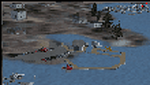
This airport was made using Airport Facilitator X, and Instant Scenery 2. Victoria Inner Harbor Airport is a water airport located in southern Victoria, British Columbia, Canada. The airlines that fly there are Harbor Air, West Coast Air, Kenmore Air, and Whistler Air. This is an airport that flight simulator does not have. I put docks for seaplanes with two seaplanes. I even made it so that you can start off at the dock. I made the small terminal and a parking lot with cars and light poles. I also put the surrounding docks with many boats. There is also a small heliport 0.73 miles away from Victoria Inner Harbor called Shoal Point Heliport. I have made this heliport because it too is another one flight simulator forgot. This was all based on Google Earth and Bing Maps. Please read the read me for instructions on how to install. This is for Flight Simulator X only. By Tyler Lawrence.
| Filename: | Victoria_Inner_Harbor_Airport_CYWH.zip |
| License: | Freeware |
| Added: | 16th January 2012, 23:53:12 |
| Downloads: | 1,488 |
| Author: | Tyler Lawrence |
| Size: | 9.98 MB |
| Category: Fly! II - TerraScene | |
| Phoenix, AZ Area Project Pack |
|
File Description:
This TerraScene 2.1 Project pack covers all of global tile 176,153, with Phoenix in the SW corner. It extends to the east through a portion of Roosevelt Lake and to the north as far as Payson and part of the Tonto Forest. This pack includes updated Tiger Census (2000) shapefile data, adding new water areas, new highways, and other details. All scenery data files are included: USGS data, shapefiles, and a complete water mask. Requires TerraScene 2.1 and Fly!II patched to v230 or later.
| Filename: | Phoenix_AZ_Area_Project_Pack.zip |
| License: | Freeware |
| Added: | 18th July 2003, 16:15:55 |
| Downloads: | 246 |
| Author: | Randall Rocke |
| Size: | 62.22 MB |
| Category: Fly! II - TerraScene | |
| Myrtle Beach (Carolinas Project) TerraScene Project Pack |
|
Images related to this file:
File Description:
This TerraScene 2.1 Project pack covers all of global tile 199,153, continuing the coastline from Georgetown, SC through Myrtle Beach. Inland you will find Conway, Marion and Florence to the west. Hartsville covers the NW, with Lake Moultrie to the SW. This pack includes updated Tiger Census (2000) shapefile data, adding new water areas, new highways, and other details. All scenery data files are included: USGS data, shapefiles, and a complete custom water mask. Requires TerraScene 2.1 and Fly!II patched to v230 or later.
| Filename: | Myrtle_Beach_Carolinas_Project_TerraScene_Project_.zip |
| License: | Freeware |
| Added: | 3rd June 2010, 22:41:45 |
| Downloads: | 176 |
| Author: | Randall Rocke |
| Size: | 51.74 MB |
| Category: Fly! II - TerraScene | |
| Raleigh (Carolinas Project) TerraScene Project Pack |
|
Images related to this file:
File Description:
This TerraScene 2.1 Project pack covers all of global tile 199,155. It includes Greenboro, NC in the west, running to the Raleigh metropolitan area on the eastern border. In the south you will find Asheboro - in the north are Roxboro and Danville, VA. This pack includes updated Tiger Census (2000) shapefile data, adding new water areas, new highways, and other details. All scenery data files are included: USGS data, shapefiles, and a complete water mask. Requires TerraScene 2.1 and Fly!II patched to v230 or later.
| Filename: | Raleigh_Carolinas_Project_TerraScene_Project_Pack.zip |
| License: | Freeware |
| Added: | 14th May 2010, 04:39:35 |
| Downloads: | 161 |
| Author: | Randall Rocke |
| Size: | 76.01 MB |
| Category: Fly! II - TerraScene | |
| Defiance (Ohio Project) TerraScene Project Pack |
|
File Description:
This is a TerraScene 2.1 Project pack for the northwestern tip of Ohio and portions of southern Michigan and northeastern Indiana. It covers all of global tile 195,160, including the western portion of Defiance, OH and the northern portion of Fort Wayne, IN. This pack includes updated Tiger Census (2000) shapefile data, adding new water areas, new highways, and other details. All scenery data files are included: USGS data, shapefiles, and a complete water mask. Requires TerraScene 2.1 and Fly!II patched to v230 or later.
| Filename: | Defiance_Ohio_Project_TerraScene_Project_Pack.zip |
| License: | Freeware |
| Added: | 16th May 2010, 23:29:11 |
| Downloads: | 697 |
| Author: | Randall Rocke |
| Size: | 60.79 MB |


© 2001-2026 AVSIM Online
All Rights Reserved
Privacy Policy |