
Where Flight Simulation Enthusiasts Gather from Around the World!
AVSIM Library - Search Results

| Category: Flight Simulator 2004 - Aircraft Repaints, Textures and Modifications | |
| Paulistana Boeing 737-700 Winglets |

|
File Description:
This is the repaint of Eric Cantu's wonderful KittyHawk 737-700 Winglets free model, in Paulistana colors.
Paulistana is a small VA from Brazil. From São Paulo we operate regional and commercial flights to major Brazilian cities and some countries in South America.
Paulistana possesses 2 Boeings 737-700 Winglets, PR-ACL and PR-ACM. Both are represented in this package.
This file contains only the textures. Search for Kittyhawk 737-700 here in AVSIM to download the model. Search for a panel and wingviews too, to complete the package.
You should then have a wonderful free plane in your hangar.
Esta é uma repintura do modelo grátis Kitthawk Boeing 737-700 Winglets do Eric Cantu, nas cores da Paulistana.
A Paulistana é uma pequena VA brasileira. De São Paulo operamos vôos regionais e comerciais para as mais importantes cidades brasileiras e alguns países na América do Sul.
Paulistana possuis 2 Boeings 737-700 Winglets, PR-ACL e PR-ACM. Ambos estão representados neste pacote.
Este arquivo contém somente as texturas. Procure por Kittyhawk 737-700 aqui na AVSIM para fazer o download do modelo. Procure também por um painel e wingviews.
Deste jeito vc terá um maravilhoso modelo grátis em seu hangar.
| Filename: | Paulistana_Boeing_737700_Winglets.zip |
| License: | Freeware, limited distribution |
| Added: | 18th January 2007, 16:19:18 |
| Downloads: | 155 |
| Author: | Carlos Alexandre Nader |
| Size: | 1.25 MB |
| Category: Flight Simulator 2004 - Scenery | |
| WIKD/WIOD Tanjung Pandan/Buluh Tumbang/H.A.S. Hanandjoeddin, Indonesia |
|
File Description:
Googly scenery for WIKD/WIOD Tanjung Pandan/Buluh Tumbang/H.A.S. Hanandjoeddin,
Indonesia, based on Google Earth satellite data. It is a small domestic airport
serving the island of Belitung, located about 17 miles from the main town of the
island - Tandjungpandan. The island produces mainly tin and pepper but there are
some beaches that are generating tourist traffic too.
Flight Simulator 2004 has made no provision for any traffic at this airport and
this scenery seeks to redress the situation. The airport sees daily scheduled
traffic operated by Batavia Air and Sriwijaya Air.
The scenery does not purport to be ultra-accurate. Based on poor quality
satellite imagery from Google Earth, the layout is proportionally correct but the
added airport features, such as buildings, are built from default Microsoft objects
and add-on libraries so will not look exactly like the real thing.
You are not obliged to download and install any additional scenery libraries,
but to enjoy this scenery in its entirety, you may wish to. It will work fine,
with or without.
The ICAO code for this airport has recently changed from WIKD to WIOD. The included
files allow you to either retain the old code or optionally change the airport to
use the new one.
| Filename: | WIKDWIOD_Tanjung_PandanBuluh_TumbangHAS_Hanandjoed.zip |
| License: | Freeware |
| Added: | 22nd February 2008, 09:19:27 |
| Downloads: | 1,774 |
| Author: | John Hinson |
| Size: | 64.96 KB |
| Category: Flight Simulator 2004 - Aircraft Repaints, Textures and Modifications | |
| Piper PA-31T Cheyenne Repaint Package Release 1.1 |
|
File Description:
Here is the entire collection of repaints for the Digital Aviation PA-31T Cheyenne Package that I have made.
One notable change is the switch to DXT3 format from 32 bit. This was done to decrease texture loading time. I have not been able to detect ANY difference in image quality as a result of the change. There are six repaints included in this package:
N801HL, a Cheyenne I
N134LV, a Cheyenne IA
N365KB. a Cheyenne IA
N151GS, a Cheyenne II
N366XY, a Cheyenne IIXL
N965RS, a Cheyenne IIXL
Each texture set is placed in its own folder, and includes pictures along with instructions.
The previously issued repaints have been modified to correct several small errors that have appeared:
The errors principally involved the transition of engine textures between the top and sides and/or the rear fuselage.
If this is the first download of these files for you, you need the entire contents of this package.
For those who have downloaded the previous release, dated 11/22/07, here is what is new in this package:
Cheyenne IA N134LV: Fuselage_1_T.bmp and Fuselage_3_T.bmp.
Cheyenne IA N635KB: Fuselage_4_T.bmp.
Simply replace the files you now have with these, overwriting the old files.
| Filename: | Piper_PA31T_Cheyenne_Repaint__Package_Release_11.zip |
| License: | Freeware, limited distribution |
| Added: | 25th November 2007, 05:45:35 |
| Downloads: | 1,460 |
| Author: | Michael Verlin; Digital Aviation |
| Size: | 6.39 MB |
| Category: Flight Simulator 2004 - Aircraft Repaints, Textures and Modifications | |
| F-51D West Virginia ANG |
|
File Description:
Repaint of the A2A WWII P-51D Mustang as F-51D-30-NT 45-11582 using John Terrell's excellent paint kit. This aircraft was one of the last batches of P-51D's delivered to the USAAF before the close of WWII. After an uneventful post-war career its final allocation was to the 167th Fighter Bomber Squadron West Virginia ANG at Kanawaha County, West Virginia in 1953. It was withdrawn fron ANG service in December 1956 and transferred to the California Air Material Area in Sacramento. It was sold to Ed Maloney November 1957 and registered N5441V. It was one of the founding aircraft of the 'Planes of Fame' museum in Chino CA and has been in near constant use since then. It has been adorned with a variety of liveries during this time and currently flies as a 334th FS 4th FG Mustang flown by Major James 'Goody' Goodson in 1944. It has for many years been affectionately known as 'Spam Can'
This repaint is based on a photograph of the aircraft in near-derelict condition carrying 2 small practice bombs, probably taken at Sacremento in 1957 before disposal. It therefore represents Spam Can in her final days in active USAF service.
| Filename: | F51D_West_Virginia_ANG.zip |
| License: | Freeware |
| Added: | 6th July 2008, 10:03:28 |
| Downloads: | 399 |
| Author: | Dave Quincey/John Terrell |
| Size: | 12.01 MB |
| Category: Flight Simulator X - Scenery | |
| TNCB - Flamingo Airport (Bonaire) |
|
File Description:
Welcome to one of the 3 ABC's beautifull dutch island, Bonaire.
Flamingo Intl. is an international airport located at Kralendijk, Bonaire, Netherlands Antilles. Flamingo Airport serves as a connecting
point for flights of KLM to some destinations in South America. It once served as a hub for BonaireExel, BonaireExpress,CuraçaoExel,
CuraçaoExpress and now serves Dutch Antilles Express as it's secondary hub & also "EZAir" serves Bonaire as its main airline, although
the airline itself is based at Curaçao.
It is the 3rd largest airport in the Netherlands Antilles behind St.Maarten's Princess Juliana International Airport & Curaçao's Hato
International Airport and is the 4th largest between the islands of the Dutch Kingdom behind the already mention St. Maarten,
Curaçao & Aruba's Queen Beatrix International Airport. Arkefly, Continental, Delta & KLM are currently the largest airline operators
that operate flights to Bonaire.
The airport is large enough to accommodate most international widebody airliners such as the Boeing 747, the Boeing 777 and the
Airbus A340, although the largest widebody type to operate to Bonaire today is the MD11. It can also accommodate medium sized
aircraft such as the Boeing 737 and Airbus A310 as well as small aircraft such as the de Havilland Dash 8, ATR 42 and other such
turboprop aircraft.
| Filename: | TNCB__Flamingo_Airport__Bonaire.zip |
| License: | Freeware |
| Added: | 13th April 2009, 08:00:18 |
| Downloads: | 2,343 |
| Author: | Daniel Louvet |
| Size: | 1.01 MB |
| Category: Flight Simulator X - Scenery | |
| 80 AI Ships and AI Ship Traffic |
|
Images related to this file:
File Description:
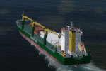
This package contains 80 new AI Ships including cruise ships, frigates, patrol vessels, LNG tankers, fishing boats, bulk carriers, and sail ships. Several of these have heli pads with hard surface and most have lights, small animations, and smoke and wake effects. This package also contains new AI shipping routes for most of the world, but in particular for the North American continent including Greenland and the Great Lakes. Ships visit among other places Toronto, Chicago, Duluth, Trois Rivieres, Vancouver, Valdez, Anchorage, Una Alaska, Boston, New York, Miami, Panama, Caracas, St.Thomas, St.Croix, Saint Martin, Natal, Fortaleza, Belem, Rio de Janeiro, Buenos Aires, Ushuaia, Los Angeles, San Francisco, Seattle, Singapore, Jakarta, Wenzhou, Arkhangelsk, Murmansk, Cork, Oslo, Bergen, Lagos, Dakar, the Galapagos, Antarctica, Nuuk, Sisimut, and many more.
This package will work in both P3D and FSX. It has been tested with several freeware and payware sceneries and default. This package requires prior installation of the other ship packages by Henrik Nielsen to achieve full benefit with the more the 520 ships included in the project to date. Models, effects, and textures by Knud Kristoffersen, Milton Shupe, Manfred Siedler, Jean-Pierre Fillion, Erwin Welker, Bernardo Barroso, and Henrik Nielsen.
| Filename: | 80_AI_Ships_and_AI_Ship_Traffic.zip |
| License: | Freeware |
| Added: | 28th June 2015, 01:44:59 |
| Downloads: | 5,429 |
| Author: | Henrik Nielsen |
| Size: | 101.4 MB |
| Category: Prepar3D V5 - AI Aircraft | |
| McDonnell Douglas DC-8 for AI Traffic (DWAI Models) |
|
Images related to this file:
File Description:

McDonnell Douglas DC-8 for AI Traffic (DWAI Models). This is the P3Dv4.5/5.2 conversion of Dee Waldron's entire DC-8 family of models for AI traffic, with permission kindly given by Dee Waldron. These models are intended as a stop-gap measure until a new DC-8 family specifically modeled for the 64-bit sims comes along, and I may have something to do with that this fall. This package has all seven of Dee's original models, and includes DC-8-12, DC-8-52, DC-8-61, DC-8-62 (two different model versions), and DC-8-63. I have also added in a small collection of the paints I have done over the years. Five main aircraft variants with a total of six models and 61 repaints are included here. This is only meant to get the AI DC-8 into the 64-bit sims, and I pretty much did straight conversions without too many upgrades. However, these aircraft, with special instructions included, are compatible with all prior paints available in the usual places. Original aircraft by Dee Waldron et. al, MCX and RADiator utilites by Arno Gerretsen, P3Dv4/5 conversion and all release repaints by Michael Pearson.
| Filename: | McDonnell_Douglas_DC8_for_AI_Traffic_DWAI_Models.zip |
| License: | Freeware, limited distribution |
| Added: | 5th September 2021, 16:55:35 |
| Downloads: | 256 |
| Author: | Michael Pearson |
| Size: | 20.64 MB |
| Category: Flight Simulator X - Aircraft Repaints, Textures and Modifications | |
| FS2004/FSX/P3D Project OpenSky V4 Japan Airlines JA8089 Boeing 747-446 |
|
Images related to this file:
File Description:

(TEXTURES ONLY)
(ONLY TESTED IN FSX: STEAM EDITION)
So I made a slight mistake in my last add-on (The Northwest Orient Cargo 747-200SF one) where I provided the resources required for advanced animations to be enabled in the POSKY 747 from Rikoooo, since in they default they did not include it. In there, I accidentally added the wrong "Contact Points" line that causes the 2 inner main landing gears to be slightly tilted when on the ground. I fixed it here. To apply the fix, just copy and paste the contact lines inside the aircraft.cfg file, that's it.
I originally supposed to be making 1 single livery for this exact aircraft, which is the 2002 Colors wearing the "Thank you for 41 Years" Sticker, but then went into a rabbit hole and found about the small Yokoso! Japan Sticker in the 2000s, the "BIG express" Decal in the 90s, and also the "Nippon Love Goal" Sticker. So I just had to do it.
I also improved the windows by using the windows from the CLS 747 Paint Kit, and re-arranged them.
Instructions and more information are included in the readme file.
| Filename: | FS2004FSXP3D_Project_OpenSky_V4_Japan_Airlines_JA8.zip |
| License: | Freeware |
| Added: | 19th March 2026, 14:09:48 |
| Downloads: | 69 |
| Author: | Ryubunao |
| Size: | 409.76 MB |
| Category: Flight Simulator 2004 - Scenery | |
| Montana Unleashed! - Part One |
|
Images related to this file:
File Description:
Montana Unleashed! Part 1 is the first in a two part series of a collection of airports in Montana. The majority of airports covered in Part 1 are located in the western half of the state. THIS IS A RE-UPLOAD OF A PREVIOUS UPLOADED SCENERY THAT WAS LOST DURING THE AVSIM HACK! NOTHING HAS CHANGED!
Montana Unleashed! is a collection of 14 highly detailed airports, created using Abacus' EZ-Scenery, scattered about the state of Montana and one in Washington. Do a ZipDive and check out some of the screenshots! The state of Montana, from what I've seen, seems to have been very neglected by scenery makers over the years which is surprising considering the beautiful and varied landscapes the state has to offer. There's some very cool approaches at many of these airports. The size of the airports vary from large all the way down to small county airports meaning you can fly just about any kind and size of aircraft with these sceneries. Fly your Delta 737 from Salt Lake to Bozeman. Fly your shiny new Skywest EMB-120 from Missoula to Billings. Or fly your Piper Cub from Havre City to Choteau and on to Dillon. It's all here!
| Filename: | Montana_Unleashed__Part_One.zip |
| License: | Freeware, limited distribution |
| Added: | 18th April 2010, 09:48:54 |
| Downloads: | 7,074 |
| Author: | Lauren Robison |
| Size: | 3.81 MB |
| Category: Flight Simulator 2004 - Scenery | |
| VGCB Cox's Bazar, Bangladesh |
|
File Description:
Googly scenery for VGCB Cox's Bazar, Bangladesh, a small domestic airport
serving the fishing town of the same name in the Bay of Bengal, to the
south of Chittagong. It boasts extensive sandy beaches which has allowed
tourism development. The unusual name comes from Captain Hiram Cox of the
British East India Company who was appointed Superintendent of the outpost
in the late 1700s. The airport, which was originally a Pakistan Air Force
base, sees domestic flights (mostly to/from Dhaka) operated by Hawker
Siddeley 748s, de Havilland Dash 8s and Fokker Fellowship aircraft of Biman
Bangladesh Airlines, GMG Airlines, United Airways and Zoom Airlines.
Flight Simulator 2004 has made no provision for traffic with only a runway
provided and this scenery seeks to redress the situation.
The scenery does not purport to be ultra-accurate. Based on high quality
satellite imagery from Google Earth, the layout is proportionally correct but the
added airport features, such as buildings, are built from default Microsoft objects
and add-on libraries so will not look exactly like the real thing.
You are not obliged to download and install any additional scenery libraries,
but to enjoy this scenery in its entirety, you may wish to. It will work fine,
with or without.
| Filename: | VGCB_Coxs_Bazar_Bangladesh.zip |
| License: | Freeware |
| Added: | 14th April 2008, 21:13:08 |
| Downloads: | 1,353 |
| Author: | John Hinson |
| Size: | 67.71 KB |


© 2001-2026 AVSIM Online
All Rights Reserved
Privacy Policy |