
Where Flight Simulation Enthusiasts Gather from Around the World!
AVSIM Library - Search Results

| Category: Prepar3D V1-4 - Scenery | |
| Valdez Alaska USA N61.06.53 W146.19.52 and Tatitlek Alaska USA N6052.00 W146.41.37 |

|
File Description:
Valdez Alaska USA N61.06.53 W146.19.52 The town is positioned at the head of a fjord on the eastern side of the Prince William Strait (at the end of the Valdez bay). It is surrounded by the Chugach mountains with many glaciers and peaks up to 2100 m above sea level. Although the northernmost port in North America is free of ice all year round. It is also the northernmost point of the Pacific coastal forest located in the 107-meter hill southwest of the town called Blueberry Hill. Valdez has an ICAO PAVD airport that in the scenario in addition to the city of Valdez you will also find a small village called Tatitlek Alaska USA N6052.00 W146.41.37 with related ICAO 7KA airport airports infrastructures have been improved with the addition of a port for landing ships and seaplanes on Valdez and Tatitlek. Important VFR point for approaching airport and seairport PAVD and 7KA.
Within the downloaded package you will find readme files for scenery installation. Good fly VFR. Pasquale Marrulli.
| Filename: | Valdez_Alaska_USA_N610653_W1461952_and_Tatitlek_Al.zip |
| License: | Freeware |
| Added: | 21st May 2018, 22:35:56 |
| Downloads: | 230 |
| Author: | Pasquale Marrulli |
| Size: | 3.27 MB |
| Category: Flight Simulator X - Missions | |
| MSF8 |
|
Images related to this file:
File Description:
All the MSF missions consist of several episodes. The present mission here is the episode n°8. It is obvious that the next episode will be the logical result of this present adventure, and so on for the following episodes.
The story of this episode n°8 begins at the airport of KIGALI and ends at the airport of GOMA. We will not resist the pleasure of flying over a famous volcano, which will force us to a small diversion before landing in GOMA. Length of this mission 48 minutes.
The briefing of departure is voluntarily very short, you will find no indication for the realization of the episode, simply the description of the context there of departure. All the indications to realize the episode will be given to you by sound files. In other words, it will be necessary to you to be very attentive to the diverse dialogues, in French, sorry, which you will hear. I will try to create an English version later.
ALL EPISODES OF MSF ARE A TRIBUTE TO THE WOMEN AND MEN OF THE MEDICAL WORLD.
| Filename: | MSF8.zip |
| License: | Freeware |
| Added: | 24th June 2021, 23:53:50 |
| Downloads: | 79 |
| Author: | Alain BOUTIE |
| Size: | 19.21 MB |
| Category: Flight Simulator 2004 - Scenery | |
| Seldovia PASO in Alaska US |
|
Images related to this file:
File Description:
Seldovia is a small airfield across the Kachemak Bay from Homer, 15 miles to the south. The runway is gravel and without lighting; the runway edges and the apron edges are marked by cones. The runway in real life is aligned 16-34 and is just over 1,800 feet, increased here to 2,200 feet to accomodate FS9 AI plane capabilities. The video is one of a series that are well worth watching and this one demonstrates the technique of short field landing and take off.
There is AI, with flights between Homer and Seldovia. I should mention here that the I can only make scenery to fit into my version of FS9, and probably your version is not exactly the same. Also, you may not have the planes that I have used for AI. Unfortunately I cannot cater for something I do not have myself. Homer PAHO will follow on from this post. If you find an error email me please, and note that my email address has been changed to rogwens at Gmail dot com.
| Filename: | Seldovia_PASO_in_Alaska_US.zip |
| License: | Freeware, limited distribution |
| Added: | 28th July 2021, 03:30:16 |
| Downloads: | 77 |
| Author: | Roger Wensley |
| Size: | 9.66 MB |
| Category: Flight Simulator 2004 - Scenery | |
| WAML Palu/Mutiara, Indonesia |
|
Images related to this file:
File Description:
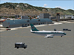
Googly scenery for WAML Palu/Mutiara, Indonesia. In Flight Simulator 2004 little
is provided other than a runway at this small domestic airport, although in the
real world it sees regular jet flights from airlines such as Batavia Air, Bouraq
Indonesia Airlines, Garuda Citylink, Lion Airlines and Merpati Nusentara and
smaller aircraft from operators like Airfast Service and Indonesia Air Transport.
These scenery files add aprons, taxiways, buildings and other airport features
to Flight Simulator's limited representation and allow "AI" traffic to land,
taxi, park and take off in a realistic manner.
The scenery does not purport to be ultra-accurate. Based on high-detail satellite
imagery from Google Earth, the layout is proportionally correct but the added
airport features, such as buildings, are built from default Microsoft objects
and add-on libraries so will not look exactly like the real thing.
You are not obliged to download and install any additional scenery libraries,
but to enjoy this scenery in its entirety, you may wish to. It will work fine,
with or without.
| Filename: | WAML_PaluMutiara_Indonesia.zip |
| License: | Freeware |
| Added: | 15th May 2010, 01:11:30 |
| Downloads: | 1,770 |
| Author: | John Hinson |
| Size: | 140.88 KB |
| Category: Flight Simulator X - AFCAD Files | |
| Woodbine Municipal Airport (1N4), NJ |
|
File Description:
Located 02 miles SE of Woodbine, New Jersey on 700 acres of land, Woodbine Municipal Airport serves small to large GA craft as well as gliders and ultralights. Tie downs are the only option for transient aircraft. The main parking area of the airport is located in the center tarmac area near the fuel station. The parking spots can accomodate aircraft with wingspans up to 50 feet. Anything larger should park off the side of the taxiway. Fuel is available by stopping near the fuel tank. It should be noted that this airport's real ICAO is KOBI.
Scenery constructed with use of satellite images/streetview, the author has not been there in person.
This scenery is meant to be used in conjunction with MegaScenery Earth New Jersey/Delaware 005. It is not required, but apron use is minimized to allow satellite scenery to show through as much as possible, and objects are placed based on the MSE textures - lack of it may make scenery look out of place.
| Filename: | Woodbine_Municipal_Airport_1N4_NJ.zip |
| License: | Freeware |
| Added: | 22nd October 2010, 06:03:35 |
| Downloads: | 202 |
| Author: | Drew Sikora |
| Size: | 352.7 KB |
| Category: Flight Simulator 2004 - AI Flight Plans | |
| Ryanair Summer 2012 |
|
Images related to this file:
File Description:
A comprehensive collation of schedules for the Summer 2012 season. 100% of flights are included, utilising the ENTIRE Ryanair fleet of 295 aircraft, of which at the time of this release, a couple are still to be delivered in the coming weeks. The schedules compiled here are 'as they stand at the moment' for the last week of July, when the season is at its peak. As is the norm for Ryanair, the start of the new season of schedules means that there are tons of new routes, destinations, and bases. New bases are: Billund, Budapest, Karlsruhe, Palma Mallorca, Paphos, and Wroclaw. New destinations include: Berlin-Brandenburg (Schonefeld closing soon), Cologne, Turku, Warsaw-Modlin, Paphos, Asturias, Bilbao, Mahon-Menorca, Dole, Alexandropoulis, Kefallonia, Araxos, of which, all are included in these schedules. Each base has the correct number of alloted aircraft, although there are a small handful of aircraft which move from base to base during the course of the week, to tie up the very few loose end flights which occurred after compiling. (These also include some positioning flights to make this possible).
| Filename: | Ryanair_Summer_2012.zip |
| License: | Freeware |
| Added: | 12th March 2012, 04:47:31 |
| Downloads: | 1,561 |
| Author: | Chris Horsfield |
| Size: | 98.62 KB |
| Category: Flight Simulator 2004 - Scenery | |
| VFR of Lario, Area B1 - Como lake, Italy |
|
Images related to this file:
File Description:

This is the second scenery of the "VFR of Lario" project that follows the previous LagoComo_A1, made with photorealistic terrain (multiseason & night) and with some 3D GMax realistic objects. With this scenery there are also enclosed the great realistic meshes that cover all the Como lake area.
Information: Como's lake (called Lario), is placed in the north of Italy, closed to the Helvetic border. This second scenery covers approximately an area of 7.5x6 kmt, from Bosco di Falmoira/Rondago (NW) to Nesso (NE), and from Balerna/Chiasso (SW) to monte Bolletto (SE), and includes some details of the towns around the lake as Cernobbio (pier, Villa Erba and Convention Center, Villa d'Este, Akzo Nobel buildings), Moltrasio (pier), Carate Urio (pier), Laglio (villa Oleandra), Brienno (buildings and pier), Nesso (pier), Careno (pier), Faggeto Lario (pier), Torno (building and Pier), Blevio (pier).
Contents: several piers and small docks, motor ships and boats, an animated hydrofoil; some other buildings (GenericBuilding system) and trees widespread all over the scenery. Review of Brunate's funicolar and Castel Baradello, due to updated meshes.
| Filename: | VFR_of_Lario_Area_B1__Como_lake_Italy.zip |
| License: | Freeware |
| Added: | 26th January 2012, 15:23:57 |
| Downloads: | 1,948 |
| Author: | Della Vedova Aldo, Daniele Lanfranchi, Diego Caligiuri, Gian Mario Verga |
| Size: | 36.15 MB |
| Category: Flight Simulator 2004 - Scenery | |
| Milano Malpensa Area (ISD) 2013 |
|
Images related to this file:
File Description:
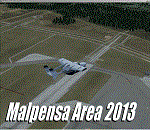
Dear Friends simmer, as always taking advantage of the beautiful objects bgl Gianluca Giovannini, I tried to improve with a symmetric pairing of autogen trees / towns / industrial buildings, the urban area near the international airport of Milano Malpensa, in the best ever scenery by the ISD project.
With the current integration I have created the village of Casenuove, Cardano al Campo, Cascina Costa, Femo, part of the small towns near the attached industrial buildings and new parking in 3D for both terminals. I paid particular attention to the impact of the approach in view of the Ticino Park with a significant density of trees near the runway. Inside you will also find the file on the grass in 3D previously published by me, so if you have already installed, you can deactivate maintaining this.
Warning Very Important: the scenery "is not complete" and to get the best result, you must install ISD LIMC 2009 (limc2009v1.1.zip) - available HERE.
| Filename: | Milano_Malpensa_Area_ISD_2013.zip |
| License: | Freeware |
| Added: | 22nd February 2013, 17:15:22 |
| Downloads: | 4,754 |
| Author: | Fabio Ferrari "fafo air" |
| Size: | 4.51 MB |
| Category: Flight Simulator 2004 - AI Aircraft | |
| Royal Norwegian Air Force Lockheed F-104G Starfighter |
|
Images related to this file:
File Description:

Royal Norwegian Air Force Lockheed F-104G Starfighter, aka the Zipper, Coffin Nail, Widowmaker, Flying Coffin, or Missile with a Man in It; in untrained hands it resembles a lawn dart, as nicknamed by the Canadians. I present a comprehensive AI traffic model package for this hotrod of military jet history. Going into production in 1955, this aircraft was manufactured, directly or by license, by 6 countries, and served the air forces of 17 countries. Late examples served until 2004, nearly fifty years after its introduction. An original 7-LOD model brings this historic aircraft to the flightsim world. This package represents the Lockheed F-104G and Canadair CF-104 (new model) in the service of the Royal Norwegian Air Force; with a total of 22 models and 41 repaints. I am also including some optional variants with separate manual install instructions. Lastly, this package includes a small fix for one model in my Danish Starfighter package (mpai_f104g_rdaf.zip). Original aircraft model and textures by Michael Pearson, flight dynamics by Michael MacIntyre.
| Filename: | Royal_Norwegian_Air_Force_Lockheed_F104G_Starfight.zip |
| License: | Freeware |
| Added: | 1st April 2013, 11:43:10 |
| Downloads: | 405 |
| Author: | Michael Pearson |
| Size: | 21.98 MB |
| Category: Flight Simulator 2004 - Scenery | |
| CYYH - Taloyoak - Nunavut, Canada |
|
Images related to this file:
File Description:
Taloyoak is on the coast of northern mainland Canada, on the west of the Boothia Peninsula, where it is at it's narrowest. Gjoa Haven is 80 miles southwest, and Hall Beach is 300 miles to the east. Taloyoak was established around a Hudson Bay trading post that was relocated from Fort Ross in 1948 because of poor ice conditions. There is now a clinic, school, church, recreation centre, two markets, two small hotels, and housing for the population of around 900. The airfield is to the west of the village on higher ground at 92 feet asl, and the 4,020 feet of 100 feet wide gravel runway is aligned 151T/331T where T stands for "true" as opposed to magnetic in the Northern Domestic Airspace. Only JETA-1 is available, unless there is some 100LL in drums. There are flights by First Air and Canadian North and the AI includes a daily flight of each, plus an afternoon cargo visit by a Buffalo C46; the closest large city is Yellowknife, 750 miles southwest.
| Filename: | CYYH__Taloyoak__Nunavut_Canada.zip |
| License: | Freeware, limited distribution |
| Added: | 18th November 2012, 09:23:20 |
| Downloads: | 377 |
| Author: | Roger Wensley |
| Size: | 3 MB |


© 2001-2026 AVSIM Online
All Rights Reserved
Privacy Policy |