
Where Flight Simulation Enthusiasts Gather from Around the World!
AVSIM Library - Search Results

| Category: Flight Simulator X - AFCAD Files | |
| Strawberry Fields Airport (89NJ), NJ |

|
File Description:
Located 02 miles N of Mays Landing, New Jersey on 220 acres of land, Strawberry Fields Airport is a private turf/sand strip. SkyVector lists the runway as 2200' long, but as measured during development it is closer to 3000'. In addition to Runways 14 and 32, there is a second runway that is not listed in the airport directory and presumed closed. However if you need it in an emergency the numbers are 03 and 21 (no starts are available for these runways). This airport is not lit and is best used only during daytime VFR conditions. The windsock can be found at the intersection of the two runways and is also not lit. You will be landing on bare terrain so have your mesh complexity slider set as high as possible for best effect.
Scenery constructed with use of satellite images/streetview/aerial photos - the author has not been there in person.
This scenery is meant to be used in conjunction with MegaScenery Earth New Jersey/Delaware 003. It is not required, but apron use is minimized to allow satellite scenery to show through as much as possible, and objects are placed based on the MSE textures - lack of it may make scenery look out of place.
| Filename: | Strawberry_Fields_Airport_89NJ_NJ.zip |
| License: | Freeware |
| Added: | 17th February 2011, 07:55:52 |
| Downloads: | 204 |
| Author: | Drew Sikora |
| Size: | 1.75 MB |
| Category: Flight Simulator X - AFCAD Files | |
| Herr Mountain Airport (5NJ2), NJ |
|
File Description:
Located 02 miles N of Stanton, New Jersey, Herr Mountain Airport is a private turf strip. No aircraft are based here, so don't expect much except for ample room to land and take off again. There is a residence on the property, but no hangar or storage facilities. The runway is 2800x100 feet so not too hard to arrive and depart from. Approaching Runway 25 can be a slight challenge given that you need to level off your descent to cross over a mountain top before diving in to land. There is no hard surface runway, so you will be landing on terrain - be gentle! It's recommended to have your mesh complexity set as high as possible to get the full effect. The runway is not lit so daytime VFR operations only are allowed at this airport.
Scenery constructed with use of satellite images/streetview/aerial photos - the author has not been there in person.
This scenery is meant to be used in conjunction with MegaScenery Earth New Jersey/Delaware 001. It is not required, but apron use is minimized to allow satellite scenery to show through as much as possible, and objects are placed based on the MSE textures - lack of it may make scenery look out of place.
| Filename: | Herr_Mountain_Airport_5NJ2_NJ.zip |
| License: | Freeware |
| Added: | 1st February 2011, 23:06:28 |
| Downloads: | 187 |
| Author: | Drew Sikora |
| Size: | 422.37 KB |
| Category: Flight Simulator X - Scenery | |
| RAF Oulton - Norfolk, England |
|
File Description:
I did this scenery for a gentlemen in Canada whose father served at the station during the war I've lost his details but hope he'll pick the scenery up when he searches on line.
RAF Oulton is a former Royal Air Force Satellite airfield located 3 miles (4.8 km) west of Aylsham, Norfolk and 12.5 miles (20.1 km) northwest of Norwich, Norfolk, England.
The airfield was built over 1939 and 1940 as a bomber airfield with T2 type hangars and grass runways, the facility operating as a satellite airfield of nearby RAF Horsham St. Faith between July 1940 and September 1942 after which it operated as a satellite airfield of RAF Swanton Morley.
In September 1943 Oulton was transferred from 2 Group to 3 Group and closed to flying for re-construction as a heavy bomber base with concrete runways, taxiways and parking areas. The work was completed in April 1944 and the airfield transferred to No. 100 Group RAF. Flying operations ceased at the end of July 1945, after which it was taken over by RAF Maintenance Command which used it to store de Havilland Mosquitos until November 1947.
Third Party add-on's will be required to gain the best effect - see the readme file.
| Filename: | RAF_Oulton___Norfolk_England.zip |
| License: | Freeware |
| Added: | 18th November 2015, 14:08:12 |
| Downloads: | 237 |
| Author: | Terry Boissel |
| Size: | 17.25 KB |
| Category: Flight Simulator 2004 - Utilities | |
| GaugeGlow v2.0 |
|
File Description:
GaugeGlow is an easy to use tool that allows you to quickly set or adjust an aircraft's 2D panel lighting and the luminous glow of your MS Flight Simulator aircraft's lumious instruments. The virtual cockpit (VC) lighting is controlled by gauge designer and aircraft modeller, and cannot be modified by GaugeGlow.
GaugeGlow gives you a WYSIWYG (what you see is what you get) view of a sample aircraft panel & instrument with easy to use but sophisticated tools to discover the RGB lighting values to create the right lighting effect for your panel. Before GaugeGlow, a panel designer would have to "estimate" desired RGB values for lighting settings, modify configuration files, and then run Flight Simulator to see if they got it right. With GaugeGlow, you can select colors easily with slider controls, and imediately see the effects on panel and gauge lighting just as it will appear in FS under any lighting conditions.
The licensed registered user will be able to easily open any aircraft's panel, to load existing settings, make changes, then save them. Unregistered you'll have to take the data you see and using your knowledge of the SDK, edit the aircraft's config files to make the actual change in that aircraft's night lighting.
| Filename: | GaugeGlow_v20.zip |
| License: | Shareware, limited functionality |
| Added: | 24th August 2006, 14:24:13 |
| Downloads: | 1,758 |
| Author: | Patrick Waugh (Benchmark Avionics) |
| Size: | 692.17 KB |
| Category: Flight Simulator 2004 - Aircraft Repaints, Textures and Modifications | |
| NHL "Edmonton Oilers Edition" Beechcraft Twin Bonanza" |
|
File Description:
Simmers,and Hockey fans,
This is the 11th repaint of my in progress NHL collection.All repaints are of "Eric Dantes" Beechcraft Twin Bonanza. All NHL teams will be represented.These repaints are not layered so each one has to be redrawn in its offical colors.This repaint has new 3D effect graphics on the wings and tail section.I hope to complete at least two a week,hopefully more :).All repaints will have two liveries,one with team logos and one without logos.
All NHL team names were put in two hats, Eastern Conference and Western Conference, they are drawn one from each hat at random.The next repaint will be the Atlanta Thrashers.Look for it soon. :)I hope you have as much fun collecting all 30 liveries as I will have painting them!
This file includes the texture.Oilers"(The Edmonton Oilers Edition)",texture.Edmonton,
"(The Edmonton Edition....NOLOGOS)",panel.Oilers and the panel.Edmonton folders.
The following additional file is required.--------------twinstar__twin__bonanza.zip--------------
This file can be downloaded @ http://www.avsim.com/
Go to the file library and just use the Quick Search: type: Chris Tuinstra and you should see the twinstar__twin__bonanza.zip,along with my other NHL and NFL repaints.Again I thank each of you for your downloads.
This file includes a complete matching interior for both liveries".
| Filename: | NHL_Edmonton_Oilers_Edition_Beechcraft_Twin_Bonanz.zip |
| License: | Freeware |
| Added: | 28th November 2007, 23:26:55 |
| Downloads: | 241 |
| Author: | Chris Tuinstra |
| Size: | 6.91 MB |
| Category: Flight Simulator 2004 - Aircraft Repaints, Textures and Modifications | |
| NHL "Atlanta Thrashers Edition" Beechcraft Twin Bonanza" |
|
File Description:
Simmers,and Hockey fans,
This is the 12th repaint of my in progress NHL collection.All repaints are of "Eric Dantes" Beechcraft Twin Bonanza. All NHL teams will be represented.These repaints are not layered so each one has to be redrawn in its offical colors.This repaint has NEW 3D effect graphics on the entire aircraft.I hope to complete at least two a week,hopefully more :).All repaints will have two liveries,one with team logos and one without logos.
All NHL team names were put in two hats, Eastern Conference and Western Conference, they are drawn one from each hat at random.The next repaint will be the Los Angeles Kings.Look for it soon. :)I hope you have as much fun collecting all 30 liveries as I will have painting them!
This file includes the texture.Thrashers"(The Atlanta Thrashers Edition)",texture.Atlanta,
"(The NHL Atlanta Edition....NOLOGOS)",panel.Thrashers and the panel.Atlanta folders.
The following additional file is required.--------------twinstar__twin__bonanza.zip--------------
This file can be downloaded @ http://www.avsim.com/
Go to the file library and just use the Quick Search: type: Chris Tuinstra and you should see the twinstar__twin__bonanza.zip,along with my other NHL and NFL repaints.Again I thank each of you for your downloads.
This file includes a complete matching interior for both liveries".
| Filename: | NHL_Atlanta_Thrashers_Edition_Beechcraft_Twin_Bona.zip |
| License: | Freeware |
| Added: | 1st December 2007, 13:04:02 |
| Downloads: | 187 |
| Author: | Chris Tuinstra |
| Size: | 6.69 MB |
| Category: Flight Simulator X - Aircraft Repaints, Textures and Modifications | |
| Exterior Enhancement Pack for the 737-700 NGX |
|
Images related to this file:
File Description:
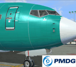
**Revised March 20th 2012** After a lot of positive feedback from forum members, and some very constructive pointers and photos from Ryan (aka Tabs), I've revised the bumps to be a bit closer to a real-world appearance. So if you prefer a more exaggerated appearance (deeper lines, higher rivets) you may prefer the first set over this revision. A completely new set of spec files (for shine and reflection) and bump maps (for surface detail) to update the exterior of your PMDG 737-700 NGX. They can be used over any existing livery for the -700 model. The bump files are in 4096 res (default is 1024) so they will use more memory, but have no noticeable effect on performance on my low-end core2 duo system aside from a slightly longer loading time. The package includes two folders; one for the specular files and the other for the bump maps. Simply drop them into the aircraft texture of your choice and you're ready to fly. More detailed instructions for installation are included. The PMDG NGX base pack and 600/700 model expansion are required. Additional before and after photos are posted in the PMDG NGX support forum.
| Filename: | Exterior_Enhancement_Pack_for_the_737700_NGX.zip |
| License: | Freeware |
| Added: | 20th March 2012, 19:26:56 |
| Downloads: | 3,808 |
| Author: | Chris Hicks, PMDG |
| Size: | 21.45 MB |
| Category: Flight Simulator 2004 - Scenery | |
| Zion National Park North, Cedar Breaks National Monument, Cedar City (KCDC), Utah, Photo-Scenery (FS9 & FSX) |
|
Images related to this file:
File Description:
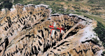
Cedar Breaks National Monument is a large amphitheater cliff in bright colors of red, orange and purple.
It lies east of Cedar City in the northern region of the scenery. The cliff was formed by erosion thru wind,
water and ice. Today erosion continues with a pace of about 2 inches every 5 years. Although it is called
Cedar Breaks, there are no cedars growing there but juniper trees. For a scenic flight to Cedar Breaks
National Monument best depart from Cedar City Regional Airport (KCDC) and head east. The scenery extends
south to Zion National Park and covers a large part of Zion Canyon and the Kolob Canyons area.
Zion National Park is another place where erosion of the Colorado Plateau formed the most beautiful colorful
stone formations of unique and wonderful shapes. There are nine different layers of stone visible in the park.
Most of them consist of sandstone. But there is also limestone, gypsum, siltstone, shale, clay and mudstone.
The Virgin River cut a spectacular and famous canyon thru Zion Park that is as narrow as 20ft and up to 2000ft tall.
High resolution versions of this scenery for FS9 and FSX (much sharper, but larger and multiple downloads)
are available at www.blueskyscenery.com/CNY_South2West5.html . The screenies are taken from the high-res versions,
so expect this version to be slightly more blurry.
Thanks to Joop Mak for providing a custom AFCADs that correct airport layouts so that they align with the photo-textures!
They are available here: www.blueskyscenery.com/AFCADs.html . YourDonation@Work: Dedicated to Richard, P.J. and Felix.
| Filename: | Zion_National_Park_North_Cedar_Breaks_National_Mon.zip |
| License: | Freeware, limited distribution |
| Added: | 14th March 2010, 00:30:28 |
| Downloads: | 1,565 |
| Author: | Gottfried Razek - blueskyscenery.com |
| Size: | 97.13 MB |
| Category: X-Plane - Original Aircraft | |
| Black Cat Catalina PBY5/5Av1.1 for x-plane |
|
File Description:
This update includes improvements to the fuselage shape, addition of retractable wing floats using wheel farings, an improved but not custom panel, improved prop efficiency and more. The PBY Catalina is probably the best known flying boat with over 4000 produced by Consolidated aircraft and licensees. The Black Cat squadrons all done in flat black played havoc particularly for the Japanese in the Pacific. Fitted with radar, with a 15 hour endurance and 2800 mile range they hunted Japanese naval ships by night and bombed or torpedoed them by the hundreds up. There are 6 engine nacelles used in the model, 2 represent the 1200 HP radial engines driving the props, the others are jets with 5 lbs of thrust, 1 is used for the rear fuselage section, 1 is used for the wing pylon, 1 is used for the flare from the fuselage to the vertical stabilizer and the last is used for the forward observation and gunner space. Two are not used. Wing sections are taken up by the main wing and the support spars so there you go. The fuel tanks are used for the side gunner pods since these can be decorated separately. The plane flies very well and is stable as a rock. Takeoffs from water are quite easy as long as you don't dip a wing tip (no floats remember). The Black Cat squadron logo used in the paint scheme is courtesy of http://www.daveswarbirds.com/blackcat/logos.htm and is from the VP-71 Black Cat squadron.
| Filename: | Black_Cat_Catalina_PBY55Av11_for_xplane.zip |
| License: | Freeware, limited distribution |
| Added: | 9th March 2003, 22:48:18 |
| Downloads: | 1,218 |
| Author: | Robert App |
| Size: | 136.75 KB |
| Category: Flight Simulator X - Aircraft Repaints, Textures and Modifications | |
| B-24 USAAF 376th BG "Lady be Good" |
|
File Description:
Following an April 4, 1943 bombing raid on Naples, Italy, conducted by the 376th Bomb Group, the Lady Be Good of the 514th Bomb Squadron failed to return to base. After attempts to locate the plane, its nine crewmen were classified as MIA, and presumed dead, believed to have perished after crashing in the Mediterranean.
Almost 16 years later on Nov. 9, 1958, several British geologists were flying over the desolate, sun-baked Libyan Desert. At approximately 400 miles south of Soluch, they spotted an aircraft on the sand. A ground party that reached the site in March 1959 discovered the plane to be a B-24D. The "Lady Be Good" had been found.
Evidence at the site indicated that the crew had become lost in the dark on return from Naples and had flown over their base and southward into the desert. As their fuel supply became depleted, the nine men aboard had bailed out but had disappeared while attempting to walk northward to civilization.
Intensive searches were made for clues as to the fate of the crew, and in 1960 the remains of eight were found, one near the plane and the other seven far to the north. Five had trekked 78 miles across the tortuous sand before perishing and one had gone an amazing 109 miles. In addition, they had lived eight days rather than only two expected of men in this area with little or no water. The body of the ninth man was never found.
Repaint for the Alphasim B-24 by Jan Kees Blom.
| Filename: | B24_USAAF_376th_BG_Lady_be_Good.zip |
| License: | Freeware |
| Added: | 11th October 2008, 13:11:09 |
| Downloads: | 386 |
| Author: | Jan Kees Blom |
| Size: | 7.61 MB |


© 2001-2026 AVSIM Online
All Rights Reserved
Privacy Policy |