
Where Flight Simulation Enthusiasts Gather from Around the World!
AVSIM Library - Search Results

| Category: Flight Simulator 2004 - Scenery | |
| VAUD Udaipur/Dabok, India |

|
Images related to this file:
File Description:
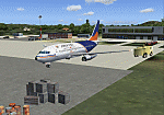
Googly scenery for VAUD Udaipur/Dabok, (also sometimes referred to as VAID) a small domestic airport in
India served by about six flights a day by jets and propeller aircraft from
airlines such as Alliance Air, Jagson Airlines and Jet Airways. These
scenery files improve/add aprons, taxiways, buildings and other airport
features to Flight Simulator's basic representation.
The scenery does not purport to be ultra-accurate. Based on high-detail satellite
imagery from Google Earth, the layout is proportionally correct but the added
[File re-uploaded at request of AVSIM]
airport features, such as buildings, are built from default Microsoft objects
and add-on libraries so will not look exactly like the real thing.
You are not obliged to download and install any additional scenery libraries,
but to enjoy this scenery in its entirety, you may wish to. It will work fine,
with or without.
[File re-uploaded at request of AVSIM]
| Filename: | VAUD__UdaipurDabok_India.zip |
| License: | Freeware |
| Added: | 23rd May 2010, 01:22:29 |
| Downloads: | 1,424 |
| Author: | John Hinson |
| Size: | 67.47 KB |
| Category: Flight Simulator 2004 - Scenery | |
| Whale Cove CYXN in Hudson Bay, Nunavut, Canada |
|
Images related to this file:
File Description:
Whale Cove is a small village with 300 or so inhabitants at N62 W92 on the west shore of Hudson Bay, 40 miles south of the large airport at Rankin Inlet. The village does not feature in FS9, so the first thing to do was to add it; not all the smaller streets are in place but it is the right shape.
I also had to add the roads, delete the stock airfield background, and add a new background. Plus, although the village isn't near the airfield I thought that if the place is called Whale Cove then the least I could do was create the cove, so there is also "whaleWATER" and "whalecoastDELETE", plus of course the scenery file and the AFCAD and AI.
NOTE: If you have had a problem with textures not showing up in the villages in these northern sceneries there is a note on how to fix it.
| Filename: | Whale_Cove_CYXN_in_Hudson_Bay_Nunavut_Canada.zip |
| License: | Freeware, limited distribution |
| Added: | 15th October 2010, 20:48:12 |
| Downloads: | 420 |
| Author: | roger Wensley |
| Size: | 1.19 MB |
| Category: Flight Simulator X - AFCAD Files | |
| Air-List-Ads Airport (JY07), NJ |
|
File Description:
This is a small turf strip 1500x70 feet located near the border of NJ and PA in the northwestern part of the state. It's not officially listed so I don't have any more data than that. No services of any kind are available. Trees are summer ONLY. If you fly VFR around the area, this will at least prevent you from seeing a random-looking grass strip over some trees and half a neighborhood. Runway headings are 11/29
Scenery constructed with use of satellite images/streetview, the author has not been there in person.
This scenery is meant to be used in conjunction with MegaScenery Earth New York 007. It is not required, but apron use is minimized to allow satellite scenery to show through as much as possible, and objects are placed based on the MSE textures - lack of it may make scenery look out of place.
| Filename: | AirListAds_Airport_JY07_NJ.zip |
| License: | Freeware |
| Added: | 16th October 2010, 08:57:57 |
| Downloads: | 182 |
| Author: | Drew Sikora |
| Size: | 283.7 KB |
| Category: Flight Simulator 2004 - Scenery | |
| Beaver Creek CYXQ 1.1 |
|
Images related to this file:
File Description:
Version 1.1 adds the missing door on the ground side of the terminal building. It is complete and does not require that you already have the previous version.
Beaver Creek CYXQ is a small airport in the northern Canada Yukon Territory, near the Alaskan border. There is a customs facility located on the Alaska Highway adjacent to the airport. There is an NDB located on the field, but no published instrument approaches. The single gravel runway is 3740'long.
This scenery was completely redone and features a custom photoreal terminal and custom runway/taxiway lights. The adjacent customs facility is included but is not based on the real one as I had no photos to work from. The custom runway lights are always on, even during the day...sorry, this is an FS9 limitation.
This scenery was designed for use with Ultimate Terrain and was not tested in the default scenery. It may or may not work in FSX.
| Filename: | Beaver_Creek_CYXQ_11.zip |
| License: | Freeware |
| Added: | 6th November 2010, 22:31:24 |
| Downloads: | 914 |
| Author: | Sidney Schwartz & Peter Ham |
| Size: | 447.05 KB |
| Category: Flight Simulator 2004 - Scenery | |
| Quaqtaq CYHA in Hudson Strait, Quebec, Canada |
|
Images related to this file:
File Description:
Quaqtaq is a small village of 310 or so inhabitants at N 61 W 69 37 on the Hudson Strait at the northwest corner of Ungava Bay. It's name has some connection with "tapeworm" in Inuit; there is a story but I won't recount it here. The village does not feature in FS9 but is included in this scenery with approximately the right shape. No village buildings were specifically modeled; they are hand-made non-specific village houses typical of the north. The airfield runway is 3,520 feet of gravel 100 feet wide and is at 103 feet above the shoreline. I added the roads, a new airfield background, plus of course there is the scenery file and the AFCAD and AI, which is an Air Inuit Dash 8-300. This is the last of a series in northern Quebec that all have similar terminal buildings; I know of others which have the same type of building but I have no photos to discover the differences.
| Filename: | Quaqtaq_CYHA_in_Hudson_Strait_Quebec_Canada.zip |
| License: | Freeware, limited distribution |
| Added: | 8th November 2010, 04:29:39 |
| Downloads: | 414 |
| Author: | Roger Wensley |
| Size: | 2 MB |
| Category: Miscellaneous Files - General Utilities | |
| My Destination Chooser V4 - DEMO weather & charts part (v1.00) |
|
Images related to this file:
File Description:

Following delays over the initial My Destination Chooser v4 schedule, we have decided to make this small demonstration.
The aim is to show you some functions that will be included in MDCv4: the Weather and Charts part.
Weather Feature: Seach by ICAO code (METAR/TAF) ; Integrated METAR decoder ; Advanced Weather Chart display (Available sources : JEPPESEN, Eurocockpit, IVAO)
Charts Feature : Charts page (See the aiports charts of various airport spread all over the world!)
The Weather function available on MDCv4 is one of the most complete and integrated one available on any free pre flight planner tool. You can also easily find the most airport chart in the world thanks to this software.
Please, remember that is only a part of the futur addon: My Destination Chooser V4
This soft can be used for all you flight, and add a step forward for you flight preparation.
WARNING: Framework 4 required (link in the manuel).
Made by AirTimSimulation Team
| Filename: | My_Destination_Chooser_V4__DEMO_weather__charts_pa.zip |
| License: | Freeware, limited distribution |
| Added: | 13th November 2010, 14:58:44 |
| Downloads: | 569 |
| Author: | "AirTimSimulation" |
| Size: | 1.72 MB |
| Category: Flight Simulator 2004 - AI Aircraft | |
| IAI Kfir (Israeli Defense Force) |
|
Images related to this file:
File Description:

IAI Kfir (Israeli Defense Force). I present a comprehensive AI traffic model package for the Israeli Aircraft Industries Kfir (Lion Cub). Going into operational
production in 1975 as a new-build Israeli re-design of the venerable Mirage III/5 series, this aircraft, in late form, is still in service with several air forces to this
day. An original 7-LOD model pays homage to this wonderful aircraft in the flightsim world. This aircraft, just like the real-deal, is a fair re-work of my original
Mirage 5 model; with new wings, gear, fuselage, tail, and other goodies. This large package represents the Kfir C1 early (no canards), C1 late (small canards), C2
(standard canards and dog-tooth wings), C7 (increased ordnance load), and TC2 (two-seater) in the service of the Israeli Defense Force; with 37 models and 122 repaints.
Original aircraft model, flight dynamics, some effects, and textures by Michael Pearson; tremendous amounts of help from Michael MacIntyre and Frank Safranek.
| Filename: | IAI_Kfir_Israeli_Defense_Force.zip |
| License: | Freeware |
| Added: | 3rd February 2013, 00:10:52 |
| Downloads: | 489 |
| Author: | Michael Pearson |
| Size: | 40.17 MB |
| Category: Flight Simulator X - Scenery | |
| KGFL - Floyd Bennett Memorial - Glens Falls, New York v3.0 |
|
Images related to this file:
File Description:
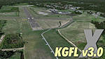
KGFL - Glens Falls, Floyd Bennett Memorial v3.0, located in the foothills of the Adirondack Mountains in upstate NY USA, this facility is owned by Warren County and run by RichAir. Although it has a 5000 ft main rwy, KGFL is a Non-controlled airfield catering to small engine a/c up to a few private jet daily traffic serving 'The Northcountry' New York. KGFL recently received several upgrades including 4 new GA hangars large enough to accommodate the needs of business jets. All Objects fully designed and completely redone in GMAX using high resolution custom photo-real textures. Complete rebuild from the ground up for FSX since v2.2 for Fs9. Also includes new ADE file, more accurate airport grounds perimeter, satellite photo-real grounds, custom taxiways, 3D taxi-signs and taxi lights, area roads, animated hangar doors, and near area landclass. No AI traffic tracks included with this release, but ADE designed to support several AI. FSX Acceleration required.
| Filename: | KGFL__Floyd_Bennett_Memorial__Glens_Falls_New_York.zip |
| License: | Freeware, limited distribution |
| Added: | 5th February 2013, 06:14:14 |
| Downloads: | 2,294 |
| Author: | EdGeneer Cox |
| Size: | 143.72 MB |
| Category: Flight Simulator X - Scenery | |
| YTUC Tuckabianna Gold Mine, Western Australia (Suspended) |
|
File Description:
YTUC Tuckabianna Gold Mine (Suspended). Project Tuckabianna is currently in advanced discovery stage and is owned by Silver Lake Resources. Gold was discovered at Tuckabianna in 1915 with intermittent small scale production from rich mineralised pods within the
hostbanded iron formation. During the period leading up to the commencement of modern open pit mining operations in 1988, total gold production was 53,000 oz at an average grade of 18 g/t Au. Between 1988 and 1997, approximately six million tonnes of ore was treated from the Tuckabianna area for a total production exceeding 500,000 oz Au. Most of this production came from 17 different open pits located within Silver Lake�¢����s project area. Exploration is finding many other minerals in the area such as copper, tungsten, silver and nickel. REQUIRES Blencowe_LibraryKit.zip
REQUIRES blencowe_librarykit_309494.zip (Available HERE)
| Filename: | YTUC_Tuckabianna_Gold_Mine_Western_Australia_Suspe.zip |
| License: | Freeware |
| Added: | 28th February 2013, 14:02:08 |
| Downloads: | 251 |
| Author: | Alan Blencowe |
| Size: | 4.59 MB |
| Category: Flight Simulator 2004 - Scenery | |
| CWCP - Cape Parry - Northwest Territories, Canada |
|
Images related to this file:
File Description:
This is a DEW line Main Station on the shore of the Canadian mainland at the far northern tip of Cape Parry. It is 60 miles north of Paulatuk, which is at the base of the Parry Peninsula, and 120 miles south of Sachs Harbour on Banks Island. The station ceased operations in 1989 and a North Warning System automated station was opened in the same year; the NWS station is not shown in this scenery as I have no information regarding it's location or layout. The runway is just over 5,000 feet of gravel 150 feet wide, aligned 037T at an elevation of 119 feet ASL. There is a large apron with a large hangar and a small shelter building for passengers. There are of course no lights, signage, or windsock. The station is up on the hill at 210 feet ASL. This is one of the more interesting stations in terms of size and complexity.
| Filename: | CWCP__Cape_Parry__Northwest_Territories_Canada.zip |
| License: | Freeware, limited distribution |
| Added: | 25th December 2012, 19:07:24 |
| Downloads: | 302 |
| Author: | Roger Wensley |
| Size: | 1.61 MB |


© 2001-2026 AVSIM Online
All Rights Reserved
Privacy Policy |