
Where Flight Simulation Enthusiasts Gather from Around the World!
AVSIM Library - Search Results

| Category: Flight Simulator X - Utilities | |
| AI Cull Traffic Density Tool for FSX/P3D (Version 1.1) |

|
Images related to this file:
File Description:

The AICull.exe utility provides intelligent traffic density for AI aircraft. The user enters the ICAO(s) of the airports the user (typically) departs from and arrives at. AICull then removes AI that is not departing from or arriving at these ICAO(s) in order to boost frame rate, but still maintain an immersive AI experience for the user. That is, the user will perceive normal traffic density at the airports the user departs or arrives at, however all other AI in the area will be deleted saving frame rates and memory. The user may also enter an unlimited number of ICAO(s) to monitor. The user may also update the list of ICAO(s) while the program is running. AICull.exe requires SimConnect and the latest, registered version of FSUIPC ver. 4.9x (or later version). For best results, use with traditional bgl-based AI traffic (e.g., default, Word of AI, My Traffic X, etc.) although the program does work to lesser effect with the simconnect-based Ultimate Traffic 2 (see the included ReadMe). Revision: fixed "Problem Opening FSUIPC Link" for P3D.
| Filename: | AI_Cull_Traffic_Density_Tool_for_FSXP3D_Version_11.zip |
| License: | Freeware |
| Added: | 22nd March 2014, 00:16:44 |
| Downloads: | 3,124 |
| Author: | Roland Foster |
| Size: | 306.83 KB |
| Category: X-Plane - Scenery | |
| BR GO SWWA - Porangatu Airport v1.0.0 |
|
Images related to this file:
File Description:
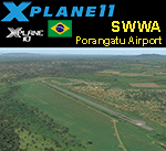
This is an X-Plane 11 and X-Plane 10 scenery package for Porangatu Airport (ICAO: SWWA, no IATA), which is the airport serving the city of Porangatu, Goiás, Brasil. It includes corrected aprons, ramps, gates, taxiways, lighting system, city buildings, ortho-photoscenery for the airfield area, and (XP11 only) airport ground services (like push back). This is a small general aviation airport, in north up state of Goais, in Brazil. This scenery was tested and is operational (as of January 03, 2018) in "X-Plane 11.11 64 bit", Windows 10 Home. It was also tested and is also operational (as of January 03, 2018) in "X-Plane 10.51 64 bit", Windows 10 Home. Only the default X-Plane 11 libraries, by Laminar Research, are needed. No third party libraries are used.
| Filename: | BR_GO_SWWA__Porangatu_Airport_v100.zip |
| License: | Freeware |
| Added: | 3rd January 2018, 18:19:13 |
| Downloads: | 54 |
| Author: | Rui Mesquita |
| Size: | 7.71 MB |
| Category: Flight Simulator X - Aircraft Repaints, Textures and Modifications | |
| Northwest Orient Airlines Boeing 757-251's |
|
Images related to this file:
File Description:
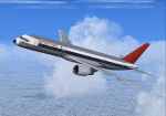
FS2004/FSX Northwest Orient Airlines Boeing 757-251's
2 livery pack featuring N504US-City of Los Angeles (Small Titles), and N513US-City of Orlando (Larger-Stretched Titles in 32 bit format.
These repaint's are specific for the time period and therefore no support for winglets is given.
In addition to the repaint I have created custom Northwest Orient 1980s Ground support equipment textures as well as ground crew all with the Northwest 1980s logo. The cabin entranceways all have custom textures designed by me and the doors are now the standard off white color. Catering textures are now Dobbs International. Customer correct window layout and includes my 757 enhancement textures for wings, Landing lights, e.t.c.
This is for the fantastic TDS - TENKUU DEVELOPER STUDIO 757-200 PW model.
| Filename: | Northwest_Orient_Airlines_Boeing_757251s.zip |
| License: | Freeware |
| Added: | 29th December 2019, 16:52:43 |
| Downloads: | 177 |
| Author: | Joe DeGregorio |
| Size: | 38.99 MB |
| Category: Flight Simulator 2004 - AFCAD Files | |
| YALG Adels Grove, Queensland, Australia |
|
Images related to this file:
File Description:
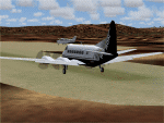
Googlyafcad A&F Data file for Adels Grove, based on Google Earth satellite data.
Unfortunately, Microsoft have omitted this location from Flight Simulator 2004 and this file will allow you and your "AI" traffic to land, taxi, park and take off in a realistic manner.
Adels Grove is a small airstrip serving Lawn Hill National Park, a port of call on the Heron Airlines Northern Affordable Air Tour. The very last commercially operated de Havilland Heron flight called here in 2003 but the service still operates and is now worked by Metroliner aircraft.
These files have been tested with Flight Simulator 2004 default scenery, Visual Australia (VOZ) enhanced scenery and add-on mesh by Andy Weir and is compatible with all. [File re-uploaded at request of AVSIM]
| Filename: | YALG_Adels_Grove_Queensland_Australia.zip |
| License: | Freeware |
| Added: | 20th June 2010, 10:48:26 |
| Downloads: | 412 |
| Author: | John Hinson |
| Size: | 60.12 KB |
| Category: Flight Simulator 2004 - AI Aircraft | |
| Channel Island Aviation package 2011 Cessna 421C |
|
Images related to this file:
File Description:

Hello
I am uploading Channel Island Aviation today. Its a small airline based in Camarillo, Ca. Use google and you can read about what they do. My goal is to replicate the day and evening Channel Island trips they provide for hikers and campers.
Its my love for A.I. traffic. The repaints I did several years ago and they need an update. The B2 Islander has a different tail now and I have been to busy to update it.
I will get to it pretty soon. I need to find some new pictures.
Thanks to Don and A.I. Flight planner.
Everything is included here except the B2 Islander model from HTAI and the 421 Cessna also made by HTAI.
If you cant find the models, email me for support.
Have fun
Roger Martin
| Filename: | Channel_Island_Aviation_package_2011_Cessna_421C.zip |
| License: | Freeware, limited distribution |
| Added: | 28th July 2011, 22:01:13 |
| Downloads: | 395 |
| Author: | Roger Martin |
| Size: | 150.45 KB |
| Category: Flight Simulator 2004 - Scenery | |
| Perrine Bridge, Twin Falls Idaho Updated |
|
Images related to this file:
File Description:
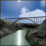
A prominent VFR landmark near Twin Falls Idaho, the Perrine Bridge spans over 1600' and stands 486 feet above the river below. At one time it was the tallest bridge in the world. Perrine Bridge is the only man-made structure in the USA were "base jumping" is allowed without a permit 365 days out of the year. Download includes gmax bridge object, a small photoscenery for the surrounding area, and two saved flight scenarios for exploring the scenery in the default J3 Cub. Bridge surface is landable and crash box has been removed allowing flight beneath the bridge. Scenery is compatible with, and nicely compliments John B. Loney's "Joslin-Magic Valley Regl" airport scenery (ktwf_v1.zip). Requires Ultimate Terrain and freeware mesh product, links provided in the readme.
| Filename: | Perrine_Bridge_Twin_Falls_Idaho_Updated.zip |
| License: | Freeware, limited distribution |
| Added: | 5th July 2011, 04:28:11 |
| Downloads: | 411 |
| Author: | Jim Robinson |
| Size: | 1.52 MB |
| Category: Flight Simulator 2004 - Scenery | |
| DGSI Kumasi, Ghana |
|
Images related to this file:
File Description:
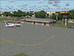
Googly scenery for Kumasi - a small domestic airport in Ghana for which no facilities
are provided in Flight Simulator 2004. These scenery files add taxiways, aprons,
buildings and other airport features, so that you and your "AI" traffic can land,
taxi, park and take off in a realistic manner.
The airport serves the city of Kumasi (capital of the Ashanti region) and sees
regular flights using turboprop airliners operated by Accra based operators
Antrak Air and Citylink.
The scenery does not purport to be ultra-accurate. Based on high-detail satellite
imagery from Google Earth, the layout is proportionally correct but the added
airport features, such as buildings, are built from default Microsoft objects
and add-on libraries so will not look like the real thing.
[File re-uploaded at request of AVSIM]
| Filename: | DGSI_Kumasi_Ghana.zip |
| License: | Freeware |
| Added: | 23rd May 2010, 01:25:23 |
| Downloads: | 1,419 |
| Author: | John Hinson |
| Size: | 80.3 KB |
| Category: Flight Simulator 2004 - Aircraft Repaints, Textures and Modifications | |
| Air Patagonia, BAC1-11 518 |
|
Images related to this file:
File Description:

BAC1-11 518 Air Patagonia. LV-MEX was a 518FG type Bac 1-11 entered into service with Austral Lineas Aereas on the 28th January 1978. She was the last Bac1-11 to fly in Austral colours, when the last scheduled service was flown the 23rd October 1994 into Aeroparque from Chapelco. Shortly after, an small subsidiary company, Air Patagonia, intended to operate LV-MEX on freight and mail services to nearby South American countries but soon after the initial crew training, only one revenue charter flight was flown from Aeroparque to Ezeiza, Resistencia, Jujuy and Salta the 20th January 1996, being the last Bac1-11 to be flown in Argentinean colours.
Textures only for David Maltby's BAC1-11 500 available at www.dmflightsim.co.uk
| Filename: | Air_Patagonia_BAC111_518.zip |
| License: | Freeware |
| Added: | 28th May 2010, 19:58:43 |
| Downloads: | 482 |
| Author: | Damian Radice |
| Size: | 4.57 MB |
| Category: Flight Simulator X - AFCAD Files | |
| S77 Magee Airstrip |
|
File Description:
This airstrip lies in the Coeur D'Alene national forest region right in the mountains, but FSX has it badly misplaced, right in the middle of a mountain, so you have the horrible looking cliffs on each side and front and back too, whereas the real airstrip is in a valley alongside and actually looks like a very nice spot to make a landing. I redid the airfield with ADE and also did the landclass for the valley to improve the overall appearance, using google earth as a reference.
I also added a small taxiway and parking, with hold short nodes, these are not part of the real world strip, but if you want AI planes to fly in and out of these strips then you need those features, otherwise the AI will just vanish.
| Filename: | S77_Magee_Airstrip.zip |
| License: | Freeware |
| Added: | 25th September 2010, 02:20:46 |
| Downloads: | 221 |
| Author: | Kim Gowney |
| Size: | 78.63 KB |
| Category: Flight Simulator 2004 - Scenery | |
| Murray Field KEKA |
|
Images related to this file:
File Description:
FS2004 Scenery - Murray Field (IATA: EKA, ICAO: KEKA, FAA LID: EKA) is a county-owned public-use airport in Humboldt County, California, United States. Murray Field Airport serves Eureka and Humboldt County. The airport has more than one runway. The longest is a paved runway extending 3000 feet. The facility is at an elevation of 7 feet at a distance of about 3 miles from Eureka. The airport is primarily used for general aviation. Also FedEx Express utilizes the small airport as a stop for package delivery from and to Humboldt County. Murray Field was first established in 1919 by pilot Dayton Murray, and was later renamed in his honor. It has a restaurant and a charter service, Northern Air, as well as a Civil Air Patrol office. Created by John B. Loney, Jr.
| Filename: | Murray_Field_KEKA.zip |
| License: | Freeware, limited distribution |
| Added: | 20th March 2012, 01:35:39 |
| Downloads: | 346 |
| Author: | John B. Loney, Jr. |
| Size: | 5.92 MB |


© 2001-2026 AVSIM Online
All Rights Reserved
Privacy Policy |