
Where Flight Simulation Enthusiasts Gather from Around the World!
AVSIM Library - Search Results

| Category: Flight Simulator 2004 - Miscellaneous Files | |
| Project Opensky -- Boeing 747-100, -200, -300, -400 Series Version 2004.8.5 |

|
File Description:
Version 2004.8.5 - Compatible and tested for FS2004 Only.
This 747 Series update provides more visual wing "droop" for 747 models, a few improvements for autopilot and autothrottle smoothness, differing location/weight/cargo/fuel specs for different 747 variants based more on pax/cargo loading, improvements to 747 performance based on additional 747
pilot input and performance charts, and alternative gear point locations. Includes all standard features such as individual FDE for specific
variant and engine type, different engine mount points per engine type, different engine performance per type, different performance per 747 variant,
all fuel and weight stations based on actual Boeing documentation. New 747 navigation light effect included. Includes manual and documentation compiled by Matt Z.
PLEASE READ THE MANUAL. SEE FAQ SECTION FOR FULL COMPILATION OF FS2004 FEATURES, PREVIOUS FIXES AND PROPER OPERATIONS.
| Filename: | Project_Opensky__Boeing_747100_200_300_400_Series_.zip |
| License: | Freeware, limited distribution |
| Added: | 31st March 2004, 03:45:42 |
| Downloads: | 14,471 |
| Author: | Warren C. Daniel |
| Size: | 3.62 MB |
| Category: Flight Simulator 2004 - Scenery | |
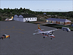
| Sao Luis (Brazil) - Photoreal |
|
Images related to this file:
File Description:
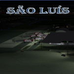
Sao Luis is a Brazilian city, capital of Maranhao state, founded on September 8, 1612. It is located on the island Upaon-Acu (the name was given by the Indians tupinambas meaning "Big Island"), South Atlantic, between the bays of San Marcos and San Jose. It is one of three Brazilian state capitals located on islands (the others are Florianopolis and Vitoria). The scenery contains:
Photoreal of Sao Luis island with hand placed autogen; Marechal Cunha Machado Intl. Airport photoreal in HD; real lighting effect; grass textures; AZL with detailed buildings and hangars; ground support vehicles; detailed terminal with fingers; ships on the coast; Itaqui harbor.
# Courtesy of Marco Santiago (Addons): Bridges Pres. Sarney, Bandeira Tribuzi and the Estreito dos Mosquitos; Terminal de Integracao BR; Alexandre Raposo aerodrome; CAVU aerodrome (Ultralight).
| Filename: | Sao_Luis_Brazil__Photoreal.zip |
| License: | Freeware, limited distribution |
| Added: | 4th December 2010, 03:58:01 |
| Downloads: | 2,727 |
| Author: | Jorge Amengol |
| Size: | 60.29 MB |
| Category: Prepar3D V1-4 - Aircraft Repaints, Textures and Modifications | |
| "That 70's Plane" Piper PA-28-180 Cherokee (N606TT) |
|
Images related to this file:
File Description:

Jamrom23T's "That 70's Plane" series #4- 6TT
N606TT - White fuselage/wings with thick blue/moroon fuselage to tail stripe. Blue/Maroon wing stripes and wheel pants. Fictitious registration number. This is a design based on an old picture of a Piper Cherokee 180 I found on the internet. Enjoy!
This is a repaint of the superb A2A Piper PA-28-180 Cherokee Archer. It was created using the Paint Kit included with the comercial release of the product. It is only a repaint an will not effect any aspect of the simulator, aircraft performance, your PC or any other electrical item you may own in your home.
*** You need to have A2A Piper PA-28-180 Cherokee installed prior to adding in this skin. This is ONLY a repaint. ***
| Filename: | That_70s_Plane_Piper_PA28180_Cherokee_N606TT.zip |
| License: | Freeware |
| Added: | 27th May 2018, 01:48:50 |
| Downloads: | 162 |
| Author: | James Romano |
| Size: | 7.59 MB |
| Category: Flight Simulator X - Aircraft Repaints, Textures and Modifications | |
| Interior and Cockpit Textures for Bombardier Global Express-v4 |
|
Images related to this file:
File Description:

V4 !
New passager cabin's textures for the original Bombardier Global Express XRS by Fr. Bill Leaming and Richard Schwertfeger.
daylight and night textures !
included : passager cabin AND a NEW full textured cockpit release !! burgundy carpet style ONLY! (the original blue-king style carpet is abandonned)
§ copy-paste texture folder here to texture folder of the Global Express.
Also included : 4/3 and wide 2D panels background BMP !
In this V4 release, the background pictures for 2D cockpit have been completely reworked from real photo of GLEX cockpit to get 3D effect !
* texture bugs in passager cabin from first release are fixed!
* passager's leather armchair have savety belt !!
ENJOY this first luxury cockpit ever made for the original fsx Bombardier Global Express by Fr. Bill Leaming and Richard Schwertfeger.
| Filename: | Interior_and_Cockpit_Textures_for_Bombardier_Globa.zip |
| License: | Freeware |
| Added: | 20th October 2016, 04:37:29 |
| Downloads: | 145 |
| Author: | Alain Bastin |
| Size: | 16.36 MB |
| Category: Flight Simulator 2004 - Scenery | |
| San Marteen Trees 2013 |
|
Images related to this file:
File Description:

Dear Friends simmer, what is one of the most beautiful landings of the world? Obvious: St. Maarten Princess Juliana! I noticed some time watching videos of the real approaches on TNCM, there aren't something to complete the complexity of the scenery of fs 2004: the density of the trees on the left side of the island. with this scenery, I wanted as much as possible, increment the realism of default scenery San Marteen fs 2004 using bgl of 'friend Gianluca Giovannini. Down the lane I also tried to increase the number of houses in the village over the Sympsoon Bay Lagoon to make the takeoff view more pleasing , Needless to say, the effect with the scenery fly tampa (payware) is really better.
Happy Flights and greetings from Italy, Fabio "fafoair" ferrari, Castione Presolana Bergamo.
| Filename: | San_Marteen_Trees_2013.zip |
| License: | Freeware |
| Added: | 1st March 2013, 07:17:19 |
| Downloads: | 2,314 |
| Author: | Fabio Ferrari "fafo air" |
| Size: | 3.07 MB |
| Category: Flight Simulator 2004 - Scenery | |
| Qikiqtarjuaq CYVM (Broughton) and DEW FOX-5 in Nunavut, Canada |
|
Images related to this file:
File Description:
Qikiqtarjuaq is an airfield on the northeast coast of Baffin Island, just over 100 miles north of Pangnirtung. The airfield is the closest Canadian airfield to Greenland and is used for ferry flights from Canada to Europe for small planes, though there is normally only JetA1 fuel available. The airfield is at only 18 feet ASL next to the sea with the village to the north; it was previously (before 1998) called Broughton Island. The runway is 3,800' of 100' wide gravel and is lighted; as it is in the Northern Domestic Airspace the runway is signed as 033T-213T, using "true" bearings instead of magnetic. There is a terminal and a small maintenance building on the apron and these have been modeled specifically for this scenery. There are AI parking spots; the AI visiting aircraft are a Canadian North Dash 8 and a First Air 42-300. Qikiqtarjuaq village is just north of the airfield and has a population of around 520; it is approximately the right size and shape but no buildings were specifically modeled for the village. There is also a North Warning System site called Fox-5 to the northeast, and this too is included. You will need Ultimate Terrain Alaska Canada.
| Filename: | Qikiqtarjuaq_CYVM_Broughton_and_DEW_FOX5_in_Nunavu.zip |
| License: | Freeware, limited distribution |
| Added: | 14th June 2011, 02:04:26 |
| Downloads: | 555 |
| Author: | Roger Wensley |
| Size: | 1.85 MB |
| Category: Flight Simulator X - Flight Plans | |
| Gunateeta Air Shuttle |
|
File Description:
Gunateeta Air Shuttle is owned by Ingur Sing, an old pilot who flew for many years as co-pilot for India Airways.
One day he desided to quit the airline and open his own business with an Auster which he bought for 70,000 Rupies
of that time. He flew passengers and cargo to many towns with just a grass strip near Bombay, for about 10 years. He now
now owns two DH 104 Doves and since he is too old to fly them he hires pilots that have the needed credentials
who fly his planes to small towns that now have a small airfield but are way out in some rugged areas.
The regular flight is that which leaves Bombay late in the afternoon, around 4:45PM and flies on to Kurpikang,
Majuri, Churpikur and finally stops in ::::::::: where the last passengers disembarc. Here the plane is loaded
with flowers and rubber plants that must be flown to Bombay where they will be transfered to the late night Flight
to N.Y. by Air India...the flowers must be next day in "Bulby Sing" flower shop in Manhattan---that´s Ingur´s
sister business in America.....
So, Piloto you have the flight this evening...get over
| Filename: | Gunateeta_Air_Shuttle.zip |
| License: | Freeware, limited distribution |
| Added: | 31st March 2009, 20:54:53 |
| Downloads: | 313 |
| Author: | Gera Godoy Canova |
| Size: | 5.51 MB |
| Category: Flight Simulator 2004 - Scenery | |
| SSJA Joaçaba, Brazil |
|
Images related to this file:
File Description:
Googly scenery for SSJA Joaçaba - a small domestic airport
in the state of Santa Caterina, Brazil, that is poorly provided for in Flight
Simulator 2004. These scenery files add taxiways, aprons, buildings and other
airport features, so that you and your "AI" traffic can land, taxi, park and
take off in a realistic manner.
The small but prosperous city of Joaçaba was originally established in 1917 as
Cruzeiro and later known as Limeira and Cruzeiro do Sol, but in 1943 adopted
the current name following the introduction of legislation prohibiting cities
in Brazil using the same name - not a bad idea really. Joaçaba has a high
quality medical centre serving the state of Santa Caterina and a renowned
university which both bring traffic to the airport which is served by mainly
by LET410 aircraft of local airline NHT Linhas Aéreas.
The scenery does not purport to be ultra-accurate. Based on high-detail satellite
imagery from Google Earth, the layout is proportionally correct but the added
airport features, such as buildings, are built from default Microsoft objects
and add-on libraries so will not look exactly like the real thing.
[File re-uploaded at request of AVSIM]
| Filename: | SSJA_Joaccedilaba_Brazil.zip |
| License: | Freeware |
| Added: | 14th May 2010, 04:47:22 |
| Downloads: | 1,263 |
| Author: | John Hinson |
| Size: | 65.83 KB |
| Category: Flight Simulator 2004 - Scenery | |
| Alaska South Slope 5; Ambler PAFM |
|
Images related to this file:
File Description:
There are four main northwestern Alaska towns which are serviced by Alaska Airlines, and from which local flights spread out. The northernmost is Barrow. Southwest of Barrow is Kotzebue, then Nome, and the furthest south is Bethel (not yet made). This is a continuation of the series for the flights from Kotzebue, 130 miles to the east to Ambler on the bank of the Kobuk River. The next additions will be a few miles further east, Shungnak and Kobuk, and a small strip just to the north of Kobuk. Ambler is a small village (population now around 260) beside the Kobuk River, the river being the reason for the existance of the village as it served (and still does) as both a source of food and a transport route. The airfield is just north of the village, with two runways, each around 3,500 feet of lit gravel and aligned 36-18 and 09-27, with PAPI on 36. There are scheduled flights by Era (now renamed Ravn) and by Bering Air, both of them originating in Kotzebue and routing east to Ambler, Shungnak, Kobuk, and then back again. The AI includes these flights along with Everts Air and GA. There are revisions to Kotzbue to provide more parking.
| Filename: | Alaska_South_Slope_5_Ambler_PAFM.zip |
| License: | Freeware, limited distribution |
| Added: | 11th October 2016, 23:26:52 |
| Downloads: | 206 |
| Author: | Roger Wensley |
| Size: | 4.21 MB |
| Category: Prepar3D V1-4 - Scenery | |
| Ariano Irpino Campania Italy N41 ° 08'59 "E15 ° 05'03" |
|
File Description:
Ariano Irpino Campania Italy N41 ° 08'59 "E15 ° 05'03" is a small town in the Campania Apennine, almost on horseback between the Campania and Puglia regions and in an almost equidistant position between the Tyrrhenian and Adriatic seas, so that the watershed crosses for dozens of kilometers the municipal agritours in the center of which is located an important Apennine valley, the Sella di Ariano. The altitude varies from 179 to 811 m. S.l.m. Important VFR point for approaching Foggia, or Naples, Avellino and Benevento..
Within the downloaded package you will find readme files for scenery installation. Good fly VFR. Pasquale Marrulli.
| Filename: | Ariano_Irpino_Campania_Italy_N41__0859_E15__0503.zip |
| License: | Freeware |
| Added: | 23rd October 2017, 14:45:12 |
| Downloads: | 408 |
| Author: | Pasquale Marrulli |
| Size: | 1.31 KB |
© 2001-2026 AVSIM Online
All Rights Reserved
Privacy Policy |