
Where Flight Simulation Enthusiasts Gather from Around the World!
AVSIM Library - Search Results

| Category: Flight Simulator 2004 - Aircraft Repaints, Textures and Modifications | |
| Qantas Airways Douglas DC-3 |

|
File Description:
Qantas VH-EDC was used immensly in regional and domestic routes in Australia.
The Douglas DC-3 revolutionized air transportation and airline service during the 1930s and 1940s.
It was a luxury airliner that boasted cabin heat and running water in its on-board lavatory.
With the right balance of efficiency, range, speed, and payload, the DC-3 was the first aircraft to earn a profit for its owners just by carrying passengers. The hero of early airlines, a handful of DC-3s are still at work today. This is the default Fs2004 aircarft which is repainted into Qantas. note: this package has the textures, the model, the panel, the FDE but no sound, what essentially has to be done is that you have to copy the dc-3(fs2004 defaut) sound files into the "Qantas DC-3 VH-EDC" aircraft folder. Enjoy flying.
| Filename: | Qantas_Airways_Douglas_DC3.zip |
| License: | Freeware |
| Added: | 24th December 2003, 05:27:28 |
| Downloads: | 1,079 |
| Author: | Jacob Kubique |
| Size: | 4.91 MB |
| Category: Flight Simulator 2004 - Scenery | |
| Webster OFL (KNUI) for UT/USA |
|
File Description:
Webster Field is an outlying airport realted to PAX Naval Air Test Center in Maryland. According to what I have read, they use the airport mainly to test unmanned aircraft.
In a support note I saw an image of this airfield in Ultimate Terrain showing its runways extending out into the water. So I fixed it. I couldn't find much more info on it other than that on www.AirNav.com, so I've just kept the default layout for the most part. I did have to rotate the runways a bit to match the satellite photo about 10 degrees for 14/32. I kept the runway labels, however as that is how they are listed in Airnav and show up in the satellite photo. If anyone has any further info I'd be happy to add to it.
This version is meant for use with Ultimate Terrain USA.
| Filename: | Webster_OFL_KNUI_for_UTUSA.zip |
| License: | Freeware |
| Added: | 23rd February 2006, 05:20:49 |
| Downloads: | 377 |
| Author: | Thomas Perry |
| Size: | 218.88 KB |
| Category: Flight Simulator 2004 - Scenery | |
| Caballococha, Peru |
|
File Description:
Caballococha, Peru - Actually I have found only one photo of the town along the Amazon River and it was only of the Plaza. This is a total impressionistic file. Creates the town, riverside features (Piers, Ferry landing) and a few features to the default airport.
New AFCAD created offering parking and a taxiway, plus two water start locations. Again totally fictious. BUT enjoy.
One thing about Caballococha is that it is along a highly navagatable portion of the Amazon and with the fantastic array of Watercraft available offers, I believe, unlimited simming possibilities.
I included the .XML file for rwy12, if you are into enhancing your own scenery...please do feel free to modify or add as desired. This scenery DOES require both LAGO FSE (Payware) and RWY12 available here at avsim) to work.
questions or comments PLEASE do e-mail me ... I will respond as rapidly as possible.
[email protected]
| Filename: | Caballococha_Peru.zip |
| License: | Freeware |
| Added: | 9th April 2006, 04:19:26 |
| Downloads: | 714 |
| Author: | Dale Caruso |
| Size: | 225.37 KB |
| Category: Flight Simulator X - Flight Plans | |
| S.O.S Belize Atolls |
|
File Description:
The " Nozyru San Maru" a Japanese Zoo Ship. Or rather a ship
which is carrying many animals to the Belize Zoo is in deep trouble. Not in deep
water but on the shallows of an Atoll off the coast of Belize. While everyone was
entertained last night feeding the animals a large wave hit the ship on its side
and crashed it into the atoll. Many animals jumped out into the atoll and are running
around howling their throats out. Some were placed in lifeboats and the current has
taken them away, really quite a mess!!!..besides Hurricane " Bubble" is on its way
to the Central American Coasts and wind is picking up fast!!!! a radioless fishing fleet
must also be warned of the coming danger.....will you join this
unusual (to say the least) SAR Mission????...or will you watch the news of it on CNM?
| Filename: | SOS_Belize_Atolls.zip |
| License: | Freeware, limited distribution |
| Added: | 19th August 2007, 11:34:19 |
| Downloads: | 733 |
| Author: | Gera Godoy C |
| Size: | 282.18 KB |
| Category: Flight Simulator X - Flight Plans | |
| Year End´s Flight ( a WW2 Flight Adventure in New Zealand) |
|
File Description:
New Zealand entered the Second World War by declaring war on Nazi Germany at 9.30 pm 3 September 1939.
It is December 29th and your DC-3, C-46 squadron 599 has been alerted to pick up special mountain experts
personnel throught the country. Your DC-3 must start at Mount Cook and fly the "Mountain" Route to places like
the famous seminary of The Holy Grail, where Father Ephrom is waiting. (Plan your approach here and land almost at
stall speed!!!!). The men and women you will pick up are expert climbers needed to advise Allied commanders in the field.
----Not a flight for beginners!!!!!-----, make sure the specially turbo charged DC-3 or C-46 is in top shape.
All the mountain fields you will be landing are very tricky so make sure some strong stuff is in the thermos bottle!!!!!
(like fortified Quanine Water!!!!)
---------Weather?...Approaching Storms!!!!!
| Filename: | Year_Ends_Flight__a_WW2_Flight_Adventure_in_New_Ze.zip |
| License: | Freeware, limited distribution |
| Added: | 28th December 2007, 23:13:36 |
| Downloads: | 704 |
| Author: | Gera Godoy C |
| Size: | 387.63 KB |
| Category: Flight Simulator X - Scenery | |
| Quebec CYQB |
|
File Description:
This is the second edition of CYQB Quebec Jean Lesage Int’l airport for FSX. Countless hours over a two years period have been devoted to develop this very accurate and truly remarkable scenery. It includes more than 50 highly detailed buildings, hangars and special features making this scenery extremely realistic and for the virtual pilot a place to visit. The center piece is the new terminal shaped like an airfoil that has been inaugurated last June. Very diversified operations take place at this airport from flying school, aircraft overhaul and international charter to domestic traffic. You will find also a fleet of 14 CL215 and CL415 water bombers operated by the Service Aerien Gouvernemental. Flying to CYQB at the control of your favorite plane will be a truly enjoyable experience. After a first visit to this airport you will make Quebec one of your favorite destinations. It is guarantee.
| Filename: | Quebec_CYQB.zip |
| License: | Freeware |
| Added: | 13th April 2009, 07:58:27 |
| Downloads: | 6,783 |
| Author: | Gilles Boily |
| Size: | 12.03 MB |
| Category: Flight Simulator 2004 - Scenery | |
| Whaletown CAW9 in British Columbia, Canada |
|
Images related to this file:
File Description:
Whaletown is a float base serving a village on Cortes Island, another one of the many islands squeezed between Vancouver Island and the mainland at this northern end. At this island passengers are delivered by amphibious Grumman Goose from Port Hardy, the main airport of the northern half of Vancouver Island with daily scheduled flights onward to and from Vancouver International. The AI was included with the post of Port Hardy. Regretably, the amphibious Goose behaves as if it is on land and moves on the water with it's wheels extended; there is no way around this. This scenery is a modification of a post made some years ago that did not support AI. In my FS9, close to Whaletown, there was an FS9 or Ultimate Terrain fault consisting of a long straight beach sticking out into the sea for a few thousand feet. This scenery now deletes that.
| Filename: | Whaletown_CAW9_in_British_Columbia_Canada.zip |
| License: | Freeware, limited distribution |
| Added: | 28th November 2018, 22:43:21 |
| Downloads: | 106 |
| Author: | Roger Wensley |
| Size: | 1.67 MB |
| Category: Flight Simulator 2004 - Scenery | |
| Homer PaHO in Alaska US |
|
Images related to this file:
File Description:
Homer is a mainly GA airfield with rows of open air parking, but it also has scheduled flights, a terminal building, a long (for GA) runway of just under 6,700 feet that is 150 feet wide and aligned 03-21 with VASI on both ends and ILS on 03. So I think we can refer to it as an airport. Plus, at the time of this scenery (around 2010) there were three newly completed hangars on the north apron that I was told were for three companies, Bald Mountain Air service, Maritime Helicopters, and Pathfinder Aviation. I do not know which was for whom, but all three companies are in the helicopter and/or plane charter business. The south apron has a number of hangars and other buildings along it's length, starting at the western end with Smokey Bay Air that has an old control tower on the roof, then the Fire Station, and then Homer Air. I am not aware of who owns what after those first three, except that at the far eastern end there are several garages etc for the airport maintenance equipment. Next to the airport at that end there are a number of boat maintenance companies with boats pulled out of the water; this could not be well replicated due to the airport elevation above the sea level and a misplaced road. The nearby Beluga Lake 5BL float base is also included here, with some AI. The lake height above sea level has been adjusted to cope with too many cliffs intruding into the water; this is an annoying FS9 habit. The Homer scenery is as close to the actual airport as I could make it, while coping with inaccurate coast lines and roads, and grassed areas that could not all be modified for reasons that I will not bore you with. The Spit is a major scenery feature next to the airport, and I have added to this to provide some boats, docks, and nearby buildings etc. Small planes use the adjacent gravel taxi path instead of the runway when back-tracking to take off on runway 21. They only go as far as the path takes them and then u-turn onto the runway and take off. By the way, this airport's AI will function at its best if the prevailing wind makes 03 the runway in use. And I will eventually stop writing 03 and just call it 3, as the US, alone in the world, does not put a zero in front of 01, 02, 03, 04 etc. Just one other thing to note is that all access to the runway is from taxiways A and B; there was (in 2010) no access to the extreme western end of the runway as the taxiway there is marked as out of service pending a needed resurfacing.
If you find an error email me please, and note that my email address has been changed to rogwens at Gmail dot com.
| Filename: | Homer_PaHO_in_Alaska_US.zip |
| License: | Freeware, limited distribution |
| Added: | 28th July 2021, 03:31:04 |
| Downloads: | 129 |
| Author: | Roger Wensley |
| Size: | 11.86 MB |
| Category: Flight Simulator X - AFCAD Files | |
| Andravida Air Base (ICAO: LGAD) |
|
File Description:
This is the Andravida airport by ANGELO TASSOGLOU, and remake by Giannis Dedes.
For military using only, Andravida air base is an important Hellenic Air Force and NATO base.
That airport is very close to Andravida, a small town in modern years in Peloponnesus.
Andravida has a very glorious past, because was the Capital (THE FRANKISH ''ANDREVILLE'') of medieval Crusader state of Principality of Achaea
(1205-1278 Champanocracy, 1278-1316 Anjoucracy, 1316-1320 Burgundocracy, 1320-1386 Aragonocracy under Sicilian crown, 1386-1402 Navarrocracy, 1402-1432 Lombardocracy)
| Filename: | Andravida_Air_Base_ICAO_LGAD.zip |
| License: | Freeware |
| Added: | 13th December 2017, 15:45:04 |
| Downloads: | 639 |
| Author: | Giannis Dedes - Angelo Tassoglou |
| Size: | 369.47 KB |
| Category: Flight Simulator X - Scenery | |
| Alfs UK airfields-Volume 18 |
|
Images related to this file:
File Description:
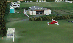
My volume 18 of UK airfields for use with FSX generic scenery consists of Baxterley X3BX, a small tricky grass airfield approximately 2nm WSW of Atherstone and 8nm WSW of Stoke Golding airfield. The Jackaroo glimpsed in the hangar is a local resident. Second is Fowlmere EGMA which is 3.5nm NE of Royston, 10nm SSW of Cambridge and only 4nm W of Duxford airfield and close to the Fowlmere Bird Reserve. Last is something a little larger, Wolverhampton (Halfpenny Green) EGBO and 5nm SE of Bridgnorth.
| Filename: | Alfs_UK_airfieldsVolume_18.zip |
| License: | Freeware |
| Added: | 17th May 2010, 00:07:33 |
| Downloads: | 1,857 |
| Author: | Alf Denham |
| Size: | 31.63 MB |


© 2001-2026 AVSIM Online
All Rights Reserved
Privacy Policy |