
Where Flight Simulation Enthusiasts Gather from Around the World!
AVSIM Library - Search Results

| Category: Flight Simulator X - AFCAD Files | |
| LATI - Renas Airport - Tirana, Albania |

|
File Description:
Tirana - Renas Airport LATI is called Mother Teresa Airport. It is the biggest airport in Albania. I have used ADE to widen the runway, enlarge the parking apron and added more buildings etc. I have tried to make the small Military part of the Airport more accurate. I worked from charts and Google Earth. The original FSX version did not show the ILS on RWY18 so I have added this.
| Filename: | LATI__Renas_Airport__Tirana_Albania.zip |
| License: | Freeware |
| Added: | 26th July 2015, 11:53:44 |
| Downloads: | 560 |
| Author: | Mike Major |
| Size: | 9.82 KB |
| Category: Flight Simulator 2002 - Scenery | |
| Erskine Floatplane Base |
|
File Description:
A fictional add-on which first requires Ian Gallagher's "Glasgow 2002" scenery. This is a floatplane base at Erskine, on the River Clyde, near Glasgow, Scotland. It also has a small fictional RAF Air-Sea Rescue helipcopter base - a few other little surprises too! This scenery requires prior installation of Ian Gallagher's Glasgow 2002 scenery and ALL Apt2.10 textures, VOD textures and ASD textures, AND all available NOVA textures.
| Filename: | Erskine_Floatplane_Base.zip |
| License: | Freeware |
| Added: | 23rd October 2002, 00:43:22 |
| Downloads: | 495 |
| Author: | Derek Maclelland (Cloudmuggers Team) |
| Size: | 1.83 MB |
| Category: Flight Simulator X - Scenery | |
| Icabaru (SVIC) & Wonken (SVUQ) - Venezuela |
|
Images related to this file:
File Description:
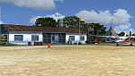
Two small airports located south of Venezuela, especially for VFR flights:
- Icabaru is one of the oldest mining towns in the region located near the border with Brazil.
- Wonken is located in the Canaima National Park, only 15 minutes by plane from Santa Elena de Uairen.
Photo-terrain area improved with Autogen files. Not compatible with versions prior to FSX. Also includes a friendly Auto-Install.
| Filename: | Icabaru_SVIC__Wonken_SVUQ__Venezuela.zip |
| License: | Freeware |
| Added: | 18th January 2014, 16:29:41 |
| Downloads: | 974 |
| Author: | David Maldonado |
| Size: | 83.37 MB |
| Category: Prepar3D V1-4 - Aircraft Repaints, Textures and Modifications | |
| Cessna 172 (D-EMZF) |
|
Images related to this file:
File Description:
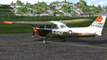
CESSNA (REIMS) F.172H ROCKET - D-EMZF | André Köhler’s passion for aviation was grown very early. As a small boy he made his first flight above his home in a small single engine plane. At this point nobody could imagine that he could call himself a plane owner one day. In summer 2016 he bought a Cessna 172H with registration D-EMZF and transferred it to its new home Rheine-Bentlage (ETHE). The former Army Airbase offered the perfect infrastructure to implement the project of an own Mescalero. In the following year the Cessna was deconstructed in every single part in hundreds of hours, repainted and assembled again. In July 2017 it received official blessing and could take-off again. The dream of an own plane had become reality. | Homebase: Rheine-Bentlage/DE, Serial #: F1720067. These are TEXTURES ONLY. You need a legal copy of the A2A C172. This paint will also work in FSX
| Filename: | Cessna_172_DEMZF.zip |
| License: | Freeware, limited distribution |
| Added: | 9th March 2019, 23:57:45 |
| Downloads: | 152 |
| Author: | Eberhard Haberkorn / A2A |
| Size: | 51.28 MB |
| Category: Flight Simulator 2004 - Scenery | |
| Bumba Airport (FZFU/BMB) |
|
File Description:
Scenery for Bumba airport (FZFU/BMB), namely a small airport located in the North part of the Democratic Republic of Congo (DRC), Mondala Province, serving the small town of Bumba located near the Congo river. Bumba is an ideal reference point for VFR flights along the Congo river in that region, as well as around that part of the DRC forest. The scenery contains two parts: the landclass, that defines the terrain at and around the airport, and the airport scenery, which contains the runway, the aprons, and the 3D objects. In comparison with the default FS2004 scenery, this contains brand new runway and aprons, drawn using custom textures that should give a more realistic feeling of the airstrip, and the landclass has been modified in order to represent faithfully the real landscape around the airport. The Static Object Library of RWY12 is necessary in order to properly display the 3D objects: it can be found easily in the AVSIM library.
| Filename: | Bumba_Airport_FZFUBMB.zip |
| License: | Freeware |
| Added: | 30th April 2020, 18:31:15 |
| Downloads: | 160 |
| Author: | Marco Ruggieri |
| Size: | 7.52 MB |
| Category: Prepar3D V1-4 - Scenery | |
| Morning Star Airport – Cape Town, South Africa |
|
Images related to this file:
File Description:
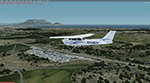
Morning Star airport is situated just north of Cape Town, Next to the N7. A small GA airport with a nice view of Cape Town and Table Mountain and right under the runway 19 approach to FACT. I could not find any official code for the airport, so I called it FAMR. Though I could learn some new skills under the current lockdown, so this is my first attempt at combining most techniques for building an airport, including some hangers and the club house for images I found on the internet. Developed using the P3D V4.5 SDK and tested in P3D V5. Developed to be used with the ORBX OpenLC Africa LC product and I uesd some ORBX library objects.
I included a small update to Robben Island to level the area where the prison is (not sure where it comes from but it is not located in the correct place) and to show the reamains of the old runways on the island.
| Filename: | Morning_Star_Airport__Cape_Town_South_Africa.zip |
| License: | Freeware, limited distribution |
| Added: | 17th May 2020, 17:23:59 |
| Downloads: | 391 |
| Author: | Johan Pienaar |
| Size: | 4.27 MB |
| Category: Flight Simulator 2004 - Scenery | |
| CWBH - Bernard Harbour - Nunavut, Canada |
|
Images related to this file:
File Description:
Bernard Harbour was a DEW line "iStation" (a small station with a staff of 5 or 7 people) on the nothern mainland coast 75 miles north of Kugluktuk, and 45 miles west of Lady Franklin Point. It closed in 1963. The slowly deteriorating buildings are still there, along with a fallen radio communications mast. The runway is also still there and has 3,040 feet of gravel, aligned 122T/302T. There is now no runway lighting, no signage, no windsock, and the bushes growing amid the gravel are winning, though slowly. In 1991 a North Warning System (NWS) automated station was established 3 miles to the southwest and there is a second smaller runway there (1,450 feet) along with a helicopter pad. A road joins the two sites for when diesel resupply is undertaken from a ship in the summer, and the zigzag route is (in reality) dictated by the numerous ponds that are too small to be picked up by Ultimate Terrain.
| Filename: | CWBH__Bernard_Harbour__Nunavut_Canada.zip |
| License: | Freeware, limited distribution |
| Added: | 11th November 2012, 01:24:20 |
| Downloads: | 258 |
| Author: | Roger Wensley |
| Size: | 1.49 MB |
| Category: Flight Simulator 2004 - Scenery | |
| VFR of Lario, Area C3 - Como lake, Italy |
|
Images related to this file:
File Description:
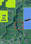
This is the twelfth scenery of the "VFR of Lario" project, made with
photorealistic terrain (multiseason & night) and with some 3D GMax realistic objects.
This scenery covers approximately an area of 7.5x6 kmt, from Limonta (NW) to the northern Grigna mountain (NE), from Onno (SW) to southern Grigna mountain (SE); some of specific buildings are included, as the small church and Museum of Cycling (Ghisallo), villa at pier (Limonta) and interruption of the freeway overpass (Mandello del Lario ... waiting for the next B3 scenery); are included five NLC piers (Limonta, Onno, Vassena, Lierna and Mandello del Lario) and two small motorboat (Ninfea and Giglio) of the NLC navigation; there are also included six sections of the freeway SS36 with its overpasses and tunnels. Some other minor boats and docks are placed alongside the lake coast.
Check video available here: http://youtu.be/q9I5B6oF4ZY
| Filename: | VFR_of_Lario_Area_C3__Como_lake_Italy.zip |
| License: | Freeware |
| Added: | 30th April 2013, 23:20:59 |
| Downloads: | 829 |
| Author: | Aldo Della Vedova, Daniele Lanfranchi, Gian Mario Verga |
| Size: | 22.95 MB |
| Category: Flight Simulator X - Flight Plans | |
| Daredevil Rescue |
|
File Description:
Dirko Marik, well known mountanier from Poland, joined the
"Golden Lake" expedition to climb some of the highest mountains
in New Zealand. Now he lies near his tent in pain and with a very
high chance of dying if he is not taken as fast as possible to a
hospital...
This morning while climbing near the lake camp Dirko moved a rock and
to his surprise a large bluish snake jumped an bit him in his left
leg, his friends brought him down to the camp and inmediatly called for
help over the radio link. The call was transfered to the Mountain Police
outpost in Glentaner (NZGT) where a flight has been set up.....the main
problem is that the target lake is very small and is located in a very
deep gorge, so a small amphibian or floatplane that can land very slowly will
have to be used...........are you ready for the task???
| Filename: | Daredevil_Rescue.zip |
| License: | Freeware |
| Added: | 15th July 2007, 22:39:05 |
| Downloads: | 1,331 |
| Author: | Gera Godoy C |
| Size: | 172.07 KB |
| Category: Flight Simulator 2004 - Scenery | |
| Lost Horn Ranch |
|
File Description:
This is Lost Horn Ranch (FA80) a small farm strip located in South Florida near Ochopee. The location is well placed to reach the west and Gulf coasts and not too far from the Keys. The strip exists in the default FS9. This scenery is fiction and tries to depict a small farm strip in the 1930s. The inspiration to make this was Golden Wings 3 (developed by Bill and Lynn Lyons and the Golden Wings Gang). Hopefully everything looks more or less in keeping with the period prior to WWII. If something stands out then let me know and I will do something about it. The scenery is a work in progress. I plan to add to it over the coming months including some outlying buildings etc and maybe another farm strip or two. I have in mind to create enough visual reference points across Florida so that pilots may fly VFR using them. In the meantime please accept my apologies for any rough edges.
| Filename: | Lost_Horn_Ranch.zip |
| License: | Freeware, limited distribution |
| Added: | 5th September 2005, 16:57:22 |
| Downloads: | 1,254 |
| Author: | Jon Masterson |
| Size: | 2.98 MB |


© 2001-2026 AVSIM Online
All Rights Reserved
Privacy Policy |