
Where Flight Simulation Enthusiasts Gather from Around the World!
AVSIM Library - Search Results

| Category: Miscellaneous Files - Demos from Commercial Vendors | |
| Emirates Airbus A380 |

|
File Description:
Demoversion with banners, new VOR gauge, with new PANEL and GAUGES, new external model, sound and virtuall cockpit. The Airbus A380 is a doubledecker, four-engined airliner manufactured by Airbus S.A.S. It first flew on April 27, 2005 from Toulouse, France. Commercial flights should begin in 2006 after 15 months of testing. During much of ist development, the aircraft was known as the Airbus A3XX. The A380 is now the largest passenger airliner, topping the Boeing 747, which was the largest for 35 years. However, the Antonov An-225 retains the record of being the world's largest commercial aircraft. The media has termed the A380 a "superjumbo", with some comparing it to Howard Hughes's Spruce Goose. The first A380 prototype was unveiled during a ceremony in Toulouse, France, on January 18, 2005. Its manufacturer's serial number is 001, and is registered as F-WWOW. The new Airbus will initially be sold in two versions: the A380-800, carrying 555 passengers in a three-class configuration or up to 800 passengers in a single-class economy configuration. Expected range for the -800 model is 8,000 nautical miles (14,800 km). The second model, the A380-800F dedicated freighter, will carry 150 tons of cargo 5,600 miles (10,400 km). Airbus made the cockpit layout, procedures and handling characteristics similar to those of other Airbus aircraft to reduce crew training costs. Likewise, the A380 features a glass cockpit and side-stick flight controller. Panel, GAUGES, model, sound and textures by www.afs-design.de - Author: A.Meyer.
| Filename: | Emirates_Airbus_A380.zip |
| License: | Commercial demo |
| Added: | 24th May 2008, 08:30:10 |
| Downloads: | 2,150 |
| Author: | Andreas Meyer |
| Size: | 2.05 MB |
| Category: Flight Simulator X - Scenery | |
| LYBE Belgrade Nikola Tesla Airport |
|
File Description:
Belgrade Nikola Tesla Airport (IATA: BEG, ICAO: LYBE) is the primary international airport serving Belgrade, Serbia. Previously known as Belgrade International Airport, it was renamed in 2006 in honour of Serbian-American scientist and
inventor Nikola Tesla.
The airport is situated 12 km (7.5 mi) west, of central Belgrade, in the Surcin Municipality, surrounded by Syrmia's fertile lowlands. Passengers on the right hand side of planes descending from the east have a view of downtown
Belgrade, especially the districts of Cukarica and Novi Beograd. In 2008 the airport installed ILS CAT IIIb equipment to allow aircraft to land and depart in the heaviest of fog, which in past years led to numerous flight diversions
mostly in late December and early January.
The airport is owned and operated by the Public enterprise Aerodrom Nikola Tesla Beograd��. The company recorded profit of 21.5 million euros at the end of 2010.
The national flag carrier and largest airline of Serbia, Jat Airways, uses Belgrade Nikola Tesla as their main hub. It is also one of the hubs for low cost airline Wizz Air. Aviogenex charter airline, and air taxi airlines Air Pink,
Jat Airways AVIO taxi, Prince Aviation and Pelikan Airways also call the airport their home.
The airport charts are included.
This file has the right coordenates, with the apron and characteristics of the airport, airport vehicules and buildings, please take note the the gates numbers needed to changed: C1A= C11, C3A=C13, C5A=C15; general aviation parking
were added a extra number due to repetion on the numbers.
| Filename: | LYBE_Belgrade_Nikola_Tesla_Airport.zip |
| License: | Freeware |
| Added: | 8th November 2012, 03:32:04 |
| Downloads: | 8,801 |
| Author: | Anwar Gonzalez |
| Size: | 15.17 MB |
| Category: Flight Simulator X - Aircraft Repaints, Textures and Modifications | |
| FSX/P3D Aloha Airlines DC-3 circa 1958 |
|
Images related to this file:
File Description:
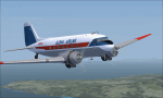
This is a repaint of the DC-3 in Aloha Airlines colors. The freeware DC-3/C-47 v3 by Manfred Jahn is needed for this repaint. Aloha was founded in 1946 under the name of Trans Pacific Airways. With a single DC-3, they offered passenger charter and cargo services between the islands of Oahu, Maui and Hawaii. On February 11 1949 they officially became a scheduled service airline. Their main rival was Hawaiian Airlines, and in 1957 they changed their name to Aloha Airline to better compete against Hawaiian. In 1959 a modern F-27 joined the fleet, which forced the retirement of Aloha's aging DC-3 fleet by the mid 1960s. They also introduced the Viscount 745D in June 1961. BAC-111s were acquired in 1966. However, the British made airliners had limitations in the very humid environment of Hawaii, and in 1967 Aloha ordered 2 Boeing 737-200s with a further 6 in 1968 to replace the BAC-111s. The 737s were destined to become the workhorse of the airline, with over 60 being used by Aloha over the years. Their iconic "Flower Power" livery was unveiled in 1969, and was reintroduced in 2006 on one of their 737 as a retro livery. Due to heavy financial problems caused by various factors, Aloha unfortunately ceased operations on March 31 2008. This DC-3, N2804D, was leased by Aloha in the late 1950s. Textures are DDS DXT5. This repaint was tested on FSX-SE and should work on FSX & P3D v1-3.
| Filename: | FSXP3D_Aloha_Airlines_DC3_circa_1958.zip |
| License: | Freeware |
| Added: | 19th December 2018, 22:31:48 |
| Downloads: | 214 |
| Author: | Ted Giana |
| Size: | 7.43 MB |
| Category: Flight Simulator 2004 - Aircraft Repaints, Textures and Modifications | |
| Lockheed VC-121A Constellation 'Columbine II' |
|
File Description:
FS2004 Lockheed VC-121A Constellation 'Columbine II'.
The Lockheed C-121A Constellation is the military
transport version of the L-749A Constellation.
Delivered on 22 November 1948, this particular aircraft
was soon converted to VC-121A VIP-transport. From
November 1952 till November 1954 this was the personal
transport of President Dwight D. Eisenhower. In 1952,
President Eisenhower was flying to Florida. The
Presidential plane was named 'Columbine II' (after the
official flower of Colorado, the First Lady’s home
state), but it was identified to flight controllers as
“Air Force 610” (from its tail number 48-610). However,
flying in the same general region was Eastern Airlines
Flight 610. The Eastern Airlines pilot overheard a
conversation between flight controllers and the
President’s plane, and for a moment thought the
references to flight “610” were meant for him. Although
nothing untoward happened, the government realized that
the confusion could have been tragic. Since then, any
Air Force aircraft with the President on board has been
referred to as “Air Force One.” Thus, the 'Columbine
II' was the first aircraft to be distinguished with
this designation, and she served President Eisenhower
for several years in this role.
This repaint is a much improved version of the one
issued in 2006. It has not been tested for the FSX
version of Abacus' Constallation but probably will
function there as well.
These are textures only. You will require Francisco
Sánchez-Castañer's great payware Lockheed L-749
Constellation, which can be obtained from Abacus'
Platinum Collection (see
http://www.abacuspub.com/default.html). Repaint (based
on Francisco Sánchez-Castañer's textures) by Maarten
Brouwer.
| Filename: | Lockheed_VC121A_Constellation_Columbine_II.zip |
| License: | Freeware, limited distribution |
| Added: | 14th September 2007, 18:25:01 |
| Downloads: | 362 |
| Author: | Maarten Brouwer |
| Size: | 3.55 MB |
| Category: Flight Simulator 2004 - Scenery | |
| WASF Fak-Fak |
|
Images related to this file:
File Description:
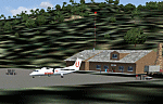
Googly scenery for WASF Fak-Fak, in Irian Jaya (Western New Gunea),
Indonesia - a small domestic airport that Microsoft managed to omit from Flight
Simulator 2004. These scenery files add the runway, apron, taxiways, buildings
and other airport features so that you and your "AI" traffic can land, taxi,
park and take off in a realistic manner.
Little information is available on the services operated - flight plans are
available for Lion Airlines showing two flights per week operated on their behalf
by Wings Abadi Dash 8 aircraft. But it is known that Merpati Nusentara also serve
the airport with Twin Otters. If you are using the Lion Airlines flight plans
for Winter 2006, you must change the airport's co-ordinates as detailed in the readme.txt file
because the co-ordinates given there will cause the aircraft to aim for a point
on the wrong side of the equator in the middle of the sea!
There is no lighting at this airport, and few navigational aids. However, I have
added a missing NDB nearby (FA, 380.0).
The scenery does not purport to be ultra-accurate. The quality of the satellite
imagery at Google Earth is poor, but a number of photographs and other information
has enabled this airport to be depicted reasonably accurately. However the added
airport features, such as buildings, are built from default Microsoft objects
and add-on libraries so will not look exactly like the real thing.
You are not obliged to download and install any additional scenery libraries,
but to enjoy this scenery in its entirety, you may wish to. It will work fine,
with or without.
An editvoicepack file has been included for the airport to help you embarrass
yourself in front of others when flying.
[File re-uploaded at request of AVSIM]
| Filename: | WASF_FakFak.zip |
| License: | Freeware |
| Added: | 7th May 2010, 22:30:22 |
| Downloads: | 1,903 |
| Author: | John Hinson |
| Size: | 72.51 KB |
| Category: Prepar3D V5 - Aircraft Repaints, Textures and Modifications | |
| Captain Sim B767-II Varig Airlines PP-VOI |
|
Images related to this file:
File Description:
Enclosed is a Varig (PP-VOI) repaint for the Captain Sim B767-II with the GE Expansion. This repaint was built in P3D v5.2.
This particular aircraft, PP-VOI (SN 24752), is a GE CF6-80C2B6 powered variant and was delivered new from Boeing to Varig (Viação Aérea Rio-Grandense) Airlines on December 12, 1989.
The relatively new ETOPS-120 certification was first awarded for TWA's B762's in May 1985 with ETOPS-180 certification for GE equipped B767's approved in 1989 through the demonstrated reliability and the continued confidence from the design of this long haul, wide bodied, twin engined aircraft.
PP-VOI was the first of sixteen B767-300's delivered that, along with the new fleet of MD11's, were intended to support Varig's long haul network and replace the aging, expensive, and limited numbers B747-300 fleet, with plans of further route expansion.
She was adorned from delivery with the "classic/retro" paint scheme seen here, which was prominent for Varig Airlines between 1961 and 1996. VOI served both scheduled and chartered North American, South American and Trans-Atlantic International Routes in this livery from Varig's bases in Rio de Janeiro (SBGL) and Sao Paulo (SBGR) for almost a dozen years before being repainted in the "newer" 1996 design scheme.
This particular airframe continued to serve Varig Airlines (once Brazil's Flag Carrier) until that airline's unfortunate split/financial restructuring into Flex Linhas Aéreas and Gol Airlines in 2006, continuing to fly charter routes for Flex until 2010.
Between 2010 and 2015, this airframe went on to be leased to Business Air Thailand continuing to fly passenger charter revenue flights under registration HS-BIC.
As of December 2021, this particular airframe continues to fly freight (an ERBDSF conversion) since 2016 for Kalitta Airways under contract to DHL as registration N761CK.
Hope you enjoy the photos and the brief history of this particular B767-341ER!
Note: This repaint was completed for the CS B767-II with the GE Expansion.
| Filename: | Captain_Sim_B767II_Varig_Airlines_PPVOI.zip |
| License: | Freeware |
| Added: | 17th December 2021, 17:11:16 |
| Downloads: | 65 |
| Author: | Rob Meier |
| Size: | 95.12 MB |
| Category: Flight Simulator X - Scenery | |
| YPNW Pannawonica, Western Australia town and strip |
|
File Description:
YPNW Pannawonica with FSX default and ORBX tints condensed into one zipfile. The town of Pannawonica is an iron-ore mining town located in the Pilbara region of Western Australia, near the Robe River, about 200��� km south-west from Karratha. In 2006, it reportedly had the highest median weekly income of any town in Australia, due to the high income of its mine workers. Pannawonica was built in 1970 by Cleveland-Cliffs Robe River Iron (predecessor of the present Robe River Iron Associates) and was gazetted as a townsite in 1972. The township�¢����s name was derived from nearby Pannawonica Hill, named by a surveyor in 1885 after the corresponding Aboriginal placename which is said to mean "the hill that came from the sea". The traditional legend is that two local Aboriginal tribes were arguing over the ownership of the hill which was located by the sea. The sea spirit decided to resolve the dispute by moving the hill inland. As the hill was dragged over the land it left a deep indentation which became the Robe River. Pannawonica is one of a number of remote-area iron-ore-mining towns built throughout the Pilbara to house workers operating open-cut mines and the loading of ore trains. It is a 'closed town', having limited facilities for visitors, the company's accommodation being reserved for its staff and visiting contractors. Some visitor accommodation is available at the Pannawonica Tavern. Pannawonica is home to more than 800 people, comprising Robe and Pilbara Iron employee families, staff on fly-in fly-out (�¢����fifo�¢����) roster from Perth, and those involved in support services. It is accessible by road, rail and light aircraft. REQUIRES Blencowe_LibraryKit.zip
REQUIRES blencowe_librarykit_309494.zip (Available HERE)
| Filename: | YPNW_Pannawonica_Western_Australia_town_and_strip.zip |
| License: | Freeware |
| Added: | 28th February 2013, 14:00:44 |
| Downloads: | 287 |
| Author: | Alan Blencowe |
| Size: | 3.38 MB |
| Category: Flight Simulator X - Scenery | |
| YFRV Oombugurri Community, Western Australia (Town closed 2011) |
|
File Description:
YFRV Oombugurri Community, Western Australia, formerly Forrest River Mission. Features extensive flattening of Forrest River which runs uphill. Take a flight there before installing the scenery.
Oombulgurri, was an Aboriginal community in the eastern Kimberley, 45 kilometres southeast of Wyndham.
The Anglican Forrest River Mission for Aborigines was founded in 1896���¢������97 by Harold Hale (Later Bishop of Prth) but was abandoned after a few months. A permanent mission, known as the Forrest River Mission, was established on the site in 1913 by the bishop of the north west, the Rt. Rev. Gerard Trower. In December 1913, Anglican priest Ernest Gribble took charge, three years after he was forced to resign as superintendent at Yarrabah. Gribble remained as superintendent until the early 1930s.
In 1926 the mission was plagued by an influenza epidemic and impacted by the Forrest River massacre where police killed a number of Aboriginal people. This event remains controversial.
The mission was closed in 1969, after the 1967 Aboriginal referendum.
In 1973, fifty Aboriginal people decided to resettle their abandoned tribal land and rename it Oombulgurri. Within a year, the population had grown to 200. Infrastructure and welfare programs were set up in the 1970s and 1980s to provide the residents with basic amenities and to allow the town to become self-sufficient.
In 2007 a Coronial Inquiry began into Aboriginal deaths in the Kimberley, including five in Oombulgurri. It revealed high levels of alcohol abuse, suicide and child neglect in Oombulgurri. Some time after the inquest, alcohol was banned there and the population began to move away to areas where alcohol was available.
It had a population of 107 as of the 2006 census. In 2011, the government of Western Australia encouraged residents of Oombulgurri to move elsewhere as it considered the community "unviable". The last residents from Oombulgurri were relocated to Wyndham just before Christmas 2011. REQUIRES Blencowe_LibraryKit.zip
REQUIRES blencowe_librarykit_309494.zip (Available HERE)
| Filename: | YFRV_Oombugurri_Community_Western_Australia_Town_c.zip |
| License: | Freeware |
| Added: | 28th February 2013, 02:37:06 |
| Downloads: | 229 |
| Author: | Alan Blencowe |
| Size: | 2.97 MB |
| Category: Prepar3D V1-4 - Aircraft Repaints, Textures and Modifications | |
| VARIG 1998 |
|
File Description:
In 1998, VARIG was still a huge legacy airline, but routes and frequencies were starting to be cut, which continued into the 2000s until their 2006 demise. MD-11s, DC-10-30s, and 747-300s mostly served long-haul routes such as NGO, NRT, LAX, MIA, JFK, MAD, BCN, LHR, CPH, ect, while the 767s did longer South America routes as well as CUN/MEX/JFK/MCO/MIA as well as flights to Spain and Portugal. VARIG's "around the world" GIG-GRU-JNB-BKK-HKG-BKK-JNB-CPT-GRU-GIG flight was flown with an MD-11 at the time, and I have assigned it to the "World Cup" livery MD-11, which means you will not see the aircraft much in Brazil but it will pop up abroad. VARIG flew many "tag on" flights, like LIM-LAX-NRT/NGO, LHR-CPH, MAD-BCN, MIA-MCO, ect, and there are many, many GIG-GRU and GRU-GIG flights that were part of international routes with no ticket sales in between. Between 0500 and 0700, there are many widebodies making this short flight. The 737-300s flew all over Brazil and to some South American countries. Rio Sul, who did the flights to CGH and SDU, is not included was released seperately on Avsim as "rio_sul_1998.zip". Though VARIG livery 737-300s flew on behalf of Rio Sul, Nordeste and PLUNA, those flights are not included and are included in those respective airlines. An MD-11 and a 737-300 were painted in special colors to celebrate the World Cup, and a 767-200 wore a special Star Alliance livery. The 747-300 in the Star Alliance colors only had them applied to one side of the aircraft and never flew revenue service in that livery, so it is not included. The rest of the fleet wore a mix of the 1997 introduced livery and the 1980s blue and white colors with the silver belly. The entire fleet on the FAIB 737-200, 737-300, 747-300, 767-200 and 767-300,and FSPX MD-11 by Raphael Rodrigues is included. The DC-10-30s on the AIM model by Jason King are on Avsim as "aim_dc1030_varig_pp-vmb_313514.zip" and "aim_dc1030_varig_oldcolors_307373.zip". Flightplans by Chasen Richardson. Part of the 1998 Flight Simulator Project. Follow us on Facebook at facebook.com/flightsim98 and on instagram as @bayviationsim. For more Retro AI, check out the forums at: http://retroai.proboards.com/
| Filename: | VARIG_1998.zip |
| License: | Freeware, limited distribution |
| Added: | 1st January 2020, 20:13:56 |
| Downloads: | 617 |
| Author: | Raphael Rodrigues, Chasen Richardson\ Bayviation |
| Size: | 30.59 MB |
| Category: Flight Simulator 2004 - Scenery | |
| FS9 Fort St John CYXJ in BC Canada |
|
File Description:
Fort St John is close to the border between British Columbia and Alberta, around 40 miles north-northwest of Dawson Creek. The airport was originally a Royal Canadian Air Force base, associated with the wartime construction of the Alaska Highway. The airfield was part of this construction effort and the wartime ferrying of planes to Russia. It is currently named "North Peace Regional Airport", or "North Peace Airport"; apparently there has been no final decision?
The date for this scenery is around 2006. I was given an old video tape cassette which was filmed on an uncertain date, but which had to be before the terminal building was renovated in 2007 and totally changed in appearance. The only way to view the video was to play it in the camera and watch it on a small screen. After I had completed everything except the buildings I started to view the video to establish the building appearances and within an hour or so the camera died. It was so old there was no way to repair it, so I then made some new buildings from memory of the video and what was available online. I also used some that I had already made for other scenery but which were similar. I may replace the terminal building that is in this version with a build of the new one, as I know this one is not a very accurate reproduction. The replacement, if I do it, will be towards the end of this year.
The AI included here is for GA, Air Canada Jazz, and two helicopter companies that were (and still are?) based there. One is at the western end of the apron and the other is at the eastern end but separated from the apron. To gain access to the taxiways and runways (so that all airport users follow the same procedures, for safety reasons) the eastern end helicopters just taxi across the grass. The helicopters are used for maintenance trips to the oil and gas fields in the surrounding area. My screenshots show Westjet at the terminal; this is because I have later Canadian AI installed, while the AI included here is only for the time around 2000 to 2010, when Westjet were not flying to Fort St John.
The airport is square in plan, with the apron running along the northern side and two runways forming diagonals. The two runways are 11-29 (6,882 feet long and 200 feet wide, with ILS at the 29 end and PAPI at the other) and 02-20 (6,684 feet long and 200 feet wide, and with PAPI at each end). The eastern side taxiway that runs north-south is not used. The western side taxiway is in use but only as a race track for cars.
Please email me if you find faults, such as a plane without textures.
| Filename: | FS9_Fort_St_John_CYXJ_in_BC_Canada.zip |
| License: | Freeware, limited distribution |
| Added: | 10th October 2022, 14:03:38 |
| Downloads: | 209 |
| Author: | Roger Wensley |
| Size: | 37.49 MB |
© 2001-2026 AVSIM Online
All Rights Reserved
Privacy Policy |