
Where Flight Simulation Enthusiasts Gather from Around the World!
AVSIM Library - Search Results

| Category: Flight Simulator X - Scenery | |
| Hartebeespoort Dam, South Africa (Fictional Water Runway Airport) |

|
Images related to this file:
File Description:
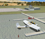
Due to no available airports in South Africa, with water runways in FSX, I decided to create a fictional airport at Hartebeespoort Dam with both a water runway as well as normal asphalt runway. FAHD also allows you to taxi from the main apron into the water as well as exit the water onto the main apron. 4 Water docking facilities also exist for aircraft with floats, which means you have a choice if you would like to start on the apron or at the water docks parking spaces. Amongst other facilities are ILS, NDB, Runway and Taxiway lights, 6 Small GA and 2 Medium GA Parking spot as well as refueling facility, a Tower and Small Terminal Building etc.
| Filename: | Hartebeespoort_Dam_South_Africa_Fictional_Water_Ru.zip |
| License: | Freeware |
| Added: | 26th March 2011, 19:50:07 |
| Downloads: | 393 |
| Author: | Otto Marais |
| Size: | 5.82 KB |
| Category: Flight Simulator X - Aircraft Repaints, Textures and Modifications | |
| Misrair Vickers Viscount 739 (SU-AID) |
|
Images related to this file:
File Description:
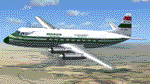
This is a repaint of Rick Piper's Viscount 700. It is painted as SU-AID of Misrair.
Vickers Viscount c/n 86 was delivered to Misrair on 04 December 1956 and registered as SU-AID. In August 1960 Misrair merged with Syrian Airlines to become United Arab Airlines and the aircraft was transfered to the new airline. It was damaged beyond repair during a wheels up landing three miles short of Wadi Halfa Airport, Sudan in a sand storm. The crew were forced to make an emergency landing due to a shortage of fuel after being unable to land at Cairo due to bad weather on a scheduled flight from Jerusalem. No injuries to the 6 crew and 10 passengers on board.
| Filename: | Misrair_Vickers_Viscount_739_SUAID.zip |
| License: | Freeware |
| Added: | 2nd September 2012, 17:44:08 |
| Downloads: | 139 |
| Author: | Graeme Swart |
| Size: | 587.75 KB |
| Category: Flight Simulator 2004 - Scenery | |
| S98 - Vista Field - Washington, USA |
|
Images related to this file:
File Description:
FS9 Scenery - Vista Field (IATA: VSK, FAA LID: S98) was a public use airport located in Benton County, Washington, United States. The airport was located three nautical miles (6 km) northwest of the central business district of the City of Kennewick and was owned by the Port of Kennewick. It was also known as Vista Field Airport. Several shipping carriers operated out of the airport. There had been controversy in recent years over whether or not to continue to operate the airport or to shut it down, however it was officially closed on December 31, 2013. Vista Field is back, at least in FS9, with a hi-def runway by Donald Miller. For your flying pleasure by John B. Loney, Jr. and Donald Miller.
| Filename: | S98__Vista_Field__Washington_USA.zip |
| License: | Freeware, limited distribution |
| Added: | 19th September 2015, 21:33:58 |
| Downloads: | 235 |
| Author: | John B. Loney, Jr. |
| Size: | 20.53 MB |
| Category: Flight Simulator X - Scenery | |
| S98 - Vista Field - Washington, USA |
|
Images related to this file:
File Description:
FSX Scenery - Vista Field (IATA: VSK, FAA LID: S98) was a public use airport located in Benton County, Washington, United States. The airport was located three nautical miles (6 km) northwest of the central business district of the City of Kennewick and was owned by the Port of Kennewick. It was also known as Vista Field Airport. Several shipping carriers operated out of the airport. There had been controversy in recent years over whether or not to continue to operate the airport or to shut it down, however it was officially closed on December 31, 2013. Vista Field is back, at least in FS9, with a hi-def runway by Donald Miller. For your flying pleasure by John B. Loney, Jr. and Donald Miller.
| Filename: | S98__Vista_Field__Washington_USA.zip |
| License: | Freeware, limited distribution |
| Added: | 19th September 2015, 21:34:03 |
| Downloads: | 345 |
| Author: | John B. Loney, Jr. |
| Size: | 18.01 MB |
| Category: Flight Simulator X - Scenery | |
| X1WL - RAF Welford - Berkshire, England |
|
File Description:
RAF Welford (ICAO X1WL) is an active Royal Air Force station in Berkshire, England. The airfield is located approximately 6 miles (9.7 km) northwest of Newbury; about 50 miles (80 km) west-southwest of London.
It opened in 1943 and was used during the Second World War by both the Royal Air Force and United States Army Air Forces.
During the war it was used primarily as a transport airfield. After the war it was closed in 1946 and placed in reserve status. As a result of the Cold War, the station was reopened in 1955 as a munitions depot by the United States Air Force.
Today it is still used by the United States Air Force although not as an active airfield.
Source: Wikipedia
| Filename: | X1WL__RAF_Welford__Berkshire_England.zip |
| License: | Freeware |
| Added: | 6th April 2016, 18:50:16 |
| Downloads: | 264 |
| Author: | Terry Boissel |
| Size: | 1.65 MB |
| Category: Flight Simulator 2004 - Utilities | |
| METAR Update Of The METAR Weather Program |
|
File Description:
Update of the Free METAR program with new features and bug's corrected.
New features:
1. I improved the temperature aloft settings. This also should give better cloud settings, esp. the cloud high is now computed out of temperature and other data.
2. No more 'weather update' messages
3. If the needed stations files not there, the program shouldn't crash anymore
4. The .reg file shouldn't be needed anymore
5. Both free METAR and WindsAloft Servers are used. To save time, the Server with the smaller files is used first. Only if this server failed the other is used.
6. The choice to get METAR text message of the nearest airport in FS9 is implemented. The message is updated every time the FS2k4METAR program updates the weather.
| Filename: | METAR_Update_Of_The_METAR_Weather_Program.zip |
| License: | Freeware |
| Added: | 23rd November 2003, 23:21:41 |
| Downloads: | 5,923 |
| Author: | Markus Brunner |
| Size: | 291.59 KB |
| Category: Prepar3D V5 - Scenery | |
| VOBL_P3Dv5 |
|
File Description:
Kempegowda International Airport (IATA: BLR, ICAO: VOBL) is an international airport serving Bangalore, the capital of the Indian state of Karnataka, in the Southern part of India. Spread over 4,000 acres (1,600 ha), it is located about 30 kilometres (19 mi) north of the city near the suburb of Devanahalli. It is owned and operated by Bengaluru International Airport Limited (BIAL), a public–private consortium. The airport opened in May 2008 as an alternative to increased congestion at HAL Airport, the original primary commercial airport serving the city. It is named after Kempe Gowda I, the founder of Bangalore. Kempegowda International Airport became Karnataka's first fully solar powered airport developed by CleanMax Solar.[5][6]
Kempegowda Airport is the third-busiest airport by passenger traffic in the country, behind the airports in Delhi and Mumbai, and is the 29th busiest airport in Asia. It handled around 33.30 million passengers in the calendar year 2018 with 658 aircraft movements a day. The cargo handled by the airport continues to increase steadily, with the airport handling about 386,849 tonnes (426,428 short tons) of cargo between April 2018 and March 2019.[7]
The airport consists of two runways and a passenger terminal, which handles both domestic and international operations. The second runway, constructed by Larsen & Toubro, was commissioned on 6 December 2019.[8][9] A second terminal is in the early stages of construction. Also, there is a cargo village and three cargo terminals. The airport serves as a hub for AirAsia India, Alliance Air, and IndiGo and is a focus city for Air India and SpiceJet.
Note: All terminal buildings credit goes to thomlinden. It's freeware scenery.
| Filename: | VOBL_P3Dv5.zip |
| License: | Freeware |
| Added: | 28th October 2020, 22:42:22 |
| Downloads: | 190 |
| Author: | Abhishek Banerjee |
| Size: | 20.83 MB |
| Category: Prepar3D V5 - Scenery | |
| VOBL_P3Dv5 |
|
File Description:
Kempegowda International Airport (IATA: BLR, ICAO: VOBL) is an international airport serving Bangalore, the capital of the Indian state of Karnataka, in the Southern part of India. Spread over 4,000 acres (1,600 ha), it is located about 30 kilometres (19 mi) north of the city near the suburb of Devanahalli. It is owned and operated by Bengaluru International Airport Limited (BIAL), a public–private consortium. The airport opened in May 2008 as an alternative to increased congestion at HAL Airport, the original primary commercial airport serving the city. It is named after Kempe Gowda I, the founder of Bangalore. Kempegowda International Airport became Karnataka's first fully solar powered airport developed by CleanMax Solar.[5][6] Kempegowda Airport is the third-busiest airport by passenger traffic in the country, behind the airports in Delhi and Mumbai, and is the 29th busiest airport in Asia. It handled around 33.30 million passengers in the calendar year 2018 with 658 aircraft movements a day. The cargo handled by the airport continues to increase steadily, with the airport handling about 386,849 tonnes (426,428 short tons) of cargo between April 2018 and March 2019.[7] The airport consists of two runways and a passenger terminal, which handles both domestic and international operations. The second runway, constructed by Larsen & Toubro, was commissioned on 6 December 2019.[8][9] A second terminal is in the early stages of construction. Also, there is a cargo village and three cargo terminals. The airport serves as a hub for AirAsia India, Alliance Air, and IndiGo and is a focus city for Air India and SpiceJet. Note: All terminal buildings credit goes to thomlinden. It's freeware scenery.
| Filename: | VOBL_P3Dv5.zip |
| License: | Freeware |
| Added: | 31st October 2020, 19:00:11 |
| Downloads: | 854 |
| Author: | Abhishek Banerjee |
| Size: | 16.84 MB |
| Category: Prepar3D V1-4 - Scenery | |
| RAF Burn |
|
File Description:
The Station opened in 1942 before closing in 1946, it hosted No. 431 Squadron, Royal Canadian Air Force as part of 4 Group RAF Bomber Command which formed at the airfield on 13
November 1942 flying Vickers Wellington Mark X aircraft while at Burn. On 15 July 1943 the squadron was transferred to RAF Tholthorpe and became part of No. 6 Group RCAF.
On 1 January 1944 No. 658 Squadron RAF moved to the airfield from RAF Clifton flying the Taylorcraft Auster III but left only seven days moving to RAF Doncaster but on 21 January
1944 the squadron returned, this time staying until 14 March 1944 when they moved to RAF Collyweston. The squadron was briefly joined on 31 December 1943 by 659 Squadron which
moved to RAF Clifton the following day.
During its use the airfield was also used by No. 10 Aircrew Holding Unit RAF.
On 6 January 1944 No. 578 Squadron RAF squadron was relocated to RAF Burn from RAF Snaith. This Bomber Command squadron flew Handley Page Halifax Mk. III before disbanding on 15
April 1945 and the station was closed for flying operations in July 1945.
On the night of 30 March 1944, Pilot Officer Cyril Joe Barton took off from RAF Burn in Halifax LK797 for a raid on Nuremberg, and won a posthumous Victoria Cross for valour.
Shortly after flying was discontinued, the Royal Army Service Corps took over some facilities to store surplus equipment. ] Many of the buildings have been dismantled but all
three runways remain intact and are used by Burn Gliding Club Ltd.
| Filename: | RAF_Burn.zip |
| License: | Freeware |
| Added: | 26th March 2017, 19:04:19 |
| Downloads: | 59 |
| Author: | Terry Boissel |
| Size: | 185.32 KB |
| Category: Flight Simulator X - Scenery | |
| RAF Burn |
|
File Description:
The Station opened in 1942 before closing in 1946, it hosted No. 431 Squadron, Royal Canadian Air Force as part of 4 Group RAF Bomber Command which formed at the airfield on 13 November 1942 flying Vickers Wellington Mark X aircraft while at Burn. On 15 July 1943 the squadron was transferred to RAF Tholthorpe and became part of No. 6 Group RCAF.
On 1 January 1944 No. 658 Squadron RAF moved to the airfield from RAF Clifton flying the Taylorcraft Auster III but left only seven days moving to RAF Doncaster but on 21 January 1944 the squadron returned, this time staying until 14 March 1944 when they moved to RAF Collyweston. The squadron was briefly joined on 31 December 1943 by 659 Squadron which moved to RAF Clifton the following day.
During its use the airfield was also used by No. 10 Aircrew Holding Unit RAF.
On 6 January 1944 No. 578 Squadron RAF squadron was relocated to RAF Burn from RAF Snaith. This Bomber Command squadron flew Handley Page Halifax Mk. III before disbanding on 15 April 1945 and the station was closed for flying operations in July 1945.
On the night of 30 March 1944, Pilot Officer Cyril Joe Barton took off from RAF Burn in Halifax LK797 for a raid on Nuremberg, and won a posthumous Victoria Cross for valour.
Shortly after flying was discontinued, the Royal Army Service Corps took over some facilities to store surplus equipment. ] Many of the buildings have been dismantled but all three runways remain intact and are used by Burn Gliding Club Ltd.
Source:Wikipedia
| Filename: | RAF_Burn.zip |
| License: | Freeware |
| Added: | 26th March 2017, 19:29:21 |
| Downloads: | 113 |
| Author: | Terry Boissel |
| Size: | 185.28 KB |


© 2001-2026 AVSIM Online
All Rights Reserved
Privacy Policy |