
Where Flight Simulation Enthusiasts Gather from Around the World!
AVSIM Library - Search Results

| Category: Flight Simulator X - Scenery | |
| Hope Airfield - CYHE (FSX) |

|
File Description:
Nestled in deep wilderness at the base of the Cascade Mountains, Hope sits on a wide sweeping curve of the Fraser River. Fly north of Hope and follow the Fraser River through the Fraser Canyon. Fly west through the pass to Harrison Hot Springs. This scenery was compiled from satellite images and photographs of the area. Acreages north of the field have been re-done. The lumber operation to the northeast is all new. All scenery objects are sourced from FSX Deluxe. Incidentally, Hope is the longest grass airstrip in Canada. You have a lot of room for a soft landing. VANCOUVER PLUS is required for this scenery to work.
| Filename: | Hope_Airfield__CYHE_FSX.zip |
| License: | Freeware, limited distribution |
| Added: | 16th April 2009, 05:05:06 |
| Downloads: | 688 |
| Author: | Will Jones |
| Size: | 560.21 KB |
| Category: Flight Simulator 2004 - Scenery | |
| CZFM - Fort McPherson - Northwest Territories, Canada |
|
Images related to this file:
File Description:
This is the first of a series of airfields that follow (approximately) that early access route to the Canadian northern shore, the Mackenzie River. At the far northern end of the river and on the eastern side of the delta there is Tuktoyaktuk, then 80 miles south is Inuvik (both already posted). 70 miles south of Inuvik is Fort McPherson, on the east bank of the Peel River, 20 miles west of the junction with the Mackenzie and on the Dempster Highway. The town has a population of around 830, and (as usual in the north!) was the site of a Hudson Bay trading post, the main post for the Mackenzie delta area for over 50 years. The airport is less than 2 miles to the south of the town, and has 3,500 feet of gravel runway. AI is two ga flights and a Buffalo Airways delivery trip that hops north and south from field to field; this will change with further posts. There is no fuel available.
| Filename: | CZFM__Fort_McPherson__Northwest_Territories_Canada.zip |
| License: | Freeware, limited distribution |
| Added: | 4th July 2014, 05:33:03 |
| Downloads: | 290 |
| Author: | Roger Wensley |
| Size: | 2.3 MB |
| Category: Flight Simulator 2002 - Scenery | |
| Hunter AAF & Tybee Island |
|
File Description:
Made from satilite photos, a fair representation of Hunter Army Air Field/CGAS Savannah, CGS Boat Station Tybee Island, Tybee Island lighthouse, ships, and Ft Pulaski, a Civil War Fort guarding the mouth of the Savannah River. Hunter AAF has most of the hangars on the main ramp represented with custom macros. Ramp is full of CH-47 Chinook, AH-64 Apache, HH-65 Dauphin helicopters and C-12 US Army Twin Props, as well as ground support vehicles. Tybee Island is under the approach to KSVN from the east and sits in the middle of the Savannah River. CGS Tybee Island is located there, a CG Boat Station with docks and a helipad (on the real tennis court location, sorry) and Ft Pulaski, a Civil War fort, the first duty station of a young Lt. Robert E. Lee, complete with cannons on the ramparts. Across the river in the town of Tybee Island is a working Tybee Island Lighthouse. Ramp statics can be easily removed if you prefer your own AI. Requires NOVA textures, a free download.
| Filename: | Hunter_AAF__Tybee_Island.zip |
| License: | Freeware, limited distribution |
| Added: | 22nd June 2003, 15:09:42 |
| Downloads: | 1,054 |
| Author: | Kyle Ramsey |
| Size: | 1.38 MB |
| Category: Flight Simulator 2004 - Scenery | |
| Kremmling, Mc Elroy (20V), Colorado, Photo-Scenery |
|
Images related to this file:
File Description:

Kremmling, Mc Elroy (20V), Colorado, Photo-Scenery (FS9 & FSX)
Ever wanted to know how the scenery looks like around Kremmling VOR? Now you got the chance! This region covers the area around Kremmling and the northern part of the Gore Range. At Kremmling the Colorado River meets both the Blue River and the Muddy Creek. West of Kremmling you can see Gore Canyon. This rugged and steep canyon is almost 1000ft deep and was carved by the Colorado River on its way thru the Gore Range.
To explore the scenery depart from Mc Elroy Airfield (20V) in Kremmling and head north. High resolution versions of this scenery for FS9 and FSX (much sharper, but larger and multiple downloads) are available at www.blueskyscenery.com/GNB_West.html . The screenies are taken from the high-res versions, so expect this version to be slightly more blurry. Thanks to Joop Mak for providing custom AFCADs that correct airport layouts so that they align with the photo-textures! They are available at www.blueskyscenery.com/AFCADs.html . YourDonation@Work: Dedicated to Michael.
| Filename: | Kremmling_Mc_Elroy_20V_Colorado_PhotoScenery.zip |
| License: | Freeware, limited distribution |
| Added: | 21st April 2010, 17:39:09 |
| Downloads: | 1,141 |
| Author: | Gottfried Razek, blueskyscenery.com |
| Size: | 91.2 MB |
| Category: Flight Simulator 2004 - Scenery | |
| Eagle County (KEGE), Glenwood Springs (KGWS), Colorado, Photo-Scenery (FS9 & FSX) |
|
Images related to this file:
File Description:
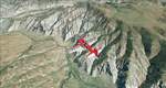
To explore this region depart from Eagle County Regional Airport (KEGE) which is a popular regional airport used in winter to transport skiers to nearby Vail. Northwest of the airport you can see the pit gypsum mine of American Gypsum which produces a variety of wallboard products. When you fly to the west and along the Eagle River, you soon pass its confluence with the Colorado River. Further west you can fly along Glennwood Canyon and finally reach Glennwood Springs where the Colorado meets the Roaring Fork River. Here you can turn south and fly direct Glenwood Springs Airport (KGWS) which lies south of the city. This scenery brings you another 3.500 sq km of beautiful Colorado in 4.7m/pix quality.
High resolution versions of this scenery for FS9 and FSX (much sharper, but larger and multiple downloads) are available at www.blueskyscenery.com/GNB_SouthWest2.html . The screenies are taken from the high-res versions, so expect this version to be slightly more blurry. YourDonation@Work: Dedicated to Alain and James.
| Filename: | Eagle_County_KEGE_Glenwood_Springs_KGWS_Colorado_P.zip |
| License: | Freeware, limited distribution |
| Added: | 30th January 2010, 17:01:49 |
| Downloads: | 2,710 |
| Author: | Gottfried Razek - blueskyscenery.com |
| Size: | 93.8 MB |
| Category: Flight Simulator 2004 - Scenery | |
| Wakefield riverfront in Quebec Canada |
|
Images related to this file:
File Description:
The village of Wakefield is 18 miles northwest of Ottawa on the west shore of the Gatineau River, and I seem to have been flying north up that river from Rock cliffe for years, past the village in a bend of the river just a few miles north of Cascades float base. It is where the tourist steam train goes through, and by "through" I mean that literally as the tracks are at the side of the main street, and one of the things it goes past is the Black Sheep Inn which hosts Canadian musical groups and individuals at the weekends. Though the radio in Ottawa uses the name in English it is actually and visibly called "Mouton Noir" on the sign. There is no airfield, and no float base. There aren't even all the buildings that are on the riverfront as it stretches further south and north. There is a public dock where you can tie up. Apart from the fact that the idea caught my fancy one afternoon outside the Mouton Noir I really can't think why I made this.
| Filename: | Wakefield_riverfront_in_Quebec_Canada.zip |
| License: | Freeware, limited distribution |
| Added: | 1st May 2010, 00:39:24 |
| Downloads: | 408 |
| Author: | Roger Wensley |
| Size: | 11.23 MB |
| Category: Flight Simulator 2004 - Scenery | |
| Mackenzie River close to Tulita CZFN in Northwest Territories Canada |
|
Images related to this file:
File Description:
I discovered, while testing another airfield near the Mackenzie River, that along the side of the Mackenzie adjacent to Tulita, and for a considerable distance, there was a cliff of water. I have no idea if my version of Ultimate Terrain has developed a fault or if this has been caused by the installation of a terrain mesh that now argues with UT for some unknown reason. Whatever, it was impossible to leave it as it was. I have included a screenshot of the cliff further upstream. To avoid the cliff of water I have flattened that area of the Mackenzie River and the adjacent river banks and both the town and the airfield to a height above sea level of 400 feet. This does not reflect the real life situation but is the lesser of two optical evils. I have included a screenshot of the flattened area. If you do not have a problem then you do not need this. If you too have a cliff of water then you might want to try this. It does not completely get rid of the problem, but it does get rid of it in the area visible when landing or taking off at Tulita.
| Filename: | Mackenzie_River_close_to_Tulita_CZFN_in_Northwest_.zip |
| License: | Freeware, limited distribution |
| Added: | 1st August 2021, 22:27:01 |
| Downloads: | 75 |
| Author: | Roger Wensley |
| Size: | 573.48 KB |
| Category: Flight Simulator 2004 - Scenery | |
| Paugan & Mercier Dams on the Gatineau River in Quebec Canada |
|
Images related to this file:
File Description:
This will not work without Ultimate Terrain, as the rivers and lakes just won't be there. The Paugan and Mercier Dams are on the Gatineau River in Quebec, north of Ottawa. Both of them are for power generation, rather than water conservation; the Paugan power generation building sits at the bottom of the sluiceway below the dam and appears far larger than the dam itself; there is a separate overflow sluice system nearby. The Paugan Dam is around 30 miles north up the river from Ottawa and the Mercier a further 70 miles. The Mercier holds back a huge and irregularly shaped volume of water known as the Reservoir Baskatong, with numerous branching arms and islands, and you will recognise where the dam must be long before you see it.
| Filename: | Paugan__Mercier_Dams_on_the_Gatineau_River_in_Queb.zip |
| License: | Freeware, limited distribution |
| Added: | 3rd May 2010, 00:11:21 |
| Downloads: | 273 |
| Author: | Roger Wensley |
| Size: | 421.81 KB |
| Category: Flight Simulator X - Scenery | |
| Quebec Scenery - Lakes and River - Baie James Hydroelectric Complex Territory |
|
File Description:
Re-uploaded file. Lakes, shorelines and rivers of the province of Quebec, Baie James hydroelectric complex territory, Canada (for FSX only)(range : N52-N55, W66-W80). For best rendering, use terrain mesh for the same territory of the province of Quebec (Canada) in LOD10 (Qc38mBJ_FSX_*de2.zip - 2 files - AVSIM library).
| Filename: | Quebec_Scenery__Lakes_and_River__Baie_James_Hydroe.zip |
| License: | Freeware, limited distribution |
| Added: | 28th May 2010, 04:17:20 |
| Downloads: | 3,865 |
| Author: | Gilles Gauthier |
| Size: | 62.77 MB |
| Category: Flight Simulator 2004 - Aircraft Repaints, Textures and Modifications | |
| T-28B, US Naval Test Pilot School, NAS Patuxent River |
|
File Description:
This is a repaint of Alphasim's excellent T-28B. These textures represent a T-28B that was used by the US Navy, US Naval Test Pilot School stationed at NAS Patuxent River in the 1970s. THESE ARE TEXTURES ONLY! You need the ALPHASIM T-28 payware package.
| Filename: | T28B_US_Naval_Test_Pilot_School_NAS_Patuxent_River.zip |
| License: | Freeware, limited distribution |
| Added: | 16th December 2004, 04:02:10 |
| Downloads: | 273 |
| Author: | Russel R. Smith & Alphasim |
| Size: | 503.74 KB |


© 2001-2026 AVSIM Online
All Rights Reserved
Privacy Policy |