
Where Flight Simulation Enthusiasts Gather from Around the World!
AVSIM Library - Search Results

| Category: Flight Simulator 2002 - Scenery | |
| Alaska Bush Scenery: Stony River Bend & Old Stony |

|
File Description:
Here's your big chance to take-off and land using a curved airstrip. Stony River Bend is located just west of Merrill Pass, very close to Tom Fica's cabin at Two Lakes (part of his 'Merrill Pass' scenery add-on). The bumpy dirt runway - becoming slightly overgrown and prone to waterlogging - is marked out with wooden posts (lit at night) and presents a unique challenge: one that I haven't really sorted out just yet! There's a small settlement just up a log-lined trail from the airfield with a gravel service track connecting with a basic NDB/DME facility to help out with night or low visibility approaches. Although Stony River Bend is fictional, it has been based loosely on a real life runway at Elk City in Idaho. Three miles downstream is another simple backwoods strip called Old Stony - the narrow gravel runway here is conventional, but it's probably in an even worse state of repair. Designed for use with Eddie Denney's FS2002 mesh of Alaska, but the scenery is usable without it.
| Filename: | Alaska_Bush_Scenery_Stony_River_Bend__Old_Stony.zip |
| License: | Freeware, limited distribution |
| Added: | 31st March 2003, 13:09:28 |
| Downloads: | 1,873 |
| Author: | James Belk |
| Size: | 2.04 MB |
| Category: Fly! II - TerraModels | |
| EGLC London City Airport And VFR River Thames |
|
File Description:
"I had a lot of fun doing this one. Unable to Terrascene this area because of the "Meridian Line" problem I took it upon myself to Create the River Thames from were Dave Taylors scenery finishes, past EGLC on to the Sea. Adding on my way, buildings, trees and other scenery like Yahts and boats. Also included in the package is some of the towers by Jeff Davis, he made for Fly! I have done a minor repaint of the ships by Biber Salsa, included in this package. Flying down the River Thames from Canary Wharf below 100 ft (tut tut) is great fun in the Bell407, taking about 8 mins. I can see this being the setting for some interesting 'online' races. This put the wonderful program by Allen Kriesman to the test. I didnt think it would cover such a large area, but it did! This whole scenery is Dedicated to Allen Kriesman and his program, Terramodels 2.2"
| Filename: | EGLC_London_City_Airport_And_VFR_River_Thames.zip |
| License: | Freeware, limited distribution |
| Added: | 3rd June 2003, 20:50:18 |
| Downloads: | 405 |
| Author: | Steve Brown YSOMdesign |
| Size: | 482.41 KB |
| Category: Flight Simulator X - Scenery | |
| Assiniboine River from Winnipeg to Portage la Prairie |
|
File Description:
The Assiniboine River from the Forks in Winnipeg, Manitoba to Portage la Prairie, Manitoba. Also some minor landclass changes in Winnipeg to add a few golf courses, the Assiniboine Forest and a green space where Assiniboine Park is.
| Filename: | Assiniboine_River_from_Winnipeg_to_Portage_la_Prai.zip |
| License: | Freeware |
| Added: | 11th December 2006, 04:11:46 |
| Downloads: | 1,946 |
| Author: | Dwayne Matheson |
| Size: | 386.73 KB |
| Category: Flight Simulator X - Missions | |
| LighthouseTour3StLawrence.zip |
|
File Description:
Intermediate helicopter mission. This is the third and final mission of the Lighthouses of the Saint Lawrence river. This mission like the former two requires the Orbx Global Base Pack for the best experience.
| Filename: | LighthouseTour3StLawrencezip.zip |
| License: | Freeware |
| Added: | 3rd April 2020, 19:29:23 |
| Downloads: | 82 |
| Author: | helomissionman |
| Size: | 11.38 MB |
| Category: Flight Simulator 2004 - Flight Plans | |
| Canadian Historical Adventures - Flight 2 (1928) |
|
File Description:
In this second flight you will retrace "Wop" May's steps and fly a Curtiss Jenny from Peace River to Fort Vermillion in a blizzard to deliver medical supplies to save people from an epidemic.
| Filename: | Canadian_Historical_Adventures__Flight_2_1928.zip |
| License: | Freeware |
| Added: | 31st October 2003, 21:32:24 |
| Downloads: | 974 |
| Author: | David Voogd |
| Size: | 280.32 KB |
| Category: Flight Simulator 2004 - Scenery | |
| 'Lake Of The Clouds' Michigan |
|
File Description:
Lake Of The Clouds - Ontonagon, Michigan scenery by Al Heline and Jim Bosworth.
This scenery includes the waterfalls on the Carp River on its way to Lk Superior.
Additional LandClass for Whitefish Point included.
| Filename: | Lake_Of_The_Clouds_Michigan.zip |
| License: | Freeware, limited distribution |
| Added: | 4th February 2004, 04:22:08 |
| Downloads: | 2,731 |
| Author: | Al Heline, Jim Bosworth |
| Size: | 565.98 KB |
| Category: Flight Simulator 2004 - Scenery | |
| City of Augusta, Georgia USA |
|
File Description:
Here is second city scenery to Georgia state USA. The second largest city in Georgia,
once the capital of Georgia. Augusta is located about halfway up the Savannah River, near border of South Carolina.
| Filename: | City_of_Augusta_Georgia_USA.zip |
| License: | Freeware |
| Added: | 18th July 2004, 16:58:48 |
| Downloads: | 2,857 |
| Author: | Toni Hiltunen |
| Size: | 676.17 KB |
| Category: Flight Simulator 2004 - AFCAD Files | |
| Trans Oceanic Airways mooring location on the Clarence River, Grafton |
|
Images related to this file:
File Description:
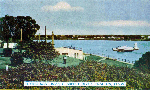
This AFCAD2 file will give you the exact and correct location for the site on the Clarence River, Grafton, where the Trans Oceanic Airways (and later, Barrier Reef Airways and then Ansett Air Services) flying boats would sit and load/unload their passengers. For years I had thought that the location was on the southern bank of the river and it was only in early October 2007 that I learned differently, purely by chance. The Readme contains further information plus the very simple installation process. (Re-upload)
| Filename: | Trans_Oceanic_Airways_mooring_location_on_the_Clar.zip |
| License: | Freeware |
| Added: | 9th May 2010, 10:12:58 |
| Downloads: | 289 |
| Author: | Bruce Kennewell |
| Size: | 223.57 KB |
| Category: Flight Simulator 2004 - Scenery | |
| Tsuniah Lake Lodge CAF4 in British Columbia Canada |
|
Images related to this file:
File Description:
Tsuniah Lake Lodge is an airstrip that serves the Lodge of the same name at the western end of the lake. Tsuniah Lake is close to the eastern side of Chilko Lake, some 7 miles south of the northern end of Chilko Lake and the recent post of Tsylos Lodge. Tsuniah Lodge is at the eastern and lake end of the grass runway, which is 4,000 feet of grass aligned 04-22 and in good condition at 4,026 feet ASL. No lights. The lodge is extensive with numerous separate cabins and I would expect the prices to be up there with the cost of the chartered planes that delivered guests. There is a second airstrip included here, around 3 miles north of the northern end of Chilko Lake and which used to serve the Wilderness Ranch before it was closed. The runway closed I mean. It is still visible but now not used at all although the ranch still functions. I have posted this as Tsuniah Lake Lodge CAF4, but I suggest that you add this to your "BC airfields" folder as previously suggested. Up to you. If you find a defect, email me.
| Filename: | Tsuniah_Lake_Lodge_CAF4_in_British_Columbia_Canada.zip |
| License: | Freeware, limited distribution |
| Added: | 23rd November 2020, 20:03:34 |
| Downloads: | 89 |
| Author: | Roger Wensley |
| Size: | 10.29 MB |
| Category: Flight Simulator 2004 - Scenery | |
| Fort St James CYJM in British Columbia Canada |
|
Images related to this file:
File Description:
Fort St James is a small town of around 1,600 folks at the southeastern end of Stuart Lake, at the head of the Stuart River, and around 360 miles north of Vancouver and 220 miles inland from the coast. It was a long-established trading post for furs, with a permanent presence there from 1806 onwards. The airfield is 3 miles south of the town and is called "Fort St James (Perison)" in the Nav Canada listings. I presume that this is part of their trend towards calling airfields by their location rather than by their name. Makes sense as it is difficult to find information by searching for an airfield that is listed under a name you don't know. The field has an asphalt runway of 4,000 feet aligned 10-28 and at 2,364 feet ASL. There is no lighting. The main user of the airfield is Interior Helicopters Ltd. who are based there as operators, and at Williams Lake as helicopter dealers. For the AI helicopters, there is a screenshot (01) of the AS350 helicopter installation folder when it has been transformed into an AI helicopter. The process is to download and install the Ecuriel AS 350, along with the additional textures, as normal; this is straightforward. Then you download the software shown in screenshot 02 and add it as instructed and as shown in 01 so that the helicopter now operates as AI, with a different air file and a modified config file. I should have included this with the Pemberton post. I have posted this as Fort St James CYJM, but I suggest that you just add it to your previously created "BC airfields" and avoid the inevitable doubling up of common textures etc. Up to you. If you find a defect, email me.
| Filename: | Fort_St_James_CYJM_in_British_Columbia_Canada.zip |
| License: | Freeware, limited distribution |
| Added: | 23rd November 2020, 20:14:04 |
| Downloads: | 151 |
| Author: | Roger Wensley |
| Size: | 2.62 MB |


© 2001-2026 AVSIM Online
All Rights Reserved
Privacy Policy |