
Where Flight Simulation Enthusiasts Gather from Around the World!
AVSIM Library - Search Results

| Category: Flight Simulator 2004 - Aircraft Repaints, Textures and Modifications | |
| VLM Airlines Fokker 50 (OO-VLS) |

|
Images related to this file:
File Description:
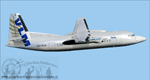
This is an Fokker 50 in VLM Airlines colors, Registration: OO-VLS, Repaint by: Mathieu Vos (APSS), Model by: Dreamwings.
VLM Airlines was until Air France-KLM announced on December 24, 2007 to take over, an autonomous, independent airline. On May 28, 2009 it was announced that Air France-KLM her daughter VLM Airlines will integrate. CityJet in Since 2010 VLM wast no longer disseminated to the public. as a brand from the beginning of 2010, all aircraft repainted in VLM colors and they will bear the name CityJet. The last VLM flight was on Friday, March 26, 2010 with the first Fokker 50 which they possessed, the OO-VLM. As of May 1, 2014, VLM Airlines is owned by Intro Aviation GmbH and is scheduled carriers converted to ACMI and charter operator. 8 aircraft flying in the colors of CityJet (currently the largest customer) and two sets in FlyVLM colors. The other two are still unknown though there are rumors that one unit will fly in Vision air colors, VLM Airlines has been used worldwide.
Also compatible for FSX.
| Filename: | VLM_Airlines_Fokker_50_OOVLS.zip |
| License: | Freeware |
| Added: | 7th July 2014, 08:58:34 |
| Downloads: | 551 |
| Author: | Mathieu Vos (APSS) |
| Size: | 2.73 MB |
| Category: Flight Simulator X - AFCAD Files | |
| Coombs Airport (7NJ7), NJ |
|
File Description:
Located 04 miles NE of Elmer, New Jersey, Coombs Airport is a private turf field 2000' in length wilth clear 20:1 approach and departure at each end of the runway. You'll find some surrounding buildings but they are all located several hundred yards from the runway. This is a good strip to keep in mind for emergencies if you're in the area. You will be landing on terrain so having your mesh complexity set as high as possible is recommended. This airport is not lit at night, daytime VFR operations only are suggested. There are no transient services offered.
Scenery constructed with use of satellite images/streetview/aerial photos - the author has not been there in person.
This scenery is meant to be used in conjunction with MegaScenery Earth New Jersey/Delaware 004. It is not required, but apron use is minimized to allow satellite scenery to show through as much as possible, and objects are placed based on the MSE textures - lack of it may make scenery look out of place.
| Filename: | Coombs_Airport_7NJ7_NJ.zip |
| License: | Freeware |
| Added: | 16th February 2011, 00:03:55 |
| Downloads: | 191 |
| Author: | Drew Sikora |
| Size: | 756.22 KB |
| Category: Flight Simulator X - AFCAD Files | |
| TKPK - Robert L. Bradshaw International Airport / Saint Kitts and Nevis |
|
Images related to this file:
File Description:
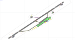
This airport update was made with the latest version of ADE (Airport Design Editor) and made for FSX as a replacement for the stock (default) airport. I've made several changes to the airport which are listed below. All these enchancements are as close to the real airport as I can get with stock library objects. I've used satellite images, terminal photos and maps throughout the whole process so building locations are as accurate as possible. Happy landings in sunny Saint Kitts and Nevis!
Features:
*Expanded parking apron
*Main terminal building with parking area for commercial traffic (Gates 1-9)
*St. Kitts airport sign
*Seperate parking area for GA traffic
*Parking stand for cargo (Gate 9)
*Misc airport buildings added
*Airport vehicles and objects throughout the airport
*Fuel tanks and station
*Airport fire station
*Windsocks added
*Birds flying near runway (beware)
*Palm trees/vegitation added near terminal
*Taxiway signs
*Taxiways Bravo and Charlie properly assigned
*New taxiway Alpha added
(For more information about Endeavourai please visit our site at endeavourai.com)
| Filename: | TKPK__Robert_L_Bradshaw_International_Airport__Sai.zip |
| License: | Freeware |
| Added: | 1st September 2012, 21:23:20 |
| Downloads: | 819 |
| Author: | Jaison Diaz / Endeavour ai |
| Size: | 87.92 KB |
| Category: Flight Simulator 2004 - Aircraft Repaints, Textures and Modifications | |
| Paradise Airlines Lockheed L-049 Constellation |
|
Images related to this file:
File Description:
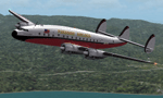
Textures for the Lockheed L-049 Constellation by the team Roland Berger, Volker Boehme, Manfred Jahn, Luis Pallas, Bill Tyne and Stefan Werner. Repaint by Manfred Meyer.
The company Nevada Airmotive bought TWA's L-049 fleet in 1962 for lease and/or resell them. But only fife of the 25 Constellations found new operators .
One of these aircrafts was c/n 2025, built 1945 and used by Lockheed as factory demonstrator until delivered to TWA as NC86504 "Star of France" in 1946. Sold to Nevada Airmotive in 1962 and leased to Futura Airlines and some month later to Paradise Airlines Inc. Oakland, CA. Paradise used the plane together with two further Constellations for flights from Oakland, Salinas, San Jose and other points in California to Lake Tahoe, bringing peoples to Horrah's gambling club there. Sadly N86504 crashed 1. march 1964 nine miles northwest of Lake Tahoe into the mountains with the lost of all 85 on board. Paradise AL then was forced to close down by FAA for failing to conduct a safe operation.
| Filename: | Paradise_Airlines_Lockheed_L049_Constellation.zip |
| License: | Freeware |
| Added: | 11th July 2015, 11:26:45 |
| Downloads: | 124 |
| Author: | Manfred Meyer |
| Size: | 4.14 MB |
| Category: Flight Simulator 2004 - Aircraft Repaints, Textures and Modifications | |
| Portuguese Air Force Lockheed PV-2 Harpoon |
|
Images related to this file:
File Description:
Featured is Forca Aerea Portuguesa 4626, ex-US Navy BuNo 37406, Lockheed c/n 15-1272. The FAP operated 42 PV-2s and PV-2D's under MDAP (Mutual Defense Assistance Program) from 1952 on in Portugal and its colonies in Africa where they were serving in a variety of rules. The FAP went into Portugal's colonial war already before the first two regular battalions of the Portuguese Army were disembarked in Luanda, on 1 May 1961. Reaching back on three already obsolete PV-2 Harpoon liaison and patrol aircraft, equipped as make-shift bombers (and later formed into Esquadra 91), and P2V-5 Neptunes, the FAP flew a number of attack sorties against various rebel concentrations. Throughout the COIN war, which ended in 25 April 1974 by a coup d'etat in Portugal, the Harpoon played a significant role. The end of the war marked the end of the Harpoon era in Portugal. You will require Milton Shupe and Team's FS2004 or FSX Lockheed PV-2 Harpoon (harpfs9v13.zip resp. harpfsxv13.zip). Repaint by Maarten Brouwer.
For FS2004 and FSX.
| Filename: | Portuguese_Air_Force_Lockheed_PV2_Harpoon.zip |
| License: | Freeware, limited distribution |
| Added: | 19th September 2015, 21:22:14 |
| Downloads: | 141 |
| Author: | Maarten Brouwer |
| Size: | 15.49 MB |
| Category: X-Plane - Scenery | |
| 2017 TMA Fortaleza XP11 Package SBFZ SJCM SJDS SNFF v1.1.0 |
|
Images related to this file:
File Description:

Version 1.1.0 (2017) - This is an X-Plane 11 scenery package for Fortaleza, Ceara, Brazil. It includes four airfields located in the metropolitan area of Fortaleza. 1. SBFZ/FOR - Pinto Martins International Airport v1.1.0. 2. SJCM - Catuleve Aeronautical and Sports Airfield v1.0.0. 3. SJDS - Fabrica Fortaleza Private Airport v1.0.0. 4. SNFF - Feijo Flight School and Private Airfield v1.0.0. It includes corrected aprons, ramps, taxiways and lighting system for SBFZ/FOR airport. v1.1.0 includes also the construction work of the terminal expansion, and XP11 ground services (like pushback) enabled. SBFZ/FOR scenery was tested and is operational (as of February 04, 2017) in "X-Plane 11 Public Beta #8 64 bit", Windows 10 Home. It was also tested but is NOT operational (as of January 27, 2017) in "X-Plane 10.51 64 bit", Windows 10 Home. This happens for two reasons: (a) XP11 native ground traffic/services enabled for SBFZ/FOR ground, a feature compatible only with XP11, and (b) the use of some internal Laminar Research made libraries for XP11 only, not present in XP10 libraries.
| Filename: | 2017_TMA_Fortaleza_XP11_Package_SBFZ_SJCM_SJDS_SNF.zip |
| License: | Freeware |
| Added: | 4th February 2017, 20:00:41 |
| Downloads: | 251 |
| Author: | Rui Mesquita |
| Size: | 18.35 MB |
| Category: Flight Simulator 2004 - Panels | |
| Super VC10 Panel upgrade Part 8.2 |
|
File Description:
This is an important additional update for David Maltby's Super VC10 model regarding the engines, also requiring download of the previous updates 1 to 8 and 8.1.
This update overcomes the bug that Microsoft introduced (left behind) in FS9 with regard to engine ignition (but corrected in FSX). In FS9 engine ignition is hard coded to 22%n2.
Not all engines can be modelled in that way so in effect the ignition sequence has to be made to run "outside" the sim. Niot a new concept by any means but it does
make the coding much more complex as lots of other factors have to be taken into account. In reality the RR Conway engines light-up at 11-12%n2 with the ignition being held on until about 24%n2.
This has now been correctly modelled. The hot start procedure has also been re-modelled to fit the new code. In the process of coding i noticed that one of the engines tends to run a bit on the hot side
so keep a watchfull eye.
| Filename: | Super_VC10_Panel_upgrade_Part_82.zip |
| License: | Freeware |
| Added: | 3rd March 2017, 15:24:28 |
| Downloads: | 216 |
| Author: | Nicholas Weber |
| Size: | 49.73 KB |
| Category: Flight Simulator X - Aircraft Repaints, Textures and Modifications | |
| USAAF PT-17 Stearman (N38940) |
|
Images related to this file:
File Description:
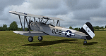
This is a repaint only, for the payware Vertigo Studios Stearman Vol.1 set. This repaint depicts the restored Stearman PT-17 N38940, owned/operated by Paul Bennett, based at Priory Farm, Norfolk, England. The aircraft was manufactured as USAAF 41-8263, and from 1941 until February 1944 the aircraft was used continually, despite being involved in 4 separate training accidents, with a 5th accident taking it out of service althogether. The remains of the aircraft were restored, with the aircraft first flying again in 1977, and later, sold to Paul Bennett in 1992, the aircraft was restored again, to factory-original award-winning condition and finished in the same all-silver color scheme it would have had in 1944. The contrast between the metal and fabric surfaces on this aircraft is period-authentic, as although the fabric surfaces were coated in silver dope, the metal panels were anodized and left bare. Two versions of the repaint are included, with one featuring the temporary 445th Bomb Group tail markings the aircraft sported in 2006.
| Filename: | USAAF_PT17_Stearman_N38940.zip |
| License: | Freeware |
| Added: | 22nd January 2017, 04:05:20 |
| Downloads: | 160 |
| Author: | John Terrell |
| Size: | 46.2 MB |
| Category: Flight Simulator X - Aircraft Repaints, Textures and Modifications | |
| WASP PT-17 Stearman (N59293) |
|
Images related to this file:
File Description:
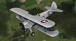
This is a repaint only, for the payware Vertigo Studios Stearman Vol.1 set. This repaint depicts the restored Stearman PT-17 N59293, owned/operated by Andrew and Mike Porter, based at Spring Lake, New Jersey. The aircraft was manufactured as USAAF 41-25714 and was used continually from June 1942 until June 1945. During WWII the aircraft had multiple assignments, one of which included Avenger Field in Sweetwater, Texas, home of the WASP (Women's Airforce Service Pilots), where it was based from February 1943 until August 1944. Sold surplus after the war, the aircraft was used as a crop duster in New Mexico all the way until 1981. Starting in 2006, the aircraft was restored to factory-original award-winning condition, and painted in the same markings it wore while stationed at Avenger Field, flying as a tribute to all of the WASP pilots. (In one of the aircraft's other WWII training assignments, Donald Strait flew this aircraft during flight training and would go on to become a double-ace flying P-51's with the 361st Fighter Squadron).
| Filename: | WASP_PT17_Stearman_N59293.zip |
| License: | Freeware |
| Added: | 22nd January 2017, 04:09:36 |
| Downloads: | 161 |
| Author: | John Terrell |
| Size: | 24.37 MB |
| Category: X-Plane - Original Aircraft | |
| JA37 Viggen for x-plane 7-UPDATE |
|
File Description:
JA37 Viggen for X-Plane 7 - With control surfaces now working properly in 7 Beta 5 the flight characteristics now closely follow the actual aircraft. Mach speed at low altitude is a bit high but is correct at mach 2.1 at altitude. Takeoff distance is now down to 1100 or 1200 ft. at 36000 lbs wt. If you have the 7 Beta 3 version of my plane dump it since the flight model isnt close.
This is the Saab JA37 Jaktviggen more commonly known as the Viggen. The plane is well known for its powerful engine, unique thrust reverser system, and its short takeoff and landing capability. At normal takeoff wt. get off in less than 400 m or 440 yards (1/4 mile) and land in 440 m. The Viggen was developed in the late 60's and early 70's; now it is being replaced by the Drakken and the the US F18. Load different weapons on numerous hard points. Make sure to put all of the parts in the weapons folder.
| Filename: | JA37_Viggen_for_xplane_7UPDATE.zip |
| License: | Freeware, limited distribution |
| Added: | 5th June 2003, 23:54:12 |
| Downloads: | 1,229 |
| Author: | Robert App |
| Size: | 2.24 MB |


© 2001-2026 AVSIM Online
All Rights Reserved
Privacy Policy |