
Where Flight Simulation Enthusiasts Gather from Around the World!
AVSIM Library - Search Results

| Category: Flight Simulator 2004 - Scenery | |
| Hassan Djamous International Airport (FTTJ) V1 |

|
Images related to this file:
File Description:
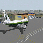
Thank you for downloading Hassan Djamous International Airport for FS9. This is the main gateway to the Republic of Chad. I tried to recreate the scenery as the airport currently looks like. Scenery contains Main terminal, VIP, Civilian hangars, Military Hangars, Fire station, Airforce base. Airport was built by Sketchup, ADE,AFL Lights SbuilderFS9, Bill Melichar Tropical Trees Macros. Scenery uses RWY12 Object library which you will find on Avsim or flightsim. Special thanks to HGS and Dedl for testing out and helping me fix issues.
| Filename: | Hassan_Djamous_International_Airport_FTTJ_V1.zip |
| License: | Freeware |
| Added: | 12th May 2021, 19:01:20 |
| Downloads: | 349 |
| Author: | EMMANUEL MWANDOSYA |
| Size: | 14.97 MB |
| Category: Flight Simulator 2004 - Scenery | |
| LICJ 2012 - FS2004 |
|
Images related to this file:
File Description:
This is Palermo Punta Raisi "Falcone-Borsellino" scenery, version 1.0, for Microsoft Flight Simulator 2004. This scenery was created with gmax, photoshop and AFX, and with assistance of Thomas Lo Gerfo. The scenery includes accurate buildings, hangars, parking bays, safe docking, night texturing and illumination effects. The Palermo Airport (IATA: PMO, ICAO: LICJ), also known as Falcone-Borsellino Airport or Punta Raisi Airport is located at Punta Raisi, 19 NM (35 km; 22 mi) west northwest of Palermo, the capital city the Sicily island (Italy).
| Filename: | LICJ_2012__FS2004.zip |
| License: | Freeware |
| Added: | 11th February 2012, 14:32:33 |
| Downloads: | 4,826 |
| Author: | Francesco Salsano |
| Size: | 12.88 MB |
| Category: Flight Simulator X - Scenery | |
| Kozani Kastoria - Greece |
|
Images related to this file:
File Description:
Kozani/Kastoria Dn
AS REAL AS IT GETS.
This is a detailed photorealistic scenery of Kozani, Kastoria and the
area from Katerini Paralia in the East, to Pentalofos in the West
WITH NIGHT TEXTURES.
(See bellow for scenery choices).
Default FSX airports of Fillipos (LGKZ) and Aristotelis (LGKA) were
redone, positioned to their exact location and buildings were added in
the airport compounds.
Aprons were added with parking spots, and aircraft traffic.
The scenery also includes autogen objects, buildings and road traffic
near the cities.
| Filename: | Kozani_Kastoria__Greece.zip |
| License: | Freeware |
| Added: | 24th November 2016, 17:57:09 |
| Downloads: | 801 |
| Author: | Angelo Tassoglou |
| Size: | 208.89 MB |
| Category: Flight Simulator X - Scenery | |
| Crete West - Greece |
|
File Description:
Crete West Dn
AS REAL AS IT GETS.
This is a detailed photorealistic scenery of the western half of the
Island of Crete WITH NIGHT TEXTURES.
See bellow for scenery choices.
Default FSX airports of Chania (LGSA) and Tympaki (LG54) were
completely redone, positioned to their exact location, and many
buildings and objects were added in the airport compounds.
New aprons, taxi signs and plenty of aircraft parking.
The scenery contains plenty of autogen objects, buildings, vegetation.
I have also included 2 aircraft traffic files.
| Filename: | Crete_West__Greece.zip |
| License: | Freeware |
| Added: | 24th November 2016, 17:42:58 |
| Downloads: | 1,568 |
| Author: | Angelo Tassoglou |
| Size: | 222.37 MB |
| Category: Flight Simulator X - Scenery | |
| Extreme Westgreenland |
|
File Description:
Extreme Westgreenland
Terrain Mesh for Greenland for Microsoft Flight Simulator X
Everybody who flies in Greenland knows, how incorrect the default scenery is.
This is a new terrain mesh scenery which covers Westgreenland - from Lat N 65 to N 68.
As SRTM data do not cover above N 60 - no Greenland mesh scenery has been produced.
This is one of the most detailed Greenland terrain mesh released up to release date of this scenery.
This great package covers more than 50.000 sq. km. area. This includes:
* LOD11 Mesh (terrain/elevation)
* Redesigned coastline
* Redesign lakes
R E S O U R C E S
Flightsim.gl sceneries for Microsoft Flight Simulator
http://www.flightsim.gl
Flightsim.gl updates, support and official website
http://www.flightsim.gl
N O T E S
This product including all files contained within this package is copyright © Flightsim.gl (www.flightsim.gl).
The information provided within this document and the Flightsim.gl Extreme Westgreenland scenery package is
not intended for real world navigation. All trademarks and/or logos mentioned and/or displayed within this
scenery package are property of their respective holders and are being used solely with the purpose of
representing reality.
| Filename: | Extreme_Westgreenland.zip |
| License: | Freeware, limited distribution |
| Added: | 22nd December 2007, 01:31:21 |
| Downloads: | 3,667 |
| Author: | Ulrik Motzfeldt |
| Size: | 44.95 MB |
| Category: Flight Simulator X - Scenery | |
| 2016 Kigali Intl (HRYR) Rwanda |
|
Images related to this file:
File Description:
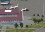
This sequel to the 2009 Kigali Intl (HRYR) Rwanda scenery (by Jacques Botha and Frits Beyer) brings it up to date with the current layout and enables full compliance with FTX Global/Vector and FSX. Buildings are added and adjusted to their real-world locations, and the new taxiway and south apron are added according to the May 2016 satellite imagery. In addition to real-world gate locations, custom apron markings are added along with apron lighting. The landclass around Kigali is also updated, and SRTMGL1 (30m) mesh is included. This scenery can be complemented by the Goma (FZNA) and Gisenyi (HRYG) scenery (FSX_FZNA-HRYG_CS.zip), and GA flightplans are included to supplement the commercial traffic at Kigali and provide more activity at FZNA and HRYG.
Updates were created or rebuilt in a manner which carefully aligns airport data with current satellite imagery. Scenery was created using Airport Design Editor X v1.70.6042, SBuilderX 3.13, and the FSX Object Placement Tool. Scenery objects were added and modified from stock FSX scenery to resemble as closely as possible the actual airports. The FSX apron lights included are from the set created by Jim Dhaenens.
| Filename: | 2016_Kigali_Intl_HRYR_Rwanda.zip |
| License: | Freeware |
| Added: | 4th August 2016, 21:10:09 |
| Downloads: | 3,387 |
| Author: | Carlyle Sharpe, Jacques Botha, and Frits Beyer |
| Size: | 17.12 MB |
| Category: Flight Simulator X - Scenery | |
| LGSK - Skiathos Airport, Greece |
|
Images related to this file:
File Description:
LGSK Skiathos Airport Greece.
Skiathos Island lies off the east coast of mainland Greece and is often referred to as 'Europe's St. Maarten' with landing aircraft skimming the beach and the nearby harbour. At 5341feet the runway is short and narrow and usually only captains are allowed to perform landings. Seasonal taffic includes Munich, Gatwick, Rome, Oslo and Stockholm, with scheduled flights to Athens.
This scenery has been designed to sit on the excellent photoreal scenery by Angelo Tassoglou, available here on Avsim, just search for 'Skiathos.zip'. Please note, it will not work with the default terrain. It also uses many objects from my LGKF Kefallinia scenery, also available here at Avsim.
The scenery features added vegetation, detailed airport buildings based on real photographs, animated windsocks, flags, road traffic, people, trees, waves, birds and air traffic. All the scenery files have been divided so they can be switched on or off according to user preference. It has been designed for and tested in DX9 and FSXA only.
Please enjoy and I hope you like my scenery as much as I enjoyed building it.
Required files:
skiathos.zip by Angelo Tassoglou
LGKF Kefallinia by George Keogh
| Filename: | LGSK__Skiathos_Airport_Greece.zip |
| License: | Freeware, limited distribution |
| Added: | 28th January 2013, 00:13:54 |
| Downloads: | 16,019 |
| Author: | George Keogh |
| Size: | 20.47 MB |
| Category: Flight Simulator 2004 - Scenery | |
| Lucknow Airport, India [ VILK ] |
|
Images related to this file:
File Description:
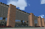
Lucknow,also Famous as 'City of Nawabs' and is capital of Uttar Pradesh,also called a political Sate of India. The Airport is 230 Nm SE of new Delhi.From previous experience I've learned a great deal of file size management to yield maximum frame rate.Now this Airport has a new Apron , which is actually not new, but lets call it new .i.e. 4-6 years old along with Taxiway Delta and echo.I just Found that theirs are no resources available in our virtual aviation community that has information in any form for this Airport scenery, afcads/afxs This ironically 'new' apron and taxiway is why,this airport has been developed.The airport has ADVANCED hanger....and many other things that will make you fly for at least one time in/out of this Place. The airport name is 'Chaudhary Charan Singh Airport" and has all basic navigational tools with CAT II ILS .how about some pics ? ..........will work in FSX.
| Filename: | Lucknow_Airport_India__VILK_.zip |
| License: | Freeware |
| Added: | 16th August 2010, 20:49:50 |
| Downloads: | 1,549 |
| Author: | Ashish Singh |
| Size: | 23.85 MB |
| Category: Flight Simulator X - Scenery | |
| Choctaw NOLF (KNFJ) |
|
File Description:
One of several Naval Outlying Landing Fields (NOLF's) in the Pensacola area, Choctaw NOLF is currently the only NOLF capable of supporting the newest US Navy primary training aircraft, the T-6B Texan II. Choctaw NOLF is located in Milton, FL just 13nm South of NAS Whiting Field. Designed for FSX, Choctaw NOLF features working IFLOLS trailers designed by Sylvain Parouty. The trailers have a functioning "meatball" to help with Field Carrier Landing Practice. Buildings and other objects were placed using default FSX objects as well as a couple of add-on libraries. You will need rwy_mark.zip by Lance Tucker and fsx_lts.zip by Jim Dhaenens. Both files are available at flightsim.com. View the readme file for more info and acknowledgments. The goal of this scenery is the same as in the real world...to provide a secondary landing field for Virtual Student Naval Aviators to practice pattern work, touch and go's, and Carrier Landing Practice. It's a great place for your FSX T-6A or T-34C!
| Filename: | Choctaw_NOLF_KNFJ.zip |
| License: | Freeware, limited distribution |
| Added: | 11th March 2010, 04:02:17 |
| Downloads: | 1,451 |
| Author: | Brandon Thetford |
| Size: | 13.53 MB |
| Category: Flight Simulator 2004 - AFCAD Files | |
| EBOS Oostende/Brugge International Airport, Ostend, Belgium (includes modified twy signs!) |
|
File Description:
These files are for the FS9 default. The "AF2_EBOS_DF.BGL" file is based on the Microsoft Virtual Earth aerial photography (via "Flash Earth"). It is an extensive modification of a file by Jean-Philippe Delwiche (merci Monsieur!). The "EBOS_twy_signs.BGL" file corrects the taxiway sign positions and content, and the exclude files prevent any default scenery from obstructing the airfield. Because I like the interesting variation and "East meets West" feel of the Oostende traffic, I like to pass through once in a while. Therefore, it is important to me that the layout is at least proportionally genuine, and a better reflection of reality than the default.
My thanks to Jean-Philippe Delwiche (aka JeePee) for his kind permission for my use of his work.
Also, thanks to Jan Martin for his guide to taxiway sign editing, which I hope I have used to good effect.
This release complements my Air Charter Express and MK Airlines flightplans well.
| Filename: | EBOS_OostendeBrugge_International_Airport_Ostend_B.zip |
| License: | Freeware |
| Added: | 11th May 2009, 01:06:04 |
| Downloads: | 725 |
| Author: | Dan Foster |
| Size: | 1.5 MB |


© 2001-2026 AVSIM Online
All Rights Reserved
Privacy Policy |