
Where Flight Simulation Enthusiasts Gather from Around the World!
AVSIM Library - Search Results

| Category: X-Plane - Original Aircraft | |
| F104G Starfighter 6.4/6.51 |

|
File Description:
F104 G Starfighter v1.0 for X-Plane 6.4/6.51 Developed under weapons program 303 in the early 1950's by Lockheed's famous skunkworks the F104 was referred to as "the missile with the man in it" due to its rocket like shape. It was the first jet aircraft to exceed 1000 mph in level flight and also the first jet to exceed mach 2. Over 2500 F104s were produced for the US and for export. The F104G had a J65 10,000 lb. thrust engine without afterburning and 15,800 lb with afterburning. Some remained in active service in Tiawan into the late 1990's. Rocket assisted NF104 aircraft set an altitude record for ground takeoff aircraft of 120,800 over Rogers dry lake in December 1963. Look for more century series aircraft coming soon for X-Plane.
| Filename: | F104G_Starfighter__64651.zip |
| License: | Freeware, limited distribution |
| Added: | 7th February 2003, 13:54:33 |
| Downloads: | 694 |
| Author: | Robert App |
| Size: | 1.13 MB |
| Category: Flight Simulator X - Missions | |
| Restricted Airspace Mission |
|
File Description:
This is my first attempt at a mission in Flight Simulator X. It's a simple mission following ATC instructions. You must be able to read a map and identify your location visually. I am working on adding a few more effects, but thought the community would enjoy this mission in its present form. I won't spoil the mission by giving too much detail, but your general heading for the flight is 70 to 80 degrees for a landing at Burke Lakefront Airport which is just north of downtown Cleveland. Prominent visual features on the shore of lake erie are the Key Bank skyscraper, Browns Stadium and the Rock Hall of Fame which are all visible in FSX. You will be flying just north of Cleveland Hopkins International Airport.
| Filename: | Restricted_Airspace_Mission.zip |
| License: | Freeware |
| Added: | 26th March 2007, 15:06:30 |
| Downloads: | 2,833 |
| Author: | William Rayer |
| Size: | 2.34 MB |
| Category: Flight Simulator 2004 - Scenery | |
| US North Cascades Mountains and Northwest Washington Coast |
|
File Description:
The files in this package completely replace the FS default landscape of the North Cascades Mountains and coastal areas of northwestern Washington State. Between Bellingham and Arlington (N-S), Orcas Island and Lake Chelan (W-E) you can now enjoy your VFR flights with accurate locations of coastlines, lakes, rivers, streams, roads, railroads, and power lines, as well as land use type (landclass) and terrain (add-on mesh). Also added are the larger glaciers of the majestic North Cascades volcanoes and peaks as well as several forestry roads and clearcuts outside the National Park and Wilderness areas. Made mostly with Christian Fumey's "Ground2K4" and Jim Keir's "Slartibartfast". Fully compatible with the recent freeware LOD10 add-on meshes of the western US. Mesh and landclass files will work in FS2002 but not the special scenery enhancements.
| Filename: | US_North_Cascades_Mountains_and_Northwest_Washingt.zip |
| License: | Freeware, limited distribution |
| Added: | 18th May 2004, 23:12:57 |
| Downloads: | 14,319 |
| Author: | Holger Sandmann |
| Size: | 12.72 MB |
| Category: Flight Simulator 2004 - Scenery | |
| Backcountry USFS fields for 19m terrain mesh in Idaho |
|
Images related to this file:
File Description:
These backcountry airfields are for use with the FSGenesis 19m mesh of Idaho; they almost certainly do not work without it. I also have Ultimate Terrain installed, with the settings as noted. The 15 airfields included here are almost all United States Forestry Service fields: 1U1 Moose Creek, 2ID7 Cayuse Creek, 2U5 Shearer, 3U1 Warren, 12ID Flying B Ranch, 24K Krassel, 75c Orogrande, I08 Cabin Creek, ID67 Lower Loon Creek, ID76 Wilson Bar, S81 Indian Creek, S92 Fish Lake, U54 Bernard, U79 Chamberlain, U81 Cold Meadows. There is also a 85U bgl included to remove the remnants of Soldier Bar which is impossible to make into a scenery with the terrain mesh, and spoiled the surroundings if left untouched and intact. The screenshots are typical examples giving a good impression of the terrain.
| Filename: | Backcountry_USFS_fields_for_19m_terrain_mesh_in_Id.zip |
| License: | Freeware, limited distribution |
| Added: | 22nd July 2019, 16:38:48 |
| Downloads: | 100 |
| Author: | Roger Wensley |
| Size: | 22.2 MB |
| Category: Flight Simulator 2004 - Scenery | |
| Israel, the Holy Land - 1North (ver. 01) |
|
File Description:
FS2002/FS2004 highly detailed landclass for Northern Israel, covering the Land of Upper and Lower Galilee, Lake of Galilee and the coastal area of North-Western Israel. Within this area there are many places with historical and Geographical significance for those who are interested in that part of the world. "Israel, the Holy Land 1" is the first released part of an ongoing effort to cover all of Israel with new, detailed landclass. The scenery is made in the highest LOD (level of detail) and shows realisticl coast lines, ports, highways, important secondary roads and rail roads, cities, towns and villages of 2,000 residents and above, accurate vegetation, sand dunes, quarries, and other landuses needed for VFR. The scenery is enhanced with night lighting to enable easy VFR navigation by night.
| Filename: | Israel_the_Holy_Land__1North_ver_01.zip |
| License: | Freeware |
| Added: | 24th October 2003, 16:36:42 |
| Downloads: | 5,803 |
| Author: | Seev Kahn |
| Size: | 2.37 MB |
| Category: Flight Simulator X - Scenery | |
| Kuujjuaq CYVP - v2 |
|
Images related to this file:
File Description:
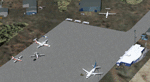
Kuujjuaq is in northern Quebec, Canada. At the southern end of Ungava Bay, and 30 miles up the Koksoak River. it was previously called Fort Chimo. Kuujjuaq is considered the capital of Nunavik, a well known northern caribou hunters and a large base of Air Inuit relay.
The scenery includes:
- The airport and its major buildings and objects,
- Weather radar on a hill northeast of the airport,
- The Zelada Desgagnes stranded facing the village and Sedna Desgagnes traveling between Kuujjuaq and the Ungava Bay,
- Large boats moving on the Koksoak River, near the island Koksoak,
- Hydrobase Stewart Lake, 2.3 miles north of the airport,
- A hunting camp (with caribou!), A geological camp and fishing camp (with cabins, tents and canoes).
| Filename: | Kuujjuaq_CYVP__v2.zip |
| License: | Freeware, limited distribution |
| Added: | 12th March 2014, 09:23:10 |
| Downloads: | 2,108 |
| Author: | Jean-Pierre Fillion, Pierre Gallant |
| Size: | 7.04 MB |
| Category: Flight Simulator 2004 - Scenery | |
| Laguna del Sauce Airport, Punta del Este (SULS), Uruguay |
|
Images related to this file:
File Description:
Photorealistic scenery of Laguna del Sauce / Curbelo (SULS) International Airport in Maldonado, Uruguay, version 1. This is the airport that serves the well-known beach resort of Punta del Este. This scenery package includes the airport facilities with the passenger terminal, general aviation area and the naval airbase on the banks of Laguna del Sauce lake. Several buildings and vehicles belonging to the airport have been recreated. Also included is the area around the airport recreated as photorealistic terrain with seasonal variations at a 4. 75 m/pixel resolution. Certain parts of the airport have been recreated with a 2 m/pixel photorealistic terrain. The aim of this scenery is to simulate flying to and around the airport under instrument flight rules (IFR) and also visual flight rules (VFR).
| Filename: | Laguna_del_Sauce_Airport_Punta_del_Este_SULS_Urugu.zip |
| License: | Freeware |
| Added: | 9th June 2010, 02:48:12 |
| Downloads: | 1,471 |
| Author: | "A Vuelo de Pajaro" / "As the Bird Flies" Design Group members: Diego Altgenug, Daniel Gazzano, Alan Pereira Pierce, Juan Pablo Simonet |
| Size: | 13.81 MB |
| Category: Flight Simulator 2004 - Scenery | |
| Leadville (KLXV), Mt. Elbert, Colorado, Photo-Scenery (FS9 & FSX) |
|
Images related to this file:
File Description:
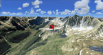
Extends my Aspen scenery to the east and contains more gorgeous Continental Divide area of the Rocky Mountains. Covers Leadville Lake County Airport (KLXV), which is the highest airport in North America (9.927 ft) and Mt. Elbert, which is the highest peak in the Rocky Mountains (14.443 ft). Aircraft performance deteriorates
with altitude, so many companies use the Leadville Airport as a base for high altitude performance testing. This scenery brings you another 3.500 sq km of beautiful Colorado in 4.7m/pix quality.
High resolution versions of this scenery for FS9 and FSX (much sharper, but larger and multiple downloads) are available at www.blueskyscenery.com/GNB_South2West.html . The screenies are taken from the high-res versions, so expect this version to be slightly more blurry. YourDonation@Work: Dedicated to Daniel, Art and Rotui.
| Filename: | Leadville_KLXV_Mt_Elbert_Colorado_PhotoScenery_FS9.zip |
| License: | Freeware |
| Added: | 1st February 2010, 19:06:58 |
| Downloads: | 1,709 |
| Author: | Gottfried Razek - blueskyscenery.com |
| Size: | 94.68 MB |
| Category: Flight Simulator 2004 - Scenery | |
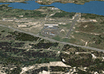
| Toronto Downtown Airport CYTZ Ontario, Canada |
|
Images related to this file:
File Description:
CYTZ is on an island in Lake Ontario and immediately adjacent to downtown Toronto. This updates the version made by Flight Ontario as there have been major changes since Porter Airlines purchased the airport. The obvious and main new item is the terminal, made with photo textures and with ten gates sized to accomodate the Dash 8-400 they currently use. The terminal has a passenger entrance and a vehicle setdown point as part of the link to the ferry terminal that wraps around the west side of the original and preserved terminal building. The ferry terminal is included here, along with a ferry. Also new are the car parking, road routing, gate and taxi markings, taxiways, taxiway signage, taxiway lighting, runway lighting, aprons, apron lighting (from Sid Schwartz and you will need to install his "lights_ss_v2"), fences, fuel tanks, tanker trucks, access roads to navigation equipment, ai parking, static parked planes, parked cars, apron equipment, and the useable floatplane ramp. The AI includes Porter, Jazz, several GA aircraft, and a helicopter. Only 3 of these require downloads. The Lake Ontario AI includes three large ships, typical of the traffic to be seen on all the Great Lakes. CYTZ has three runways and there is an airport diagram included. 08-26 has ILS and is the only runway actually long enough to be used by Porter; FS9 atc will ignore this. There is fuel available and it is dispensed from a truck. The longer projection from the front of the terminal building is a covered ramp that leads up from the terminal basement level, used by towed luggage trolleys. The gates are not powered in any way except for the weather cover that protects passengers as they cross the small area of asphalt between plane and gate. I did not try to reproduce this in FS9.
| Filename: | Toronto_Downtown_Airport_CYTZ_Ontario_Canada.zip |
| License: | Freeware, limited distribution |
| Added: | 23rd October 2012, 12:52:14 |
| Downloads: | 1,806 |
| Author: | Roger Wensley + Flight Ontario |
| Size: | 12.43 MB |
| Category: Flight Simulator 2004 - Scenery | |
| Puntzi Mountain CYPU in British Columbia Canada |
|
Images related to this file:
File Description:
Puntzi Mountain is near a village called Chilanko Forks, approximately midway between Bella Coola and Williams Lake and just north of the Chilcotin to Bella Coola Highway. It is what remains of a military base and which currently shows in FS9 as a town, reduced in my scenery version to what remains after the base was closed and cleared. All that remains of the base is now the runway, over 6,000 feet of asphalt aligned 04-22, unlit, at 2,985 feet above sea level, and with centre line markings that are almost invisible. The runway is used in the summer for whatever local fire-fighting operations are needed by ConAir and there are some buildings and fuel tanks for this. It is also used for local flights such as those for a lodge on Puntzi Lake to the north. I have added three AT-802 textures with additional tail numbers for use in the AI. These are to be added to an aircraft that you very likely already have and which was included in Don Grovestine's posting of Abbotsford CYXX. I have also included the revised config file that adds the planes to Don's original; save the original config under another name and replace it with mine. Put the three new texture folders in with the original, which is called "CYXX-AI_Air Tractor AT-802 (Wheels)". If you do not have Don's scenery I suggest you get it, as his work is worth having and like Greg Putz he puts in a lot more effort than I do. The L188 Electra should already be with you if you downloaded my Smithers CYYD scenery. If you find a defect, email me.
| Filename: | Puntzi_Mountain_CYPU_in_British_Columbia_Canada.zip |
| License: | Freeware, limited distribution |
| Added: | 20th November 2020, 05:33:01 |
| Downloads: | 171 |
| Author: | Roger Wensley |
| Size: | 10.33 MB |
© 2001-2026 AVSIM Online
All Rights Reserved
Privacy Policy |