
Where Flight Simulation Enthusiasts Gather from Around the World!
AVSIM Library - Search Results

| Category: Flight Simulator 2004 - Scenery | |
| Canada - British Columbia - Bowron Lake Prov.Park Scenery Update v1.1 |

|
File Description:
Updates V1.0 to v1.1 by adding waterfalls and river rapids in the Cariboo and Isaac Rivers and adds a landclass fix. Designed to compliment UT Canada/Alaska and FSGenesis Cordillera or other 38.2 meter mesh (LOD10) such as Raimondo Taburet freeware mesh for BC. Patches for UT Canada have yet to repair this areas rivers. Located in central BC, Bowron Lake is a world famous canoeing circuit. This scenery fixes two major sections of the Cariboo River that are missing from UT Canada. Includes scenery files, effects, park documents and screenshots.
| Filename: | Canada__British_Columbia__Bowron_Lake_ProvPark_Sce.zip |
| License: | Freeware, limited distribution |
| Added: | 12th October 2005, 09:12:13 |
| Downloads: | 1,866 |
| Author: | Bryan Wallis |
| Size: | 7.91 MB |
| Category: Navigation and ATC - Navigation | |
| Lake Huron Chart Chunks Optimized For Moving Map Application |
|
File Description:
Sectional chart chunks made from the August 2009 Sectional charts at the original scale, formatted in the WGS84 lat/lon geographic coordinate system for GPS, moving map application for flight simulation use.
These chart chunks were converted to the JPEG format for compatibility and size. Coverage is the full Sectional area North and South divided into 8 JPEG tiles. They are about 3k x 3k pixels at 2.5mb with coverage of 90nm x 130nm per tile. Included is also the projection files and world files.
Note: This type of map is a equal grid and no further calibration is needed, only the two points referenced in the world file. Example: for users of FSM Moving Map, just mass import, done.
| Filename: | Lake_Huron_Chart_Chunks_Optimized_For_Moving_Map_A.zip |
| License: | Freeware |
| Added: | 20th February 2010, 22:08:53 |
| Downloads: | 129 |
| Author: | David Myers |
| Size: | 20.82 MB |
| Category: Navigation and ATC - Navigation | |
| Salt Lake City Sectional Chart Chunks for Aerosoft's FSMap |
|
File Description:
Sectional chart chunks made from the August 2009 Sectional charts at the original scale, formatted in the WGS84 lat/long geographic coordinate system for the FSMap, moving map application for flight simulation use. The chart chunks are the full sectional divided by 2 tiles (east/west) and converted to baseline 8bit tiffs with packbits compression applied. The images average 6,000x6,000 pixels at about 25mb each, also included is the FSMap fsm Calibration file for importing. No further calibration is needed, just import, save, and enjoy.
| Filename: | Salt_Lake_City_Sectional_Chart_Chunks_for_Aerosoft.zip |
| License: | Freeware |
| Added: | 24th March 2010, 19:42:31 |
| Downloads: | 378 |
| Author: | David Myers |
| Size: | 34.73 MB |
| Category: Flight Simulator 2004 - Scenery | |
| CYDF Deer Lake Regional Airport for Newfoundland & Labrador FS9 |
|
Images related to this file:
File Description:
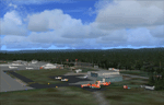
This scenery is a very accurate freeware version of Deer Lake Regional airport and sorounding area, on the west coast of the island of Newfoundland.
Designed to suit a variaty of computers, there is a setup for everyone.
There is something here for Heli, Bush, Low and slow right up to the IFR hight in the sky fliers.
Two solid years went into this scenery to try to capture as much detail as possible.
I really hope you enjoy it as much as Flight Ontario enjoyed working on it.
| Filename: | CYDF_Deer_Lake_Regional_Airport_for_Newfoundland__.zip |
| License: | Freeware |
| Added: | 2nd May 2010, 02:07:39 |
| Downloads: | 1,935 |
| Author: | Al Sibley Flight Ontario |
| Size: | 89.8 MB |
| Category: Flight Simulator 2004 - Scenery | |
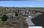
| Chignik Lake A79 and Port Heiden PAPH - Alaska, USA |
|
Images related to this file:
File Description:
These are two villages in Alaska, in the peninsula that is the start of the Aleutians. Both are east of Perryville, Chignik Lake by 30 miles on the south side of the peninsula and Port Heiden by 75 miles on the north coast. Both are served by Grant Aviation government-subsidised regional flights from King Salmon. Chignik Lake has a population of around 70. There are two buildings on the airfield, but passengers still wait in their car for the plane to arrive as there is no terminal building as such. The runway is 3,300 feet of gravel aligned 08-26, as are so many in this area. Port Heiden is on the north shore of the peninsula, and the population is around 100. FS9 showed the town as being large enough to house 10,000; the new landclass here reduces this to the actual 40 or so houses, one and a half miles south of the airport. The roads are still the FS9 originals, which are approximately in the right place but are brightly lit at night as I was too lazy. The main occupation is fishing. There are buildings on the airfield (mostly old, except for a garage building) but passengers again wait in their cars for the plane to arrive. The two runways are both gravel, and are 05-23 of 6,200 feet, and 13-31 of 4,400 feet.
| Filename: | Chignik_Lake_A79_and_Port_Heiden_PAPH__Alaska_USA.zip |
| License: | Freeware, limited distribution |
| Added: | 30th March 2015, 20:28:47 |
| Downloads: | 291 |
| Author: | Roger Wensley |
| Size: | 5.1 MB |
| Category: Flight Simulator 2004 - Scenery | |
| Road 7 farm strip near Lake Ontario in Canada |
|
File Description:
Road 7 farm strip is some 15 miles east of Oshawa and 7 miles north of Lake Ontario, and as its name suggests it is next to county road 7. Just one of the hundreds that are waiting to be included into FS; if only there was more time in the day!
| Filename: | Road_7_farm_strip_near_Lake_Ontario_in_Canada.zip |
| License: | Freeware |
| Added: | 2nd August 2007, 00:31:13 |
| Downloads: | 433 |
| Author: | Roger Wensley and Jim Turner |
| Size: | 474.82 KB |
| Category: Flight Simulator X - Scenery | |
| KSLC - Salt Lake City Intl Airport 2020, Utah, USA |
|
Images related to this file:
File Description:
I have been asked many times could i do an update for SLC, knowing there were going to be major changes there I held off until now when someone sent me a plan for the new terminal layout and its taxiways, so here is my interpretation of what it may look like in 2020.
This is a version of Salt Lake City Intl Airport with two optional files and made only for FSX, do not use in P3D: There is one version with the Crosswind runway 14/32 operating where all 4 runways will be used for takeoff/landing and one version as the default airport runway operation, The new south terminal A and north concourse B have been designed similar to the plan i have, i also had to take a guess at which airlines will park where so may not be accurate on opening day, as a Delta hub they are only assigned to terminal A, most other airlines are assigned to the north concourse B, transient parking is retained in the same place, the north cargo ramp and buildings updated, runway 17/35 is now parallel with 16L/34R which is also part of the upgrade plan, and the approaches for it aligned with the new position, all other approaches and frequencies updated to the latest charts where needed, extra fuel trucks, Helipads/start locations now in their correct positions, De-icing pads added, support vehicle roads rebuilt and many other scenery improvements and objects added, airport views are from the roof of the control tower (when in tower view) please view the readme before installation,
| Filename: | KSLC__Salt_Lake_City_Intl_Airport_2020_Utah_USA.zip |
| License: | Freeware, limited distribution |
| Added: | 6th March 2018, 04:23:35 |
| Downloads: | 44,414 |
| Author: | Ray Smith |
| Size: | 4.91 MB |
| Category: Flight Simulator X - Aircraft Repaints, Textures and Modifications | |
| Skywagon C185, "Call of the Wild", Big Lake, Alaska |
|
Images related to this file:
File Description:
This is a repaint of the Carenado's excellent C185B/F Skywagon. These textures represent a Skywagon B wheeled variant and a Skywagon F amphibian variant. THESE ARE TEXTURES ONLY! You need Carenado's payware package
| Filename: | Skywagon_C185__Call_of_the_Wild__Big_Lake_Alaska.zip |
| License: | Freeware, limited distribution |
| Added: | 28th April 2010, 13:55:47 |
| Downloads: | 728 |
| Author: | Russel R. Smith, Carenado |
| Size: | 18.83 MB |
| Category: Flight Simulator 2004 - Miscellaneous Files | |
| The Fleet of VFR of Lario - Como Lake, Italy |
|
Images related to this file:
File Description:

First release of Navigazione Lago di Como "navigable fleet", including 14 boats: three old Steamers as Concordia, Plinio and Bisbino (the last two for their memory), two light Motorboats as Giglio and Ninfea, three heavy Motorboats as Manzoni, Volta, Orione, two Hydrofoils as Marconi and Freccia delle Valli, three Catamarans as Citta di Como, Citta di Lecco and Tivano, one Ferry as Adda.
All the above vessels are GMax made, already included in the sceneries of VFR on Lario project in static way, but those new ones are fully "flyable" on the lake surface. Enjoy your sailing on Como's lake!
Check videos available here: http://youtu.be/6OR1mpdk2DU
http://youtu.be/v3AB6OCAeSY
http://youtu.be/cbM8CNTPCEE
| Filename: | The_Fleet_of_VFR_of_Lario__Como_Lake_Italy.zip |
| License: | Freeware |
| Added: | 31st January 2014, 12:21:56 |
| Downloads: | 577 |
| Author: | Aldo Della Vedova, Daniele Lanfranchi, Gian Mario Verga |
| Size: | 29.8 MB |
| Category: Flight Simulator 2004 - Scenery | |
| Kogd-Ogden,Utah |
|
Images related to this file:
File Description:
KOGD-Ogden,Ut Take your sailboat to the Great Salt Lake inland sea or hike the many mountains and enjoy the vistas offered atop the lofty peaks. Visit the quiet mountain valley town of Eden to the east of KOGD with its annual balloon festival and summer fun on Pineview dam or spend the day shopping the shops of Brigham City to the north or Salt Lake City to the south. Fly over the Great Salt Lake to the west. See the Ogden airport come alive with this must have add-on. With the help of Google Earth and FS Earth I have recreated the Ogden airport, with its new taxiway A (from a site visit), and the surrounding cities and towns to look as real as possible. Made with Ultimate Terrain, but the airport should be ok with default FS9. (No guarantee though ;-) The scenery enhancements were made with Ultimate Terrain in place. I modified the landclass to look more like the real thing. The airport is very close to a exact replica of KOGD! The crane by the tower was there when I took the pictures so I included it.
| Filename: | KogdOgdenUtah.zip |
| License: | Freeware |
| Added: | 15th December 2009, 00:45:07 |
| Downloads: | 725 |
| Author: | Alan C. Heiner |
| Size: | 15.59 MB |
© 2001-2026 AVSIM Online
All Rights Reserved
Privacy Policy |