
Where Flight Simulation Enthusiasts Gather from Around the World!
AVSIM Library - Search Results

| Category: Flight Simulator X - Aircraft Repaints, Textures and Modifications | |
| WASP PT-17 Stearman (N59293) |

|
Images related to this file:
File Description:
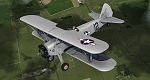
This is a repaint only, for the payware Vertigo Studios Stearman Vol.1 set. This repaint depicts the restored Stearman PT-17 N59293, owned/operated by Andrew and Mike Porter, based at Spring Lake, New Jersey. The aircraft was manufactured as USAAF 41-25714 and was used continually from June 1942 until June 1945. During WWII the aircraft had multiple assignments, one of which included Avenger Field in Sweetwater, Texas, home of the WASP (Women's Airforce Service Pilots), where it was based from February 1943 until August 1944. Sold surplus after the war, the aircraft was used as a crop duster in New Mexico all the way until 1981. Starting in 2006, the aircraft was restored to factory-original award-winning condition, and painted in the same markings it wore while stationed at Avenger Field, flying as a tribute to all of the WASP pilots. (In one of the aircraft's other WWII training assignments, Donald Strait flew this aircraft during flight training and would go on to become a double-ace flying P-51's with the 361st Fighter Squadron).
| Filename: | WASP_PT17_Stearman_N59293.zip |
| License: | Freeware |
| Added: | 22nd January 2017, 04:09:36 |
| Downloads: | 161 |
| Author: | John Terrell |
| Size: | 24.37 MB |
| Category: Civil Flight Simulators - Looking Glass Flight Unlimited 3 | |
| Channel Islands (add on region) |
|
File Description:
This is a kit to build a new region for the Flight Unlimited 3 game. You have just to move the /channel folder into the /region folder of the game but
the /maps folder has just the blank water tiles and no texture maps due to copyright restrictions. You will have to download the maps by yourself using Maps2BGL and building the tiles using the included automated script. The region includes Jersey, Guernsey and Alderney with 3 prepared airports.
No building or trees are placed, this is left to you and I hope to see a package uploaded at avsim a bit later. To fly in the Channel region you must use a copy of FU3 without the Seattle region or temporarily move the /Seattle folder out of the game (not delete, just move !!!)
This kit also demonstrate how to build a minimal region (8x8 tiles, 131kmx131km. You must learn to handle Maps2BGL to finish the Channel region installation.
A fast Internet connection is needed to download the maps also.
Tool references:
maps2bgl.zip (DLID=120356)
maps2bgl__how_to_.zip (DLID=121257)
| Filename: | Channel_Islands_add_on_region.zip |
| License: | Freeware, limited distribution |
| Added: | 22nd May 2008, 11:31:31 |
| Downloads: | 257 |
| Author: | André Meystre |
| Size: | 22.91 MB |
| Category: Flight Simulator X - Scenery | |
| KMKG - Muskegon Country Airport - Muskegon, Michigan (Photoreal) Version 1.1 |
|
Images related to this file:
File Description:

Version 1.1 (corrected ILS & terminal Jetways)
This is a total reworking of KMKG - Muskegon County Airport in Muskegon, Michigan - USA.
Photo scenery includes two seasonal photo real ground textures (winter included) covering the airport and on the south side of the airport. New buildings include a custom Terminal & Parking lot, FBO (Executive Air Trainsport), Control Tower, Terminal Shed, and Hanger for West Michigan Flying Club. All new buildings have night textures. Runway 32/14 has been lengthened to the current real world length & the old Runway 36/18 has been closed and turned into a taxiway.Various other changes include taxiway/sign modifications and autogen changes.
This has been tested on FSX as well as P3d 2.2. Both work. The only difference is in P3d the night lighting will not "cover" the tarmac like in FSX.
Special thanks goes out to Jim Dhaenens and allowing me to use his lighting objects. All other custom items where made by myself using google sketchup.
| Filename: | KMKG__Muskegon_Country_Airport__Muskegon_Michigan_.zip |
| License: | Freeware |
| Added: | 18th August 2014, 21:16:41 |
| Downloads: | 2,400 |
| Author: | Matt Wohlford |
| Size: | 205.06 MB |
| Category: Flight Simulator 2004 - Scenery | |
| High-resolution 76-m (LOD9) Terrain Mesh and Scenery Enhancements for the Southern Canadian Rockies |
|
File Description:
Not simply an add-on mesh, these files include many scenery enhancements for the southern Rockies of British Columbia and Alberta. Coverage extends from Cranbrook to Calgary, and Hinton to Edmonton (N48.9-53.4 W112.3-116.3). The mesh source data are 3-arcsec (~90-m) Shuttle Radar (SRTM) files, compiled at LOD9 (76-m) resolution. All lake elevations (!) have been adjusted to eliminate the problems with the default lake data and to better fit the new terrain mesh. In addition, the Transcanada Highway/Icefields Parkway corridor in Banff National Park, from Canmore to the Hwy 11 junction, has been completely re-made, with dozens of alpine lakes (including Lake Louise, Moraine Lake, and Lake O'Hara), accurate transportation network, and landclass/waterclass updates based on satellite imagery. Due to significant changes in FS2004 to vector layering and autogen features, the special scenery enhancements cannot be used with FS2002. However, terrain mesh, lake corrections and landclass replacements will work well in FS2002.
| Filename: | Highresolution_76m_LOD9_Terrain_Mesh_and_Scenery_E.zip |
| License: | Freeware, limited distribution |
| Added: | 29th October 2003, 03:01:22 |
| Downloads: | 15,468 |
| Author: | Holger Sandmann |
| Size: | 21.81 MB |
| Category: Flight Simulator X - Scenery | |
| LFAW - Villerupt-Errouville |
|
Images related to this file:
File Description:
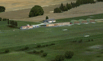
This scenery represents the field of Villerupt-Errouville LFAW where the flying club is based "Nord Lorraine" located in the north of the department 54 a few kilometers from Belgium and Luxembourg borders and the model aircraft club. The buildings have been modeled in GMAX, static devices are also present. Finally the autogen was placed on the same perimeter as the slab photo realistic.
********************************
Cette scene represente le terrain de Villerupt-Errouville LFAW qui est base l'aeroclub Nord Lorraine situe dans le nord du departement 54 a quelques kilometres de la Belgique et du Luxembourg ainsi qu'un club d'aeromodelisme et parachutisme.
L'ensemble des batiments ont ete modelises sous GMAX, des appareils statiques sont egalement presents.
Une dalle photo realiste a ete inseree mais je vous conseille de continuer le sol photo avec des logiciels comme fsEarthTile.
Enfin de l'autogen a ete place sur le meme perimetre que la dalle photo realiste.
| Filename: | LFAW__VilleruptErrouville.zip |
| License: | Freeware, limited distribution |
| Added: | 3rd January 2012, 11:24:06 |
| Downloads: | 1,863 |
| Author: | Alexandre Remy FAF010 |
| Size: | 17.72 MB |
| Category: Flight Simulator 2004 - Scenery | |
| Rome Fiumicino Area 2013 |
|
Images related to this file:
File Description:
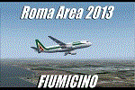
Dear Friends simmer, as always taking advantage of the beautiful objects bgl Gianluca Giovannini, I tried to improve with a symmetric pairing of autogen trees / towns / industrial buildings and grass in 3-D, the urban area near the Intercontinental Airport in Rome Fiumicino in the amazing scenery by the ISD project. "With the current integration I have created the town of Fiumicino located on the south west of the airport.The scenery is based videos of real landing and satellite photos availables on the web.
The purpose of visualization tasks is an overall improvement of the work of Leonardo da Vinci airport . The scenery is designed only for ISD project (even better with UTE by Flight one software), but i dont exclude that (which you should remove the file from the folder scenery the bgl Groups houses) or the more recent Payware published by Aerosoft. Most information inside the read me file. Best regards from Italy, Fafo !
| Filename: | Rome_Fiumicino_Area_2013.zip |
| License: | Freeware |
| Added: | 24th February 2013, 01:02:07 |
| Downloads: | 3,485 |
| Author: | Fabio Ferrari "fafo air" |
| Size: | 4.28 MB |
| Category: Flight Simulator X - AFCAD Files | |
| MZBZ - Philip S. W. Goldson International Airport / Belize City, Belize (v2.0) |
|
Images related to this file:
File Description:

This airport update was made with the latest version of ADE (Airport Design Editor) and made for FSX as a replacement for the stock (default) airport. I've made several changes to the airport which are listed below. All these enchancements are as close to the real airport as I can get with stock library objects. I've used satellite images, terminal photos and maps throughout the whole process so building locations are as accurate as possible. Happy landings in Belize, scuba diving heaven!
Features:
*Expanded parking apron
*Terminal building with parking for commercial aircraft
*Assigned parking for Maya Island Air flights
*Ramp extension construction
*Runway 7/25 expanded to 9,695ft
*Taxiway corrections
*Autogen exclusion for trees that occupy field in stock scenery (no other files needed)
*Palm trees and vegetation
*Airport hangars and static aircraft
*Airport vehicles and objects
*Parking lot with static vehicles
*Birds in proximity to airfield
(For more information on Endeavourai please visit our site at endeavourai.com or our forums at http://endeavourai.boards.net/)
| Filename: | MZBZ__Philip_S_W_Goldson_International_Airport__Be.zip |
| License: | Freeware |
| Added: | 21st August 2012, 23:13:12 |
| Downloads: | 1,174 |
| Author: | Jaison Diaz / Endeavour ai |
| Size: | 96.25 KB |
| Category: Flight Simulator X - AFCAD Files | |
| High Meadow Farms Airport (9NJ8), NJ |
|
File Description:
Located 02 miles SW of Hope, New Jersey on 88 acres of land, High Meadow Farms Airport is a private turf strip 1850' in length. Take notice that the traffic pattern for Runway 13 is Right while the pattern for Runway 31 is Left. There is no hard surface runway so have your terrain mesh set as high as possible. There is tie down space available next to the paved area by the other parked aircraft however there are no official services offered for transient aircraft. This is a great airport to depart from to see some nice hilly terrain in northern NJ, it is just a few miles from the Delaware River Water Gap.
Scenery constructed with use of satellite images/streetview/aerial photos - the author has not been there in person.
This scenery is meant to be used in conjunction with MegaScenery Earth New York 007. It is not required, but apron use is minimized to allow satellite scenery to show through as much as possible, and objects are placed based on the MSE textures - lack of it may make scenery look out of place.
| Filename: | High_Meadow_Farms_Airport_9NJ8_NJ.zip |
| License: | Freeware |
| Added: | 7th April 2011, 00:16:49 |
| Downloads: | 200 |
| Author: | Drew Sikora |
| Size: | 641 KB |
| Category: Flight Simulator X - AFCAD Files | |
| Weiss Farm Airport (JY24), NJ |
|
File Description:
Located 02 miles W of Allamuchy, New Jersey on 264 acres of land, Weiss Farm Airport is a private turf strip 1800' in length. The published width is 50' but you really have closer to 100' to play with. There are no services offered to transient aircraft but you can start parked next to the barn if you wish to taxi out to the runway. No hard surfaced runway is used to have your terrain mesh set as high as possible the start of Runway 23 is a bit slanted and bumpy so you may want to aim long on your approach. The airport is unlit so daytime VFR operations only are recommended.
Scenery constructed with use of satellite images/streetview/aerial photos - the author has not been there in person. This scenery is meant to be used in conjunction with MegaScenery Earth New York 007. It is not required, but apron use is minimized to allow satellite scenery to show through as much as possible, and objects are placed based on the MSE textures - lack of it may make scenery look out of place.
| Filename: | Weiss_Farm_Airport_JY24_NJ.zip |
| License: | Freeware |
| Added: | 21st April 2011, 10:09:59 |
| Downloads: | 192 |
| Author: | Drew Sikora |
| Size: | 593.91 KB |
| Category: Flight Simulator X - Aircraft Repaints, Textures and Modifications | |
| FSX/P3D/FS2004 Air Virginia Fairchild Metroliner II 1982 |
|
Images related to this file:
File Description:
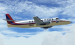
This is a repaint of the Fairchild Metroliner II in Air Virginia 1982 colors. The freeware Fairchild Metro III by Jon Murchison is needed for this repaint. Lynchburg based Air Virginia was formed by Rodney H. Jaeger in January 1979, and started operations with daily flights to Washington DC. They initially used Fairchild (Swearingen) Metro IIs, and Piper Navajo Chieftains. In 1981 they introduced the British Aerospace BAe 748-B2 to the fleet. 1983 saw them buy and merge Mid-South Airlines.
Their route network expanded to 17 destinations by 1984; Maryland, Virginia,New York, New Jersey, Ohio, North Carolina, Pennsylvania, and the District of Columbia. Later that year, the airline was purchased by Dimitri P. Nicholas. In 1985 they became a commuter partner of American Airlines, and inaugurated flights as the third member of the American Eagle commuter network. They changed their name to AV Air in November 1985, but by 1988 the airline ceased operations. This repaint depicts a Fairchild (Swearingen) SA226-TC Metro II of Air Virginia, which was delivered new to the airline in October 1980. Textures are 32bit bmp. This repaint was tested on FSX-SE. It should work on FSX, FS2004 & P3Dv1-3.
| Filename: | FSXP3DFS2004_Air_Virginia_Fairchild_Metroliner_II_.zip |
| License: | Freeware |
| Added: | 25th May 2019, 16:37:35 |
| Downloads: | 98 |
| Author: | Ted Giana |
| Size: | 2.01 MB |


© 2001-2026 AVSIM Online
All Rights Reserved
Privacy Policy |