
Where Flight Simulation Enthusiasts Gather from Around the World!
AVSIM Library - Search Results

| Category: Flight Simulator X - AFCAD Files | |
| Dave's Aerodrome Airport (7NJ9), NJ |

|
File Description:
Located 01 miles SW of Cedarville, New Jersey on 43 acres of land, Dave's Aerodrome Airport is a private turf field 2000' with a 600' displaced threshold on Runway 12. Each runway has a clear 20:1 approach slope, but in the case of Runway 12 be sure to aim for a landing past the hangar! There are power lines running along the road at the runway threshold that are not just there for decoration - come in too low and FSX will register a crash. In real life they have red balls on them - unfortunately I have no way of adding those in the sim at this time. So be on the lookout while on approach. Also take note that it is a right pattern for Runway 12 and a left pattern for Runway 30. The windsock is located next to the hangar and is not lit. There are no lights at this airport so daytime VFR operations only are suggested. No services are offered for transient aircraft. There is no hard-surfaced runway, you will be landing on bare terrain so set your mesh complexity slider as high as it will go for the best effect.
Scenery constructed with use of satellite images/streetview/aerial photos - the author has not been there in person.
This scenery is meant to be used in conjunction with MegaScenery Earth New Jersey/Delaware 005. It is not required, but apron use is minimized to allow satellite scenery to show through as much as possible, and objects are placed based on the MSE textures - lack of it may make scenery look out of place.
| Filename: | Daves_Aerodrome_Airport_7NJ9_NJ.zip |
| License: | Freeware |
| Added: | 16th February 2011, 15:36:42 |
| Downloads: | 211 |
| Author: | Drew Sikora |
| Size: | 1.02 MB |
| Category: Flight Simulator 2004 - AI Flight Plans | |
| Great Lakes ANG Part 2 Complete AI Package |
|
Images related to this file:
File Description:

Military AI Works is proud to bring you the Great Lakes ANG Part 2 Complete AI Package for FS2004. The second and last of a two part series, this package depicts the various Air National Guard and Air Force Reserve units currently operating out of states that border the Great Lakes of the United States. Part 2 features units stationed in the states of Pennsylvania, New York, New Jersey, Massachusetts, Rhode Island and Connecticut. Credits: Models by Henry Tomkiewicz, PAI, DJC AI, Rysiek Winawer, Charles Dayhuff, Dee Waldron and Nick Black, Repaints by Graham King and Mark Heimer, FDE/Effects by Mike MacIntyre, Steve Holland and Nick Needham, Flightplans by Desmond Burrell, AFCADs by Desmond Burrell, Matt Magner and Michael Wood and EVPs by Desmond Burrell, Mike Guenthner and Stewart Pearson
| Filename: | Great_Lakes_ANG_Part_2_Complete_AI_Package.zip |
| License: | Freeware, limited distribution |
| Added: | 4th January 2010, 02:19:00 |
| Downloads: | 1,440 |
| Author: | Desmond Burrell, Military AI Works (MAIW) |
| Size: | 26.46 MB |
| Category: Flight Simulator 2004 - Scenery | |
| Relief textures: 5.-Spring And Water |
|
File Description:
FS2004 Relief textures: world surface textures: SPRING & WATER
This is the logic extension to my prior work, the relief textures for the autogen and
airport buildings, that you can find in the file rlftxts1.zip.
Now I try to improve the 3D aspect and ·relief of the ground textures, and give
them a "bit of life"...
I believe that these new textures are more "immersive" than the default ones, but
this is only my opinion.
Again, judge by yourself...
The water textures are FULLY COMPATIBLE with the water reflections textures of Bill Lyon's and other authors.
There are 5 files projected:
1.-fall
2.-winter
3.-Heavy winter
4.-spring and water
5.-summer
| Filename: | Relief_textures_5Spring_And_Water.zip |
| License: | Freeware |
| Added: | 29th November 2003, 01:52:32 |
| Downloads: | 3,630 |
| Author: | Carlos Lorenz Benlloch |
| Size: | 19.07 MB |
| Category: Flight Simulator 2004 - Scenery | |
| O12 - Grand Lake St. Marys Seaplane Base - Ohio, USA |
|
Images related to this file:
File Description:
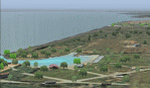
Grand Lake St. Marys Seaport O12 rests in Ohio's largest inland lake at Celina, Ohio. Float and soar plane enthusiasts will find thermals (several are placed within about a 60 mile radius) and plenty of docks or moors around the lake for your Amphib and afcads. Grand Lake St. Marys Seaport O12 scenery is made to blend with autogen scenery and default mesh. I used custom made objects & default objects. Grand_thermals.BGL is the troublesome file with winds aloft for sail planning thermals. Some people may want to remove it for smoother landing at one of the airports. Airports: Lakefield KCQA - Mulholland OI99 - Fortman 1OH4 and Grand Lake St Marys O12. I pulled this from my old archives.
| Filename: | O12__Grand_Lake_St_Marys_Seaplane_Base__Ohio_USA.zip |
| License: | Freeware |
| Added: | 11th July 2015, 11:22:45 |
| Downloads: | 242 |
| Author: | Rick Connolly |
| Size: | 13.53 MB |
| Category: Flight Simulator X - Scenery | |
| Archipelago of St-pierre & Miquelon (non-flat airport) |
|
File Description:
"The archipelago of St Pierre (LFVP) and Miquelon (LFVM)".
Theses islands are situated in the south of New Foundland island, beetwin Canada and United States.
All the archipelago is made up of a new local mesh, landclass, photorealists textures in 2m/pixel in St-Pierre island (4 seasons and the night) with specific autogen, the harbour, various buildings, churches, and reference marks
visual.
The airport of St-Pierre (LFVP) is created with a non-flat runway, as it
is in reality, whith a true lenght profil.
A basic mission named "De Miquelon à St Pierre" is placed at "beginner"
level for discover easely the archipelago.
This scenery is only for FsX and is not compatible with Fs 2004 (Fs9)."
| Filename: | Archipelago_of_Stpierre__Miquelon_nonflat_airport.zip |
| License: | Freeware, limited distribution |
| Added: | 4th July 2008, 16:11:23 |
| Downloads: | 3,939 |
| Author: | Marc-henri Guitteny |
| Size: | 17.41 MB |
| Category: Flight Simulator 2004 - Scenery | |
| Long Beach KLGB Version 4.0 (New Terminal Construction) |
|
Images related to this file:
File Description:

This is a transitional version of Long Beach Daugherty Field. A brand new terminal is currently under construction and due to open in 2013. This version of the scenery shows the terminal as built but not yet operational which reflects current operations as of November 2012. All parking stands have been moved from their original staggered locations to positions surrounding the new terminal complex. Airlines serving the airport have been updated, and other heavy modifications have also taken place. In addition, Signal Hill has been converted from the giant rock scenery object to a correct elevation change file. The hill now has autogen and proper positioning and elevation. A future update with the fully operational terminal will be forthcoming.
| Filename: | Long_Beach_KLGB_Version_40_New_Terminal_Constructi.zip |
| License: | Freeware |
| Added: | 28th October 2012, 12:58:03 |
| Downloads: | 2,632 |
| Author: | FRFStudio.net / William Morgan / Sheryar Ansari |
| Size: | 81.5 MB |
| Category: Flight Simulator 2004 - Scenery | |
| VFR of Lario, Area B2 - Como lake, Italy |
|
Images related to this file:
File Description:
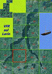
This is the fourth scenery of the "VFR of Lario" project, made with photorealistic terrain (multiseason & night) and with some 3D GMax realistic objects.
Information: Como's lake is in the north of Italy, closed to the Helvetic border. This third scenery covers approximately an area of 7.5x6 kmt, from Nesso/Erno (NW) to Barni (NE), and the ridge east of Monte Bolletto (SW) to Asso/Canzo (SE) and includes some details (GMax) of Pognana Lario NLC pier (fantasy), the A. Volta motorship with the Hydrofoil G. Marconi (both animated). GMax objects as above and other buildings, minor piers and boats together with autogen buildings and trees are fully spreaded on the scenery.
| Filename: | VFR_of_Lario_Area_B2__Como_lake_Italy.zip |
| License: | Freeware |
| Added: | 13th March 2012, 22:06:00 |
| Downloads: | 1,769 |
| Author: | Della Vedova Aldo, Daniele Lanfranchi, Gian Mario Verga, Diego Caligiuri |
| Size: | 11.09 MB |
| Category: Flight Simulator 2004 - Scenery | |
| Milano Linate Refresh 2017 |
|
Images related to this file:
File Description:

Hello guys, I proceed with my work retexturizzazione the legendary scenery isd Milan Linate done by ISD.
Basically I worked to make it less "cartoon" the old texture of the airport making it much more plausible real photos the colors of the airport.
To install it is sufficient to copy the texture folder of your Linate isd new textures. (I recommend making back up first).
To complete the work I recommend to install in addition to the original scenario, even my "Linate area" 2013 always available on AVSIM.
It goes without saying that I recommend for the best performance to have autogen to massimo.Ps (not a job of AFCAD but only graphic)
VIVA FS2004! VIVA ITALY
| Filename: | Milano_Linate_Refresh_2017.zip |
| License: | Freeware |
| Added: | 9th March 2017, 04:49:28 |
| Downloads: | 1,956 |
| Author: | fabio ferrari |
| Size: | 7.89 MB |
| Category: Flight Simulator X - AFCAD Files | |
| Ekdahl Airport (NJ59), NJ |
|
File Description:
Located 04 miles S of Freehold, New Jersey, Ekdahl Airport is a private turf strip 1300' in length bordered closely by trees. This makes for an interesting landing as the 90' width of the runway is all the room you have to play with. However because it can be difficult to gauge your distance to trees and also because even the slightest brush with a tree can cause a crash, all trees immediately adjacent to the runway have crash disabled - mainly so you can turn your plane around if you land on Runway 02. The hard surface runway was removed so make sure your terrain mesh complexity is set as high as possible to get that bumpy ground realism. A windsock is listed as being available on this field but I could not locate it in any imagery and so placed it by default near the hangar building. You can start on the runways or parked in front of the hangar. Make sure your plane is capable of these take off and landing distances! Tree height around the field was not listed so I again used my best judgement from studying aerial photos. There is no fuel or parking for transient aircraft available. The field is not lit - daytime VFR operations only are recommended.
Scenery constructed with use of satellite images/streetview/aerial photos - the author has not been there in person.
This scenery is meant to be used in conjunction with MegaScenery Earth New Jersey/Delaware 002. It is not required, but apron use is minimized to allow satellite scenery to show through as much as possible, and objects are placed based on the MSE textures - lack of it may make scenery look out of place.
| Filename: | Ekdahl_Airport_NJ59_NJ.zip |
| License: | Freeware |
| Added: | 13th August 2011, 16:53:55 |
| Downloads: | 172 |
| Author: | Drew Sikora |
| Size: | 550.03 KB |
| Category: Flight Simulator X - AFCAD Files | |
| Peters Airport (4NJ8), NJ v1.1 |
|
File Description:
Located 05 miles W of Somerville, New Jersey on 70 acres of land, Peters Airport is a private turf strip that will test your short field skills to the max. The published runway dimensions for this strip are 1700x200 feet, and for the most case this is fairly accurate - however at the ends of both runways you have tree obstacles to overcome so this can shorten the amount of usable runway significantly, although the tree obstacles are no higher than 12-14m. There is no hardened runway surface so you will be landing/taking off on terrain. Depending on how high your mesh resolution is, this can be a significant factor, as Runway 31 is mainly uphill enough that you will need to power up with parking brakes on if you want to make it in the air. Runway 13 is the best since you are going downhill and the trees at the end are fewer and smaller. Pay close attention to the pattern! Runway 13 is Left and Runway 31 is Right - this airport is within 2 miles of Solberg-Hunterdon (N51) and you don't want to get in the way of that field's traffic! The runway is not lit, so daytime VFR operations only. There are no services at this strip for transient aircraft.
Scenery constructed with use of satellite images/streetview/aerial photos - the author has not been there in person.
This scenery is meant to be used in conjunction with MegaScenery Earth New Jersey/Delaware 001. It is not required, but apron use is minimized to allow satellite scenery to show through as much as possible, and objects are placed based on the MSE textures - lack of it may make scenery look out of place.
| Filename: | Peters_Airport_4NJ8_NJ_v11.zip |
| License: | Freeware |
| Added: | 20th September 2011, 14:08:43 |
| Downloads: | 405 |
| Author: | Drew Sikora |
| Size: | 461.03 KB |


© 2001-2026 AVSIM Online
All Rights Reserved
Privacy Policy |