
Where Flight Simulation Enthusiasts Gather from Around the World!
AVSIM Library - Search Results

| Category: Flight Simulator 2004 - Sounds | |
| Suvarnabhumi Airport ICAO SUVARNABHUMI |

|
Images related to this file:
File Description:

FS2004/FSX EditVoicepack ICAO file for Suvarnabhumi Airport, VTBS/BKK, Thailand. This is part of our 1st round of EditVoicepack files (see aig_tower_release_1.zip). Our goal is to provide accurate ATC calls in order to provide Microsoft Flight Simulator traffic with quality ATC. These sounds are the best that we have been able to compile and are accurate as of release date and to the extent that our data and the limitations of the EditVoicepack allow. Visit us at www.alpha-india.net for more information.
| Filename: | Suvarnabhumi_Airport_ICAO_SUVARNABHUMI.zip |
| License: | Freeware |
| Added: | 4th December 2010, 14:49:04 |
| Downloads: | 1,305 |
| Author: | Bruce Nicholson & Alpha India Group |
| Size: | 2.56 KB |
| Category: Flight Simulator 2004 - AFCAD Files | |
| HSDN Dongola Airport, Sudan |
|
File Description:
Hi every one, this is my AFCAD project for Dongola airport in SUDAN , I used the satellite
photos in designing, I hope you like it.
Dongola Airport (IATA: DOG, ICAO: HSDN) serves Dongola, the capital city of the Northern state in Sudan.
| Filename: | HSDN_Dongola_Airport_Sudan.zip |
| License: | Freeware |
| Added: | 5th December 2010, 10:32:35 |
| Downloads: | 265 |
| Author: | Hosam Gubara |
| Size: | 241.46 KB |
| Category: Flight Simulator X - Scenery | |
| KIGQ - Lansing Municipal Airport |
|
Images related to this file:
File Description:
This airport replaces the default Lansing Municipal Airport (KIGQ) in FSX in Lansing, IL. Multiple taxiways have been corrected including the lengthening of the taxiway along runway 36-18. Papi lights have been added to all runways and runway markings have been corrected.
| Filename: | KIGQ__Lansing_Municipal_Airport.zip |
| License: | Freeware |
| Added: | 10th December 2010, 02:34:03 |
| Downloads: | 500 |
| Author: | Gregory Van Den Ham |
| Size: | 152.71 KB |
| Category: Flight Simulator 2004 - Sounds | |
| Muskoka Airport ICAO CYQA |
|
Images related to this file:
File Description:

FS2004/FSX EditVoicepack ICAO file for Muskoka Airport, CYQA/YQA, Canada. This is part of our 2nd round of EditVoicepack files (see aig_tower_release_2.zip). Our goal is to provide accurate ATC calls in order to provide Microsoft Flight Simulator traffic with quality ATC. These sounds are the best that we have been able to compile and are accurate as of release date and to the extent that our data and the limitations of the EditVoicepack allow. Visit us at www.alpha-india.net for more information.
| Filename: | Muskoka_Airport_ICAO_CYQA.zip |
| License: | Freeware, limited distribution |
| Added: | 2nd January 2011, 17:02:10 |
| Downloads: | 156 |
| Author: | Bruce Nicholson & Alpha India Group |
| Size: | 2.39 KB |
| Category: Flight Simulator 2004 - Sounds | |
| Kobe Airport ICAO RJBE |
|
Images related to this file:
File Description:

FS2004/FSX EditVoicepack ICAO file for Kobe Airport, RJBE/UKB, Japan. Uses the Japanese pronunciation. This is part of our 2nd round of EditVoicepack files (see aig_tower_release_2.zip). Our goal is to provide accurate ATC calls in order to provide Microsoft Flight Simulator traffic with quality ATC. These sounds are the best that we have been able to compile and are accurate as of release date and to the extent that our data and the limitations of the EditVoicepack allow. Visit us at www.alpha-india.net for more information.
| Filename: | Kobe_Airport_ICAO_RJBE.zip |
| License: | Freeware, limited distribution |
| Added: | 2nd January 2011, 17:02:34 |
| Downloads: | 480 |
| Author: | Bruce Nicholson & Alpha India Group |
| Size: | 2.38 KB |
| Category: Flight Simulator 2004 - Scenery | |
| Matanza airport (SADZ), Argentina |
|
Images related to this file:
File Description:
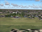
Simple scenery of small aeroclub airport located near Buenos Aires. Based on real photographs and satellite map view.
| Filename: | Matanza_airport_SADZ_Argentina.zip |
| License: | Freeware |
| Added: | 9th January 2011, 19:26:45 |
| Downloads: | 265 |
| Author: | Martin Hrabeta |
| Size: | 1 MB |
| Category: Flight Simulator X - AFCAD Files | |
| Vliet Airport (6NJ1), NJ |
|
File Description:
Located 02 miles SE of Washington, New Jersey, Vliet Airport is a private turf field. Trees border the runway on three sides, and a dirt mound and semi-truck are also obstacles to watch out for at the end of Runway 06 if you land long. At 1300' feet, it is a very short runway so make sure you check the capabilities of your aircraft before attempting to either land or take off here! Don't forget that in order to clear trees, usable runway space is closer to only 1000'. This airport has no lighting so daytime VFR operations only are recommended. Take note that there is also no wind sock, so be sure you are aware of the weather conditions prior to arriving/departing. There is also no hard-surfaced runway and you will be landing on terrain so it's suggested you have your mesh resolution slider as high as possible.
Scenery constructed with use of satellite images/streetview/aerial photos - the author has not been there in person.
This scenery is meant to be used in conjunction with MegaScenery Earth New York 007. It is not required, but apron use is minimized to allow satellite scenery to show through as much as possible, and objects are placed based on the MSE textures - lack of it may make scenery look out of place.
| Filename: | Vliet_Airport_6NJ1_NJ.zip |
| License: | Freeware |
| Added: | 8th February 2011, 23:20:47 |
| Downloads: | 182 |
| Author: | Drew Sikora |
| Size: | 375.28 KB |
| Category: Flight Simulator X - AFCAD Files | |
| Parker Airport (70NJ), NJ |
|
File Description:
Located 02 miles S of Asbury, New Jersey on 13 acres of land, Parker Airport is a private turf strip located on residential property. This airport is challenging in many ways. For one, when approaching from the southeast the airport is located immediately after a tall ridge, so when topping this ridge at altitude you may not even see the airport over the nose of your aircraft before you overfly it. The runway for this airport is 1600' feet long but it is curved and slightly sloped perpendicular to your roll, so significant rudder will be needed to stay aligned - be careful when operating with any crosswind component! It is highly recommended that you only depart via Runway 25 and arrive via Runway 07 to avoid having to clear significant obstacles prior to landing or after taking off. This airport has no hard-surfaced runway and there is a very noticeable "bump" in the terrain halfway down the runway that will literally bounce your aircraft into the air - I tried my best to smooth it over but could not get rid of it entirely. When taking off make sure you have back pressure applied so your main gear only bounce you high enough to remain within ground effect - hitting your nose wheel can cause an extreme pitch up leading to a stall. Trees close in tight to the runway at the end of Runway 07 or the start of Runway 25, however collision has been disabled with the trees nearest the runway so you can scrape some branches if needed on the takeoff/landing rolls. The author has successfully departed and arrived on both runways in the default Cessna 172 under moderate crosswind from the northeast. This field may definitely require some practice but it is usable!! This airport has no edge lighting, so daytime VFR operations only are recommended.
Scenery constructed with use of satellite images/streetview/aerial photos - the author has not been there in person.
This scenery is meant to be used in conjunction with MegaScenery Earth New York 007. It is not required, but apron use is minimized to allow satellite scenery to show through as much as possible, and objects are placed based on the MSE textures - lack of it may make scenery look out of place.
| Filename: | Parker_Airport_70NJ_NJ.zip |
| License: | Freeware |
| Added: | 10th February 2011, 05:04:30 |
| Downloads: | 215 |
| Author: | Drew Sikora |
| Size: | 559.02 KB |
| Category: Flight Simulator X - AFCAD Files | |
| Coombs Airport (7NJ7), NJ |
|
File Description:
Located 04 miles NE of Elmer, New Jersey, Coombs Airport is a private turf field 2000' in length wilth clear 20:1 approach and departure at each end of the runway. You'll find some surrounding buildings but they are all located several hundred yards from the runway. This is a good strip to keep in mind for emergencies if you're in the area. You will be landing on terrain so having your mesh complexity set as high as possible is recommended. This airport is not lit at night, daytime VFR operations only are suggested. There are no transient services offered.
Scenery constructed with use of satellite images/streetview/aerial photos - the author has not been there in person.
This scenery is meant to be used in conjunction with MegaScenery Earth New Jersey/Delaware 004. It is not required, but apron use is minimized to allow satellite scenery to show through as much as possible, and objects are placed based on the MSE textures - lack of it may make scenery look out of place.
| Filename: | Coombs_Airport_7NJ7_NJ.zip |
| License: | Freeware |
| Added: | 16th February 2011, 00:03:55 |
| Downloads: | 191 |
| Author: | Drew Sikora |
| Size: | 756.22 KB |
| Category: Flight Simulator X - AFCAD Files | |
| Winchelsea Airport (8NJ0), NJ |
|
File Description:
Located 01 miles W of Port Republic, New Jersey, Winchelsea Airport is a private turf strip. Pay very, very close attention to the published length of this grass runway: 980'. This is in addition to 50ft tree obstacles at either end of the runway. Double-check your aircraft's takeoff and landing distances before visiting this airfield!! A strong headwind is suggested for operations out of this location. Also take note the traffic patterns vary for each runway. There are no transient services offered and the airport is not lit at night so daytime VFR use only is suggested. There is no hard surface runway so set your terrain mesh slider as high as you can for the best effect of landing on terrain.
Scenery constructed with use of satellite images/streetview/aerial photos - the author has not been there in person.
This scenery is meant to be used in conjunction with MegaScenery Earth New Jersey/Delaware 003. It is not required, but apron use is minimized to allow satellite scenery to show through as much as possible, and objects are placed based on the MSE textures - lack of it may make scenery look out of place.
| Filename: | Winchelsea_Airport_8NJ0_NJ.zip |
| License: | Freeware |
| Added: | 24th March 2011, 19:28:46 |
| Downloads: | 162 |
| Author: | Drew Sikora |
| Size: | 396.23 KB |


© 2001-2026 AVSIM Online
All Rights Reserved
Privacy Policy |