
Where Flight Simulation Enthusiasts Gather from Around the World!
AVSIM Library - Search Results

| Category: Flight Simulator 2004 - Scenery | |
| VAKE Kandla/Gandhidham, India |

|
Images related to this file:
File Description:
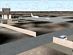
Googly scenery for VAKE Kandla/Gandhidham - a small domestic airport
in the state of Gujurat, India, for which little other than a runway is
provided in Flight Simulator 2004. These scenery files add taxiways, aprons,
buildings and other airport features, so that you and your "AI" traffic can
land, taxi, park and take off in a realistic manner.
Gandhidham is a small city about 5 miles from the seaport of Kandla, in the
Gulf of Kutch, and was developed in 1950 after the separation of Pakistan and
India left the key port of Karachi in Pakistan. The airport is served by daily
flights using turboprop aircraft of Air Deccan.
The scenery does not purport to be ultra-accurate. Based on high-detail satellite
imagery from Google Earth, the layout is proportionally correct but the added
airport features, such as buildings, are built from default Microsoft objects
and add-on libraries so will not look exactly like the real thing.
You are not obliged to download and install any additional scenery libraries,
but to enjoy this scenery in its entirety, you may wish to. It will work fine,
with or without.
[File re-uploaded at request of AVSIM]
| Filename: | VAKE_KandlaGandhidham_India.zip |
| License: | Freeware |
| Added: | 14th May 2010, 05:11:31 |
| Downloads: | 848 |
| Author: | John Hinson |
| Size: | 67.36 KB |
| Category: X-Plane - Scenery | |
| BR SP SBGP - Gaviao Peixoto Embraer Airport v1.0.0 |
|
Images related to this file:
File Description:
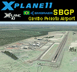
This is an X-Plane 11 and X-Plane 10 scenery package for Embraer Unidade Gavião Peixoto Airport (ICAO: SBGP, no IATA code) is a private airport located in a rural area near Gavião Peixoto and Araraquara, in Brazil. It is owned and operated by Embraer and used as for testing civil and military aircraft. Additionally, this scenery also includes a grass airstrip (SJAW Fazenda Citrica Airfield), a rural citrical farm facility for agricultural aviation. You can try landing there with your favorite prop aircraft. It's located around 1nm or 2nm northeast of SBGP airport. It includes corrected aprons, ramps, gates, taxiways, lighting system, Araraquara city buildings, ortho-photoscenery for the airfield area, and (XP11 only) airport ground services (like push back). This scenery was tested and is operational (as of March 18, 2017) in "X-Plane 11 Public Beta #15 64 bit", Windows 10 Home. It was also tested and is also operational (as of March 18, 2017) in "X-Plane 10.51 64 bit", Windows 10 Home. Only the default X-Plane 11 libraries, by Laminar Research, are needed. No third party libraries are used.
| Filename: | BR_SP_SBGP__Gaviao_Peixoto_Embraer_Airport_v100.zip |
| License: | Freeware |
| Added: | 19th March 2017, 08:13:27 |
| Downloads: | 95 |
| Author: | Rui Mesquita |
| Size: | 21.63 MB |
| Category: Flight Simulator 2004 - Scenery | |
| Joslin-Magic Valley Regl KTWF |
|
File Description:
FS2004 Scenery-Joslin Field - Magic Valley Regl Airport (KTWF) serves Twin Falls, ID and Twin Falls County and is owned by the City & County Of Twin Falls. The airport has more than one runway. The longest is a paved runway extending 8703 feet. The facility is at an elevation of 4151 feet at a distance of about 4 miles from Twin Falls. Created with EZ Scenery, Rwy12 and Lago's FSE with AFCAD2 and Traffic Tools. Textures for custom EZ Scenery objects included. By John B. Loney, Jr.
| Filename: | JoslinMagic_Valley_Regl_KTWF.zip |
| License: | Freeware |
| Added: | 3rd July 2006, 01:48:04 |
| Downloads: | 1,094 |
| Author: | John B. Loney, Jr. |
| Size: | 891.05 KB |
| Category: Flight Simulator X - Scenery | |
| KTEB Teterboro Airport, New Jersey - *Update* New Taxiways |
|
File Description:
This is an update to 'teterboro_airport.zip' by Eric McCloud (found here on AVSIM). It adds new taxiways to bring the airport up to date with the most recently published airport diagrams. Also some slight taxiway sign tweakage, closed a taxiway that is no longer operational, some additional apron lighting and a few cosmetic hold-short lines - these were added as they appear on Google Maps satellite imagery but are not connected to the AI link system so they will not affect AI traffic flow.
| Filename: | KTEB_Teterboro_Airport_New_Jersey__Update_New_Taxi.zip |
| License: | Freeware |
| Added: | 8th September 2010, 10:40:27 |
| Downloads: | 982 |
| Author: | Drew Sikora |
| Size: | 32.13 KB |
| Category: Flight Simulator X - Scenery | |
| P13 San Carlos Apache Airport (Globe, Arizona) |
|
Images related to this file:
File Description:
San Carlos Apache Airport is an airstrip 7 miles east of Globe, Arizona.
I made this because I have bean there and the default FSX scenery looks nothing like real world does!(of coarse not!), I did a colour match to the default scenery around the area to make it look good with default land class, I included a large area of photo scenery for the surrounding area to give the right "look and feel" as you approach the airport at low altitude!. Hope you like it?
| Filename: | P13_San_Carlos_Apache_Airport_Globe_Arizona.zip |
| License: | Freeware |
| Added: | 19th April 2013, 22:10:33 |
| Downloads: | 654 |
| Author: | Darrell Meadr |
| Size: | 65.64 MB |
| Category: Flight Simulator X - AFCAD Files | |
| VABJ - Bhuj Airport - Bhuj, Gujarat, India |
|
File Description:
Bhuj Airport (IATA: BHJ, ICAO: VABJ) is located in Bhuj in the Kutch District of the state of Gujarat, India.
The airport was previously made up of two bunkers/buildings near the Bhuj Rudra Mata Air Force Base, with which it shares the runway. On one side of the passing road there was an Indian Airlines bunker, and on the other side a Jet Airways bunker. From there a coach would transport one across the Indian Air Force grounds to the small departures terminal.
| Filename: | VABJ__Bhuj_Airport__Bhuj_Gujarat_India.zip |
| License: | Freeware |
| Added: | 30th April 2013, 16:45:13 |
| Downloads: | 259 |
| Author: | Ladhani Ramesh |
| Size: | 22.27 KB |
| Category: Flight Simulator X - AFCAD Files | |
| Andravida Air Base (ICAO: LGAD) |
|
File Description:
This is the Andravida airport by ANGELO TASSOGLOU, and remake by Giannis Dedes.
For military using only, Andravida air base is an important Hellenic Air Force and NATO base.
That airport is very close to Andravida, a small town in modern years in Peloponnesus.
Andravida has a very glorious past, because was the Capital (THE FRANKISH ''ANDREVILLE'') of medieval Crusader state of Principality of Achaea
(1205-1278 Champanocracy, 1278-1316 Anjoucracy, 1316-1320 Burgundocracy, 1320-1386 Aragonocracy under Sicilian crown, 1386-1402 Navarrocracy, 1402-1432 Lombardocracy)
| Filename: | Andravida_Air_Base_ICAO_LGAD.zip |
| License: | Freeware |
| Added: | 13th December 2017, 15:45:04 |
| Downloads: | 643 |
| Author: | Giannis Dedes - Angelo Tassoglou |
| Size: | 369.47 KB |
| Category: Flight Simulator 2004 - Scenery | |
| Mankomen Lake, Alaska |
|
File Description:
Welcome to Mankomen Lake! Great scenery and fantastic fishing are found throughout the entire area. Mankomen sits almost right in the middle of an outdoorsman's paradise. One may fly in and land at the airport or use the floatplane facility at the lake. This is a great hub to fly out to other lakes in the area from. Bigger airports such as Gulkana, Valdez, and Northway, are not too far from Mankomen. While Mankomen Lake is truly a real-world airport, this scenery is fictitious. Please enjoy!
| Filename: | Mankomen_Lake_Alaska.zip |
| License: | Freeware, limited distribution |
| Added: | 7th October 2005, 17:48:29 |
| Downloads: | 1,505 |
| Author: | Don Moser |
| Size: | 1.34 MB |
| Category: Flight Simulator 2004 - AFCAD Files | |
| CYQA - Muskoka Ontario AFCAD2 Update |
|
File Description:
I made some changes to the Muskoka file to make it more accurate and accessable. These are the changes I made.
--Added 7 parking spaces around the airport
--Added a taxiway to the grass runway
--Added numbers and a STOL designator to the grass runway to make it more usable
--Changed radio frequencies to add traffic frequency (MF is used in real life, no such thing in flight sim)
--Added frequency to make use of AWOS that is located at the airport in real life.
| Filename: | CYQA__Muskoka_Ontario_AFCAD2_Update.zip |
| License: | Freeware, limited distribution |
| Added: | 6th November 2003, 22:44:47 |
| Downloads: | 586 |
| Author: | David Voogd |
| Size: | 48.3 KB |
| Category: Flight Simulator X - Scenery | |
| Utah Complete (Update 1.2) |
|
File Description:
This update includes AFCAD updates for various airports, adds the new ILS approach to RWY 17 at Logan-Cache Airport (KLGU), adds a new parallel taxiway at Ogden (KOGD), fixes some "building crashes" at Salt Lake City Int'l KSLCfor those with crash detection enabled, and fixes a problem some users have experienced with terrain anomalies at St. George (KSGU) airport. Read the readme file for installation instructions! You must have Utah Complete 1.0 and update 1.1 installed first! You can download these required files here at AVSIM.
| Filename: | Utah_Complete_Update_12.zip |
| License: | Freeware, limited distribution |
| Added: | 22nd November 2007, 12:55:07 |
| Downloads: | 3,538 |
| Author: | James Udall |
| Size: | 211.36 KB |


© 2001-2026 AVSIM Online
All Rights Reserved
Privacy Policy |