
Where Flight Simulation Enthusiasts Gather from Around the World!
AVSIM Library - Search Results

| Category: Flight Simulator X - AFCAD Files | |
| PAAK - Atka Airport - Alaska, USA |

|
File Description:
Atka Airport (IATA: AKB, ICAO: PAAK, FAA LID: AKA, formerly 40A) is a state owned, public use airport located two nautical miles (4 km) north of the central business district of Atka, a city on Atka Island. Scheduled commercial airline passenger service is subsidized by the Essential Air Service program.
Changes are based on 2007 construction plans. Length of Runway `6/34 was increased to 5,000 feet and width to 100 feet.Moved and increased size of parking area.REIL lights placed.
| Filename: | PAAK__Atka_Airport__Alaska_USA.zip |
| License: | Freeware |
| Added: | 8th October 2013, 19:27:28 |
| Downloads: | 264 |
| Author: | Wayne Roberts |
| Size: | 3.95 KB |
| Category: Flight Simulator 2004 - AFCAD Files | |
| Marshall Islands Int'l (PKMJ) |
|
File Description:
Here is an AFCAD2 file for Marshall Islands Int'l in the Pacific. The runway has been extended, equipped with full approach lighting and now features a hold point at the 07 end. Parking for aircraft upto B747 size has been added, together with an enlarged apron. ATIS and Tower frequencies are now included. This makes an ideal pacific stopover or diversion airport. Also in this package is a voicepack update for the airport. This is meant for the FS2004 default scenery only.
| Filename: | Marshall_Islands_Intl_PKMJ.zip |
| License: | Freeware |
| Added: | 11th December 2004, 06:03:29 |
| Downloads: | 1,056 |
| Author: | Lee Brompton |
| Size: | 4.31 KB |
| Category: Flight Simulator 2004 - Aircraft Repaints, Textures and Modifications | |
| Numa Cessna C550 |
|
File Description:
The Cessna Citation 550 painted in the colors of Clive Cussler's National Underwater and Marine Agnecy (NUMA).
You will need to download C550IRON.ZIP to use these textures.
Also included are two new .bgl files for KSAN scenery featuring a new fictional runway 09L/27R for one of several options for future expansion of the airport, which is currently being debated by the San Diego County Regional Airport Authority. Also included is a revised AFCAD file for use with the new runway.
| Filename: | Numa_Cessna_C550.zip |
| License: | Freeware |
| Added: | 18th February 2005, 20:12:05 |
| Downloads: | 179 |
| Author: | Bill Baldwin |
| Size: | 831.66 KB |
| Category: Flight Simulator 2004 - Scenery | |
| Manchester Airport KMHT |
|
File Description:
FS2004 Scenery-Manchester Airport (KMHT) serves Manchester and Hillsboroughugh County and is owned by the City Of Manchester. The airport has more than one runway. The longest is a paved runway extending 7001 feet. The facility is at an elevation of 234 feet at a distance of about 3 miles from Manchester. Created using FSDS2, Rwy12, Lago's FSE, AFCAD2 and Traffic Tools2.x. Be sure to read the readme file for important information about this scenery. By John B. Loney, Jr.
| Filename: | Manchester_Airport_KMHT.zip |
| License: | Freeware |
| Added: | 6th November 2005, 18:41:58 |
| Downloads: | 6,909 |
| Author: | John B. Loney, Jr. |
| Size: | 2.02 MB |
| Category: Flight Simulator 2004 - Scenery | |
| Mangalore Airport VOML |
|
File Description:
This scenery models Bajpe Airport, Mangalore (VOML) in Southern India (as seen in 2004). Works best when combined with my "India_76m-Mesh_Part_A" available at the AVSIM library.
Mangalore airport is known for it's infamously short runway that sits on top of a table-top mountain. This is modelled quite accurately in my mesh for Southern India. There have been quite a few near miss incidents in the past 20Yrs. So, if you're flying big tin, don't forget to step on the brakes ;-)
| Filename: | Mangalore_Airport_VOML.zip |
| License: | Freeware |
| Added: | 21st January 2006, 22:36:44 |
| Downloads: | 2,873 |
| Author: | Keith Sebastian |
| Size: | 169.52 KB |
| Category: Prepar3D V5 - Scenery | |
| KCLT - Charlotte/Douglas Intl - Charlotte, NC - P3DV5 - airac 2011 |
|
File Description:
this is an updated version of the default p3d airport:
*airac 2011*
-corrected runway dimensions/markings/lighting configurations
-corrected terminal ramp geometry
-corrected positions/orientation of terminal buildings
-added north A concourse, west hardstand area
-improved all gate positions and numbering
-various taxiway corrections
my intent is to have a functional and current airport, not eye candy. the idea is to pretty much
match the real charts for online use (vatsim, etc). not tested with any type of AI traffic or atc.
| Filename: | KCLT__CharlotteDouglas_Intl__Charlotte_NC__P3DV5__.zip |
| License: | Freeware |
| Added: | 28th October 2020, 05:24:27 |
| Downloads: | 551 |
| Author: | Mike Teague |
| Size: | 369.08 KB |
| Category: Flight Simulator X - Scenery | |
| Paros New Airport |
|
Images related to this file:
File Description:

The PAROS (GREECE) scenery following the design of our philosophy which allows the simmer to enjoy a full scenery without getting tired to find solutions which have to do with settings, yields etc, without unnecessary construction that nobody ever sees and which only need to create a commercial impression in some photos.
Objects constructed with Gmax and 3Dmax that make you enjoy your virtual trip to the Paros airport.
*At this scenery all included the old Paros airport, Parikia, Alikes, and Naousa
| Filename: | Paros_New_Airport.zip |
| License: | Freeware |
| Added: | 2nd April 2017, 18:12:28 |
| Downloads: | 2,268 |
| Author: | GREEK AIRPORTS PROJECT - Mihalis Triantafillou |
| Size: | 44.8 MB |
| Category: Flight Simulator 2004 - Scenery | |
| FS2004 Scenery - Waukegan Regional KUGN |
|
Images related to this file:
File Description:
Re-upload. FS2004 Scenery-Waukegan Regional Airport (KUGN) serves Chicago/Waukegan and Lake County and is owned by Waukegan Port District. The airport has more than one runway. The longest is a paved runway extending 6000 feet. The facility is at an elevation of 727 feet at a distance of about 35 miles from Chicago. Textures included. Requires Traffic Tools and AFCAD2 along with Rwy12 objects/textures and FSE. Created with FSDS2, Rwy12 and FSE. By John B. Loney, Jr.
| Filename: | FS2004_Scenery__Waukegan_Regional_KUGN.zip |
| License: | Freeware, limited distribution |
| Added: | 7th June 2010, 08:25:49 |
| Downloads: | 1,406 |
| Author: | John B. Loney, Jr. |
| Size: | 1.91 MB |
| Category: Flight Simulator 2004 - Scenery | |
| Capua LIAU Airport for GA planes - Italy |
|
File Description:
This file installs under FS2004 a good reproduction (thanks go to Google Earth and AFX) of the Little airport LIAU Capua, Italy. It consists in a simple dirt runway for VFR GA planes with no apron of sorts (even in Real Life it's like that), long about 3300 feet and wide about 75 feet, few miles inland from the military airport of Grazzanise LIRM.
For all the VFR pilots, Italians and/or from afar, who like to fly in FS2004 Italy.
| Filename: | Capua_LIAU_Airport_for_GA_planes__Italy.zip |
| License: | Freeware |
| Added: | 16th April 2009, 19:24:05 |
| Downloads: | 569 |
| Author: | Iandiorio Sabato |
| Size: | 2.96 KB |
| Category: Flight Simulator X - Scenery | |
| Rome Urbe airport - LIRU |
|
Images related to this file:
File Description:
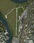
Urbe is the third airport in Rome, base for flight schools and also the Capital city's main heliport.
Despite its size, it can reach up to 300 movements a day.
This is a very accurate version of Roma Urbe airport created using only default library objects and precisely geo-referred.
The scenery has been created with ADE and tested on FSX and P3D (couple of ground texture issues reported with the latter). Tested also on IVAO with AURORA ATC software.
| Filename: | Rome_Urbe_airport__LIRU.zip |
| License: | Freeware |
| Added: | 18th May 2020, 18:54:13 |
| Downloads: | 852 |
| Author: | Lorenzo Stroppa |
| Size: | 1.76 MB |


© 2001-2026 AVSIM Online
All Rights Reserved
Privacy Policy |