
Where Flight Simulation Enthusiasts Gather from Around the World!
AVSIM Library - Search Results

| Category: Flight Simulator X - Scenery | |
| PABE - Bethel Airport - Alaska, USA |

|
Images related to this file:
File Description:
Bethel Airport is a state owned, public use airport located three nautical miles (6 km) southwest of the central business district of Bethel.
Construction began September 21, 1941, and the airfield was activated July 4, 1942; it is also known as Bethel Air Base. It was used by Air Transport Command as auxiliary airfield for Lend-Lease aircraft being flown to Siberia. The facility was transferred to Eleventh Air Force, then to Alaskan Air Command in 1945; it became the joint-use Bethel Airport. It was used for construction of AC&W Bethel Air Force Station in mid 1950s. Full jurisdiction was turned over to Alaska Government in 1958.
Added and adjusted aprons and buildings. Also added additional parking. Added runway 1R/19L.Re-numbered runways to conform with AirNav data.
Created with Airport Design Editor 9x by ScruffyDuck Software using current FAA documentation and Google Earth measurements, this package offers a replacement for FSX's stock airport. All these enhancements are as close to the real airport as I can get with stock library objects and custom buildings.
| Filename: | PABE__Bethel_Airport__Alaska_USA.zip |
| License: | Freeware |
| Added: | 5th December 2014, 13:35:35 |
| Downloads: | 994 |
| Author: | Wayne Roberts |
| Size: | 94.58 KB |
| Category: Flight Simulator 2004 - Scenery | |
| WIID 1962 Jakarta Kemayoran V2 |
|
Images related to this file:
File Description:
We have produced this scenery to provide taxiways and details
as they were around 1962 in Jakarta, Yogyakarta, Juanda and Denpasar.
We have also included new parking to allow the AI aircraft to taxi
correctly at the new (old!) airports.
Kemayoran airport was Jakarta’s and Indonesia’s first international airport.
It was gradually forgotten after the Indonesian government opened
two new airports, Halim Perdanakusuma and Soekarno-Hatta.
In late 1920’s early 1930’s the Dutch turned the area into an airport
and built several military camps to house their soldiers at what is
now Garuda Street.
Kemayoran airport was officially opened for international flights
on 8 July 1940.
The airport was managed by KNILM
(Koninklijke Nederlands Indische Luchtvaart Maatschappy),
a subsidiary of KLM, the official airline of the Netherlands.
Kemayoran Airport was officially closed on 31 March 1985
because the location was deemed no longer appropriate,
and the government wanted to convert it into a commercial area.
Now including along with WIID Jakarta Kemayoran:
WIIJ Yogyakarta ( Java )
WRSJ Surabaya ( Java )
WRRR Denpasar ( Bali )
| Filename: | WIID_1962_Jakarta_Kemayoran_V2.zip |
| License: | Freeware, limited distribution |
| Added: | 17th December 2017, 20:31:20 |
| Downloads: | 607 |
| Author: | Wolfgang Gersch, Mike Stevens |
| Size: | 2.35 MB |
| Category: Prepar3D V1-4 - Scenery | |
| TNCA - Queen Beatrix International Airport - Aruba |
|
File Description:
The scenery was made using the Airport Design Editor, ModelConverterX, FSEarthTiles, SketchUp 2017 an others.
Queen Beatrix International Airport (Dutch: Internationale luchthaven Koningin Beatrix; Papiamento: Aeropuerto Internacional Reina Beatrix), colloquially known as Aruba Airport (IATA: AUA, ICAO: TNCA), is an international airport located in Oranjestad, Aruba. It has flight services to the United States, several countries in the Caribbean, the northern coastal countries of South America, Canada, as well as some parts of Europe, notably the Netherlands.
It is named after Beatrix of the Netherlands, who was Queen of the Netherlands from 1980 to 2013.
The airport offers United States border preclearance facilities. A terminal for private aircraft opened in 2007. The airport used to serve as the hub for bankrupt airline Air Aruba, which was for many years an international airline. Before Aruba's separation from the Netherlands Antilles in 1986 it was also one of three hubs for ALM Antillean Airlines as well as a home base for Tiara Air until 2016.
This scenario was only tested on P3Dv4.5.
History - fron Wikipedia.com
| Filename: | TNCA__Queen_Beatrix_International_Airport__Aruba.zip |
| License: | Freeware |
| Added: | 8th May 2021, 17:39:28 |
| Downloads: | 686 |
| Author: | Eduardo Puelker |
| Size: | 3.78 MB |
| Category: Flight Simulator X - Scenery | |
| UBBB Baku X DEMO |
|
Images related to this file:
File Description:
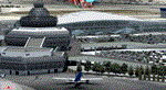
Baku X DEMO is the scenery featuring a highly detailed representation of UBBB Heydar Aliyev airport in Azerbaijan. This product is fully compatible with FSX and FSX SE.
It's a fully functional DEMO version of the commercial payware product. It features same airport layout as in the full version but with limited 3D objects and low resolution textures. Using this free demo ensures no problems with online (VATSIM, IVAO, multiplayer etc.) flying in case some users use the payware scenery and some don't.
Heydar Aliyev International Airport (IATA: GYD, ICAO: UBBB) (former Bina International Airport) is the main international airport in Azerbaijan, the home of Azerbaijan Airlines, the national flag carrier.
It's equipped with an automatic installer, which means that the scenery will be automatically added to the Flight Simulator Scenery Library.
Please uninstall all previous versions of this airport you may have installed before. Please make also sure that no duplicated AFCAD files are installed!
Enjoy your virtual flying with Drzewiecki Design!
| Filename: | UBBB_Baku_X_DEMO.zip |
| License: | Commercial demo |
| Added: | 21st May 2016, 20:39:05 |
| Downloads: | 3,859 |
| Author: | Drzewiecki Design |
| Size: | 14.32 MB |
| Category: Flight Simulator 2004 - Scenery | |
| DTTG Gabes, Tunisia |
|
File Description:
Googly scenery for Gabes (ICAO: DTTG), a somewhat nondescript airport
shoe-horned into one of Tunisia's largest industrial cities. Famed for
its beaches, the city hosts cement, chemical and brick factories and an
oil refinery, resulting in poor levels of air pollution. The airport is
a joint military and civilian operation although military traffic appears
to be mostly helicopter activity and the civilian traffic consists of an
ATR of Sevenair calling in once in a blue moon.
Microsoft have only provided a runway at this airport in Flight Simulator
2004 and this scenery seeks to redress the situation so that you and your
"AI" traffic can use the airport realistically.
The scenery does not purport to be ultra-accurate. Based on high quality
satellite imagery from Google Earth, the layout is proportionally correct but the
added airport features, such as buildings, are built from default Microsoft objects
and add-on libraries so will not look exactly like the real thing.
You are not obliged to download and install any additional scenery libraries,
but to enjoy this scenery in its entirety, you may wish to. It will work fine,
with or without.
| Filename: | DTTG_Gabes_Tunisia.zip |
| License: | Freeware |
| Added: | 14th October 2008, 13:18:33 |
| Downloads: | 757 |
| Author: | John Hinson |
| Size: | 83.15 KB |
| Category: Flight Simulator X - Scenery | |
| Sioux Falls South Dakota Regional Airport - Joe Foss Field for FSX |
|
Images related to this file:
File Description:
Sioux Falls South Dakota Regional Airport - Joe Foss Field for FSX. Several improvements have been made to the default airport. The default terminal buildings have been replaced with buildings created in FSDS; aircraft gates have been correctly coded using Airport Design Editor 1.70.6042; a new airport vehicle network has been built; extra fuel trucks have been added throughout the airport; the tower view has been changed to display from the roof of the control tower; a static FedEX truck in two different color schemes has been placed in the cargo area; all taxiway signs are correctly placed and all taxiway designators are correctly named; there is the option to open all three runways to AI traffic; the 114th Fighter Wing of the South Dakota Air National Guard is represented; optionally, a set of GA flight plans is included using all default FSX aircraft to liven up the GA area; also included is a set of military flight plans for the 114th Fighter Wing; and Jim Dhaenen's excellent ramp lights are also included. Please read the README FIRST.txt and Installation.txt files to insure proper installation of all files.
| Filename: | Sioux_Falls_South_Dakota_Regional_Airport__Joe_Fos.zip |
| License: | Freeware, limited distribution |
| Added: | 14th April 2017, 07:16:53 |
| Downloads: | 974 |
| Author: | Patrick Finch |
| Size: | 3.56 MB |
| Category: Flight Simulator 2004 - Scenery | |
| FNGI N'giva/Ondjiva Pereira, Angola |
|
File Description:
Googly scenery for N'giva - Ondjiva Pereira (ICAO: FNGI, IATA: NGV), an airport
serving Ondjiva, one of Angola's larger cities. Until relatively recently it
possessed little more than a dirt runway but recent expansion has seen the
commissioning of a longer asphalt runway and a terminal area. Today, the airport
sees passenger and cargo flights from airlines such as Air Gemini, Angola
Airlines, Savanair and Sonair utilising a variety of aircraft from the little
Let 410 turboprop through to Boeing 737 jets.
Microsoft have only provided the dirt runway at this airport in Flight Simulator
2004 and this scenery seeks to redress the situation so that you and your
"AI" traffic can use the airport realistically.
The scenery does not purport to be ultra-accurate. Based on high quality
satellite imagery from Google Earth, the layout is proportionally correct but the
added airport features, such as buildings, are built from default Microsoft objects
and add-on libraries so will not look exactly like the real thing.
You are not obliged to download and install any additional scenery libraries,
but to enjoy this scenery in its entirety, you may wish to. It will work fine,
with or without.
| Filename: | FNGI_NgivaOndjiva_Pereira_Angola.zip |
| License: | Freeware |
| Added: | 15th October 2008, 12:40:17 |
| Downloads: | 1,613 |
| Author: | John Hinson |
| Size: | 73.94 KB |
| Category: Flight Simulator 2004 - AFCAD Files | |
| The U.S. Virgin Islands (TISX/TIST) |
|
File Description:
Accurate rendition of the TIST and TISX airports. Includes accuarate gate numbering and locations for all airlines serving the airport as well as for general aviation aircraft. This is my continuing series of doing airports that have been neglected by both MS and the community. Hopefully this will enhance flying into this airport for those of you that frequent it. Unfortuantely there aren't many reference materials in terms of gate assignments or locations or numbering on the internet. I've flown in and out of this airport several times so most of this is from memory and a few shots I managed to find on airliners.net and jetphotos.net. It may not be 100% correct but it's pretty close and defientely a major improvement over the default scenery, which by the way...MS decided to place two large cell phone or radio towers right on the tarmac in front of the terminal, brilliant idea! If anyone out there knows of a way to remove them please e-mail me. Having said that, it's a beautiful island and a fun airport to fly into and out of. The St. Croix airport is also pretty much done from memory and a few photos since there isn't much reference material for gates, in this instance there aren't airline assignments to the gates since this is a smaller airport and the airlines pretty much are assigned random gates since there are only about a handful of gates. Again, though, definetely an improvement over the default. Now if only someone would do some landclass for the Virgin Islands ;-) Hope this enhances your flying into the sunny Caribbean!
| Filename: | The_US_Virgin_Islands_TISXTIST.zip |
| License: | Freeware |
| Added: | 30th June 2004, 04:52:33 |
| Downloads: | 2,703 |
| Author: | Jason Diaz |
| Size: | 136.53 KB |
| Category: Flight Simulator 2004 - Miscellaneous Files | |
| AI TimeTable 1.98 |
|
File Description:
AI TimeTable bring on your desktop the feel of a typical airport time-table, with airline names, logo and, for registered users, also real time flight information.
| Filename: | AI_TimeTable_198.zip |
| License: | Shareware, limited functionality |
| Added: | 31st July 2006, 18:33:38 |
| Downloads: | 1,366 |
| Author: | geniX Software |
| Size: | 186.06 KB |
| Category: Flight Simulator 2004 - Miscellaneous Files | |
| A346 Configuration File |
|
File Description:
This is a configuration file of the Just Flight / Commercial Level Simulations Airbus A340-600 (CLS A346) for the Payware Addon "Airport Enhancement Services (AES)" by Aerosoft.
| Filename: | A346_Configuration_File.zip |
| License: | Freeware |
| Added: | 24th February 2007, 20:56:56 |
| Downloads: | 3,387 |
| Author: | Michel Hunziker |
| Size: | 988 B |


© 2001-2026 AVSIM Online
All Rights Reserved
Privacy Policy |