
Where Flight Simulation Enthusiasts Gather from Around the World!
AVSIM Library - Search Results

| Category: Flight Simulator X - Scenery | |
| Puerto Ordaz (SVPR) - Venezuela |

|
File Description:
The International Airport Manuel Carlos Piar, is the sixth airport
in importance inside Venezuela and the principal air terminal of the
south of the country. Puerto Ordaz is a planned city in southern Venezuela.
Founded in 1952 as a mining export port on the banks of the Caroni River.
Photo-terrain area improved with Autogen files.
Only compatible with versions to FSX, P3Dv1.x or P3Dv2.x.
Also includes a friendly Auto-Install.
| Filename: | Puerto_Ordaz_SVPR__Venezuela.zip |
| License: | Freeware |
| Added: | 17th March 2014, 05:33:05 |
| Downloads: | 2,240 |
| Author: | David Maldonado |
| Size: | 104.69 MB |
| Category: Flight Simulator X - Scenery | |
| TNCM - Princess Juliana Intl |
|
File Description:
You want to have fun in the sun? Then get ready because this is going to give you a better time when your flying around St. Maarten! This scenery for FSX gives you a little more to look at. Complete with trucks(with real names like GateGourmet), more airport vehicles, animals in water/air, and a carrier right by the airport + more. Big thanks to Drew Bunting and Steve Ziegler for their scenery designs.
| Filename: | TNCM__Princess_Juliana_Intl.zip |
| License: | Freeware |
| Added: | 14th May 2008, 03:31:40 |
| Downloads: | 23,160 |
| Author: | Derek Souza |
| Size: | 2.31 MB |
| Category: Fly! II - Miscellaneous Files | |
| KGRB to KDTW flight plan |
|
File Description:
This adventure starts at the Austin Straubel International Airport (KGRB) and ends at the Detroit Metro Wayne Airport (KDTW). There are stops at Pellston Regional Airport (KPLN), Minneapolis St. Paul Airport (KMSP, and Sawyer International Airport (KSAW). The total plan is 965 NM.
| Filename: | KGRB_to_KDTW_flight_plan.zip |
| License: | Freeware |
| Added: | 9th September 2005, 12:47:52 |
| Downloads: | 183 |
| Author: | Wayne Roberts |
| Size: | 17.42 KB |
| Category: Flight Simulator 2004 - Scenery | |
| VNSK - Surkhet Airport - Surkhet District, Nepal |
|
File Description:
Surkhet Airport is an airport in Surkhet, Nepal (IATA: SKH, ICAO: VNSK). This airport is one of the hub airports in Mid-Western Nepal. Surkhet Airport is 5 km from the city of Birendranagar and is sometimes referred to as Birendranagar Airport.
| Filename: | VNSK__Surkhet_Airport__Surkhet_District_Nepal.zip |
| License: | Freeware |
| Added: | 4th November 2014, 19:24:10 |
| Downloads: | 328 |
| Author: | Billy Guo |
| Size: | 336.99 KB |
| Category: Flight Simulator X - Scenery | |
| Margaret Ekpo International Airport Calabar. FSX\P3D |
|
File Description:
Margaret Ekpo International Airport (IATA: CBQ, ICAO: DNCA), also known as Calabar Airport, is an airport serving Calabar, the capital of the Cross River State in Nigeria.
Calabar Airport for FSX
-------------------
Photoreal Background, Corrected Parkings, Added more buildings, Ramp Lights, Airport chart....
| Filename: | Margaret_Ekpo_International_Airport_Calabar_FSXP3D.zip |
| License: | Freeware |
| Added: | 29th September 2018, 16:36:32 |
| Downloads: | 680 |
| Author: | Raheem Adeleke |
| Size: | 41.47 MB |
| Category: Flight Simulator 2004 - Scenery | |
| Modesto City-County Airport |
|
File Description:
FS2004 Scenery-Modesto City-County-Harry Sham Field Airport (KMOD) serves Modesto and Stanislaus County and is owned jointly by the City of Modesto and Stanislaus County, and the airport is operated by the City of Modesto. The airport has more than one runway. The longest is a paved runway extending 5911 feet. The facility is at an elevation of 97 feet at a distance of about 2 miles from Modesto. Created with FSDS2, Rwy12, Lago's FSE, AFCAD2 and Traffic Tools. Textures included. By John B. Loney, Jr.
| Filename: | Modesto_CityCounty_Airport.zip |
| License: | Freeware |
| Added: | 29th October 2005, 05:26:38 |
| Downloads: | 1,219 |
| Author: | John B. Loney, Jr. |
| Size: | 1.57 MB |
| Category: Flight Simulator X - Scenery | |
| Naples, FL Municipal Airport (KAPF) |
|
Images related to this file:
File Description:
The Naples, FL airport does not currently have airline service, and the terminal is being used for general aviation while the general aviation terminal is being remodeled. This scenery includes the GA terminal as it was before remodeling.
Changes in this package are based on Virtual Earth images and the latest airport diagram. This is a complete redo of the default FSX KAPF; surrounding landclass changes; new terminals and FBOs; and revised taxiways, aprons and hangers. Also includes placement of library objects and a library of new airport buildings.
| Filename: | Naples_FL_Municipal_Airport_KAPF.zip |
| License: | Freeware |
| Added: | 17th December 2009, 03:31:17 |
| Downloads: | 998 |
| Author: | Art Poole |
| Size: | 834.68 KB |
| Category: Flight Simulator X - Scenery | |
| Kerkyra - LGKR |
|
Images related to this file:
File Description:
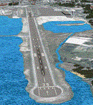
AS REAL AS IT GETS.
This is a highly detailed photorealistic scenery of the beautiful island of Kerkyra.
The scenery contains many objects like cars, boats and buldings in the City of Kerkyra.
Default FSX airport of the island (LGKR) was corrected and repositioned to the exact location and some buildings and trees were added in the airport vicinity.
Airport vehicle trafic and a small air trafic file included.
The scenery also includes autogen buildings, vegetation and road trafic near the city to enhance and animate the landscape.
| Filename: | Kerkyra__LGKR.zip |
| License: | Freeware |
| Added: | 22nd June 2011, 02:42:10 |
| Downloads: | 8,543 |
| Author: | Angelo Tassoglou |
| Size: | 137.18 MB |
| Category: Flight Simulator X - Scenery | |
| Eagle Island Airport PEIR Version 1.0 |
|
Images related to this file:
File Description:
This is the first version of the fictional Eagle Island airport, located near Nome, Alaska. This airport includes:
1.Eagle Island Airport has a fully functional ATC with specific Approach, Departure, Ground, and ATIS frequencys.
2.Both runways have ILS, and the longest runway 19R/01L (15000ft) has a GPS approach.
3.Two fuel parking spaces
4.Two working fuel trucks for all the GA parking spaces and all the gates east of runway 19R/01L
5.Working jetways on all gates west of runway 19R/01L
6.PAPI glide slope indicators for all runways.
| Filename: | Eagle_Island_Airport_PEIR_Version_10.zip |
| License: | Freeware, limited distribution |
| Added: | 18th July 2011, 19:47:54 |
| Downloads: | 307 |
| Author: | George Smith |
| Size: | 6.8 KB |
| Category: Flight Simulator X - Scenery | |
| Buffalo Niagara International Airport (KBUF) |
|
Images related to this file:
File Description:
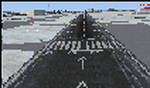
This airport was made using Airport Facilitator X, and Instant Scenery 2. Buffalo Niagara International Airport is located near Buffalo, New York. I have added more gates to the main terminal and all the jetways will show. I also put gates at the cargo area and a few cargo trucks. I made a general aviation terminal with many static GA aircraft. This was based on Google Earth and Bing maps. Your scenery complexity has to be set to normal or higher for anything to show up. This is for Flight Simulator X only.
| Filename: | Buffalo_Niagara_International_Airport_KBUF.zip |
| License: | Freeware |
| Added: | 1st January 2012, 23:50:29 |
| Downloads: | 2,375 |
| Author: | Tyler Lawrence |
| Size: | 12.15 MB |


© 2001-2026 AVSIM Online
All Rights Reserved
Privacy Policy |