
Where Flight Simulation Enthusiasts Gather from Around the World!
AVSIM Library - Search Results

| Category: Flight Simulator X - Scenery | |
| French Polynesian Island Tour, Part 1 |

|
File Description:
This is Part 1 of a 2 Part 45 leg mostly VFR "tour" of a geographical area of the South Pacific where the FSX default island airports even with
the addition of add-ons such as Orbx LC and Vector are typically not rendered very well. All the French Polynesian airports of these 2 packages
have tested successfully in FSX Acceleration with Orbx Vector and Orbx LC installed by 2 FSX users. They may also be compatible with the early
(32 bit) versions of P3D; up to, but not including P3Dv4. ADE, Ver 1.78 was primarily used as the tool for airport modification and creation,
with the help of Google Earth, Google Maps, and several online airport information and flight planning utilities.
| Filename: | French_Polynesian_Island_Tour__Part_1.zip |
| License: | Freeware |
| Added: | 8th June 2024, 17:41:42 |
| Downloads: | 59 |
| Author: | Ken Boardman |
| Size: | 347.01 KB |
| Category: Flight Simulator X - Scenery | |
| French Polynesian Island Tour, Part 2 |
|
Images related to this file:
File Description:
This is Part 2 of a 2 Part mostly VFR "tour" of a geographical area of the South Pacific where the FSX default island airports even with
the addition of add-ons such as Orbx LC and Vector are typically not rendered very well. All the French Polynesian airports of these 2 packages
have tested successfully in FSX Acceleration with Orbx Vector and Orbx LC installed by 2 FSX users. They may also be compatible with the early
(32 bit) versions of P3D; up to, but not including P3Dv4. ADE, Ver 1.78 was primarily used as the tool for airport modification and creation,
with the help of Google Earth, Google Maps, and several online airport information and flight planning utilities.
| Filename: | French_Polynesian_Island_Tour_Part_2.zip |
| License: | Freeware |
| Added: | 8th June 2024, 17:41:50 |
| Downloads: | 61 |
| Author: | Ken Boardman |
| Size: | 342.47 KB |
| Category: Flight Simulator X - Scenery | |
| Austin Bergstrom Intl - KAUS - Texas |
|
Images related to this file:
File Description:
This is a reasonably accurate and up-to-date version of Austin Bergstrom Intl airport and made only for FSX users, not to be used in P3D: I have given this airport a complete makeover, assigned parking as per their website where possible with extra overflow parking, the new eastern extension for the main terminal now included, all gates numbered correctly, a new South terminal also added, taxiways and taxi signs updated to the latest charts, ILS approaches also updated to the latest charts where possible, extra fuel trucks, support vehicle roads rebuilt, lighted helipads and many other scenery improvements and objects added, airport views are from inside the control tower (when in tower view) please view the readme before installation.
| Filename: | Austin_Bergstrom_Intl__KAUS__Texas.zip |
| License: | Freeware, limited distribution |
| Added: | 17th July 2020, 17:55:47 |
| Downloads: | 28,932 |
| Author: | Ray Smith |
| Size: | 2.64 MB |
| Category: Flight Simulator X - Scenery | |
| Changi Airport - WSSS - Singapore |
|
Images related to this file:
File Description:
This is a fairly accurate and up-to-date version of Changi Intl Airport, and created only for FSX users, not suitable for P3D: This airport reflects today's situation with its 4 terminals and concourses bought up-to-date, including the Cargo aprons and buildings, all parking spots correctly numbered, airlines assigned to their original terminal where possible, 15 gates/parking spots allocated for the A380, taxiways and taxi signs updated to the latest charts, new control tower, extra fuel trucks and support vehicle paths, drainage channels and the south end reservoir also added, fuel tank farm and many other scenery enhancements and objects included to make this airport more realistic, airport views are from the roof of the control tower.
| Filename: | Changi_Airport__WSSS__Singapore.zip |
| License: | Freeware, limited distribution |
| Added: | 9th March 2021, 05:31:11 |
| Downloads: | 44,723 |
| Author: | JMS Designs |
| Size: | 2.76 MB |
| Category: Flight Simulator X - Scenery | |
| Frankfurt Main Airport with new 25L/R ILS approaches (v2.2) |
|
Images related to this file:
File Description:
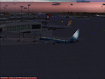
This is an update to v2.1 of the FSX Frankfurt/Main scenery airport package and was designed using ADE v1.40.
This update now includes missing CAT signs and jet bridge textures. Sorry about that!
All other features remain unchanged. Features include additional jetways, vehicle roadways around Terminal 2, up-to-date airline mapping to gates and additional taxiway and CAT II/III signs. ** Gates have been resized and added as per current layout ** Additional fuel trucks & support vehicle roads built around the airport ** 3 helipad start locations added ** B Gates now contain double jetways ** The control tower view has been moved to the south side and aprons have been remodelled ** 25L and 25R ILS Rwy frequencies now updated.
News: Stay tuned for a new update to the Frankfurt scenery, v3.0.
| Filename: | Frankfurt_Main_Airport_with_new_25LR_ILS_approache.zip |
| License: | Freeware |
| Added: | 25th September 2010, 13:42:07 |
| Downloads: | 1,261 |
| Author: | Mark Aldridge |
| Size: | 3.37 MB |
| Category: Flight Simulator X - Scenery | |
| RAF Kelstern - Lincolnshire, England |
|
File Description:
RAF Kelstern is a former Royal Air Force station located 3.6 miles (5.8 km) south east of Binbrook, Lincolnshire and 4.9 miles (7.9 km) north west of Louth,
Opening for business in late September of 1943 the first Sqn to be based at the station was actually formed there (No 625) and became operational in mid October 1943 and was undertaking their first operational tour with 9 Lancasters bombing Hanover afew nights later. As with many RAF Stations, of the era, RAF Kelstern was placed on care and maintenance and finally closed in August 1946. The Station was sold off to various farmers during the 60s with very little left to show of an active airfield. Third party add-on's will be required. See the readme.txt file for details.
| Filename: | RAF_Kelstern__Lincolnshire_England.zip |
| License: | Freeware |
| Added: | 31st October 2015, 12:25:45 |
| Downloads: | 151 |
| Author: | Terry Boissel |
| Size: | 9.63 KB |
| Category: Flight Simulator X - Scenery | |
| Laviolette bridge, Trois-Rivières, Québec Canada for FSX |
|
File Description:
The Laviolette bridge (in French, pont Laviolette) connecting the city of Trois-Rivières and Bécancour on the South shore of the Saint Lawrence River (Highway 55) is an important land mark for pilots flying between Montreal (CYUL) and Quebec City (CYQB). It is a beautiful and aesthetic arch bridge of 2.7km long with a main span of 335m and a total height of 106,6m
A lot of attention to details was required to reproduce the bridge complex structure. This scenery features a very accurate bridge with 4 lanes traffic, night textures, road lighting and static ships. Pilots are invited the take off from nearby CYRQ airport at the control of their favourite helicopter or slow aircraft to fly around the bridge to inspect the structure and appreciate the view.
| Filename: | Laviolette_bridge_TroisRivires_Qubec_Canada_for_FS.zip |
| License: | Freeware |
| Added: | 14th March 2008, 09:22:13 |
| Downloads: | 8,093 |
| Author: | Gilles Boily |
| Size: | 1.36 MB |
| Category: Flight Simulator X - Scenery | |
| Delta Heritage Air Park - CAK3 (FSX) |
|
File Description:
Known as "Delta" this is a PPS grass strip aerodrome situated south of Vancouver in Delta, British Columbia, Canada. The air park is well known for fly-ins breakfasts and numerous family activities. Formerly a farm in the 1960’s, the owner (a pilot) saw the growing need for those with small aircraft.
Delta has close to sixty aircraft that are stored in hangars or tied down on the grass. I have redone the entire airport according to available photos and satellite images. All objects are stock Autogen. If I owned a small aircraft this would be one of my favorite fields. Everyone here is very sociable. There are a lot of antiques at this site (Both fliers and aircraft).
VANCOUVER PLUS is required for this scenery to work.
| Filename: | Delta_Heritage_Air_Park__CAK3_FSX.zip |
| License: | Freeware |
| Added: | 16th April 2009, 05:05:18 |
| Downloads: | 707 |
| Author: | Will Jones |
| Size: | 1.56 MB |
| Category: Flight Simulator X - Scenery | |
| Yeu island - LFEY |
|
Images related to this file:
File Description:
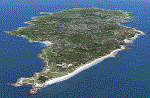
The island of Yeu (LFEY) is located in the west of France, in the south-west of Nantes. Its main runway is located on the wild coast, near the great lighthouse.
It is made up of :
- A new mesh based ASTER compiled in LOD11 and a very local mesh for the airport, compiled in LOD13 to get a good compatibility with the specific payware meshes.
- Photorealistic texture at 0.5 m/pixel based on aerial photography.
- The airfield and runway. The runway is flat, allowing to preserve the AI traffic. The grass strip is modeled with its relief. There is therefore no AI traffic on the grass strip.
- The port of Port-Joinville and several notable buildings made with Gmax (churches, chapel, castle, fort, ruins, beacons, etc)
- Generic or custom objects created with Gmax (boats, buildings).
| Filename: | Yeu_island__LFEY.zip |
| License: | Freeware |
| Added: | 29th December 2012, 04:03:47 |
| Downloads: | 1,721 |
| Author: | marc guitteny |
| Size: | 217.78 MB |
| Category: Flight Simulator X - Scenery | |
| Pearl Harbor and Waikiki |
|
File Description:
This is a simple landclass and waterclass update for FSX with SP2/Acceleration that does the following:
- A complete make-over of Ford Island so that it more closely matches its present day appearance, including addition of the USS Missouri
- Some updates to the South East Lock in Pearl Harbor to more closely match it's present day appearance
- Updates to Sand Island in an attempt to more closely match reality
- Uses a darker waterclass for Pearl Harbor and Kaneohe Bay in an attempt to more closely match reality
- Adds some missing beaches along the southern coast of Oahu, including Waikiki
- Adds shallow, coral reef waterclass where appropriate along the southern coast of Oahu in an attempt to more closely match reality
- Diamond Head uses a volcanic rock texture
| Filename: | Pearl_Harbor_and_Waikiki.zip |
| License: | Freeware |
| Added: | 6th February 2014, 18:11:00 |
| Downloads: | 2,784 |
| Author: | Gregg Douglass |
| Size: | 7.74 MB |


© 2001-2026 AVSIM Online
All Rights Reserved
Privacy Policy |