
Where Flight Simulation Enthusiasts Gather from Around the World!
AVSIM Library - Search Results

| Category: Flight Simulator X - Scenery | |
| Crete Island, Version 2 |

|
Images related to this file:
File Description:
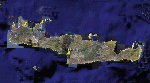
Crete is the bigger than the islands of the Greek archipelago and it is the south rampant of the Aegean sea. This scenery contains the following airports: LGIR, LGSA, LGOB, LGTL and 78 cities.
In this 2nd version I have used the mesh terrain of Yiannis Dermitzakis that offers a bigger realism to the costs. This has put under an obligation to reconstruct the entirety of the populations of the since costs they were located inside the sea. At the same time I have been able to redraw them populations with houses and real facilities that. I believe that I can offer a quite realistic scenery especially in the group of populations of the coast.
| Filename: | Crete_Island_Version_2.zip |
| License: | Freeware |
| Added: | 7th November 2009, 21:08:05 |
| Downloads: | 6,015 |
| Author: | Toni Agramont |
| Size: | 31.14 MB |
| Category: Flight Simulator X - Scenery | |
| Archipelago of St-pierre & Miquelon (non-flat airport) |
|
File Description:
"The archipelago of St Pierre (LFVP) and Miquelon (LFVM)".
Theses islands are situated in the south of New Foundland island, beetwin Canada and United States.
All the archipelago is made up of a new local mesh, landclass, photorealists textures in 2m/pixel in St-Pierre island (4 seasons and the night) with specific autogen, the harbour, various buildings, churches, and reference marks
visual.
The airport of St-Pierre (LFVP) is created with a non-flat runway, as it
is in reality, whith a true lenght profil.
A basic mission named "De Miquelon à St Pierre" is placed at "beginner"
level for discover easely the archipelago.
This scenery is only for FsX and is not compatible with Fs 2004 (Fs9)."
| Filename: | Archipelago_of_Stpierre__Miquelon_nonflat_airport.zip |
| License: | Freeware, limited distribution |
| Added: | 4th July 2008, 16:11:23 |
| Downloads: | 3,939 |
| Author: | Marc-henri Guitteny |
| Size: | 17.41 MB |
| Category: Flight Simulator X - Scenery | |
| CAK3 - Delta Heritage Airpark |
|
File Description:
Welcome to Delta Heritage Airpark!
"Delta" is an uncontrolled aerodrome located south of Vancouver in Delta, British Columbia. It's the home of RAAC Chapter 85, the Boundary Bay Flying Club and COPA Flight 5.
I have redevelopped the club, reorganised the tarmac for proper access to hangar and other building, including the famous roundabout for aircraft traffic, added the 50 ft obstable for RWY 25 and of course many Gliders as well as the farm life. Got to go back and see if there is farmers around there though...;)
Anyway, hope you'll enjoy your stop-over in Delta Heritage in your Light aircraft....as it is a "grass" airfield of 2600ft long! ;)
| Filename: | CAK3__Delta_Heritage_Airpark.zip |
| License: | Freeware |
| Added: | 15th March 2009, 12:58:56 |
| Downloads: | 1,176 |
| Author: | Daniel Louvet |
| Size: | 1.79 MB |
| Category: Flight Simulator X - Scenery | |
| KMEM v. 1.0 (Memphis International Airport) |
|
File Description:
This is update to the STOCK KMEM for FSX and FSX Steam Edition. I have completely redone the terminal by demolishing the spine and southeastern leg of Concourse B as the airport is undergoing major renovation. This is as of July 2018. All airlines have been moved to Concourses A & C during this time. I also added the military ramp and the South Cargo ramp with DHL and other airlines. Now to the FedEx SuperHub, All gates have been REDONE with proper numbers and assigned to FedEx. I also added Jim Dhaenens FSX LTS file into the airport for apron and gate lighting. Please, please, PLEASE read the READ ME file included in the ZIP file
| Filename: | KMEM_v_10_Memphis_International_Airport.zip |
| License: | Freeware |
| Added: | 24th July 2018, 17:02:34 |
| Downloads: | 1,713 |
| Author: | Louis Chader |
| Size: | 26.25 MB |
| Category: Flight Simulator X - Scenery | |
| RAF Honeybourne 1945 - Worcestershire, England |
|
File Description:
RAF Honeybourne was a Royal Air Force station located 0.6 miles (0.97 km) south of Honeybourne, Worcestershire, England and 4.6 miles (7.4 km) east of Evesham, Worcestershire, England.
The airfield was home to No. 24 Operational Training Unit RAF (OTU) which used Vickers Wellingtons and Armstrong Whitworth Whitleys from 15 March 1942 until July 1945 flying many operational bombing and leaflet dropping operations.
A number of units from Ferry Command were based here including a ferry training unit using Lockheed Hudsons and Bristol Beauforts.
The airfield was also temporarily home to No. 21 OTU flying Wellingtons from RAF Enstone from August 1945 for two months because the runways at their home base were being repaired. From October 1945 until 1946 107 Sub Storage Unit from No. 8 Maintenance Unit used the airfield for storing Wellingtons and General Aircraft Hamilcar gliders.
The role of the airfield after the war changed with the reduction of flying movements and with a slight change in what the units did on the airfield when No. 107 Sub Storage Unit from 1947 began to collect no longer needed Wellingtons which were then scrapped and taken to Weston Subedge goods yard (which was near to the south-western corner) where the railway would take them to the necessary destination.
In July 1948 the site was closed and much has reverted to farmland with runways being removed in 1968. Since then, the airside area has evolved into the Honeybourne Airfield Trading Estate with the five hangars being used for different purposes.
| Filename: | RAF_Honeybourne_1945__Worcestershire_England.zip |
| License: | Freeware |
| Added: | 3rd June 2016, 11:00:06 |
| Downloads: | 131 |
| Author: | Terry Boissel |
| Size: | 2.29 MB |
| Category: Flight Simulator X - Scenery | |
| LGLS - Lousoi Airfield **Fictional** |
|
Images related to this file:
File Description:
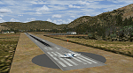
An imaginary airfield in north central Peloponnese Greece named after the elevated mountain plain where it would be situated. LGLS Lousoi airfield has a 1,000m runway at elevation of 3,186ft surrounded by mountains.
The aiport is equiped with NDB, ILS DME, PAPIs and night lighting for instrument approaches; approach chart included.
As bonus two imaginary helipads LGKK Kleitoria and LGPP Planitero are added in the nearby two villages.
All are infrastructure I wish they existed in the area since I drive there often for vacations in Planitero and always wondered how it would be if I could fly there. Planitero sits at the south footings of Chelmos mountain, the highest peak in the area. No AI traffic plans included.
| Filename: | LGLS__Lousoi_Airfield_Fictional.zip |
| License: | Freeware, limited distribution |
| Added: | 15th April 2015, 01:07:43 |
| Downloads: | 138 |
| Author: | Kyprianos Biris |
| Size: | 1.87 MB |
| Category: Flight Simulator X - Scenery | |
| Lake Kipawa - Quebec bush scenery |
|
File Description:
This scenery is fictitious and created for the pleasure of all. All the objects are already included in FSX and no other library was used. Seaplane base Kipawa is located on the North side of the lake, and this place is meant to be a site of free time for small boats. It can also be a refueling place for seaplanes. Lake Kipawa is situated at the far South West coast of Quebec, in the region of Abitibi-Temiscamingue. Must have before installing the Aerovirtuel bush flying sceneries:
1-Quebec Elevation 38m (LOD10) Gilles Gauthier sur http://avsim.com/ 5 files.
2-Quebec Scenery - Lakes and Rivers (1/5) http://avsim.com/ 5 files and one fix
3-Quebec Scenery - Addition of Roads http://avsim.com/
| Filename: | Lake_Kipawa__Quebec_bush_scenery.zip |
| License: | Freeware, limited distribution |
| Added: | 10th November 2007, 22:15:04 |
| Downloads: | 838 |
| Author: | Denis Dupuis |
| Size: | 1.01 MB |
| Category: Flight Simulator X - Scenery | |
| Lewiston-Nez Perce County Airport [KLWS] |
|
Images related to this file:
File Description:
Welcome to the Lewiston-Nez Perce County Airport in northern Idaho [KLWS] for FSX!
I have added the new tie-down area, taxiways (Z,Z1, and Z2), and the new Airport Operations
Facility located south of runway 08/26.
All the structures are custom. Airport vehicles use
the proper vehicle paths and do not use taxiways.
I have included a Traffic bgl that will add a number of AI flights into and out of Lewiston to other nearby
destinations. If you don't want that feature just delete the KLWS Traffic.bgl file in the scenery folder.
As with all my work the structures are original work.
Three scenery complexity levels are used (normal,dense, and very dense). More eye candy appears with each
increase.
| Filename: | LewistonNez_Perce_County_Airport_KLWS.zip |
| License: | Freeware, limited distribution |
| Added: | 10th April 2020, 15:46:08 |
| Downloads: | 182 |
| Author: | Brett Delana |
| Size: | 3.64 MB |
| Category: Flight Simulator X - Scenery | |
| X2DA - RAF Down Ampney - Gloucestershire, England |
|
File Description:
RAF Down Ampney (ICAO X2DA) was a Royal Air Force station located 1.8 miles (2.9 km) north east of Cricklade, Wiltshire and 3 miles (4.8 km) south west of RAF Fairford, Gloucestershire.
The airfield operated during World War II from February 1944 until February 1947.
Down Ampney was part of a group of 3 airfields with RAF Broadwell and RAF Blakehill Farm dedicated to air transportation.
No. 48 Squadron RAF and No. 271 Squadron RAF flew Douglas Dakotas on major missions. On D-Day they dropped the main elements of the 3rd Parachute Brigade in Normandy as well as towing Airspeed Horsa gliders across the English Channel.
They were also active in Operation Market Garden (Arnhem) and the Rhine crossing.
Source: Wikipedia.
| Filename: | X2DA__RAF_Down_Ampney__Gloucestershire_England.zip |
| License: | Freeware |
| Added: | 16th April 2016, 11:37:35 |
| Downloads: | 149 |
| Author: | Terry Boissel |
| Size: | 1.94 MB |
| Category: Flight Simulator X - Scenery | |
| YBWW - Brisbane West Wellcamp - Wellcamp, Australia |
|
File Description:
YBWW Brisbane West Wellcamp is Australia's newest airport and was privately built by Wagners Group. The Family had a dream so they built it. At the time of uploading QANTASLink (QLK16D, QLK15D, and QLK17D) are already flying direct to and from YSSY using the DH8D. REX are expected to commence using YBWW as a hub from January 2015. Wellcamp is located just west of Toowoomba in South Eastern Queensland. This is my first upload to AVSIM. It is not an extensive scenery, but provides enough to get operations started. There is nothing there is FSX, only a creek and farming land. I did this only because I couldn't locate one on the web for FSX. Credit to ADE and SBuilderX313, the two programs I used. Happy flying!
| Filename: | YBWW___Brisbane_West_Wellcamp__Wellcamp_Australia.zip |
| License: | Freeware |
| Added: | 24th November 2014, 19:31:41 |
| Downloads: | 821 |
| Author: | Sean Harrison |
| Size: | 4.51 KB |


© 2001-2026 AVSIM Online
All Rights Reserved
Privacy Policy |