
Where Flight Simulation Enthusiasts Gather from Around the World!
AVSIM Library - Search Results

| Category: Flight Simulator X - Scenery | |
| Ben Gurion Airport Scenery LLBG compatibility with FSX |

|
File Description:
I finally decided to share these "adapter" files so others can also enjoy this great scenery made for LLBG. (Ben Gurion Airport, Tel Aviv, Israel)
This download will enable the scenery of LLBG (FS2004) so it can work also on FSX. You first need to download the scenery from this link:
http://flightsim.com/kdl.php?fid=135660 - This fix addresses issues with
ground textures in the scenery - Fixes the underlying runways so there are no crashes when taxing - Assigned airline codes to some parkings - Enabled two tower views at their respective locations - Corrected heading of ILS 26 - parkings and parking numbers have been relocated to fit the scenery (via original FSX afcad) - AI planes checked and working with UT2and defaults - Frame Rate Friendly
| Filename: | Ben_Gurion_Airport_Scenery_LLBG_compatibility_with.zip |
| License: | Freeware |
| Added: | 29th November 2009, 22:25:20 |
| Downloads: | 3,331 |
| Author: | Nuriel Shem-Tov |
| Size: | 23.16 KB |
| Category: Flight Simulator X - Scenery | |
| ldsp_split_2025 |
|
File Description:
FSX Scenery LDSP_Split (CROATIA) (created with ADE & SketchUp 2017)
In order to correct any errors, anyone with aerial photos can send them to my email.
This scene was created without pretension, with the tools and data available, with as much precision as possible. AI has not been tested.
Some buildings are generic, others created with Sketchup often with very little reference (photos, height, width, etc.).
So I hope you will be happy to use it, accepting the flaws but knowing the many hours spent on its design.
Thank you for your understanding.
This scenery was built from the official maps for the runway and taxiways with GoogleMaps as a background image as support.
The different signs were positioned without any documentation or references
| Filename: | ldsp_split_2025.zip |
| License: | Freeware |
| Added: | 13th January 2025, 16:02:56 |
| Downloads: | 262 |
| Author: | serge libon |
| Size: | 10.71 MB |
| Category: Flight Simulator X - Scenery | |
| YBWW - Brisbane West Wellcamp - Wellcamp, Australia |
|
File Description:
YBWW Brisbane West Wellcamp is Australia's newest airport and was privately built by Wagners Group. The Family had a dream so they built it. At the time of uploading QANTASLink (QLK16D, QLK15D, and QLK17D) are already flying direct to and from YSSY using the DH8D. REX are expected to commence using YBWW as a hub from January 2015. Wellcamp is located just west of Toowoomba in South Eastern Queensland. This is my first upload to AVSIM. It is not an extensive scenery, but provides enough to get operations started. There is nothing there is FSX, only a creek and farming land. I did this only because I couldn't locate one on the web for FSX. Credit to ADE and SBuilderX313, the two programs I used. Happy flying!
| Filename: | YBWW___Brisbane_West_Wellcamp__Wellcamp_Australia.zip |
| License: | Freeware |
| Added: | 24th November 2014, 19:31:41 |
| Downloads: | 819 |
| Author: | Sean Harrison |
| Size: | 4.51 KB |
| Category: Flight Simulator X - Scenery | |
| KLAS - McCarran Intl, Las Vegas, Nevada, USA |
|
Images related to this file:
File Description:
This is a fairly accurate update for McCarran Intl airport with two optional files and made only for FSX, not suitable for P3D users: There is one file with the Crosswind runways operating where all 4 runways will be used for takeoff/landing and one file as the default FSX airport runway operation, assigned parking for the gates and terminals as per their website with extra parking including gates for the A380, Terminal 2 demolished, taxiways and taxi signs updated to the latest charts, extra fuel trucks, support vehicle roads rebuilt and many other scenery improvements and objects included, airport views are from the roof of the new control tower (when in tower view) please view the readme before installation.
| Filename: | KLAS__McCarran_Intl_Las_Vegas_Nevada_USA.zip |
| License: | Freeware, limited distribution |
| Added: | 10th August 2020, 17:17:47 |
| Downloads: | 45,313 |
| Author: | Ray Smith |
| Size: | 4.54 MB |
| Category: Flight Simulator X - Scenery | |
| Baltimore\Washington Intl Airport (KBWI) Maryland, USA |
|
Images related to this file:
File Description:
This is a very accurate rendition of KBWI with two optional files made only for FSX: one version with the Crosswind runway 10\28 activated where all 3 runway's will be used for takeoff\landing and one version of the default airport runway operation, Runway 4\22 has now been decommissioned, extension added to concourse A with all gates now numbered correctly, assigned parking as per their website with extra parking, taxiways and taxi signs updated to the latest charts, UPS and Fedex ramps and buildings updated, extra fuel trucks, support vehicle roads rebuilt and many other scenery improvements and objects added, airport views are from inside the control tower (when in tower view) please view the readme before installation
| Filename: | BaltimoreWashington_Intl_Airport_KBWI_Maryland_USA.zip |
| License: | Freeware, limited distribution |
| Added: | 25th August 2017, 02:54:48 |
| Downloads: | 29,625 |
| Author: | Ray Smith |
| Size: | 4.78 MB |
| Category: Flight Simulator X - Scenery | |
| Mayaguana (MYMM) - The Bahamas |
|
Images related to this file:
File Description:
Mayaguana is the easternmost island in the Bahamas with Bahamasair providing Nassau and Inagua air connections. The airport utilizes part of an abandoned 11,000 foot USAF runway. The runway is listed as 7300 foot long, but 2400 feet on the east end is closed indefinitely. A new terminal building was completed, but no apron or taxiway connects it to the runway so it is unoccupied. Construction was started on another terminal, apron and taxiway as well as runway repaving, but the project is currently abandoned. All of the aforegoing is represented by this scenery. The scenery includes custom scenery objects; placement of library objects and landclass changes. Scenery is based on Bing Maps and photos taken locally, and it is optimized for use with UTX-TAC.
| Filename: | Mayaguana_MYMM__The_Bahamas.zip |
| License: | Freeware |
| Added: | 20th April 2013, 20:18:45 |
| Downloads: | 1,123 |
| Author: | Art Poole |
| Size: | 1.04 MB |
| Category: Flight Simulator X - Scenery | |
| Laviolette bridge, Trois-Rivières, Québec Canada for FSX |
|
File Description:
The Laviolette bridge (in French, pont Laviolette) connecting the city of Trois-Rivières and Bécancour on the South shore of the Saint Lawrence River (Highway 55) is an important land mark for pilots flying between Montreal (CYUL) and Quebec City (CYQB). It is a beautiful and aesthetic arch bridge of 2.7km long with a main span of 335m and a total height of 106,6m
A lot of attention to details was required to reproduce the bridge complex structure. This scenery features a very accurate bridge with 4 lanes traffic, night textures, road lighting and static ships. Pilots are invited the take off from nearby CYRQ airport at the control of their favourite helicopter or slow aircraft to fly around the bridge to inspect the structure and appreciate the view.
| Filename: | Laviolette_bridge_TroisRivires_Qubec_Canada_for_FS.zip |
| License: | Freeware |
| Added: | 14th March 2008, 09:22:13 |
| Downloads: | 8,093 |
| Author: | Gilles Boily |
| Size: | 1.36 MB |
| Category: Flight Simulator X - Scenery | |
| TNCB Flamingo/Bonaire International Airport |
|
File Description:
Flamingo International Airport or Bonaire International Airport (IATA: BON, ICAO: TNCB) is an international airport located at Kralendijk, Bonaire, Netherlands.
The Flamingo Airport serves as a connecting point for flights of KLM to some airports in South America. Thus airport once served as a hub for BonaireExel, BonaireExpress, CuracaoExel, CuracaoExpress, and it now serves the Dutch Antilles Express as its secondary hub, along with Insel Air, for its flights to and from Miami, Florida, and also EZAir serves Bonaire, as well as Curacao, as its main airline, although the airline itself is based at Curacao. The airport is also a refueling stop for KLM's flights to Ecuador.
This file has the right coordinates, with the apron and characteristics of the airport. The runways and runways were resized the gates placed on correct location.
| Filename: | TNCB_FlamingoBonaire_International_Airport.zip |
| License: | Freeware |
| Added: | 8th April 2011, 11:39:42 |
| Downloads: | 1,832 |
| Author: | Anwar Gonzalez |
| Size: | 6.08 KB |
| Category: Flight Simulator X - Scenery | |
| St. Kitts Island - Federation of Saint Kitts and Nevis |
|
Images related to this file:
File Description:
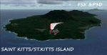
A representation of St. Kitts using photo-real scenery along with hand placed autogen. Robert L. Bradshaw International Airport is an international airport located just northeast of Basseterre, on the island of Saint Kitts, serving the nation of Saint Kitts and Nevis.
New construction started late 2004. Up to 6 wide bodied jets can now be accommodated on the tarmac. The airport can accommodate commercial jumbo jets and handles scheduled non-stop jet flights to Canada and the United States, as well as numerous regional commuter flights from within the Caribbean area. For the best results of this scenery, PWSceneries Volume 5 has to be installed. Features included are custom photo scenery covering the entire island, hand placed autogen, detailed 3D Objects and custom buildings. Works in FSX and P3D.
| Filename: | St_Kitts_Island___Federation_of_Saint_Kitts_and_Ne.zip |
| License: | Freeware |
| Added: | 24th September 2015, 10:57:42 |
| Downloads: | 827 |
| Author: | Kenje Thomas & Jamalje Bassue |
| Size: | 105.56 MB |
| Category: Flight Simulator X - Scenery | |
| X3LR - RAF Langar - Langar, Nottinghamshire, England |
|
File Description:
RAF Langar (ICAO X3LR) is a former Royal Air Force station located near the village of Langar, Nottinghamshire, England. The airfield is located approximately 6 miles (9.7 km) east-southeast of Radcliffe on Trent and about 100 miles (160 km) north-northwest of London, England.
Opened in 1942 during World War II, it was used by both the Royal Air Force and United States Army Air Forces. During the war it was used primarily as troop carrier transport airfield. After the war it was provided to the Royal Canadian Air Force which used it as an operational base until 1963.
Today the airfield is the location for the British Parachute Schools, who use the original control tower for their headquarters. The former Avro industrial complex is used by private industry.
| Filename: | X3LR__RAF_Langar__Langar_Nottinghamshire_England.zip |
| License: | Freeware |
| Added: | 19th March 2016, 12:18:06 |
| Downloads: | 229 |
| Author: | Terry Boissel |
| Size: | 1.88 MB |
© 2001-2026 AVSIM Online
All Rights Reserved
Privacy Policy |