
Where Flight Simulation Enthusiasts Gather from Around the World!
AVSIM Library - Search Results

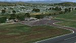
| Category: Flight Simulator X - Scenery | |
| Southern California Scenery Enhancements v2.0 |

|
File Description:
This is a compilation of the Scenery Enhancements that I have uploaded over the past year. Enhancements include KMHV Mojave Airport, KTSP Tehachapi Municipal Airport, KVBG Vandenberg AFB, Palm Springs Windmill Farm & So. Cal Oil Rigs v2.1. All Rwy12 Object Libraries textures have been included; meaning that ANY scenery enhancement requiring Rwy12 Objects Textures will work. These enhancements have been conveniently placed in a simple installation file. This file is for FS-X ONLY!
| Filename: | Southern_California_Scenery_Enhancements_v20.zip |
| License: | Freeware |
| Added: | 7th December 2006, 11:20:22 |
| Downloads: | 5,582 |
| Author: | Brian C. Selb |
| Size: | 39.71 MB |
| Category: Flight Simulator X - Scenery | |
| EDDV - Hannover Airport, Germany |
|
Images related to this file:
File Description:
This scenery is for Hannover Airport with two optional files made only for FSX: assigned parking as per their website with extra parking, new control tower, taxiways and taxi signs updated and corrected to the latest charts, extra fuel trucks, support vehicle roads rebuilt and many other scenery improvements and objects added, airport views are from the roof of the control tower (when in tower view) please view the readme before installation.
| Filename: | EDDV__Hannover_Airport_Germany.zip |
| License: | Freeware, limited distribution |
| Added: | 17th August 2017, 17:14:36 |
| Downloads: | 19,307 |
| Author: | Ray Smith |
| Size: | 1.76 MB |
| Category: Flight Simulator X - Scenery | |
| 7castles |
|
File Description:
Seven castles (Himeji castle, Kumamoto castle, Osaka castle, Edo castle E Yatsushiro castle, Hikone Castle, Goryoukaku)
It hardly exists except for Himeji castle, Hikone castle and Goryoukaku in these seven castles.
It was reproduced based on the materials.
As for Osaka castle, Tokugawa Osaka castle was reproduced.
It was arranged at the foot of a mountain of Hokkaido Mt Youteizann.
The arrangement latitude, longitude of Osaka castle is N42*55.98 E140*46.60.
| Filename: | 7castles.zip |
| License: | Freeware |
| Added: | 18th June 2008, 00:30:37 |
| Downloads: | 2,276 |
| Author: | Harutoshi Nakagawa |
| Size: | 10.29 MB |
| Category: Flight Simulator X - Scenery | |
| Cape Girardeau Regional Airport |
|
Images related to this file:
File Description:
FSX Scenery - Cape Girardeau Regional Airport (IATA: CGI, ICAO: KCGI) is a public airport located five miles (8 km) southwest of the central business district (CBD) of Cape Girardeau, a city in Cape Girardeau County, Missouri, USA. The airport covers 557 acres (225 ha) and has two runways. It is used for general aviation. Created using Instant Scenery. Libraries listed. Created With assistance from David "Opa" Marshall, by John B. Loney, Jr.
| Filename: | Cape_Girardeau_Regional_Airport.zip |
| License: | Freeware, limited distribution |
| Added: | 27th February 2011, 04:41:31 |
| Downloads: | 693 |
| Author: | John B. Loney, Jr. |
| Size: | 5.85 MB |
| Category: Flight Simulator X - Scenery | |
| Misrata Intl. Airport HLMS FSX |
|
File Description:
This Addon for FSX, Currently the most realistic and best addon for Misrata airport.
Changes:
- APT position aligned.
- Correct Taxiway designators.
- Corrected stands and thier positions.
- Corredted VOR position
- Apron Lights.
and more...
-Info. : Misrata Airport (IATA: MRA, ICAO: HLMS) is an international airport serving Misrata, a Mediterranean coastal city in the Misrata District of Libya. It also acts as an air base and training center for the Libyan Air Force.
for contact: [email protected]
| Filename: | Misrata_Intl_Airport___HLMS_FSX.zip |
| License: | Freeware |
| Added: | 17th February 2019, 18:56:27 |
| Downloads: | 561 |
| Author: | Hamza Aswaid |
| Size: | 54.59 MB |
| Category: Flight Simulator X - Scenery | |
| KSEA - Seattle-Tacoma Intl - Washington, USA |
|
Images related to this file:
File Description:
This airport update is for KSEA and made only for FSX: Concourses A, B, C, D, S and N now updated to reflect todays situation, assigned parking also updated as per their website with extra parking, taxiways and taxi signs updated to the latest charts, extra fuel trucks, support vehicle roads rebuilt and many other scenery improvements, airport views are from inside the control tower (when in tower view) please view the readme before installation.
| Filename: | KSEA__SeattleTacoma_Intl__Washington_USA.zip |
| License: | Freeware, limited distribution |
| Added: | 11th September 2015, 02:17:58 |
| Downloads: | 29,787 |
| Author: | Ray Smith and Craig Scott |
| Size: | 1.68 MB |
| Category: Flight Simulator X - Scenery | |
| ENGM - Gardermoen - Oslo, Norway |
|
Images related to this file:
File Description:
This airport update is for Gardermoen Airport and made only for FSX: The new North pier added including the gates and jet bridges, assigned parking as per their website with extra parking, Cargo area updated, taxiways and taxi signs updated to the latest charts, extra fuel trucks, support vehicle roads rebuilt and many other scenery improvements, airport views are from the roof of control tower (when in tower view) please view the readme before installation.
| Filename: | ENGM__Gardermoen__Oslo_Norway.zip |
| License: | Freeware, limited distribution |
| Added: | 17th June 2016, 09:01:18 |
| Downloads: | 28,727 |
| Author: | Ray Smith |
| Size: | 1.4 MB |
| Category: Flight Simulator X - Scenery | |
| SVGU Guanare, Venezuela |
|
Images related to this file:
File Description:
The Coromoto National Airport serves to Guanare's city, to the west of Venezuela.
Currently this airport is not operating for commercial aviation.
With photo-terrain scenery from satellite imagery of Google Earth.
Photo-terrain area improved with Autogen files.
Not compatible with versions prior to FSX.
This scenery requires SP1, SP2, or the Acceleration
expansion pack in order to be displayed correctly.
Also includes a friendly Auto-Install.
| Filename: | SVGU_Guanare_Venezuela.zip |
| License: | Freeware |
| Added: | 6th October 2013, 17:28:27 |
| Downloads: | 1,277 |
| Author: | David Maldonado |
| Size: | 70.66 MB |
| Category: Flight Simulator X - Scenery | |
| RAF Honeybourne 1945 - Worcestershire, England |
|
File Description:
RAF Honeybourne was a Royal Air Force station located 0.6 miles (0.97 km) south of Honeybourne, Worcestershire, England and 4.6 miles (7.4 km) east of Evesham, Worcestershire, England.
The airfield was home to No. 24 Operational Training Unit RAF (OTU) which used Vickers Wellingtons and Armstrong Whitworth Whitleys from 15 March 1942 until July 1945 flying many operational bombing and leaflet dropping operations.
A number of units from Ferry Command were based here including a ferry training unit using Lockheed Hudsons and Bristol Beauforts.
The airfield was also temporarily home to No. 21 OTU flying Wellingtons from RAF Enstone from August 1945 for two months because the runways at their home base were being repaired. From October 1945 until 1946 107 Sub Storage Unit from No. 8 Maintenance Unit used the airfield for storing Wellingtons and General Aircraft Hamilcar gliders.
The role of the airfield after the war changed with the reduction of flying movements and with a slight change in what the units did on the airfield when No. 107 Sub Storage Unit from 1947 began to collect no longer needed Wellingtons which were then scrapped and taken to Weston Subedge goods yard (which was near to the south-western corner) where the railway would take them to the necessary destination.
In July 1948 the site was closed and much has reverted to farmland with runways being removed in 1968. Since then, the airside area has evolved into the Honeybourne Airfield Trading Estate with the five hangars being used for different purposes.
| Filename: | RAF_Honeybourne_1945__Worcestershire_England.zip |
| License: | Freeware |
| Added: | 3rd June 2016, 11:00:06 |
| Downloads: | 131 |
| Author: | Terry Boissel |
| Size: | 2.29 MB |
| Category: Flight Simulator X - Scenery | |
| YKLN Kulin Town and YJLN Kulin, Jilakin Rock, Western Australia |
|
File Description:
YKLN Kulin Town and YJLN Kulin, Jilakin Rock. Kulin is located in the upper great southern Wheatbelt of Western Australia, the Shire of Kulin covers an area of 4,790 square kilometres. It encompasses the towns of Kulin, Pingaring, Dudinin, Jitarning, and Holt Rock. The Kulin economy is based on agriculture and was settled by pastoralists in 1905. The crosswind runway is actually 7 miles to the east at Jilakin Rock and slopes uphill to the east. For convenience, I have used fictitious YJLN. Jilakin Downs is a Dorper sheep stud farm and the home of the Kulin Bush Races. Dorpers are currently under a cloud in Western Australia as the local abatoirs claim their hair is contaminating the meat and won't accept them. "We welcome air traffic to our 2012 Kulin Bush Races Weekend. A crosswind airstrip is available, with a shuttle bus service to the Jilakin Track. GPS position is S32-39-95 E118-18-71 and the elevation is 950 feet. The strip is 7 nautical miles east of the town of Kulin. Camping and toilets are close to the strip so that you can camp near your plane.
Kulin airstrip is also available for landing and takeoff during the weekend, a shuttle bus is available to take you out to the race track. If this option is chosen please contact Barry West. Please contact Barry West for flying information on 9880 9021" www.kulin.wa.gov.au/tourism_and_local_events/kulin_bush_races/flying_visit.html REQUIRES Blencowe_LibraryKit.zip
REQUIRES blencowe_librarykit_309494.zip (Available HERE)
| Filename: | YKLN_Kulin_Town_and_YJLN_Kulin_Jilakin_Rock_Wester.zip |
| License: | Freeware |
| Added: | 28th February 2013, 13:52:31 |
| Downloads: | 225 |
| Author: | Alan Blencowe |
| Size: | 5.73 MB |
© 2001-2026 AVSIM Online
All Rights Reserved
Privacy Policy |