
Where Flight Simulation Enthusiasts Gather from Around the World!
AVSIM Library - Search Results

| Category: Flight Simulator X - Scenery | |
| Improved Thermals v. 1.1 |

|
File Description:
The auto-generated thermals in FSX are made more challenging and diversified by editing the ThermalDescriptions.xml. Three more classes of thermals were added and the lookup table that determines which thermals occur on each landclass type was edited. The characteristics of thermals (climb rate, ceiling, diameter) should be more realistic and challenging.
| Filename: | Improved_Thermals_v_11.zip |
| License: | Freeware, limited distribution |
| Added: | 27th January 2007, 01:13:19 |
| Downloads: | 2,682 |
| Author: | Markus Paul |
| Size: | 28.83 KB |
| Category: Flight Simulator X - Scenery | |
| Assiut International Airport( HEAT) Egypt |
|
File Description:
This is a good version of Assiut International Airport ( HEAT )Egypt
designed only for FSX,tested working with P3D gates/parking now numbered in the correct order,
taxiways and taxi signs corrected to the latest charts,many other scenery improvements and objects added.
Please view the read me before installation. By Mohamed Salamoni
| Filename: | Assiut_International_Airport_HEAT_Egypt.zip |
| License: | Freeware |
| Added: | 17th April 2017, 00:11:51 |
| Downloads: | 879 |
| Author: | Mohamed Salamoni |
| Size: | 5.14 MB |
| Category: Flight Simulator X - Scenery | |
| DAAE - Bejaia, Algeria - VFR |
|
Images related to this file:
File Description:
fly one of the most beautiful coast in the East part of Algeria.
This scenery has a High resolution ground texture.
The city of Bejaia
West part (Yemma gouraya - Cap Carbon - Pic des singes - zegwatt creeq)
to the East (Touristic zone Capritour) - Tichy - Aowkas - souk ett'nine and Malbou Beach
Includes also night texture
| Filename: | DAAE__Bejaia_Algeria__VFR.zip |
| License: | Freeware |
| Added: | 25th April 2013, 20:35:00 |
| Downloads: | 4,005 |
| Author: | Zoheir BENMERADI |
| Size: | 97.76 MB |
| Category: Flight Simulator X - Scenery | |
| Warsaw - Ursynow 3D Scenery ver. 3.0 |
|
Images related to this file:
File Description:
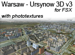
Ursynow district in Warsaw for FSX.
Scenery contains the majority of the buildings from the Warsaw district Ursynow.
Scenery includes phototextures, 3D buildings and other objects. Additionaly contains
new autogen objects (trees, buildings) for other product - "Warsaw Photo Scenery".
This scenery doesn't require Warsaw Photo Scenery for action, but exceptionally I recommend it.
| Filename: | Warsaw__Ursynow_3D_Scenery_ver_30.zip |
| License: | Freeware |
| Added: | 29th September 2010, 12:59:51 |
| Downloads: | 2,197 |
| Author: | Jacek Zaczek |
| Size: | 142.83 MB |
| Category: Flight Simulator X - Scenery | |
| Aswan International Airport( HESN) Egypt |
|
File Description:
This is a good version of Aswan International Airport ( HESN )Egypt
designed only for FSX,tested working with P3D gates/parking now numbered in the correct order,
taxiways and taxi signs corrected to the latest charts,many other scenery improvements and objects added.
Please view the read me before installation. By Mohamed Salamoni
| Filename: | Aswan_International_Airport_HESN_Egypt.zip |
| License: | Freeware |
| Added: | 17th April 2017, 19:46:08 |
| Downloads: | 1,439 |
| Author: | Mohamed Salamoni |
| Size: | 10.92 MB |
| Category: Flight Simulator X - Scenery | |
| KFRR - Front Royal-Warren County Airport - Front Royal - Virginia, USA |
|
Images related to this file:
File Description:
Front Royal-Warren County Airport (IATA: FRR[2], ICAO: KFRR, FAA LID: FRR) is a county owned, public use airport located three nautical miles (6 km) west of the central business district of Front Royal, a town in Warren County, Virginia, United States. It is included in the National Plan of Integrated Airport Systems for 2011-2015, which categorized it as a general aviation facility.
This is a complete re-work of the airport based on Google Maps. Created with Airport Design Editor by ScruffyDuck Software using current FAA documentation and Google Earth measurements, this package offers a replacement for FSX's stock airport. All these enhancements are as close to the real airport as I can get with stock library objects and custom buildings.
| Filename: | KFRR__Front_RoyalWarren_County_Airport__Front_Roya.zip |
| License: | Freeware |
| Added: | 1st October 2014, 14:01:40 |
| Downloads: | 366 |
| Author: | Wayne Roberts |
| Size: | 232.02 KB |
| Category: Flight Simulator X - Scenery | |
| X2DA - RAF Down Ampney - Gloucestershire, England |
|
File Description:
RAF Down Ampney (ICAO X2DA) was a Royal Air Force station located 1.8 miles (2.9 km) north east of Cricklade, Wiltshire and 3 miles (4.8 km) south west of RAF Fairford, Gloucestershire.
The airfield operated during World War II from February 1944 until February 1947.
Down Ampney was part of a group of 3 airfields with RAF Broadwell and RAF Blakehill Farm dedicated to air transportation.
No. 48 Squadron RAF and No. 271 Squadron RAF flew Douglas Dakotas on major missions. On D-Day they dropped the main elements of the 3rd Parachute Brigade in Normandy as well as towing Airspeed Horsa gliders across the English Channel.
They were also active in Operation Market Garden (Arnhem) and the Rhine crossing.
Source: Wikipedia.
| Filename: | X2DA__RAF_Down_Ampney__Gloucestershire_England.zip |
| License: | Freeware |
| Added: | 16th April 2016, 11:37:35 |
| Downloads: | 148 |
| Author: | Terry Boissel |
| Size: | 1.94 MB |
| Category: Flight Simulator X - Scenery | |
| TACAN Replacements - US Complete |
|
File Description:
By default, all of the TACAN navigational aids present within FSX have the bearing component turned off, so as to properly represent the real world result of tuning in the DME component of a TACAN with a civilian plane. However, this limits their functionality when you wish to use them in conjunction with a plane (generally military) equipped with a representation of a functioning TACAN system.
This download contains 105 fixed/adjusted/changed navigational aids for the United States to represent all currently active TACAN stations. These navigational aids have all had the bearing component turned on, so that they are completely usable for navigation within the sim.
This package completely replaces any previous partial TACAN release for the United States.
| Filename: | TACAN_Replacements__US_Complete.zip |
| License: | Freeware |
| Added: | 17th June 2014, 16:15:09 |
| Downloads: | 1,227 |
| Author: | Jim Stewart |
| Size: | 111.71 KB |
| Category: Flight Simulator X - Scenery | |
| GPS Enabled Oil Rig Platform |
|
File Description:
An FSX Oil rig placed at the correct real life coordinates about 100+ miles from Aberdeen and Peterhead. The landing pod has GPS facilities and a code of RIG1 Meaning you can start at the pod and/or fly to it by entering RIG1 into the GPS Direct To. A Cargo Ship sails from the tidal Aberdeen Harbour at 06:18 Local time and heads for Peterhead which is an hour away. It joins another Cargo ship there and the two set sail for the Piper alpha rig some 5 hours away. Sailings are twice a day and can be followed by boat plane. The rig landing pod is excellent for landing practice in a helicopter and especially with the built in GPS coordinates.
| Filename: | GPS_Enabled_Oil_Rig_Platform.zip |
| License: | Freeware |
| Added: | 20th November 2011, 00:43:58 |
| Downloads: | 572 |
| Author: | Steve Brooks |
| Size: | 6.26 KB |
| Category: Flight Simulator X - Scenery | |
| YCHP Yanchep St Andrews, Western Australia (Closed) |
|
File Description:
YCHP Yanchep St Andrews (Closed) was built by the Bond Corporation in the 60's for the development of the St Andrews Estate and Sun City development and has since fallen into disrepair. Alan Bond was a larger than life character and most of Western Australia will still remember his airship or his lear jet flying around Perth. I have placed a windsock and cones to help you find your way around on the ground because there is little else there. In real life, the strip may still look inviting but it is overgrown and most likely not safe. REQUIRES Blencowe_LibraryKit.zip
REQUIRES blencowe_librarykit_309494.zip (Available HERE)
| Filename: | YCHP_Yanchep_St_Andrews_Western_Australia_Closed.zip |
| License: | Freeware |
| Added: | 25th February 2013, 09:01:20 |
| Downloads: | 239 |
| Author: | Alan Blencowe |
| Size: | 1.4 MB |
© 2001-2026 AVSIM Online
All Rights Reserved
Privacy Policy |