
Where Flight Simulation Enthusiasts Gather from Around the World!
AVSIM Library - Search Results

| Category: Flight Simulator X - Scenery | |
| Bhutan Airports and Paro Valley |

|
Images related to this file:
File Description:
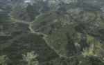
This project adds and updates all of the airports of Bhutan. Bathpalathang (VQBT) and Gelephu (VQGP) are added, Yongphulla (VQ10) is updated and recoded as VQTY, and Paro (VQPR) is fully updated to reflect current satellite imagery. These are all fully functioning AI airports as well. Special attention was given to the entire Paro Valley, and numerous road/river vectors were updated around Gelephu. Accurate coastlines, lakes, road and river data, as well as corrected landclass are provided based on the latest available satellite imagery. They are optimized to fit seamlessly with FTX Vector's roads/water, but they should be fully functional in all FSX configurations.
GA-encoded flight plans for the Buddha Air/Kathmandu charter are provided to enhance service to Paro. NASA SRTM Global 3 arc second terrain mesh is also included for all of Bhutan. Updates were created or rebuilt in a manner which carefully aligned airport data with current satellite imagery, when available. Scenery was created using Airport Design Editor X v1.61.5298, SBuilderX 3.13, and the FSX Object Placement Tool. Scenery objects were added and modified from stock FSX scenery to resemble as closely as possible the actual airports.
| Filename: | Bhutan_Airports_and_Paro_Valley.zip |
| License: | Freeware |
| Added: | 19th January 2015, 06:09:17 |
| Downloads: | 11,433 |
| Author: | Carlyle Sharpe |
| Size: | 21.4 MB |
| Category: Flight Simulator X - Scenery | |
| LYPG Podgorica Airport, Montenegro |
|
File Description:
Podgorica Airport (IATA: TGD, ICAO: LYPG) is an international airport located 11 km (6.8 mi) south of Podgorica, Montenegro. It is the main hub for Montenegro Airlines.
It is one of two public airports in Montenegro, the other being Tivat Airport. Both are operated by the state-owned company Airports of Montenegro. The airport is sometimes called Golubovci Airport by the locals, as the town of
Golubovci is in close proximity. Airports Council International awarded Podgorica the best airport under 1 million passengers in 2007.
The IATA code of the airport is still TGD because Podgorica was named Titograd (after Josip Broz Tito) from 1946 to 1992, during which time the airport opened.
The airport handles domestic flights within Montenegro as well as international flights. As Montenegro's two main airports are merely 80 km apart, there are no regular passenger domestic flights. Domestic flights have been reduced to
charter flights and general aviation, and all scheduled traffic is international.
There are daily scheduled flights to various European destinations. During the summer season, there are many charter flights and air connections to various major cities in the world. The flight to Belgrade airport has traditionally
accounted for majority of the traffic at the airport, but the percentage is decreasing.
VIP and taxi airlines Vektra Aviation, Di Air and OKI Air are based at the airport. Serbian VIP airlines Air Pink and Prince Aviation also use the airport.
Podgorica Airport served 538,477 passengers in 2008. However, due to global economic downturn, passenger numbers declined to 450,504 in 2009. In 2010, strong growth was recorded, so numbers passed the 600,000 mark.
Thanks to Serbia And Montenegro Virtual Area Control Center for the airport charts.
This file has the right coordinates, with the apron and characteristics of the airport, airport vehicles and buildings, also it is set to the correct altitude of 126 feet or 38 meters.
| Filename: | LYPG_Podgorica_Airport_Montenegro.zip |
| License: | Freeware |
| Added: | 29th October 2012, 21:41:37 |
| Downloads: | 4,666 |
| Author: | Anwar Gonzalez |
| Size: | 10.52 MB |
| Category: Flight Simulator X - Scenery | |
| Cedar Rapids Iowa USA Eastern Iowa Airport-KCID |
|
Images related to this file:
File Description:
Cedar Rapids Iowa USA Eastern Iowa Regional Airport for FSX. Several improvements have been made to the default airport. The default terminal buildings have been replaced with buildings created in FSDS; aircraft gates have been correctly coded using Airport Design Editor 1.70.6042; a new airport vehicle network has been built to prevent airport vehicles from entering the taxiways; extra fuel trucks have been added throughout the airport; the tower view has been changed to display from the roof of the control tower; static FedEx and UPS scenery objects have been placed throughout the airport; all taxiway signs are correctly placed and all taxiway designators are correctly named; there is the option to open both runways to AI traffic; optionally, a set of GA flight plans is included using all default FSX aircraft to liven up the GA area; and Jim Dhaenen's excellent ramp lights are also included. Please read the README FIRST.txt and installation.txt files to insure proper installation of all files.
| Filename: | Cedar_Rapids_Iowa_USA_Eastern_Iowa_AirportKCID.zip |
| License: | Check within download |
| Added: | 29th September 2017, 16:54:49 |
| Downloads: | 867 |
| Author: | Patrick Finch |
| Size: | 6.34 MB |
| Category: Flight Simulator X - Scenery | |
| Lafayette Louisiana USA Regional Airport |
|
Images related to this file:
File Description:
Lafayette Louisiana USA Regional Airport for FSX. Several improvements have been made to the default airport. The default terminal building has been replaced with a custom building created in FSDS; aircraft gates have been correctly coded using Airport Design Editor 1.70.6042; a new airport vehicle network has been built to prevent airport vehicles from entering the taxiways; extra fuel trucks have been added throughout the airport; the tower view has been changed to display from the roof of the control tower; static FedEx and UPS scenery objects have been placed throughout the airport; all taxiway signs are correctly placed and all taxiway designators are correctly named; there is the option to open both runways to AI traffic; the ILS for Runway 4R has been added; optionally, a set of GA flight plans is included using all default FSX aircraft to liven up the GA area; and Jim Dhaenen's excellent ramp lights are also included. Please read the README.txt file to insure proper installation of all files.
| Filename: | Lafayette_Louisiana_USA_Regional_Airport.zip |
| License: | Freeware, limited distribution |
| Added: | 2nd November 2017, 17:58:44 |
| Downloads: | 689 |
| Author: | Patrick Finch |
| Size: | 3.09 MB |
| Category: Flight Simulator X - Scenery | |
| Daytona_Beach_FL_redone |
|
File Description:
This is a compilation of my changes to scenery at Daytona Beach, FL and the surrounding area during the past year. This includes Updates to KDAB, Daytona International Speedway, KDED, KOMN and KEVB. It also includes the addition of a seaplane dock at Halifax River landing area 1FD1, Main Street pier, City Island ball park, Ponce Inlet lighthouse with a working beacon, inlet jetties, marinas, and landclass corrections. All FBOs are included at airports as well as the Embry Riddle Aeronautical University Flight Center and Tech Center. This scenery has been tested using Ultimate Terrain X and WOAI.
| Filename: | Daytona_Beach_FL_redone.zip |
| License: | Freeware |
| Added: | 4th December 2008, 16:30:47 |
| Downloads: | 3,291 |
| Author: | Art Poole |
| Size: | 2.26 MB |
| Category: Flight Simulator X - Scenery | |
| The Dry Tortugas Photo Scenery |
|
Images related to this file:
File Description:
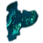
Where are the Dry Tortugas? Should you be wondering, at the western end of the Florida Keys. Located 68 miles west of Key West, they are accessible only by boat and of course via your favorite seaplane.
Source Data: National Agriculture Imagery Program (NAIP) Orthoimagery, 1 meter per pixel resolution. The scenery package also corrects the MS-FSX Island and Lighthouse position errors overlooked by UTX-USA and UTX-TAC.
For your finest virtual experience it is highly recommended you download, install and use with: South Florida and The Bahamas Water Class scenery. (S-FL_Bahamas_WC.zip)
Enjoy your flight and don't forget your Scuba Gear or the sunscreen! - Wally-Bob
| Filename: | The_Dry_Tortugas_Photo_Scenery.zip |
| License: | Freeware, limited distribution |
| Added: | 23rd August 2014, 11:08:17 |
| Downloads: | 918 |
| Author: | Walter Roberts |
| Size: | 50.9 MB |
| Category: Flight Simulator X - Scenery | |
| ValparaÃso Provincia, Litoral 2016. Chile. For FSX |
|
Images related to this file:
File Description:
Scenery of ValparaÃso Province from North (Quintero) to South (Laguna Verde valley). About 2.000 km2 intervention that brings up to fsx the current urban density, neighborhoods, forests and the most important iconic 3d objects you can recognize from a real VFR flight. This project uses FTX Vector as it main complement (only for the shapes of the coast). Also uses satellite background DAY/NIGHT, SPRING/ FALL / WINTER Photoscenery for Ritoque, Aconcagua, Concon, Embalse Los Aromos, Salinas, Borde Costero de Viña del Mar, Tranque La Luz, Peñuelas. Recomended to use (as an option) with my airport projects. SCVM, SCER, SCRD, SCSN, SCCV, SCIR, SCEL.
| Filename: | Valparaso_Provincia_Litoral_2016_Chile_For_FSX.zip |
| License: | Freeware |
| Added: | 4th November 2016, 04:59:42 |
| Downloads: | 1,097 |
| Author: | Orlando Veas |
| Size: | 180.36 MB |
| Category: Flight Simulator X - Scenery | |
| Edmund Fitzgerald |
|
Images related to this file:
File Description:

The last trip of the Edmund Fitzgerald, who sunk in Superior lake in 1975. In AI version (accompagned by the Arthur M. Anderson) and alone in static version.
| Filename: | Edmund_Fitzgerald.zip |
| License: | Freeware |
| Added: | 1st March 2015, 15:37:10 |
| Downloads: | 264 |
| Author: | Jean-Pierre Fillion |
| Size: | 8.75 MB |
| Category: Flight Simulator X - Scenery | |
| St Remy de Maurienne LFKR Senery |
|
File Description:
Scenery of small airport of St Remy de Maurienne LFKR in French Alpes missed in the default scenery in FSX.
| Filename: | St_Remy_de_Maurienne_LFKR_Senery.zip |
| License: | Freeware, limited distribution |
| Added: | 26th April 2016, 20:31:58 |
| Downloads: | 514 |
| Author: | Jean-Pierre Kozerawski |
| Size: | 5.96 MB |
| Category: Flight Simulator X - Scenery | |
| Vietnam War project - base pack |
|
Images related to this file:
File Description:
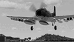
FSX Vietnam War Project - base pack version 0.9. FSX SP1/SP2 needed - Acceleration Pack optionnal, recommended.
About 100 new and redone airfields from SEA (Cam Ranh, Bien Hoa, Phu Cat, Nakhon Phanom, Korat...). French and English documentation (50 pages). Requires Vietnam War project AI airplanes (VnW_AI.zip).
TAD for each airfield. Additional sceneries. 25 flight plans to help you flying over the area.
Included : Al Simms Vietnam war objects, Jim Dhaenens Radars, lights and shelters, Guy Diotte static airplanes.
2 Objects libraries needed : read the quick installation guide.
Visit the project web site : http://vietnamwar.project.free.fr/
To contact us : [email protected]
FSX Vietnam War project: Jacques Godfrin - Xavier Carre
| Filename: | Vietnam_War_project__base_pack.zip |
| License: | Freeware, limited distribution |
| Added: | 11th April 2010, 07:57:17 |
| Downloads: | 2,047 |
| Author: | Jacques Godfrin, Xavier Carre, Vietnam War project |
| Size: | 76.47 MB |


© 2001-2026 AVSIM Online
All Rights Reserved
Privacy Policy |